Our new paper in @ametsoc MWR validates cycloidal debris swaths as a tornado wind speed estimation method, using Fujita's original equations. Estimates showed agreement with the EF-scale, treefall, and forensic methods across multiple events. #tornado
https://t.co/rMO8IusFV8
NOAA is flying over over the area affected by Hurricane Melissa to support disaster response efforts in Jamaica. Find all the available imagery in our viewer: https://t.co/rgbKUtRyMI
As my research group continues to probe the factors contributing to the #DeerCreekFire's EF-2 fire-generated vortex (FGV), one possible vorticity source appears to be coherent terrain-forced cyclonic flow in the lee of the La Sal mountains. Here are the HRRR near surface wind vectors and fire perimeter near the time of the vortex. A hypothesis is that the fire heating ingests ands stretches this vorticity, causing a rapidly developing tornado-strength vortex. This is, of course, just one model and may not accurately capture the wind field...
🔥 FIRENADO 🌪️
#DeerCreekFire - San Juan County, Utah
An EXTREMELY large fire whirl was observed by firefighters on Saturday, July 12 in the early afternoon being called a “vortex/tornado ordeal” by fire managers. Debris can be seen flying through the air as the ‘firenado’ moved towards structures.
Latest acreage ~ 8,925 acres.
🎥 BLM-UT-DRD crew member
NOAA's widely-used billion dollar disasters database is being retired, the agency revealed today, and will now span the years 1980-2024. Staff cuts, narrowing of focus (and scrutiny of climate-related datasets) are to blame. https://t.co/HVdTwbjLd5
Today, the NWS will examine instruments at the Midland (TX) Int'l Air & Space Port to conclude if Tuesday's 111 mph gust set their all-time record during an apparent microburst.
�� below: Stephen Allen & Priss Darrough via @NWSMidland
in Lake Mary, Florida. About 4 mins from our TV station on Blue Iris Place. Two homes nearly leveled, about 6 with major damage. Path appears at least 1/2 a mile. @fox35orlando
Here are potential impacts for the upcoming strong winds Tuesday through Wednesday. Here's what you can do to prepare to help minimize impacts! #CAwx#SoCal#LA#LAwind#LosAngeles#VenturaCounty
Another: @dtroegner39's discussion of using machine learning to analyze ASOS and radar data for wind loading design applications (graduate student in @CliMAS_Illinois & @WindLaboratory!)
. @dtroegner39 of @WindLaboratory discusses his work on machine learning as it relates to ASOS and radar data for wind load design. Here he is showing that the August 10, 2020 Iowa derecho was a 1 in 700-year event
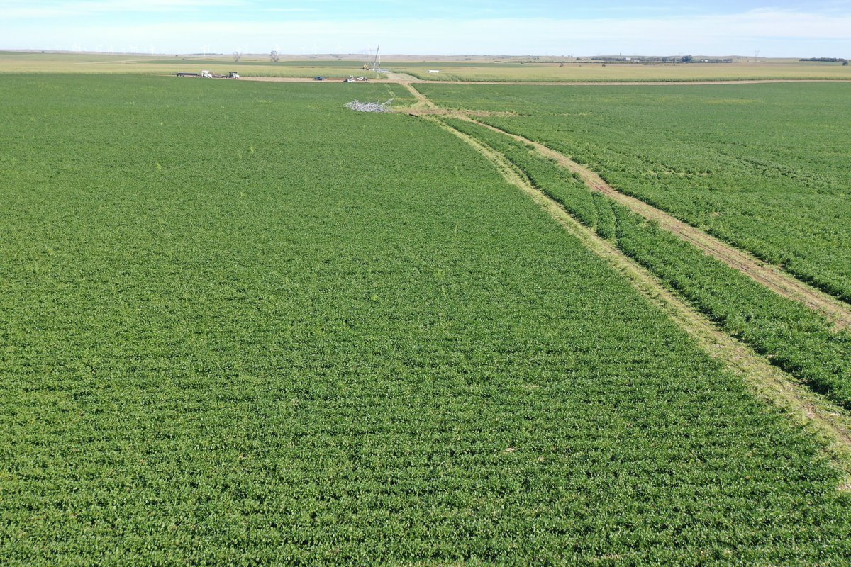
Labor Day Weekend was busy for the UIUC Wind Engineering Research Lab team. We surveyed the damage caused by the August 28th, 2024 Mound City, SD Tornado. Crop damage along with Transmission Line failures were documented. Stay tuned for more details! #tornado @NWSAbderdeen