Jan 19 storm grades: @weatherwilly
C- for Willy boy. Boston ended up on the low end of his range. Points deducted for range being as large as the eventual snow total
Not to be redundant but here is a last look at what I expect today. This will be graded when storm ends. I can tell you right now some areas in NNJ and CT can see 5 to 6 inches locally (hopefully my backyard) with coastal taking over later. Real deal today
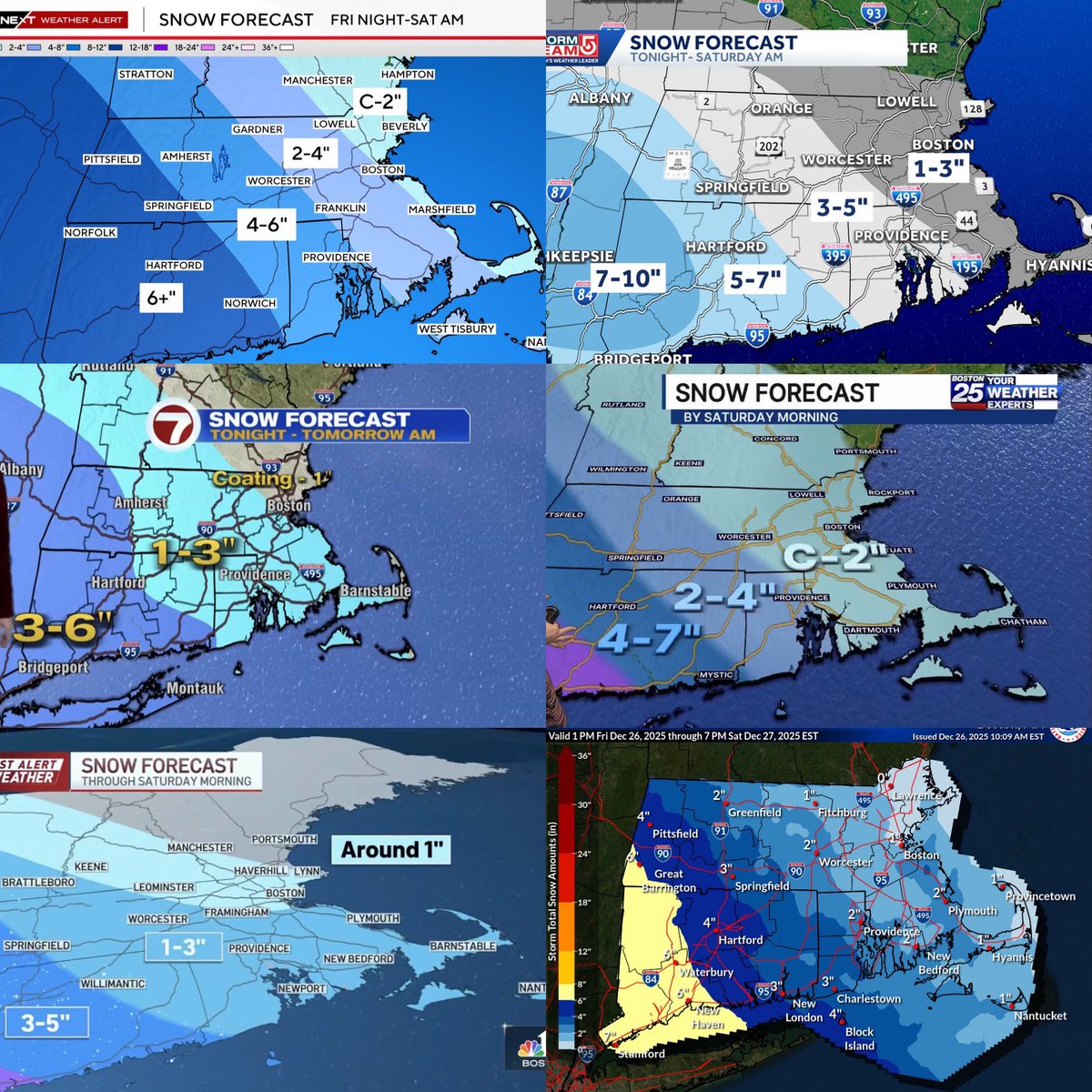
Dec 27 snow forecast grades:
Ch 4: B-
Ch 5: B
Ch 7: C+
Ch 25: C
Ch 10: D
NWS: B+
Not the best not the worst. Ch 10 probably the worst of the bunch but seems like everyone was scared to call this one
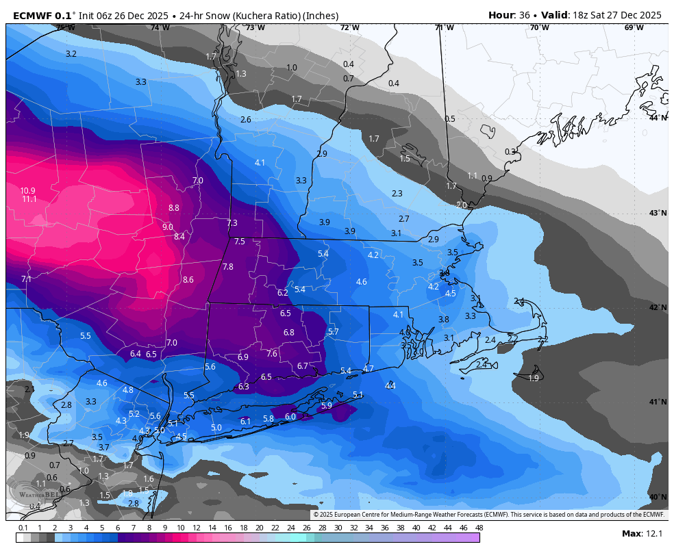
While you were sleeping off a food coma, guidance came out with the goods this AM.
Snow breaks out by 7-10p (ocean effect 1st). Wraps for most before dawn..but keeps up along coast until mid AM. Super fluffy/fine snow. 3-5" for most, 5-8+" in spots at coast (favoring S. Shore).
Dec 27 storm grades @MassachusettsWx
D-
The red balloon really did Matty Flurries here. Circling a 6-7 range only to end up with 3 is a tough look. You’re on my watch list Matt!
Here is my last call snowfall map for our event tonight! Have been aggressive/north than most folks since yesterday, and I feel good about this forecast..tricky set up down towards NYC/LI. Hope for the best, prep for the worst. Enjoy!
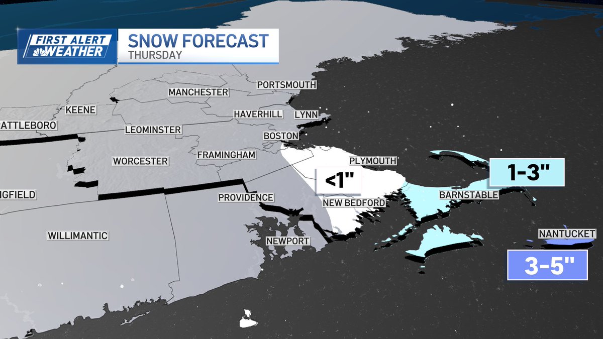
Snowfall Forecasts (ch. 4,5,7,25,10,NWS) Boston could see a little thursday afternoon ocean effect flurries. Nantucket is where the real snow is at. Slight warmup over the weekend into next week.
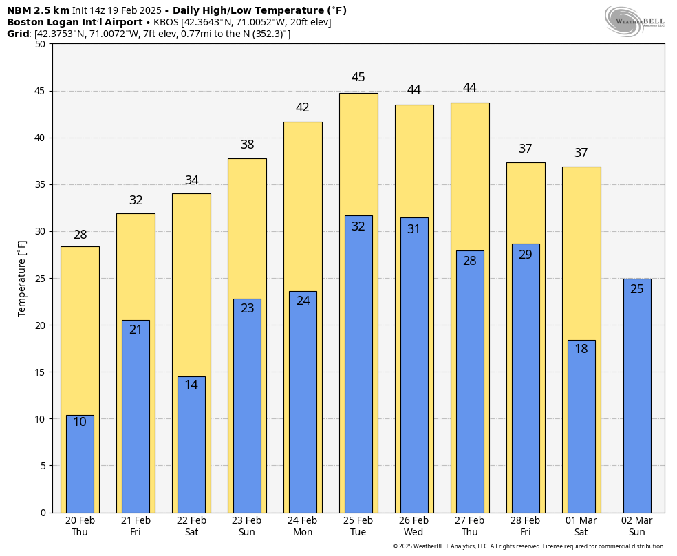
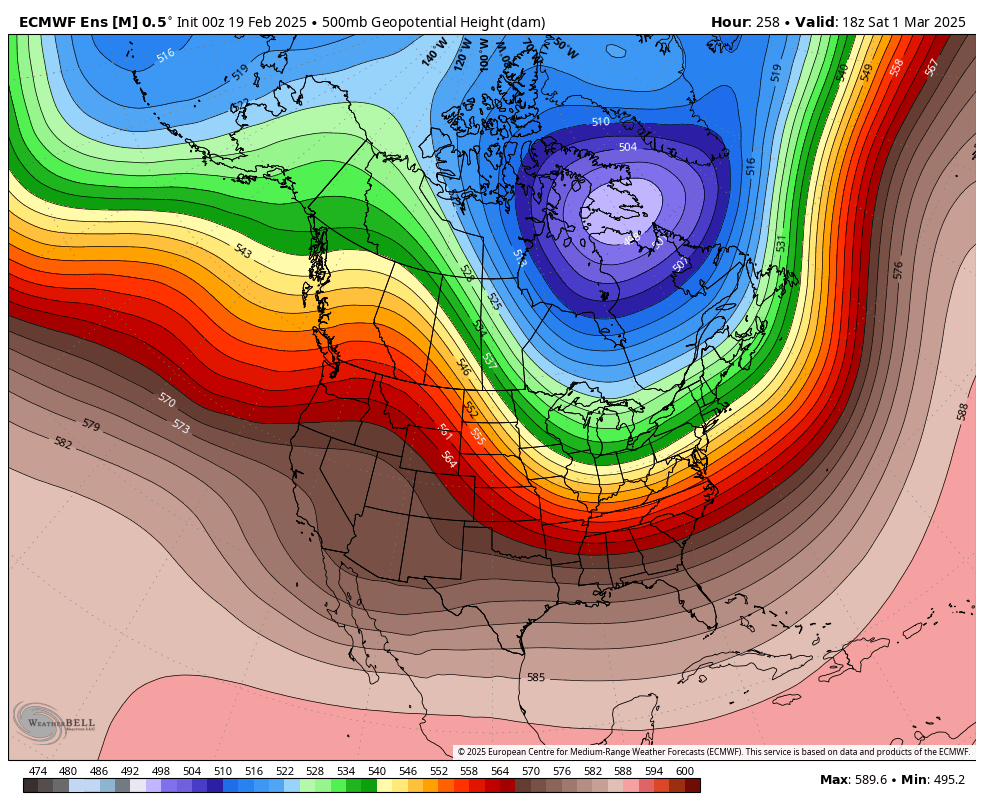
(Mostly) dodging a storm tomorrow, then it appears we're in for a mini thaw. Don't be deceived, however, as long as that big blue (& violet) blob remains to our north, winter holds sway.
**Snowfall Forecast*
Too busy today to make official map so here is my cheery picked model for best forecast Sat afternoon. The 0z Euro ensemble at 75th percentile. This makes most sense to me. This is for initial burst of snow only before changeover to rain.
Feb 16 storm grades: @1DegreeOutside
1Degree continues to ride the hot hand. Very close on snow totals, nailed the transition to rain. Firmly in the trust tree
A
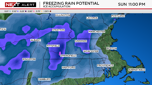
Over a foot of snow for some, prolonged icing for others, heavy rain too. It's all about location! Everything you need to know about the weekend storm in Insights: https://t.co/lJmcFj3CAq
Feb 16 storm grades: @TerryWBZ
Scary Terry nailed this one. Slightly under predicted, but nailed down the transition to rain and was closer than most on snow totals
A-
Feb 16 storm grades: @Lclimateguy
Liam gets points for a nearly unreadable map with colors that are barely distinguishable. Points removed tho for being what we call in the biz “wrong”
C+
Here's my snowfall map for tomorrow. Im thinking a widespread 2-4 for most of sne. Get elevation or latitude and there could be up to 8. I might be a little too low in some areas, but im not getting burned by the under for another storm this winter. Enjoy!
Feb 16 storm grades: @MetMikeWCVB
Mike “wank em” wankum undershot this one a bit with boston getting close to 6 inches. Double points taken off for being wrong by the amount of his provided range (2 in). Mike now lives on the watch list
C-
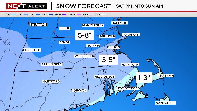
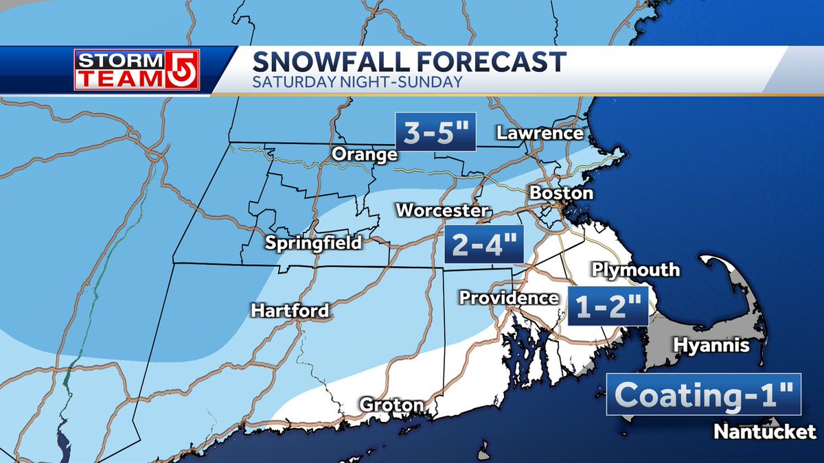
nother storm, another mix of snow, rain and ice. This will arrive toward sunset on Saturday and be with us all day Sunday. Depending on the time of the change over to rain it looks like about 2-4" in Boston. More snow toward the north were the change over is later.