We lead in the adoption and application of technologies that help impact society through Water resources management, Environmental management, GIS and Plumbing.
Smart meter integration within the water sector in Kenya is a business that is currently thriving with water utilities reporting improved billing and reduced losses among other benefits that come with their incorporation. While this is both admirable and commendable,
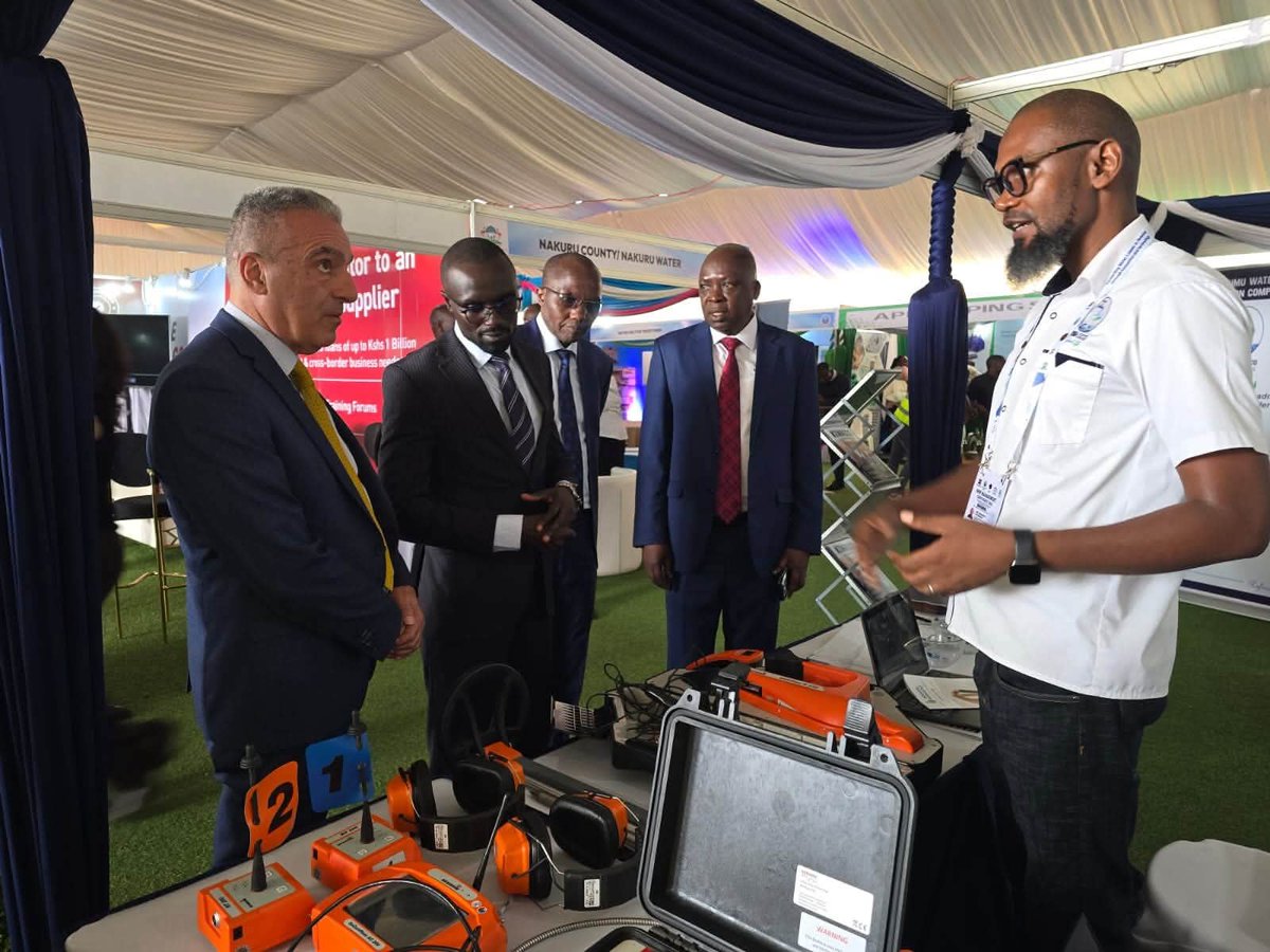
Listening through the presentations made yesterday at the NRW management conference, the role of GIS in the water sector cannot be understated. @WASPAKenya,@Nyeri_water
The WASPA Non-Revenue Water Management Conference 2026 sets off!
This is a sector forum that is bringing together stakeholders to explore innovative solutions, smart technologies, and collaborative approaches to reducing water losses and improving service delivery.
Through the use of IoT & AI, utilities are now able to make data-driven decisions & detect losses more efficiently & improve overall operational performance.
~ Eng. Daniel Nganga
Managing Director, Murang'a Water & Sanitation Company Ltd (MUWASCO)
Acquiring foundational site details usually means traveling to sites, finding utility access points, and tracking down disparate data sources. Google Earth is changing the way professionals work. https://t.co/Gk3eDMQ4IN
New AI-powered data layers in Google Earth pull from billions of Google Street View images to map infrastructure assets like fire hydrants, storm drains, and more. Plus, when combined with new building footprints and land parcels you have powerful, time-saving data a click away.
Inspecting utility access and site constraints from anywhere is now even easier with Google Earth.
These layers are now available for Professional & Professional Advanced customers on web and Android, with coverage expanding over the coming weeks.
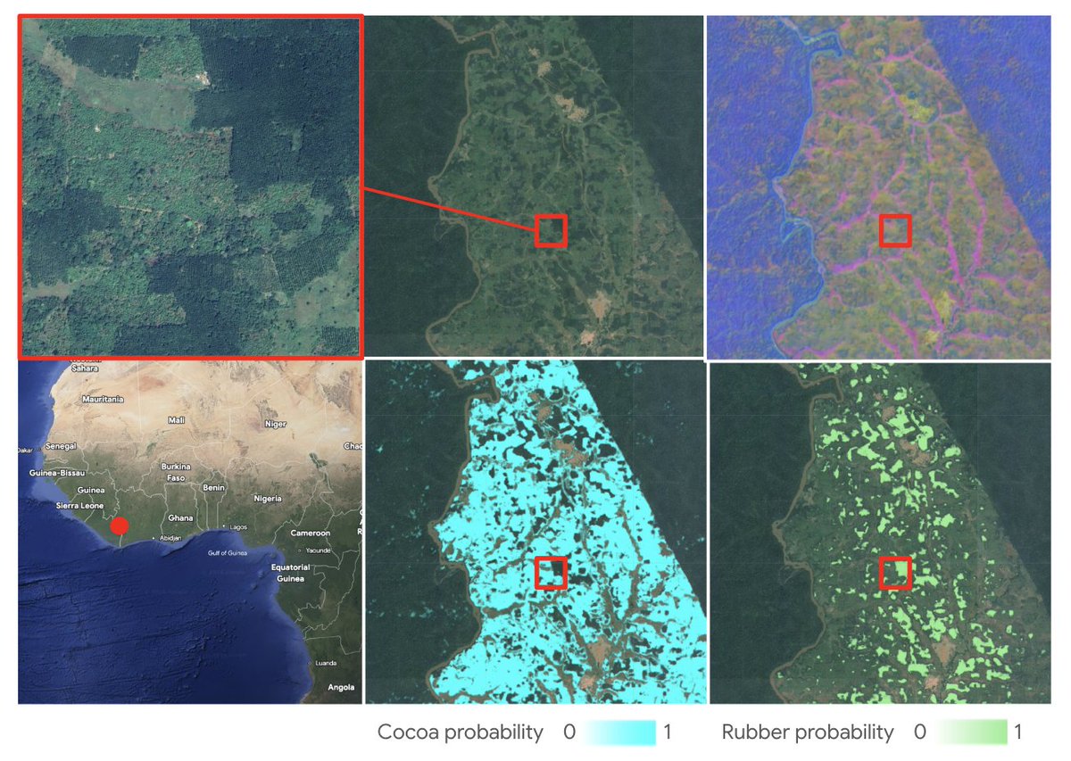
Today, we're excited to announce a major milestone in spatial transparency: the launch of annual, global commodity tree crop maps (coffee, cocoa, oil palm and rubber) built with Google’s Satellite Embedding dataset, part of Google Earth AI. https://t.co/CO5Hjvn9yK
This dataset represents the first pan-tropical, open source, 10-meter resolution map for cocoa, coffee, and rubber, key commodity tree crops associated with deforestation.
These maps are a core output of the Forest Data Partnership (FDaP), a global consortium dedicated to halting forest loss by collaboratively improving monitoring and supply chain tracking. By scaling our coverage from individual countries to the entire tropical belt, we’re closing a critical data gap that has hindered conservation efforts for decades.
The Kenya Met has issued a 24-hour alert for heavy rainfall and thunderstorms today, May 6, affecting Nairobi, Central Kenya and parts of the Rift Valley. #NewsFixNTV
Terrain impacts nearly every project. Luckily, Google Earth’s measure tool just got a major upgrade. Introducing elevation profiles. https://t.co/strPGePtP1
Simply draw a line, as you always have, to instantly generate a detailed and interactive elevation profile in the inspector panel. Whether you are tackling complex route and transportation planning, conducting viewshed analysis, or mapping out logistics for heavy machinery, you can now instantly contextualize terrain dips and peaks directly on the map.
Shapefiles have officially landed on Earth. https://t.co/bqJwgFbdmk
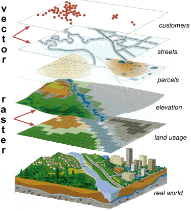
By simply uploading a .zip file, you can render features and attributes as flexible, cloud-native data layers. This is the ultimate silo-breaker for professionals who need to combine local zoning data, property boundaries, and more to get a complete geospatial picture.
Add your first Shapefile to Google Earth now.
Today, we’re thrilled to announce the launch of Shapefile and 3D model import support on Google Earth. Plus, we’ve also added elevation profiles to the measure tool just for… good measure! https://t.co/vpIJA3HCv4
You’ve made it clear. You want to be able to bring more of your data and models to Google Earth’s real-world canvas. We're excited to take the next step in delivering on that promise with these new features:
🔶 Shapefiles (SHP): Render industry-standard geospatial data as performant, cloud-native layers.
💡 3D Models (GLB): Place custom architectural mock-ups, massings, and more in a visually rich context.
🗻 Elevation Profiles: View detailed terrain data in the measure tool you already know and love.
These new features are live now on Google Earth!