Hello guys, logging in real quick to remind everyone that this account is not operational right now. For weather updates in the Northeast, follow the main account
@weathertrackus.
Thanks.
^sib
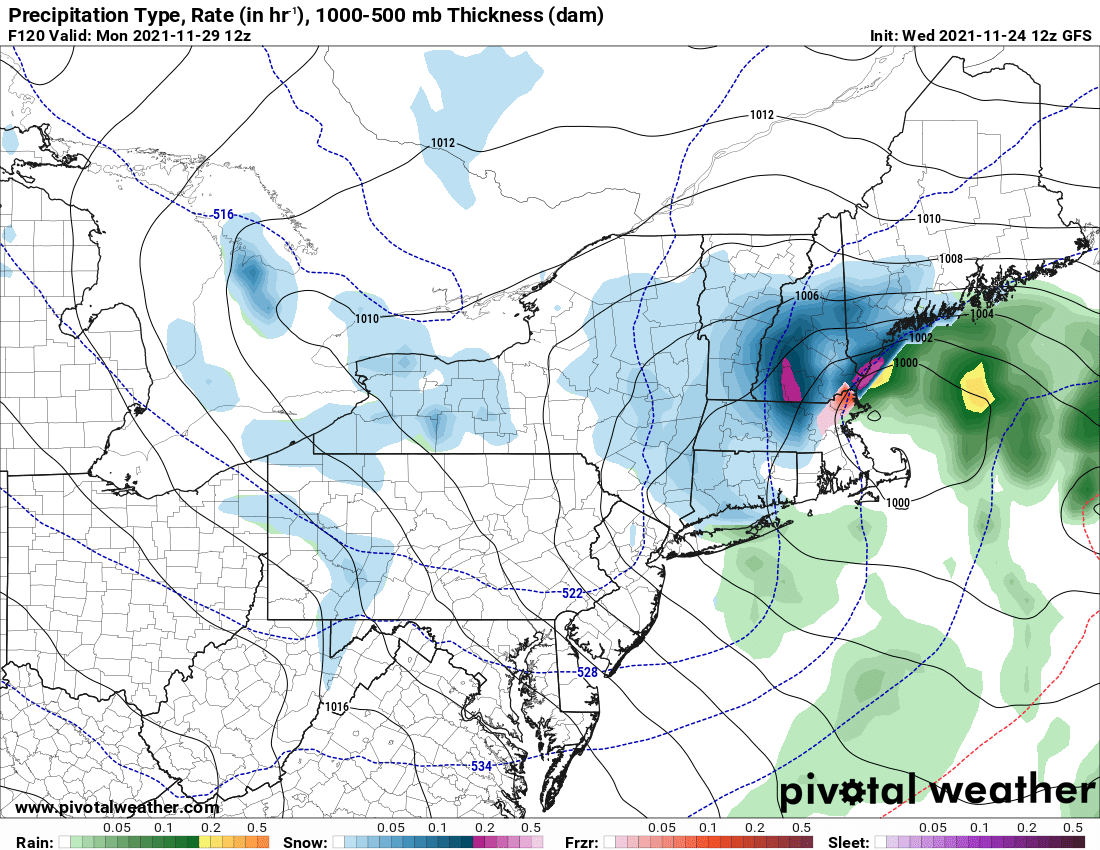
Noticeable changes here from the GFS on the 12z to the latest 18z on the right.
1. The storm is slightly further west at 00z Sunday... but overall the track is around the same
2. The storm is also a few millibars deeper.
3. Snow totals are higher on the 18z.
#winterwx#wxtwitter
WTUS Northeast will be in a slumber for the next little while until we can get people to run this account. For Northeast weather, follow @weathertrackus .
WTUS Northeast will be in a slumber for the next little while until we can get people to run this account. For Northeast weather, follow @weathertrackus .
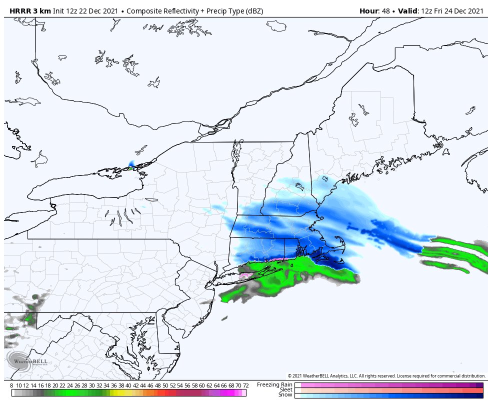
Hey everyone! Hope you guys are having a fantastic Wednesday! There is a chance of snow Christmas eve. Currently, it doesn't look like too much of a travel issue but a coating to 2 inches in local spots could occur.
We've created a GETTR page to expand our social reach! Don't worry, we're not leaving Twitter, we are only expanding our platform!
Check us out:
https://t.co/Wi5nQ4nqBM
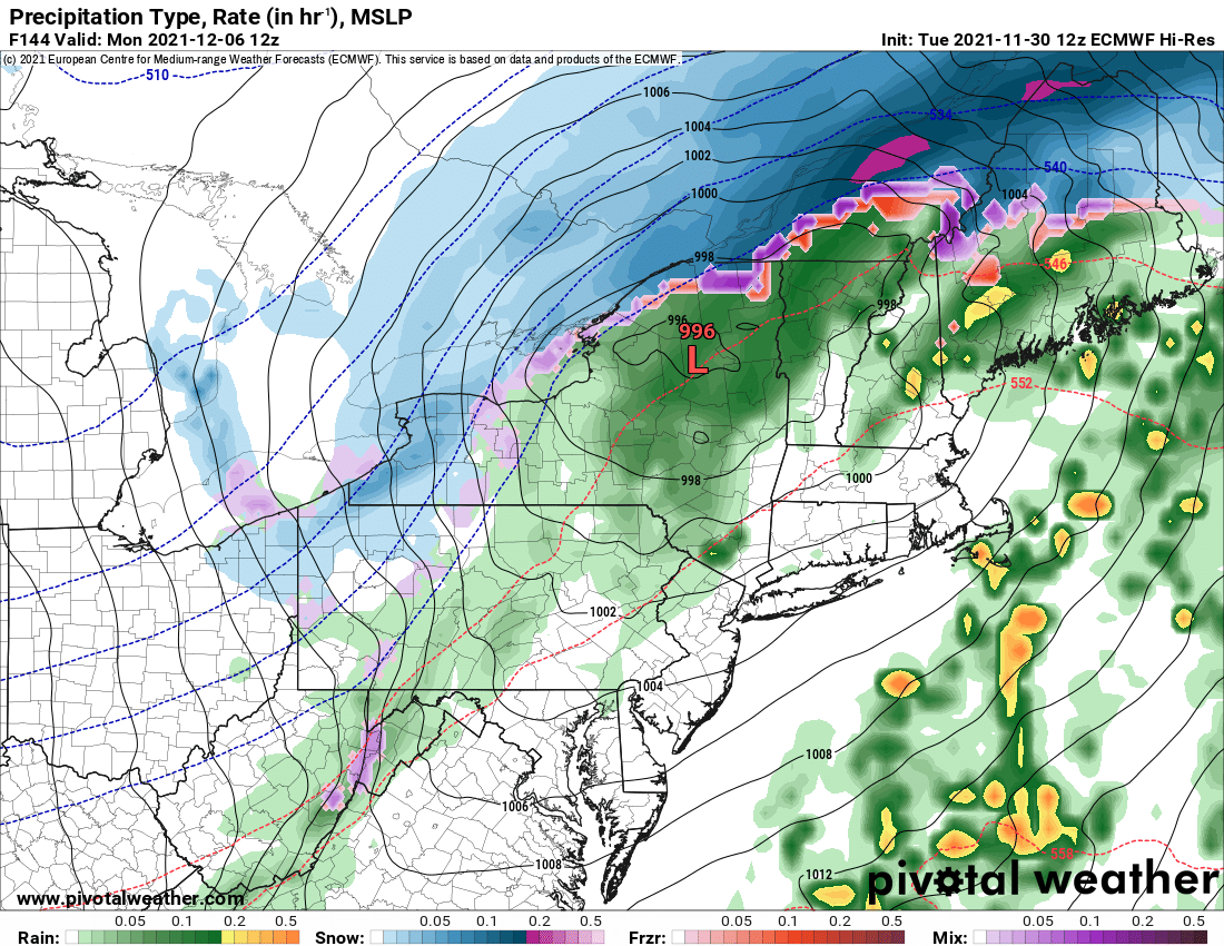
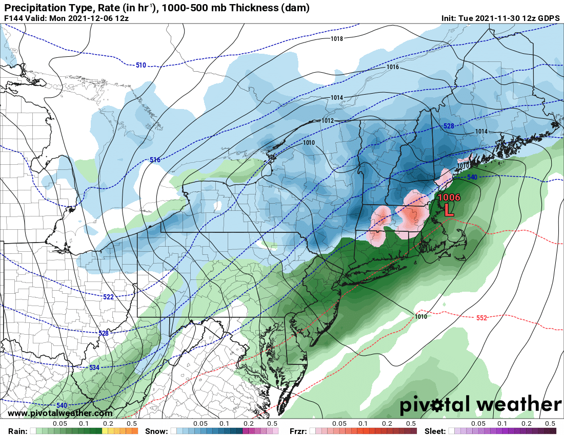
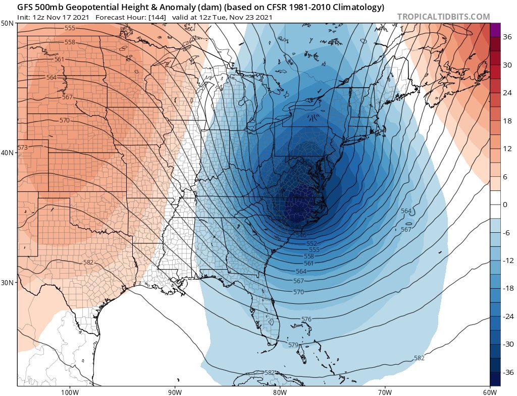
We are keeping tabs on a storm system for Monday. Details are vague at this point and are certainly subject to change.
3 separate models are shown below that show a wide variety of tracks/solutions, so take each one with a grain of salt.
We will continue to update this.
Another front will move through the vicinity Thursday into early Friday morning, bringing *some* rain. Not a significant amount but still might be noticeable.
Temperatures will drop after it moves through and will cause Friday to be pretty cold.
We're monitoring a potential storm system Sunday into Monday for the northeast.
Too early to get specific but we do know that it may bring snowflakes to some some areas that have yet to receive any this season.
More to come soon. ❄️❄️
00z GFS went crazy last night but it did back down at least for southern NE.
I don't think it's that far out to where I can't talk about this but details are vague at this point.
I will be monitoring this over the coming days.
Seems like something worth monitoring.
Another cold front may potentially come through the northeast on Friday morning.
GFS has been interesting because it's been showing a little snow on the backside.
Take this with a grain of salt but still interesting to see.
Spotty Snow showers are affecting portions of New York and also into New Hampshire and Vermont. Travel conditions may be rough at times. #nywx#winterwx#weather#wxtwitter
The 18 GFS is very different from the 12z GFS.
The difference with this run is that another low-pressure system forms as the first one moves out and sort of backs into the coast.
I'm not sure if this is a trend or if it's a hiccup. Let's see what the next couple GFS runs do.
A cold front is on track to move through the northeast tomorrow night into Friday morning.
Most will see rain but some areas in the mountains may see a quick change over to snow before winding down.
Behind the front is cold. Friday's highs may not reach 50° at all for most.
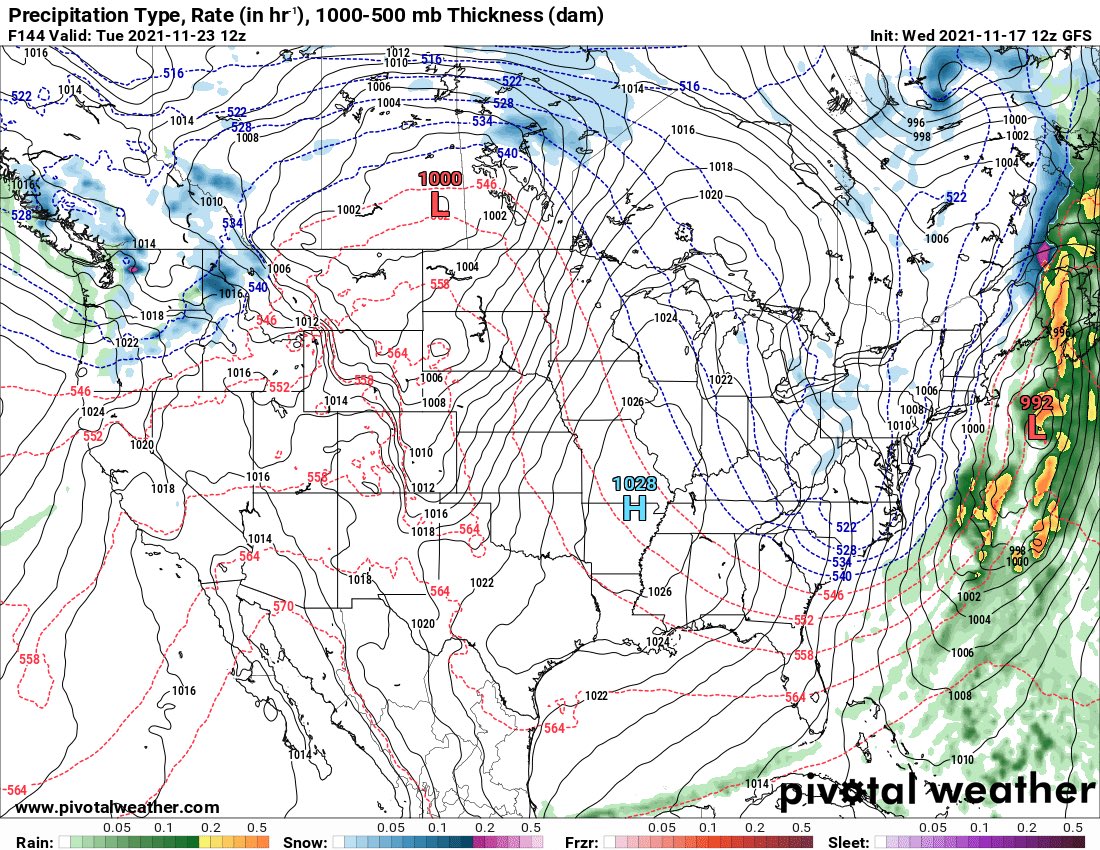
For the past several days now, there has been pretty good consistency that a decent trough will move through the eastern U.S the first half of next week.
Considering the spread in models aside from the trough depiction, I would say it's too early to go into details. (1/2)
#OTD 3 years ago (2018), a rare impactful November snowstorm impacted NYC and places north.
Impactful because of its poor time of arrival and the unexpected higher snow totals especially for NYC and the surrounding areas.
Cars were stuck in traffic for many hours that evening.
Another #tornado has been confirmed by the NWS in Upton. This time, in Suffolk county, NY. Specifically, in East Islip.
It lasted a brief 2 minutes and traveled about 900 yards in that time. It’s wind speed was up to 85 MPH, making it an EF-0.
Some damages was reported with it.