West Virginia's only statewide TV newscast | Anchored by @MarkCurtisWOWK | Weeknights at 5:30 PM on @WOWK13News @WVNS59News, @WTRF7News, @WBOY12News & @WDVMTV
**SEVERE THUNDERSTORM WATCH** until 10 p.m. for Roane, Jackson, Mason, Jackson (OH), Gallia, Meigs, Vinton, Athens, Calhoun, Wirt and Wood counties in our region. Damaging wind gusts, heavy rainfall and small hail are the primary threats.
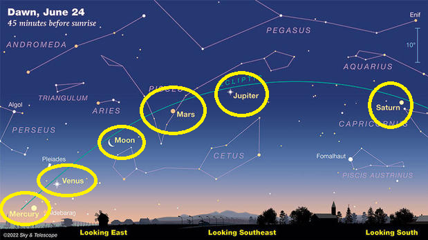
ONE WEEK OUT: Next Friday morning, FIVE planets will align: Mercury, Venus, Mars, Jupiter, and Saturn along with the Moon and will be viewable in the morning sky! You do NOT need equipment to views this rare alignment - just good eyes!
https://t.co/7JaIbhq1fL
MOST of us will be dry on Sunday. However, the storms that pop up will be in a pretty decent storm environment. Damaging wind gusts and hail are possible. I'm not a huge fan of level 1 marginal risks by the SPC, but I think this case is justified with how isolated they will be.
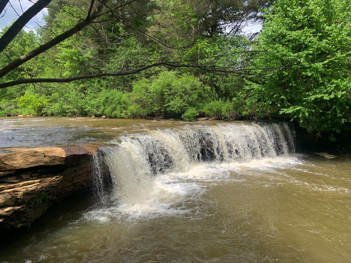
If you've only got a couple of hours to hike, you can check out these four sensational waterfalls in West Virginia that are right beside of each other!
https://t.co/G5aENxf3ly
Three years today on May 23rd, 2019, the second largest hailstone was recorded in eastern Kanawha County - 4.25" in diameter! Many communities in eastern Kanawha County and Fayette County were pummeled with hail larger than baseballs. #wvwx
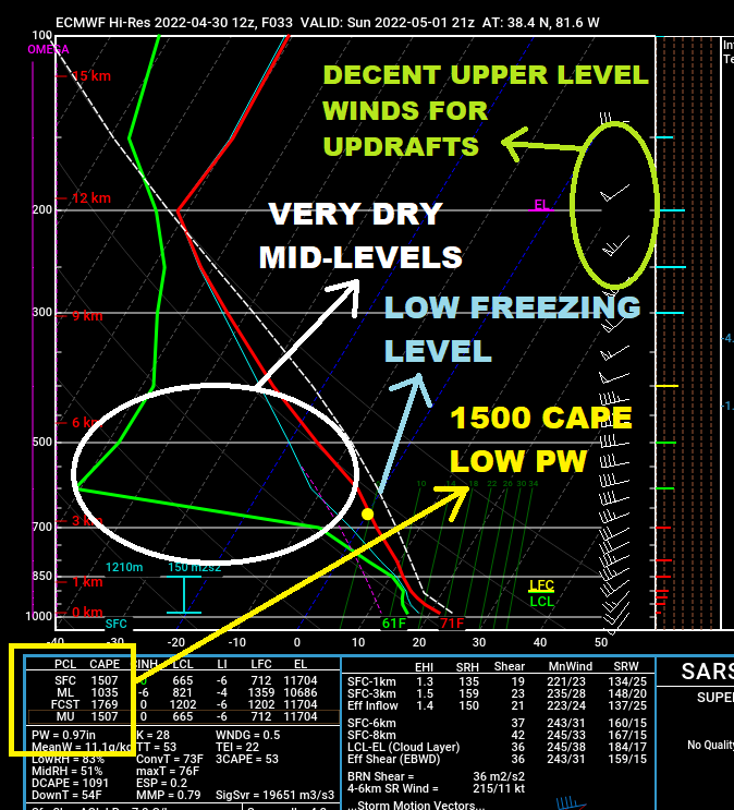
IF (a big if) we can get a few rays of sunshine for instability Sunday, we're looking at a hail threat in the Tri-State. A few signs are showing up on forecast soundings that signal a hail threat, including very dry air in the mid-levels. Keeping an eye on it! #wvwx#ohwx#kywx
We're getting closer to our average last freeze in the Tri-State! It's still too early right now, but on average, we deal with freezes for only about two to three more weeks. Here's a few cities in our region, plus a map for each state in the Tri-State:
INTERNATIONAL SPACE STATION VIEWING TONIGHT! It's at 9:17 p.m. and most of us will have mostly clear skies to view it! There will be more clouds the farther north you are but most of us should get a view. It will appear in the NW sky and should be pretty viewable. Enjoy!
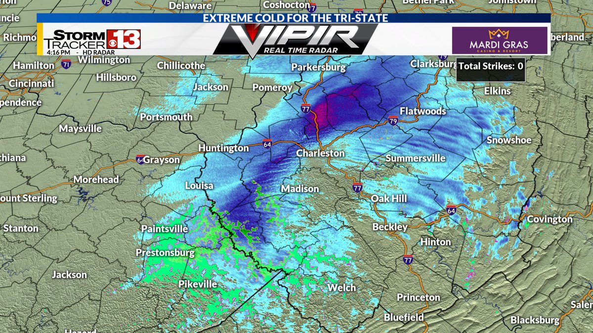
A quick burst of snow is dropping a quick dusting to perhaps as much as 1" of new snow for areas north of I-64. This will not be fun to drive in, so be careful as this snow burst heads east of I-77 over the next half hour.
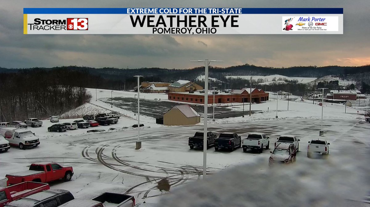
Snow is coming down very hard in the Tri-State! We've picked up about an inch of snow on our Weather Eye in Hurricane over the last 45 minutes or so. Be extremely careful on roadways this morning! #wvwx
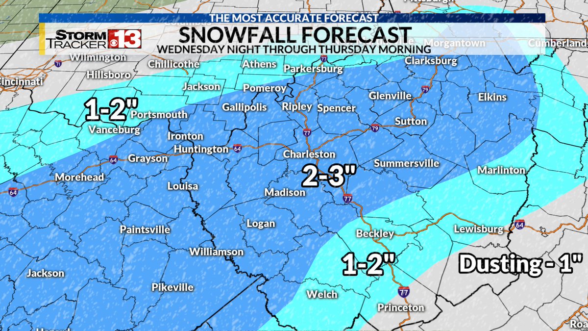
We've got another system heading in Wednesday night into Thursday morning that will bring in more wet snow that will cause slick roadways! Most of us will see a couple of inches of additional snow. #wvwx#ohwx#kywx
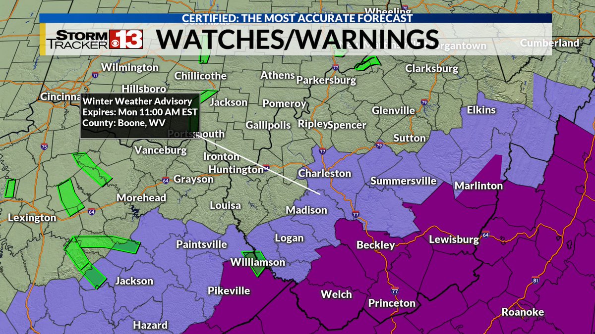
⚠WINTER STORM WARNING⚠ is in effect for a majority of the region for Sunday through Monday morning. We're still expecting very slick travel Sunday evening through Monday morning. #wvwx#ohwx#kywx
People have been asking about seeing a foot of snow Sunday into Monday. I think there's two issues with that kind of snow:
1) Precip totals for this storm are only in the 1/2 to 3/4 inch range right now
2) Warm wedge is likely coming into play
DETAILS: https://t.co/6rTvA01wjD
A snowstorm is set to move from coast to coast, meanwhile arctic air prepares to plunge into the lower 48. Join our team of Nexstar meteorologists including @SpencerWeather for the long-range outlook on #WatchingWinterLive
https://t.co/MBuPT7cD1J
Our southern low pressure system continues to strengthen as it approaches the Carolinas this evening. A heavy wet snow is coming for southern WV and eastern KY in our region! #wvwx#kywx#ohwx
The Winter Severity Index for tonight's storm shows that some minor to moderate impacts are expected across our far southern counties, where a few inches of snow will be possible. The threat for significant issues drops drastically as you travel north, especially north of I-64.
⚠COUNTIES ADDED⚠ More Winter Weather Advisories have been issued, including for Kanawha, Clay, Boone, Logan and Mingo counties in anticipation of tonight's snow. Some slick travel is expected, especially south!
https://t.co/enwO8hBgY9
Impressive snow is arriving tonight for some of us! A heavy & wet snow is expected across southern WV, eastern KY and the WV mountains, where a few inches of snow will be possible. A VERY tight snowfall gradient will be present near the I-64 & US-119 corridors! #wvwx#ohwx#kywx