Latest 00z GFS model showing snow amounts through end of next week👀
This will most likely not happen and WILL change. One thing for sure though is major cold air will be pummeling all the way south once again next week with the chance of some winter precipitation.
Less than a week to go from the latest GFS 👀. Things will still change but computer models have consistently shown the possibility of winter precipitation all the way down south. We’ll see what they show into the weekend.
#GFS#Snow#WINTER
Latest 18z GFS update. This shows 2 weeks from now. This will 100% change but latest models have consistently put a hurricane somewhere in the Gulf during the week of September 9.
#HurricaneSeason2024
And here we go…A crucial day for #Beryl and what impacts it will bring to Texas. The storm has 18-24 hours left in the Gulf before making landfall somewhere along the middle Texas coast. It seems wind shear is decreasing and a recent blow-up around the center in the last hour.
@AFlyover Right now the National Hurricane Center has Beryl moving due west which would have it make landfall closer to Tulum but this particular futurecast has Beryl wobbling more north with a direct impact to Cozumel.
While #HurricaneBeryl has certainly decreased in size, I just don’t see it weakening to a Cat 1 when it makes its next landfall in the Yucatan. It’ll spend tomorrow under unfavorable shear but this storm has been unique so far. We’ll see what it looks like in the morning.
#Beryl
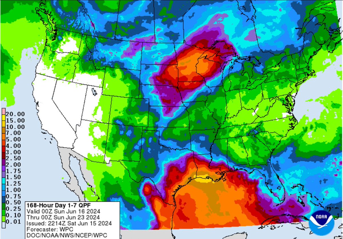
Almost certain that the Gulf Coast from Mexico to Louisiana will see high rain amounts in the next week beginning Monday. Regardless if a system forms, some locations could get more than a foot of rain in the next 7 days.
#txwx
From Ice to Flooding:
Now that this past week’s ice event is behind us, eyes move towards next week where the threat for flooding is increasing. Latest GFS model shows several inches of rain for those along Louisiana and SE TX including #Houston from next Mon-Sat.
#txwx
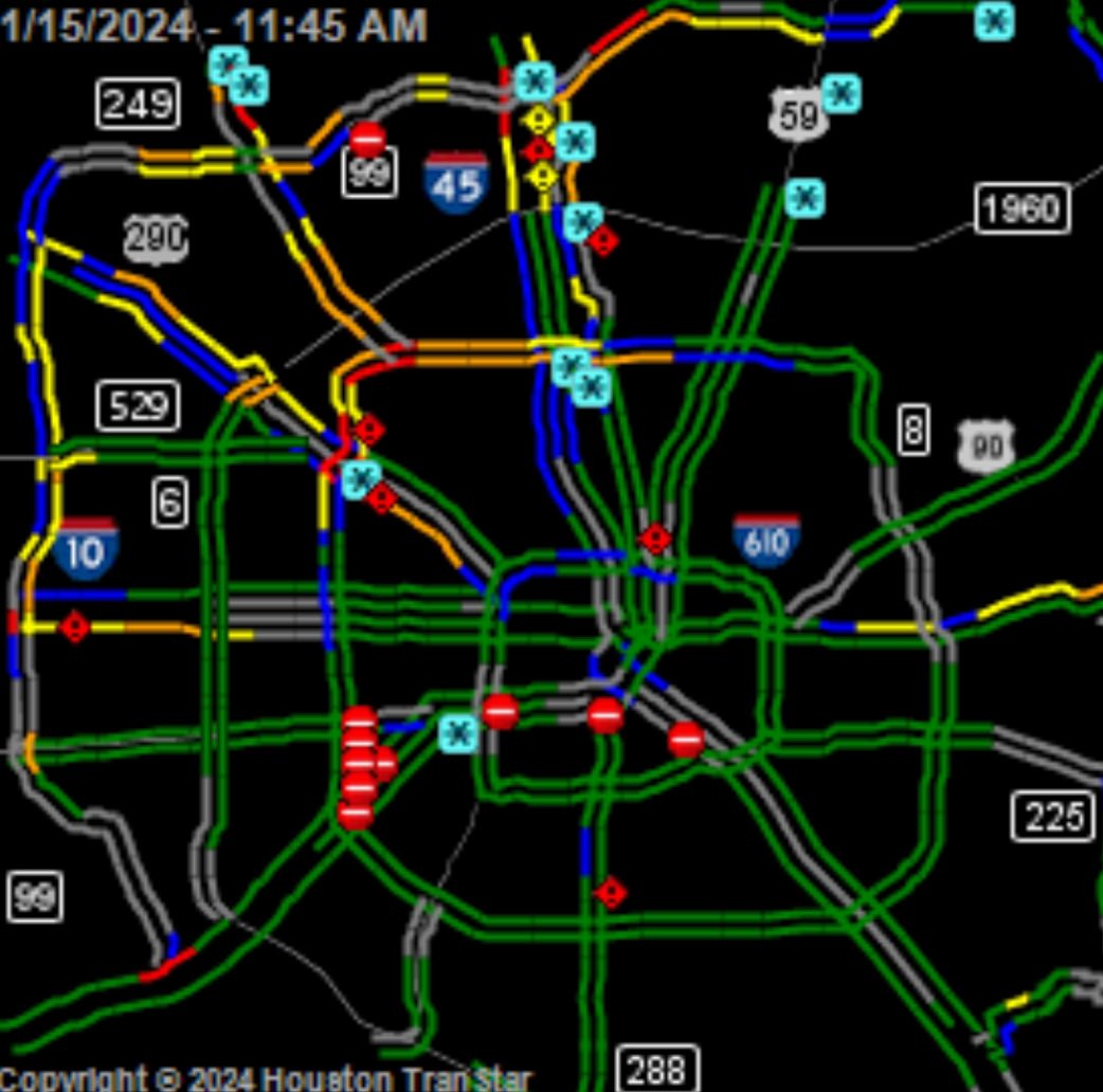
Conditions deteriorating in the #Houston area. Traffic problems especially in the north and west side of the city. Chances of sleet/freezing rain will continue until the evening hours. Winter Weather Advisory/Wind Chill Advisory/Hard Freeze Warning in effect for the area.
#txwx
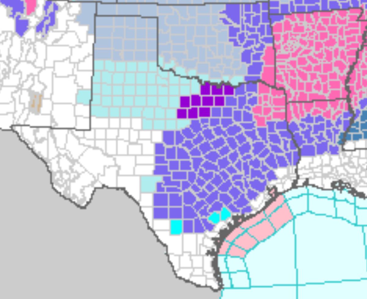
Almost every major city in #Texas now under a winter-weather related alert with #Houston now officially included in a Winter Weather Advisory (in purple). Winter Storm Warnings in pink and Wind Chill Warnings/Advisories in blue. Thankfully, this will not be like Feb. 2021.
#txwx
Current Ice forecast for Texas until Monday from the NWS. Feel like this will continue to change until tomorrow night. By then, models will get a better grasp on how fast the cold air will be pushing south (Models tend to have a hard time with Arctic air masses in TX).
#txwx
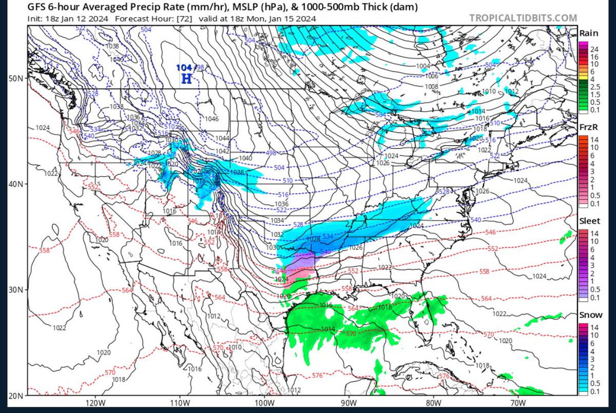
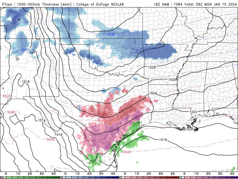
Updated 6z GFS still solid on frozen precip. for many places in TX Sun. Night into Mon. Chances increasing for cities like DFW and Austin. It’s going to be a close call for San Antonio and Houston. All depends how far south the freezing line and moisture come together.
#txwx
WOWZERS🧊
New NAM model coming in line with what the GFS and EURO model hinted yesterday. Models have also sped up the timing of the cold front. Freezing Rain accumulations possible for Monday/Tuesday for a large part of TX including #Houston#ArcticBlast#TXWeather
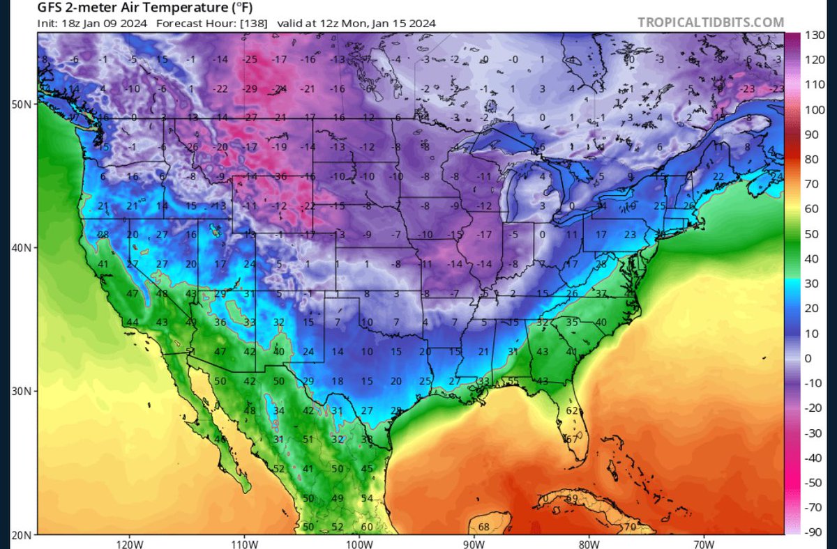
As of now, this “pipe-bursting” event will be similar to December 2022 (cold but short lived with no precipitation issues) for #Houston .However, wind chill values will be close to 0° especially for Monday night and highs possibly not getting out of the 30s for Tuesday.
ARCTIC BLAST WATCH:
This holiday weekend will be FRIGID including most of Texas. Multiple nights in the 10s and 20s for most cities including #Houston As of now, precip. SHOULD be to the east before freezing temps take over, but still too early to tell.
#GFS#HoustonWeather
#Texas y’all doing okay?
Excessive Heat Warnings, Heat Advisories, Tornado Watches, Severe Thunderstorm Warnings, and Flash Flood Warnings covering almost the entire state at this hour.