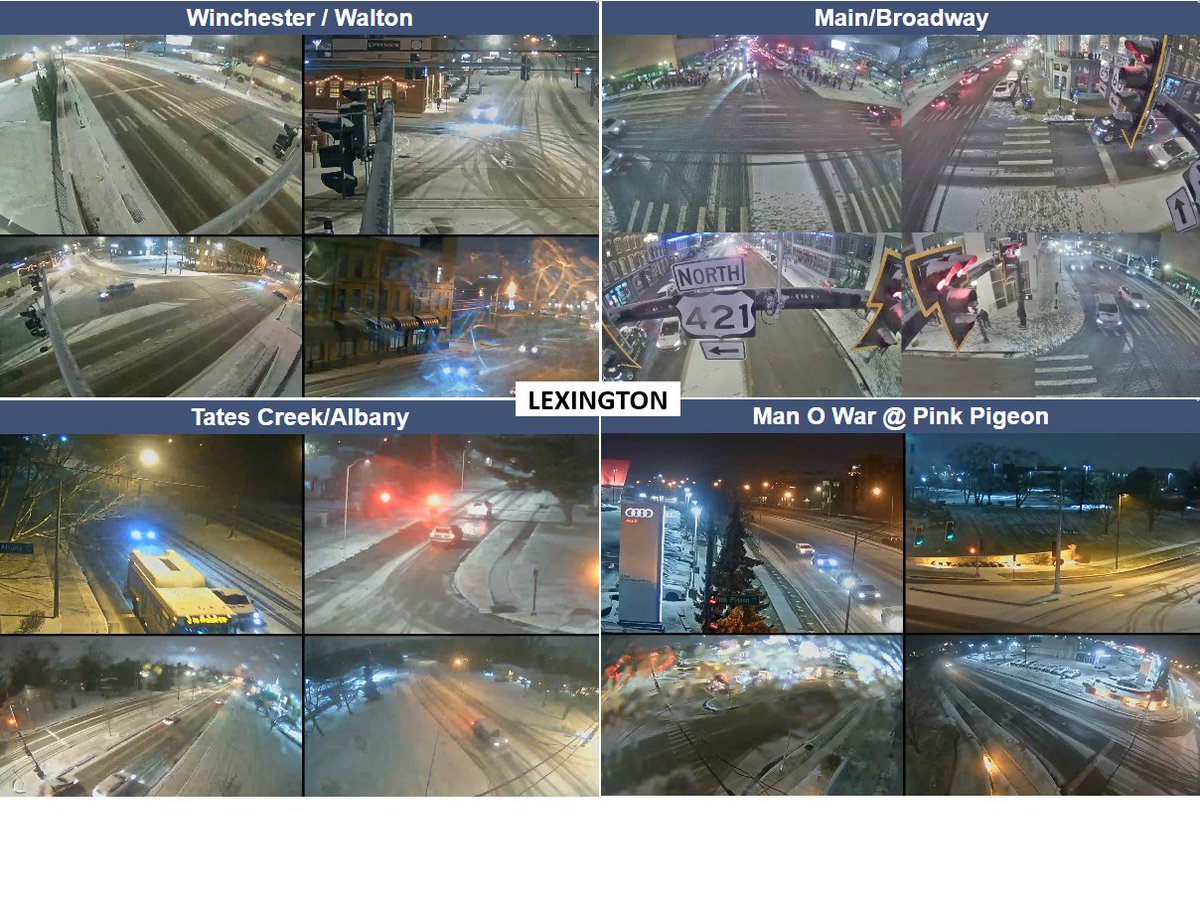
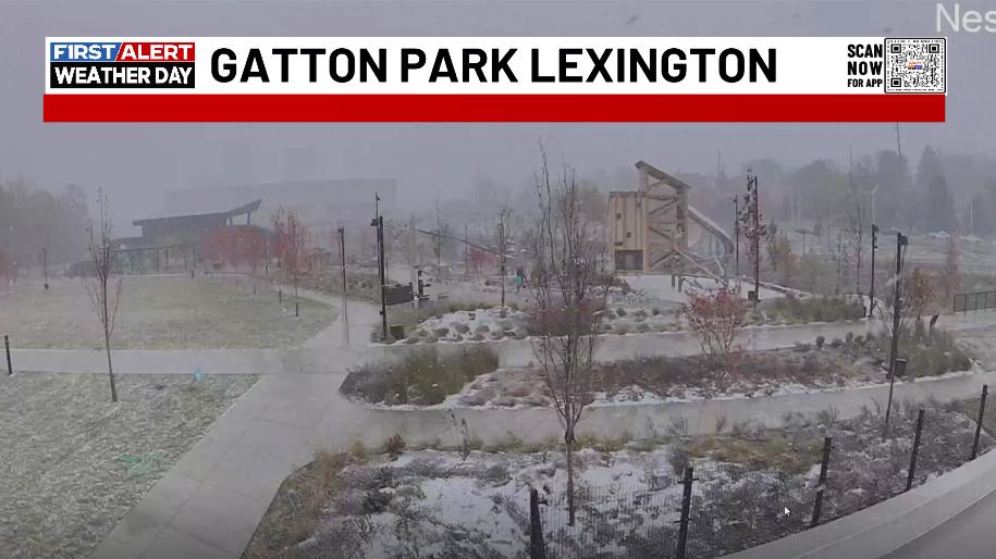
🌧️➡️🌨️Rain showers will transition to snow showers on Wednesday night and linger through Thursday afternoon.
⚠️Snow may become heavy at times.
❄️Snow accumulations look to remain light over most of the region, with some areas in the eastern Bluegrass seeing closer to an inch.
40mph+ wind gusts are likely tonight and early Friday as this line of showers and storms rumbles eastward. Some power hits and minor wind damage possible. #kywx
Y'all want a SNOW DAY tomorrow? Do you REALLY want a Snow Day tomorrow?? If so, let's bring back the famous Snow Dances that seem to always work in getting the day off from school. Post your snow dance videos and I'll pick some to show on WKYT News on the CW Lexington at 10 and on WKYT at 11. #kywx
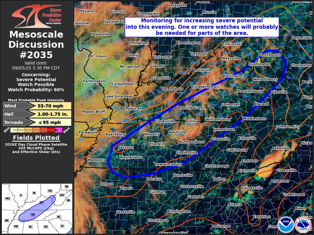
We should be getting a severe weather watch soon for areas of central and eastern Kentucky. Here’s the area being monitored by the Storm Prediction Center. #kywx
🚨#BREAKING: Watch as a time-lapse captures the dramatic retreat of water at Hanalei Bay in Hawaii, receding over 100 feet from its usual shoreline. This marks the confirmed arrival of the tsunami in Hawaii, with the first wave now detected at Hanalei, following a powerful 8.8 magnitude earthquake.
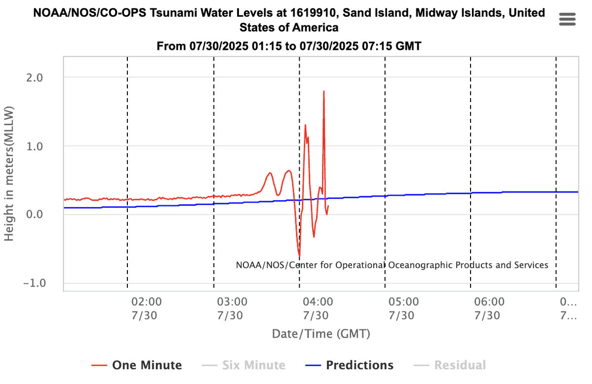
This is what a real tsunami looks like.
Over 2 meters of vertical displacement measured at Midway, a huge signal for deep water.
Waves like this amplify near shore.
Hawaii and other Pacific coasts: this one’s not minor.
Here's a breakdown of what's ahead:
- Strong storms dump pockets of torrential rains today
- Hottest temps of summer possible Tuesday and Wednesday
- Strong storms with a Thursday cold front
- Very cool to start August. Temps go well below normal.
- Some 50s for lows? #kywx
Holy outflow boundaries! Check out these rain cooled boundaries colliding and igniting more storms. Flash flooding and local wind damage with these. #kywx