Chief Meteorologist for @cpsenergy. Former TV meteorologist in Victoria, Tyler, & San Antonio, Texas. My tweets/retweets are mine & not that of my employer.
9:19PM: Showers and storms are in San Antonio with more approaching from the west. Expect some heavy showers with lightning, and some gusty winds up to 40 mph.
7:14AM: Flash Flood Warning is currently in effect for Central Bexar county until 8:15am. Doppler estimated over 2" in many locations. As of 6:50am, San Antonio Int'l has observed 2.39" in a couple of hours, breaking the rainfall record for the day of 1.51".
9:58PM: A 41 mph wind gust was reported at San Antonio Int'l Airport. Storms moving west-southwest. Expect lightning, locally heavy rain. Isolated minor flooding is possible.
8:24PM: Tracking two areas of storms moving toward San Antonio. Wind gusts over 40 mph have been observed in the Austin area. In addition to gusty winds, frequent lightning, locally heavy rain will be possible.
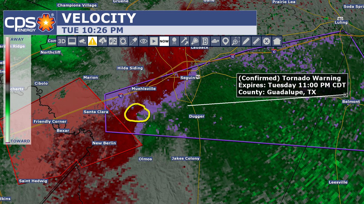
10:43PM: The rotation has ended with the storms east of San Antonio. Light to moderate showers remain in Bexar county with a lot of lightning. If you have to venture out tonight watch out for water on the roads and low water crossings.
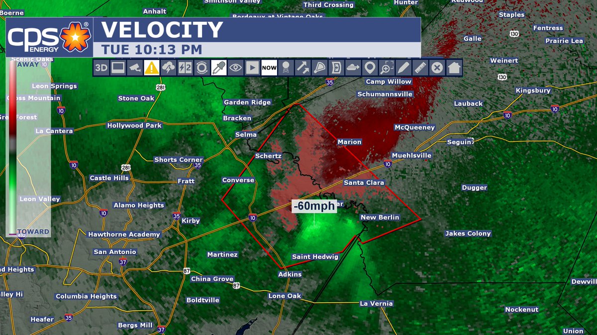
10:13PM: If a tornado doesn't form there are strong winds associated with this storm. Doppler estimates of up to 60 mph north of St. Hedwig. Storm continues to move northeast.
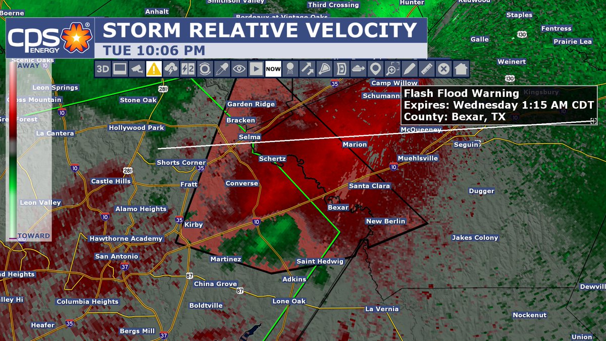
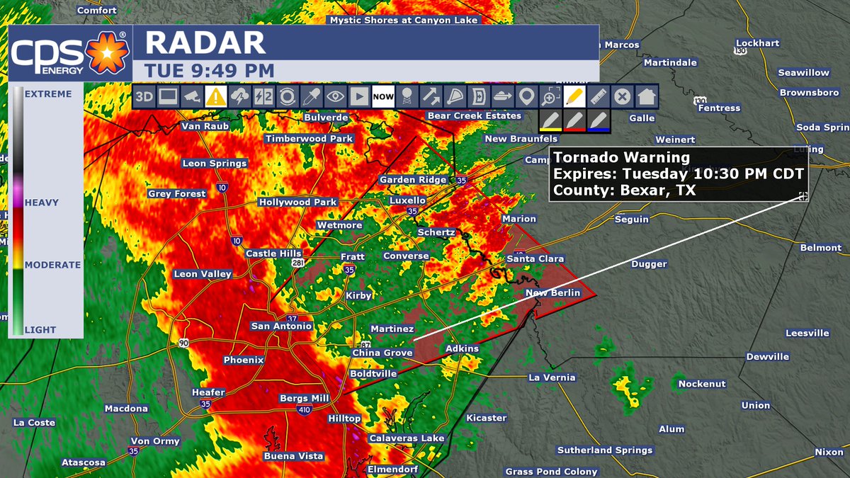
10:06PM: Rotation has become more broad but the storm still bears watching as the rotation could become tight again which could lead to the potential of a tornado. Flash Flood Warning has been issued for Bexar county until 1:15am.
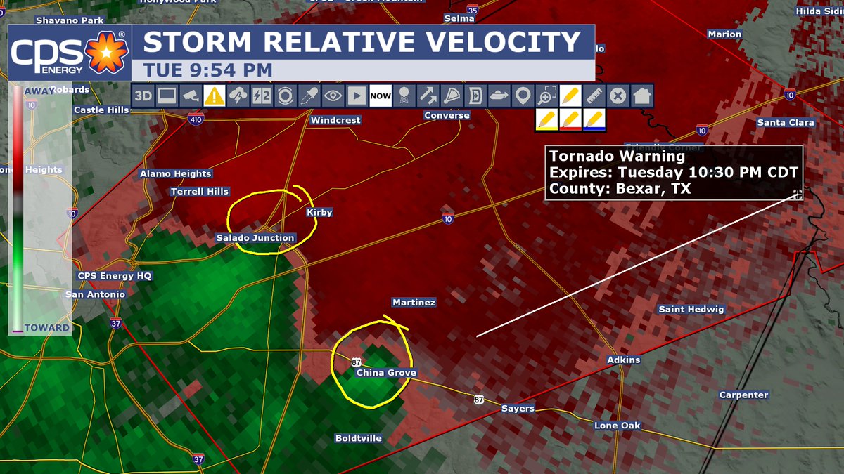
9:54PM: I have circled two areas of rotation that could produce a tornado. If you live in the northeast side of San Antonio, take your tornado precautions right now. Get into an interior room away from outer doors and windows.
9:40PM: Flood Advisory for Bexar county until 12:45am. Doppler radar estimates up to an inch has fallen within the past hour in parts of the county. More rain is expected.
9:03PM: Two severe thunderstorm warnings in effect for Bexar county until 9:45pm. Storms have now arrived. Expect moderate to heavy rain, gusty winds, some hail and heavy rainfall.
SEVERE THUNDERSTORM WATCH: has been issued for Bexar county and most of South Texas until 6am tomorrow morning. Storms will have the capability of producing gusty winds, hail, heavy rain, and an isolated tornado.
7:53PM: Squall line is getting better organized and moving toward San Antonio. Storm Prediction Center says a new T-Storm Watch likely to be issued within the hour. This would include Bexar county.
1:33PM: Severe Thunderstorm Watch has been issued for counties west of San Antonio until 9pm this evening. Severe storms are already developing north of Carrizo Springs. A few showers have already developed in Bexar county this afternoon.
FLOOD WATCH: has been issued for the San Antonio area. It goes into effect later this afternoon through Wednesday morning. Tonight, widespread showers and storms will be capable of producing 1-3" with isolated higher amounts.
FLOOD WATCH: Has been canceled for the San Antonio area. It still remains south and east of San Antonio. New information suggest rain chances will be diminishing over the next couple of days. We still could see storms but widespread flooding appears unlikely.