Weather when you want it, where you want it. Videos, forecasts, musings and much more. Pro-forecasters, pro-tweets. Part of Weather Consultancy Services Ltd.
You wil have noticed how it has been the warmth overnight that has made things so uncomforortable during this heatwave. The good news is that after another roaster tonight (apart from central & northern Scotland), Friday night will be much cooler for most.
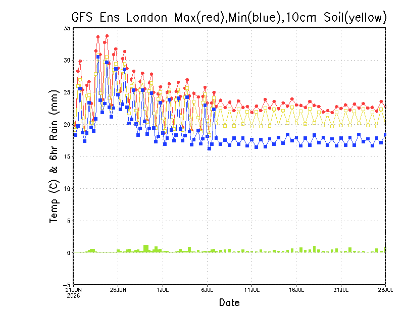
Interesting to see how the latest 35-day temperature forecast from the GFS ENS through to late July continues to keep temperature warm to very warm in southern England. Best get used to the heat then?
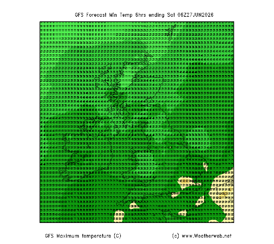
Major heatwave conditions ahead this week. The heat steadily builds to peak on Tuesday, Wednesday and Thursday in England and Wales. Very warm Ireland and Scotland too. The potential for it to go 'BANG' on Friday as thunderstorms develop, but still lower confidence in this.
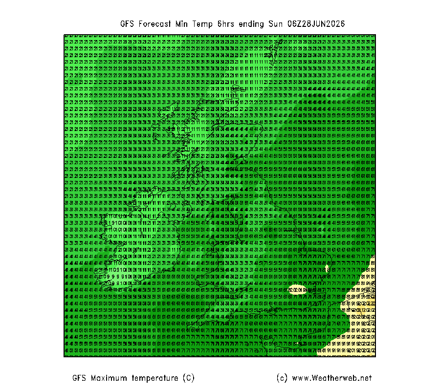
Let the hay-making begin? Daily maximum temperature charts showing how heat spreads across the country over the coming days together with drier weather too.
We’re updating Weatherweb Premium members; you can get a free 7-day subscription at https://t.co/npguIGzz1f
Oh yeah! Aviation Weather School (Part 1) about to kick off!
Can’t wait to get more pilots weather confident and flying more!
Thank so much for letting me talk weather for the next 2.5 hrs 😃😃😃😃
Models quietly confident in building pressure and heat next week. AIGEFS for locations across the UK and Ireland showing little rain and warmest east and south. Unsurprising with the winds becoming more southerly.
Plenty of cloud and outbreaks of rain this morning. Windy in western and southern areas of England, Wales & Ireland, severe gales for south coasts this afternoon. Rain fading for many.
Some facts (well as good as there can be 'facts' when dealing with El Nino forecasts) from IRI combined forecasts. Average of these (bold lines) show an ENSO index of 2, that is in the 'very strong' category and these previously occurred in 1982/83, 1998/98 2015/16.
Overnight rainfall (12-hours to 7am Tuesday morning) shows most rain extending through southern England, the Midlands and into northern England, 25.8mm being the highest total. It wasn't a cold one. Yesterdays sunshine totals clearly show how the SE enjoyed most of it.
We have seen a fair amount of rain in some parts of Wales today. Totals for the last 12-hours to 7pm are shown here. It was warm in the sunshine in the east as well with temperatures exceeding 24C. Even with the rain it was reasonable mild in the west as well.
Latest ideas through the rest of June are featured in today's Look Ahead video, ready to watch now at https://t.co/npguIGzz1f
Not only that, the 2-Week Planner, Fast Forecast and Rapid Update are online too.
Get free Premium Membership for 7-days at https://t.co/G9kEY8XUvs
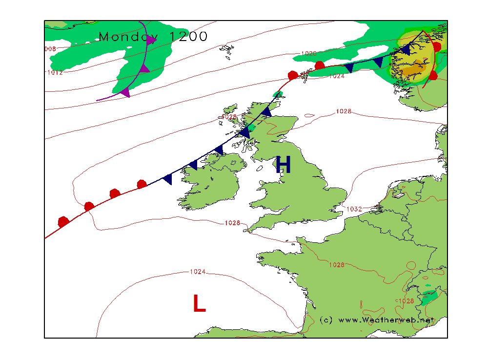
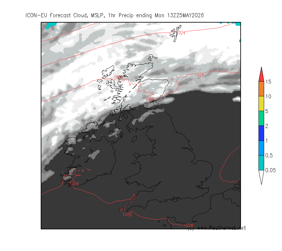
d, rain and pressure charts for tonight and Monday showing cloud increasing from the west with rain already in Ireland then encroaching eastwards through Scotland, Wales and much of England (except the south east) through Monday. Becoming murky over W & S coasts.
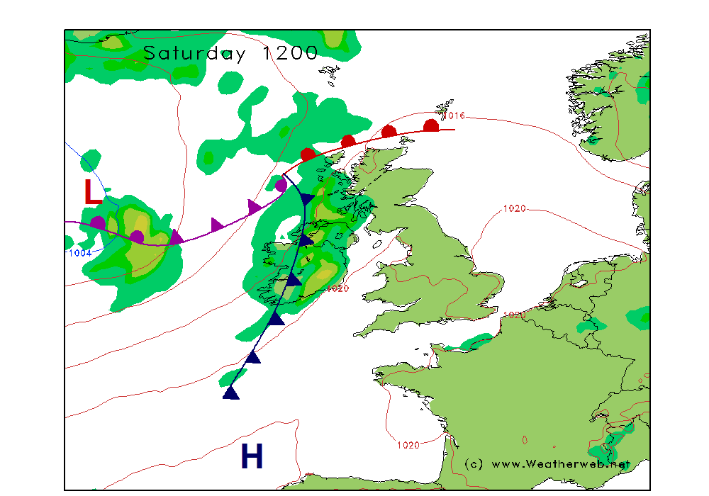
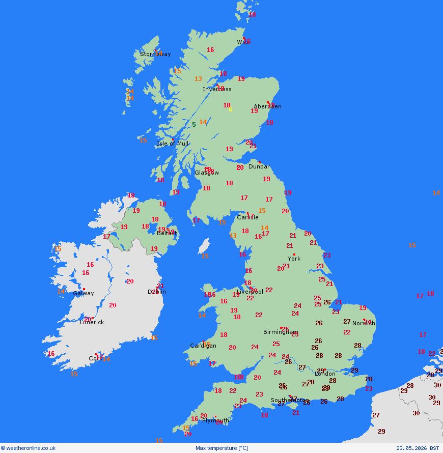
Saturday's weather is still warm over most of England and Wales, very warm in the east. But a change is slowly coming in from the west with some cloud and showery rain in Ireland and Scotland. This is easing us into the colder, unsettled weather ahead next week.
Rainfall in the last 90-stays stays in short supply. Rainfall anomalies show below average totals over much of the UK and Central Europe, with the daily graph highlighting how March had near average rainfall, but then dropped below average from 1st April and continues now.
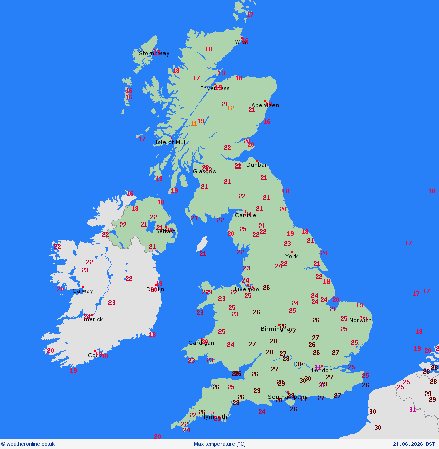
Hold on tight today (Monday) then because here we go with a scorcher. 33C is possible in southern and central England this afternoon. Lots of sunshine for most under cloud-free skies, but cloudier and cooler northern Scotland.
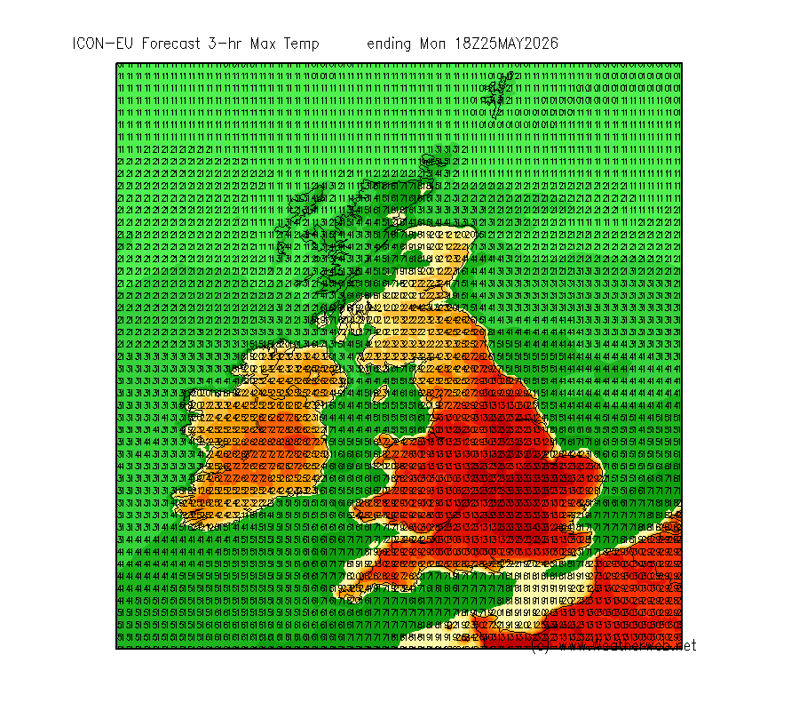
A hot day ahead for Friday, temperatures into the high 20's in much of the Midlands and eastern England. Cloudier in the west, a little drizzle on some exposed coasts this morning and the more persistent rain moving north through Ireland this afternoon.
Some rain over the next couple of days as fronts pass east. Most of the rain and drizzle west and south where there will be low cloud on hills and coasts. Generally better in the east.
Fewer showers today as the airmass is a little more stable. Trough clears south taking morning showers with it, ahead of the more stable air arriving. This is assisted by the ridge to the west building pressure. Gotta love the weather-machine! 😁🌧️☀️🌤️🌦️