🗺️ urban transformation in #Biskra mapped.
Using Landsat imagery+classification in QGIS/SCP, I tracked how the city's land cover evolved: urban sprawl, shrinking old oases,expanding new settlements.
with 3D relief view.👇
https://t.co/szsAwWwLpF
#GIS#RemoteSensing#Cartography
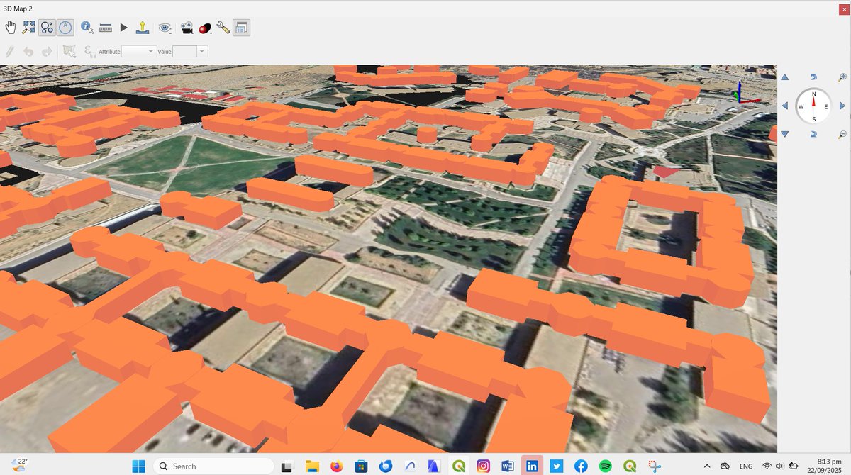
Improving my skills in 3D maps on QGIS. University of Batna1 in #Algeria. Working on srtm 90 meters resolution DEM. Google sattelite as a background and modelling and building heigth data from OSM.
Good evening for all!
I have to celebrate this. Not very interesting graphically, but I am so happy of this first result.
My first 3d #GIS view using #QGIS, #srtm 30m #DEM and data from #OSM. University of Batna in #Algeria.
Good evening for all!
I have to celebrate this. Not very interesting graphically, but I am so happy of this first result.
My first 3d #GIS view using #QGIS, #srtm 30m #DEM and data from #OSM. University of Batna in #Algeria.
#Art, #Geography, and #Urbanism. My desktop wallpaper provider shared this stunning image, beautifully blending these three areas of my interest.
Great Dune of Pilat, France.
https://t.co/FxKoz15E1u
There is an urgent need for African economic integration and Arab economic integration, both in terms of markets and trade and in terms of infrastructure, including information and data infrastructure.
#Africa#iatf2025#iatf#Algerian#الجزائر#أفريقيا
https://t.co/3rxsNgcykE
هناك حاجة ملحة لتكامل اقتصادي إفريقي و كذا لتكامل اقتصادي عربي سواءا من ناحية الأسواق و التبادلات أو من ناحية البنى التحتية بما فيها بنى المعلومات والبيانات.
https://t.co/3rxsNgcykE
#Africa#iatf2025#iatf#Algerian#الجزائر#إفريقيا
هناك حاجة ملحة لتكامل اقتصادي إفريقي و كذا لتكامل اقتصادي عربي سواءا من ناحية الأسواق و التبادلات أو من ناحية البنى التحتية بما فيها بنى المعلومات والبيانات.
https://t.co/3rxsNgcykE
#Africa#iatf2025#iatf#Algerian#الجزائر#إفريقيا
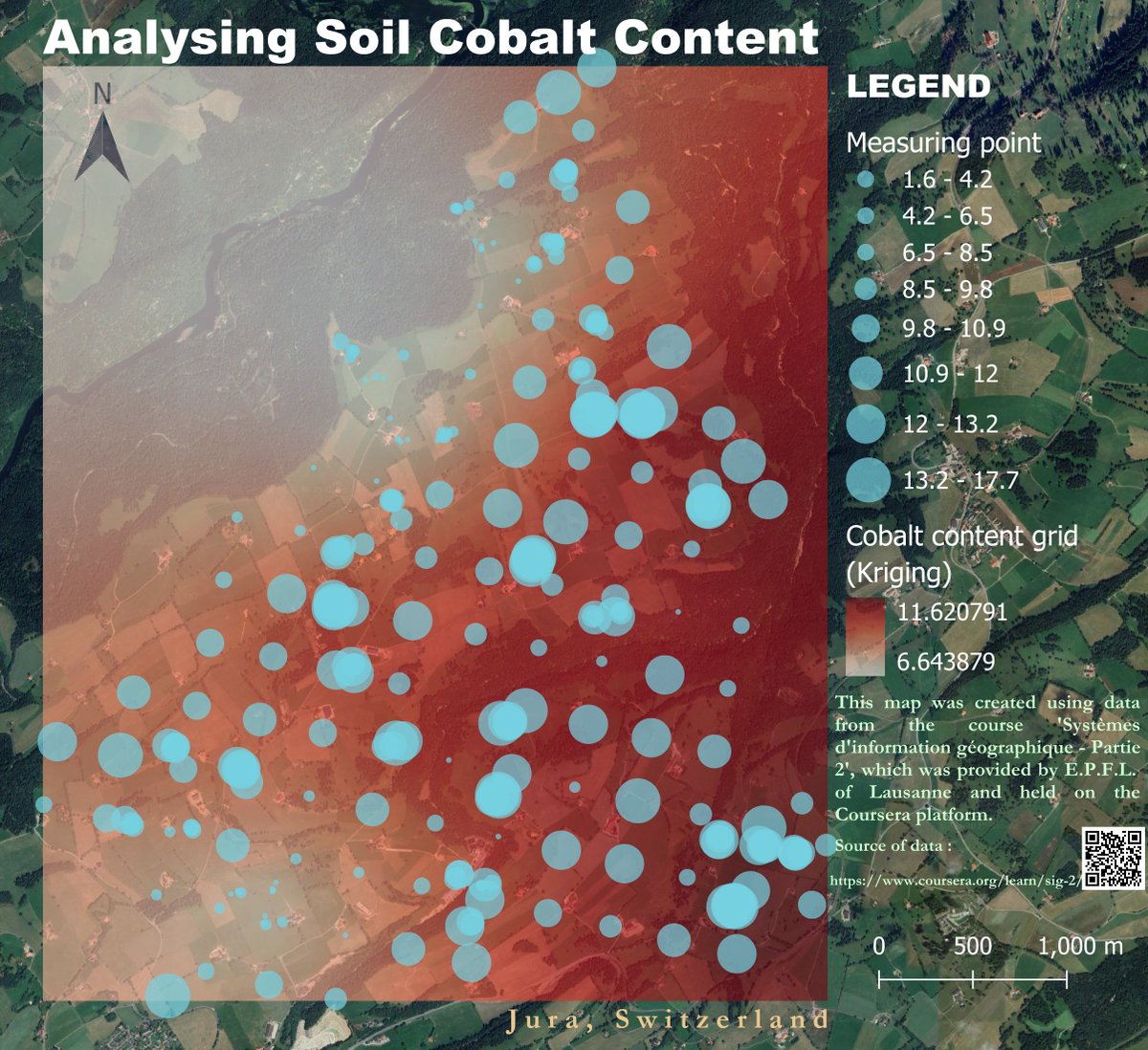
This map was created using data from an assignment of the course 'Systèmes d'information géographique-Partie 2', provided by EPFL of Lausanne and held on #Coursera.
Source of data: https://t.co/GqW0JyzSEK
Map & Artwork built by me @yoostech.
Work on #QGIS 3.44 - #GIMP 3.0.4
تُعبتر Parcel Fabric من أفضل الحلول إلا ممكن تحتاجها في شغلك لو أنت شغال
في مشاريع تقسيم الأراضي سواء (والزمامات والتعديات وتقنين)
وأيضاً مشاريع الشهر العق��ري.
لما لها من أههمية في تقسم المجاورات بناء علي إتجهات معية وكمان بتوفر إطار لرسم وتحديد حدود الأراضي (Parcels) بدقة.