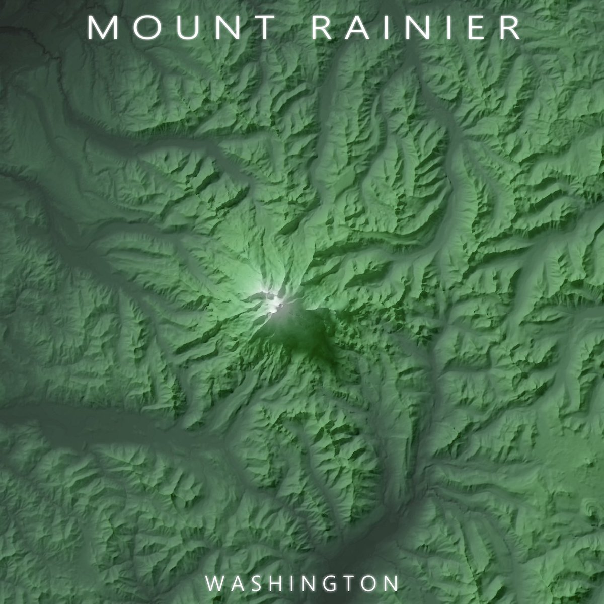
I made this exaggerated relief map of Mt. Rainier a while back. It's bothering me that I didn't center its peak and I lost the original files to fix it so I delisted it from my shop. If you'd like to download the 4000 x 4000 image you can download it for free on my website.
June 6, 1944, this US Twelfth Army Group situation map shows the presumed locations of Allied and Axis forces on D-Day, when Allied troops landed on the beaches of Normandy. I added a few close up images of the map on my website. Where it’s also for sale. https://t.co/8xleXyfRrR
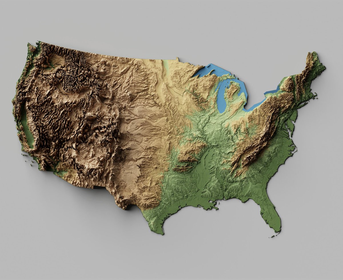
An exaggerated relief map of the lower 48. This really highlights the difference in elevation between the eastern and western sides of the country.
Prints of this map are now for sale on my website. - https://t.co/7XYnNfuO6M
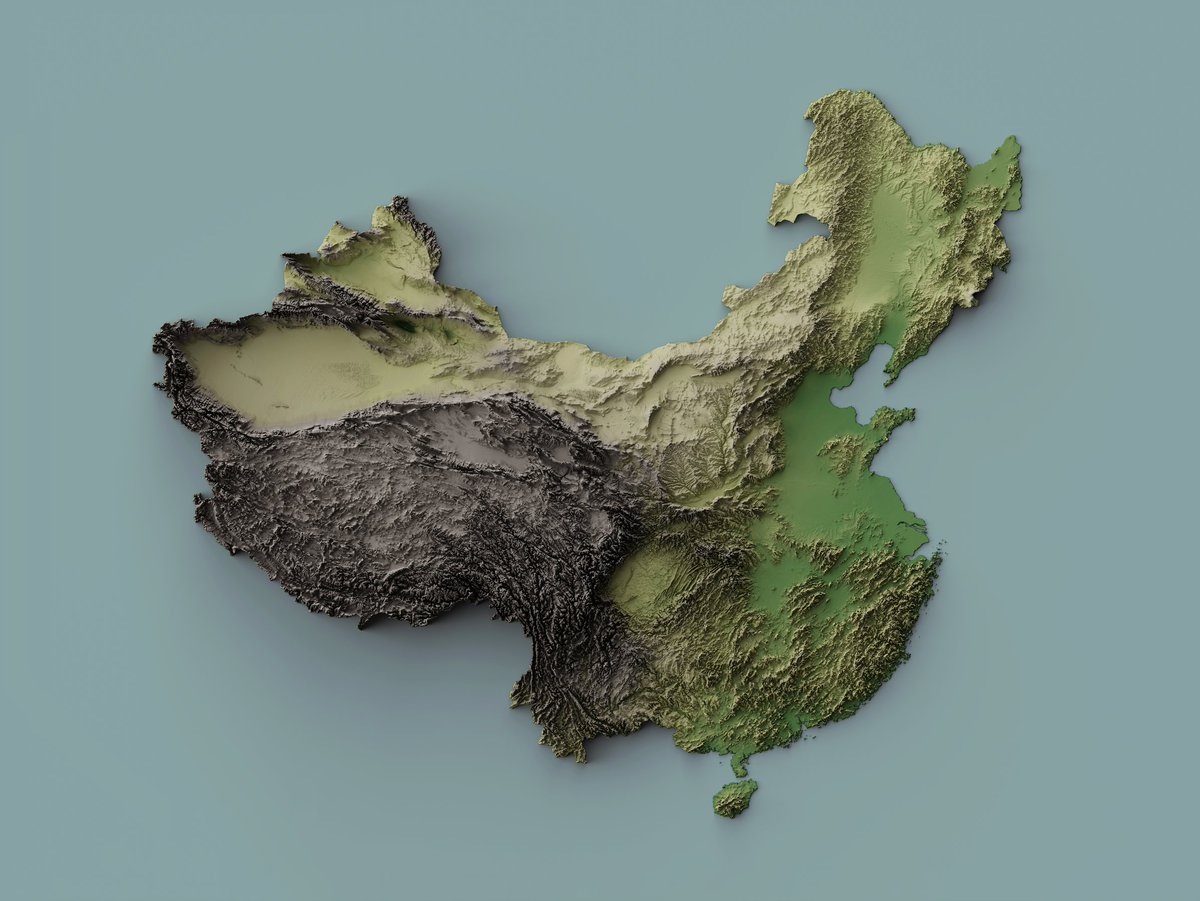
An exaggerated relief map of China. This map really displays the elevation difference between the Taklamakan Desert and the Tibetan Plateau. Prints of this map are now for sale on my website. Expect more countries and US states to be uploaded soon. - https://t.co/4cFy1Hd6Av
A scene that Captain John Smith saw when he was captured in 1607. It’s a longhouse with Chief Powhatan at its center. This image was printed on Smith's 1612 map of the Virginia Colony.