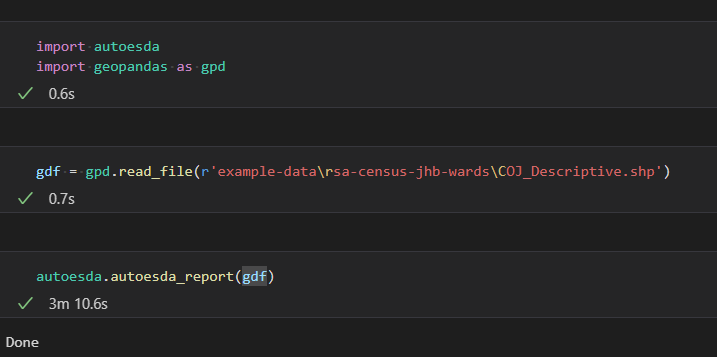
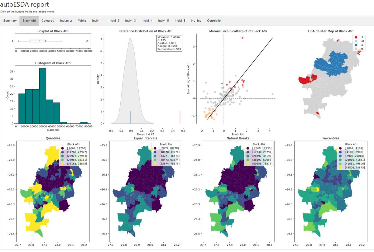
I achieved an exciting milestone today as autoesda - a python library developed as part of my honours project is available for download from @pypi and @condaforge 👨💻👾 A special shout out goes to @giswqs for your extremely informative YouTube Playlist🙏
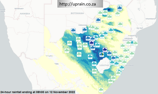
Day 25: An Interactive map for the #30DayMapChallenge@Zelbe04 created this map for her honours research project. The map visualizes rainfall🌧 data scraped from OpenWeatherMap and SAWS. The interactive map can be found here https://t.co/HzTjxrdOxA
Day 20 of the #30DayMapChallenge and today's challenge is to map Movement. Commercial Airliners🛩 trasport millions of people each year between different locations, which is why @Zelbe04 mapped the 10 busiest air routes in Africa based on the number of passengers transported.
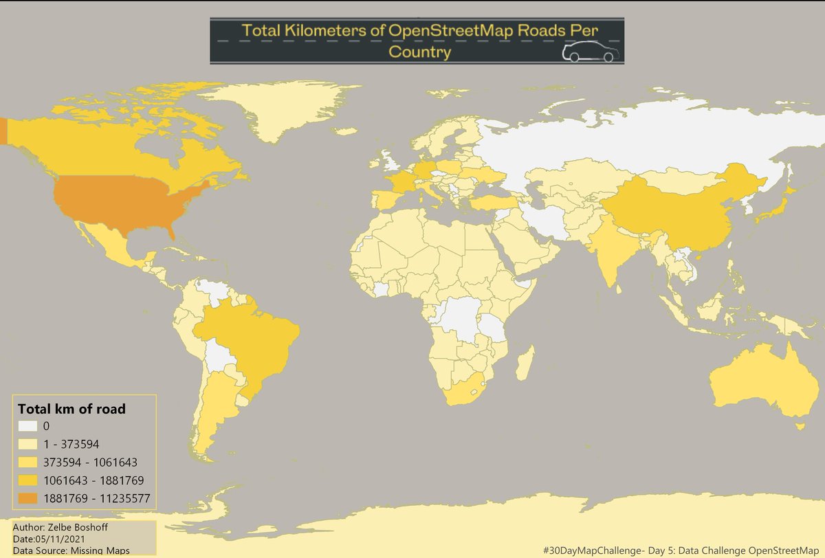
Day 5 of #30DayMapChallenge and the 1st data challenge 💪. The Challenge is OpenStreetMap.
Today's map was created by @Zelbe04 and shows the total kilometres of roads 🛣 mapped in OSM per country.
Calling ALL University of Pretoria students to participate in UPMappers 2021 Crossword Competition.
Complete the data visualization crossword and you will be placed in a raffle to win R500.
Crossword: https://t.co/REy1HaIlKT
Submit here: https://t.co/ErhiIyNEqR
Deadline: 31 March
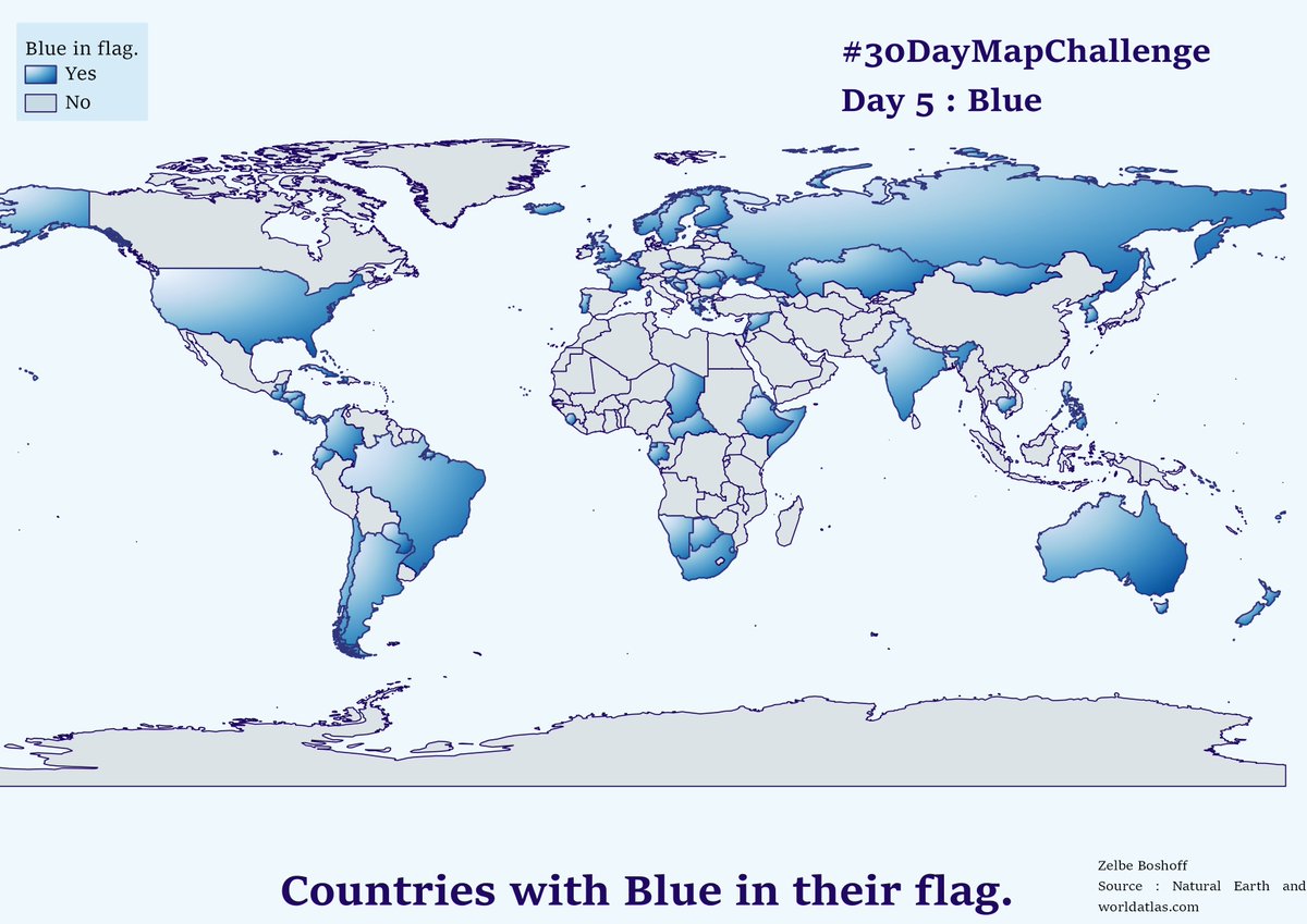
#30DayMapChallenge
Day 6: Red
In honor of the Queen👑, @taylorswift13 , I have mapped Countries where her Red album reached Top 10 in the country's charts.
For day 3 of the #30DayMapChallenge I took inspiration from one of my favorite shows, Gossip Girl. I've decided to map Manhatten, New York using colours that were used in Gossip Girls opening credits.
Day3: Polygons
@UPmappers is hosting a virtual geospatial tech event for school students interested in geoinformatics and geography on 10 October 09:00 (UTC+2). To participate, register here, https://t.co/fN88AzW2O3
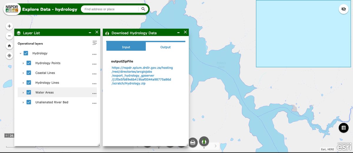
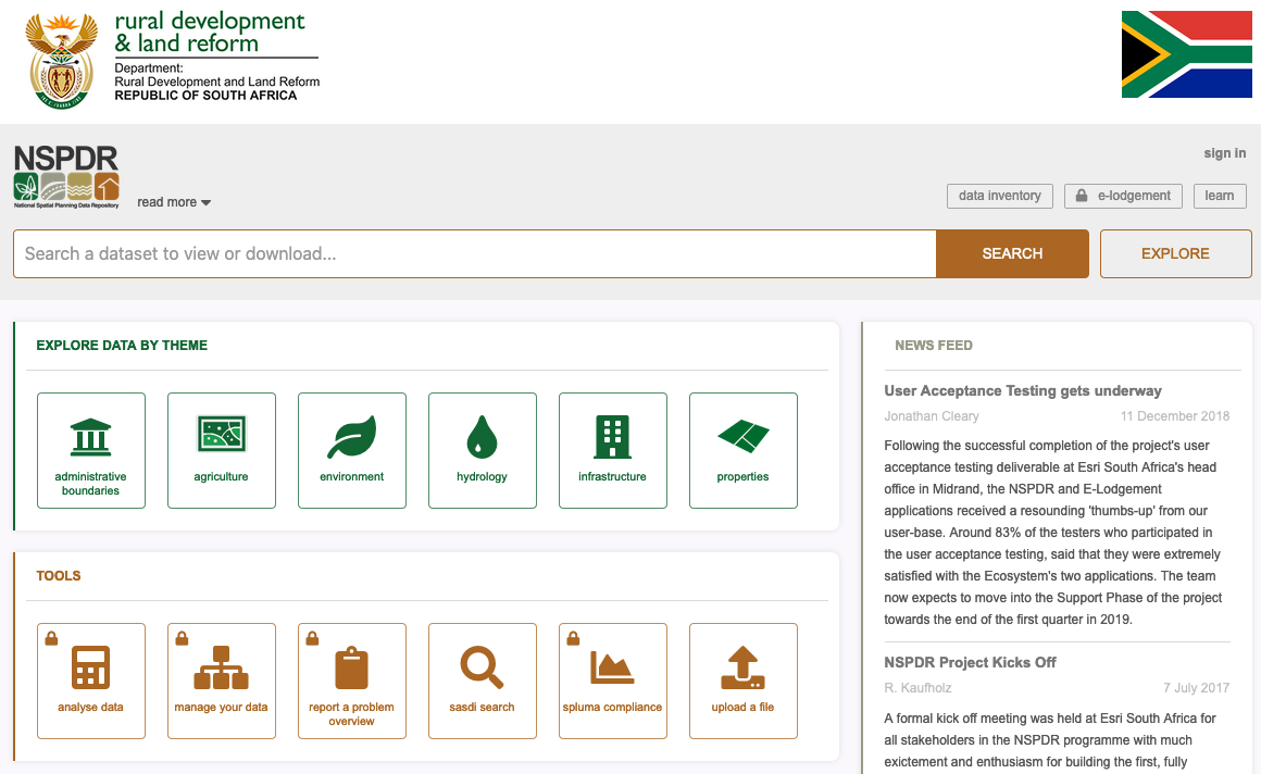
New National Spatial Planning Data Repository (NSPDR) is available for testing👍🏾@FuthiGama @DRDLR_online. Export of data points in area of interest works nicely https://t.co/9XJWec0jim