A multi-day severe weather outbreak is expected to begin tomorrow across parts of the Canadian Prairies. Damaging winds, large hail, and strong tornadoes will be possible. #abstorm#skstorm#mbstorm
TORNADO OUTBREAK POSSIBLE SASKATCHEWAN TO MANITOBA SATURDAY AND SUNDAY!
Team Dominator is surging north to the Canadian Prairies for a two-day #tornado outbreak threat. We will be targeting southeastern SK tomorrow along a warm front zone Regina to Yorkton, and an even more significant tornado threat Sunday PM across southern Manitoba.
Live storm chasing mode imminent as we execute out science mission
Team Dominator is heading to CANADA for a #tornado outbreak this weekend!
We will be targeting southeastern Saskatchewan on Saturday and southern Manitoba on Sunday.
Meanwhile, the Dominator 3 is heading to the Dakotas with a new motor for the Tuesday-Thursday #tornado event next week. This is when our science will peak
#stormchasing
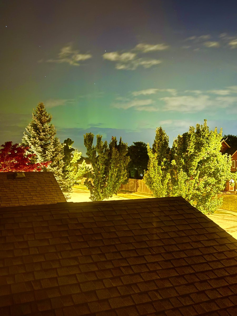
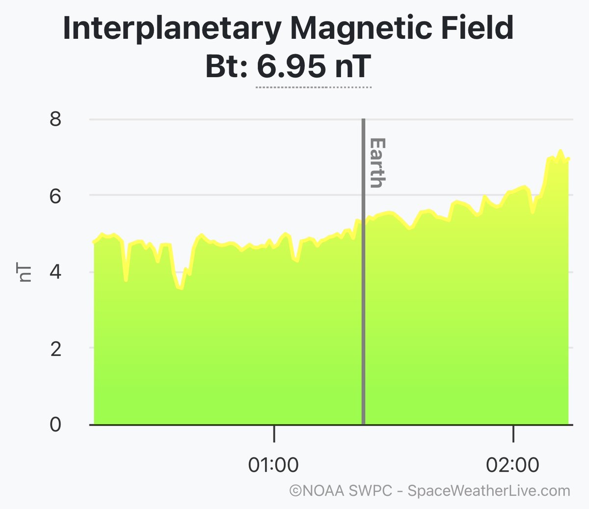
@JAtanackov Bortle 7 here at 43°N with greatest light pollution Bortle 8 to the north. (~55°N geomagnetic latitude). First photo is a G2 substorm, 2nd is a G4 one. Might venture out if things get interesting early enough with bortle 3 skies nearby. 24°C here at 9 pm.
Fire response continues on Timmins 9, remapped at 2,945 hectares. Aerial fire suppression is underway as of this morning. An increase in fire behavior is expected this afternoon, as persistent hot, dry and windy conditions are forecast.
Photo Timmins 9 - June 3, 2026.