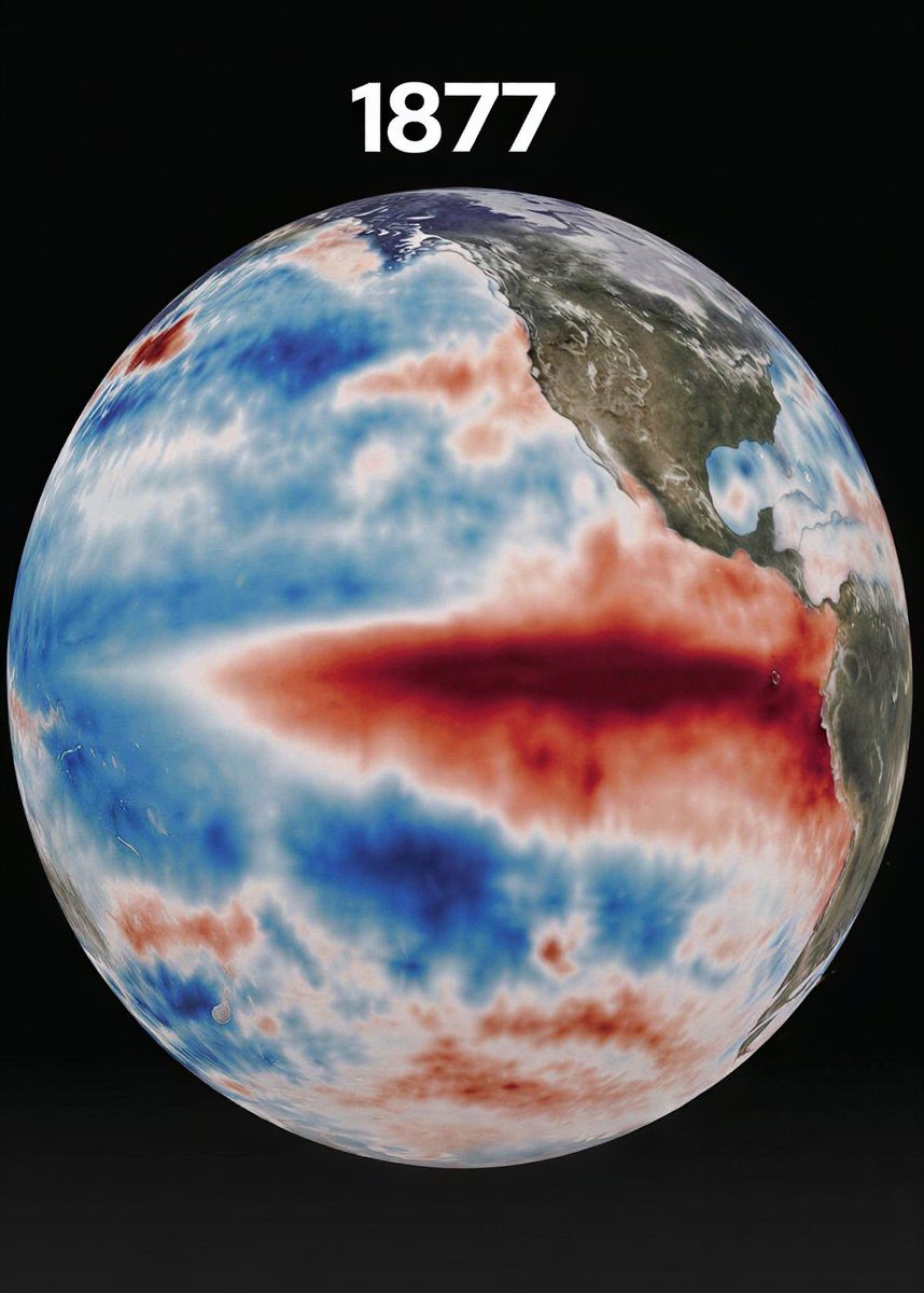
BREAKING🚨: Earth just entered intense weather cycle and could be the strongest ever recorded
The 2026 El Niño is shaping up to be the deadliest since 1877 — the year famines killed more than 50 million.
Forecasters are tracking ocean temperature spikes of 2 to 3 degrees Celsius. That's not a minor uptick. That's the signature of a once-in-150-years event.
Per LiveScience: a "Super" El Niño is now the most likely outcome by year's end. The human cost could be staggering.
A magnitude 6.2 earthquake struck Hokkaido
in northern Japan at 5:23 a.m. on April 27. Authorities say it is unrelated to a recent advisory issued for a possible mega quake.
Visit: https://t.co/bZpiKm94yl for more.
Note: This video replaces another we posted earlier.
Huge widespread dust storms have hit Xinjiang, China, after a cold air mass swept across the region, setting off severe conditions and reducing visibility across large areas.
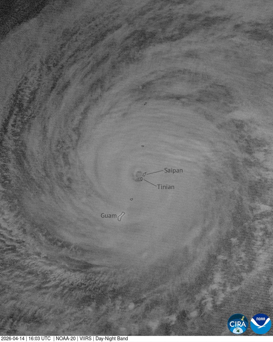
This past weekend Typhoon Sinlaku underwent rapid intensification into a super typhoon, and has spent the last few days lashing Guam and the Mariana Islands in this multi-day satellite imagery.
The most crisp and clear satellite imagery of Super Typhoon Sinlaku’s atmosphere-rattling peak intensity on Sunday.
185 MPH, 890 MBAR, and over ~30 consecutive hours at Category 5 status.
One of the most impressive peak strength phases you’ll see.
❗️❗️ MONSTER Typhoon Sinlaku is now pushing into the Tinian–Saipan area in the Northern Mariana Islands, western Pacific, this evening.
It’s only the second time on record a Category 4 system (JTWC scale) has tracked directly through here.
Breathtaking views of Super Typhoon Sinlaku seen yesterday and today from the JPSS weather satellites, capturing the very impressive eye at the center of the storm.
🌀 Super Typhoon Sinlaku is approaching the Mariana Islands. A powerful Category 5 system with a well-defined eye and winds of around 280 km/h. It has likely peaked but will weaken only gradually. Follow official warnings and instructions from local authorities. ⚠️
You are looking, right now, at the most powerful storm on the planet tonight.
Typhoon Sinlaku is twisting herself into a furious and frenzied craving for evaporated heat energy over the Pacific Ocean, and she is fast approaching or already exceeding Category 5 intensity. Icy spindles are reinforcing her CDO, lightning packets are bursting throughout the eyewall, and the air pressure in her eye is absolutely tanking. This is an incredible display of explosive cyclonic intensification.