@MagicBathy is thrilled to participate in the #ScienceIsWonderful 2025 event, showcasing our cutting-edge research in #seabed and #underwater mapping! 🚀🌊 Join us as we dive into the fascinating world of remote sensing, #AI, and #3D computer vision! 🌎💡
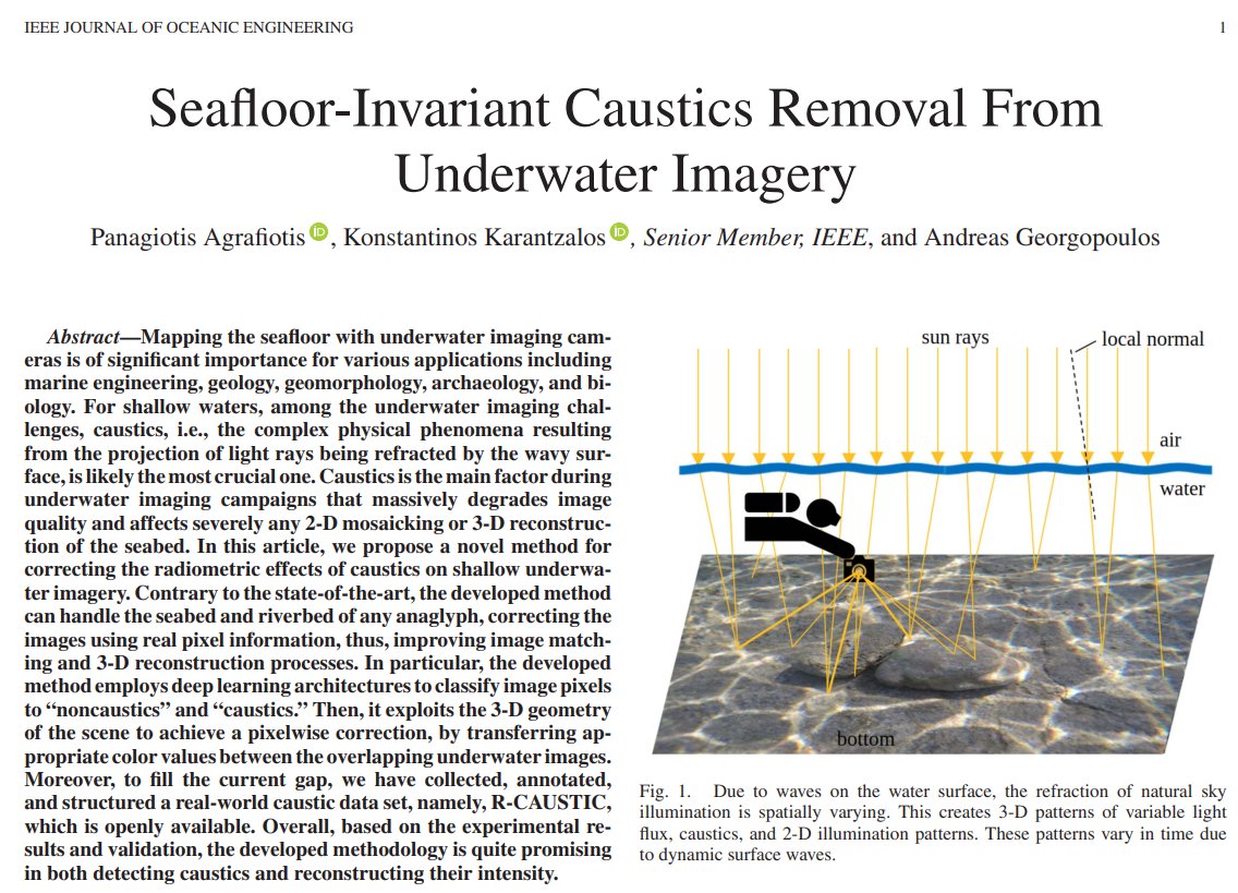
Pleased to see our work at @NTUA on #seabed#caustics being recognized and used as a baseline for innovative methods that also exploits our R-CAUSTIC dataset! This week at #ECCV2024, a compelling study on #deep#monocular#SLAM will be presented. Definitely worth checking out!
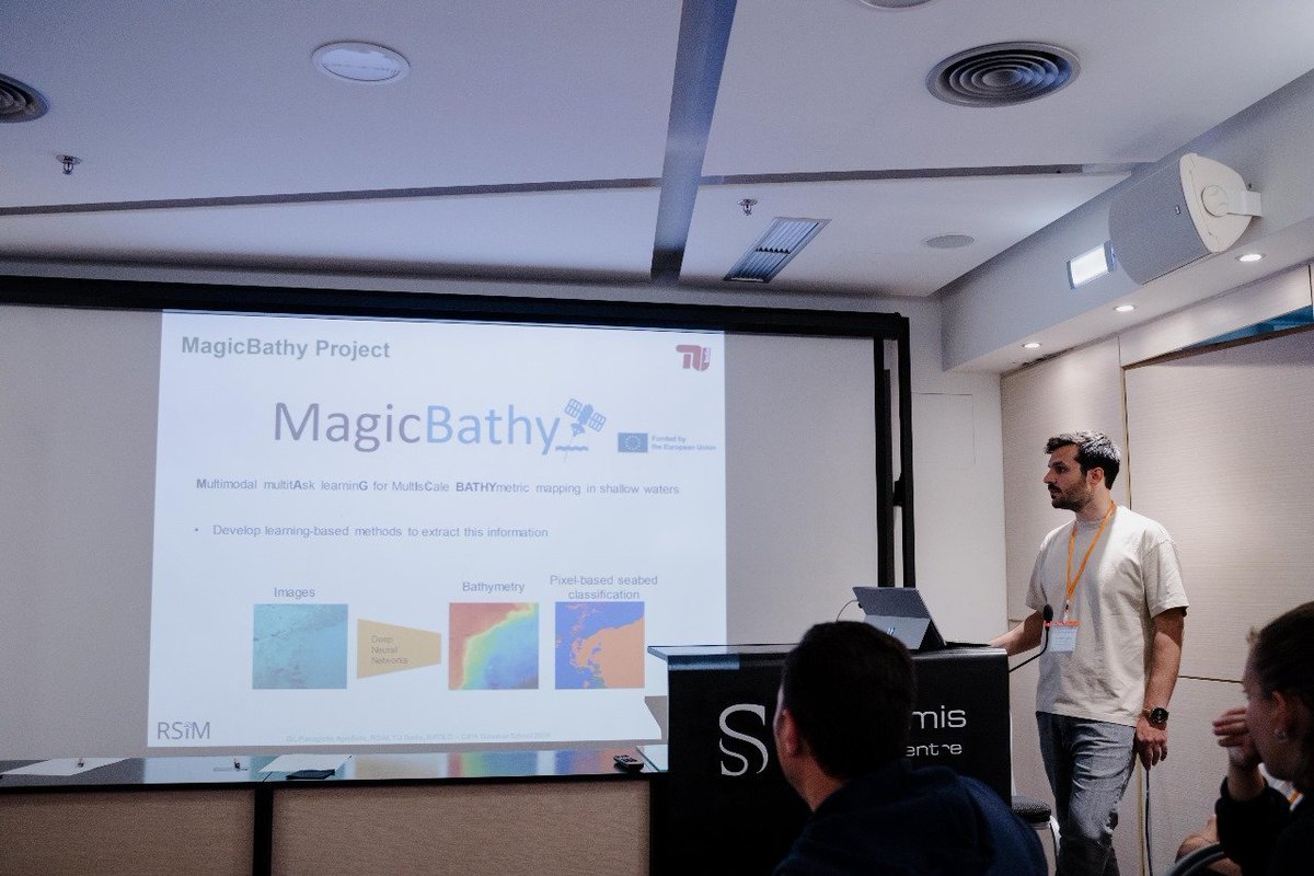
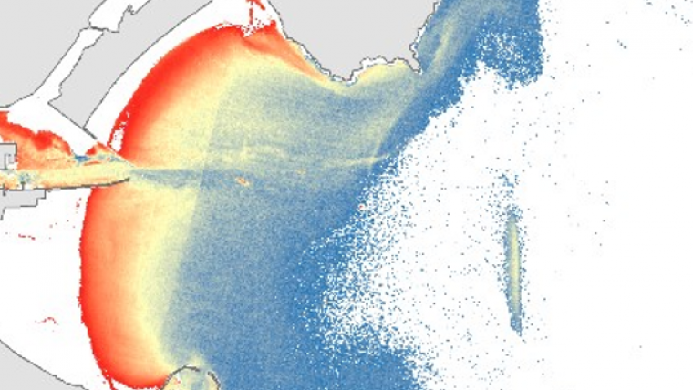
🌊 Introducing #MagicBathyNet — the first public dataset for bathymetric & semantic mapping using air/satellite images 🌍 Developed by Dr. Panagiotis Agrafiotis
🔹Cost-effective
🔹Frequent & consistent mapping
Link: https://t.co/iRiUTPhQKa
#SeabedMapping#AIForGood#EO
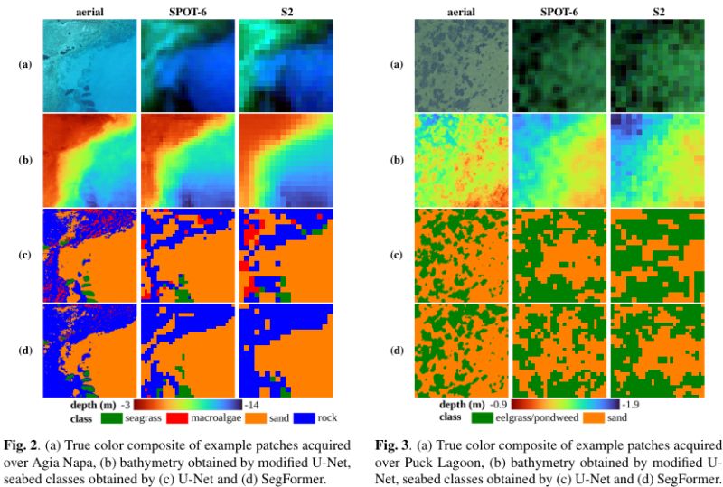
🚀MagicBathyNet features this unique region across multiple modalities: aerial imagery, SPOT-6, and Sentinel-2 multispectral data! Dive in and enhance your research on #bathymetry prediction and pixel-based #seabed classification with our dataset! https://t.co/fL6sGPhASU
🎉We've just released MagicBathyNet! This benchmark dataset includes Sentinel-2, SPOT-6, and aerial imagery, bathymetry, and annotations of seabed classes. Created as part of the @MagicBathy@MSCA#EU project 🛰🌍🌊
Dataset, pre-trained weights, and code: https://t.co/4RdU2gu4Su
Thrilled to have @MagicBathy presented to over 40 cultural heritage professionals during 2024 #CIPA Summer School in Rhodes, Greece, engaging discussions on its AI-based seabed mapping solutions and their applicability for submerged CH mapping! #CulturalHeritage#AI#EUProject
#Eyecandy Review with us a wonderful evening at the Zeiss-Großplanetarium in Berlin at https://t.co/FHSuxfwZpf
Through three engaging lectures, scientists from @NASA , the Planetarium Berlin, and BIFOLD explained the significance of satellite images and modern AI techniques.
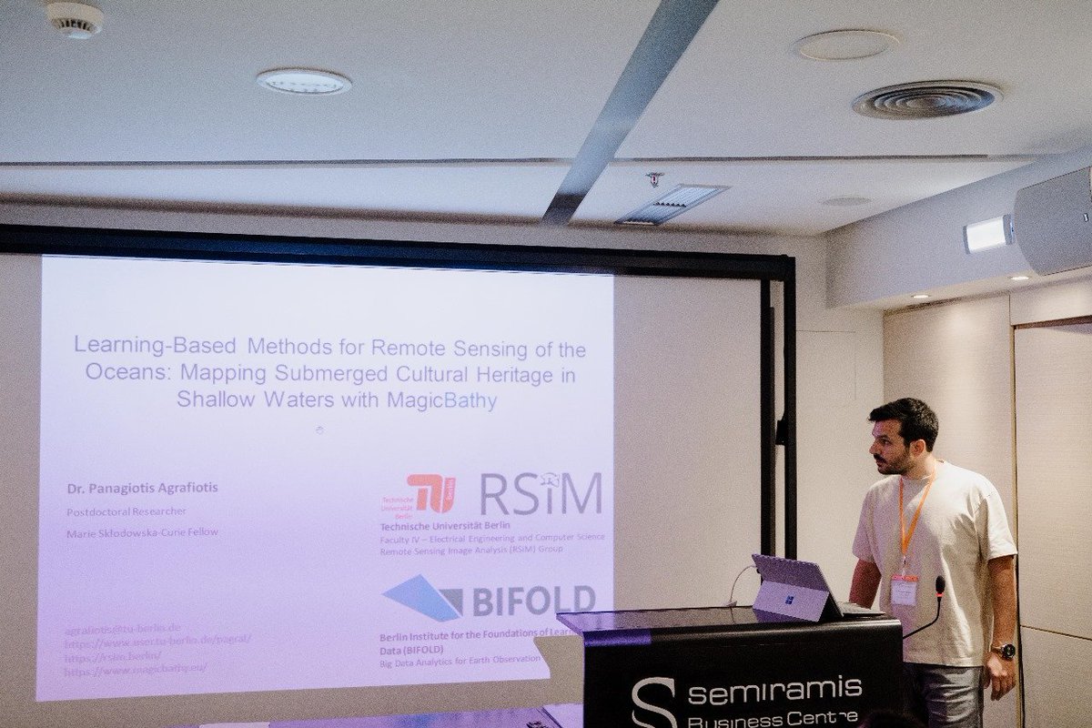
Last week I talked in the “SMART SKY: TRANSFORMING EARTH OBSERVATION THROUGH AI” event organized by @bifoldberlin & Zeiss-Großplanetarium in Berlin. It was such a faschinating experience to share my research in the context of @MagicBathy#MSCA#EUProject on the Planetarium dome!
Thanks a lot SPECTRUM for giving me the opportunity to share my experiences in #underwater CH #3dmodeling. It is always a joy to inspire young professional on the field https://t.co/NgSw7bHFWd @CyUniTech @ISPRS_SC @UNESCO_DCH_ERA
@MagicBathy#EU @MSCActions project can't wait to participate to this event with @PAgrafiotis presenting the performed research on leveraging #AI for better understanding our #Oceans! 🌊🛰🌎
#ISPRS WG II/7 and NAUTILUS* invite you to the online user meeting that will take place on 15.01.24! Two sessions will be organised to optimise coverage of different time zones around the globe. https://t.co/Ys0OmmCWwg
*NAUTILUS is a Scientific Initiative founded by the ISPRS
📣 We are organizining an #ISPRS#Underwater#Mapping Workshop -#Geospatial techniques for underwater documentation, mapping and #monitoring- in the context of ISPRS Geospatial Week 2023! Follow the link for more!
🔗https://t.co/h3AUjKJNzp
Explore the latest in shallow-water and coastal mapping with these five inspiring articles! Mapping these areas is crucial for human activities, but it can be a challenging task. Discover new insights and ideas for improving these important maps. https://t.co/1WcZ9euurs