@MagicBathy is funded under @HorizonEU PFs @MSCActions GA101063294 for #AI based #ocean#mapping. Related tweets reflect only the views of the project owner.
MagicBathy (Multimodal multitAsk learninG for MultIsCale BATHYmetric mapping in shallow waters) is an @HorizonEU 🇪🇺@MSCActions Project, aiming to create an advanced deep learning framework for lowcost shallow water mapping using single UAV and satellite imagery!🛰️🌍🌊
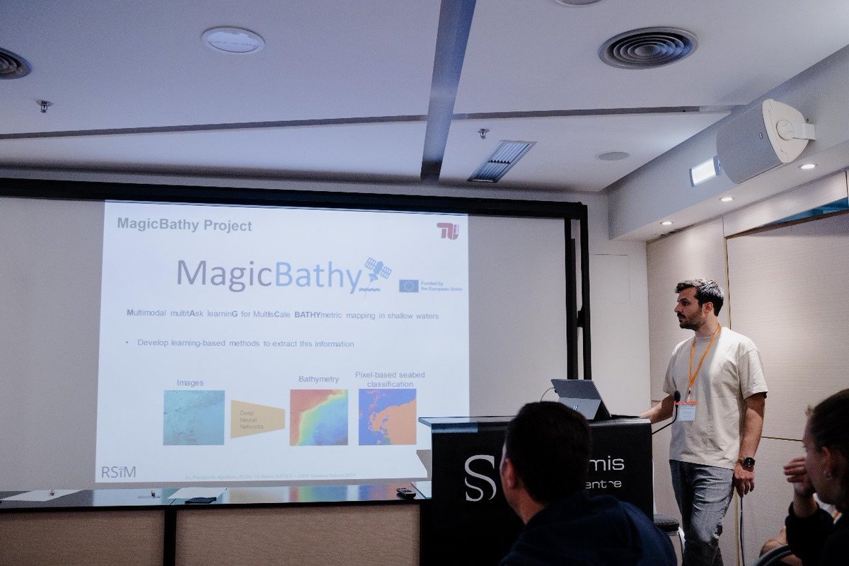
🌊🌍🛰️✨ Super excited to share our latest paper “Seabed-Net: A multi-task network for joint bathymetry estimation and seabed classification from remote sensing imagery in shallow waters” published in ISPRS Journal of Photogrammetry & Remote Sensing!
https://t.co/kWglFXzUaC
🌊✨Excited to share that our paper "Sea-Undistort: A Dataset for Through-Water Image Restoration in High Resolution Airborne Bathymetric Mapping" has been accepted in IEEE GRSL!
📂 Dataset, code & weights: https://t.co/52dYtRHYRX
📖 Preprint: https://t.co/q24hBtzVls
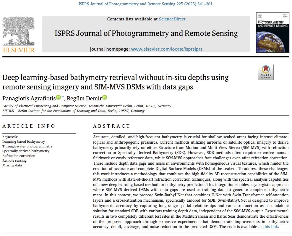
🌊🌍🛰️✨Excited to share our new paper, “Deep learning-based #bathymetry retrieval without in-situ depths using remote sensing imagery and #SfM-#MVS DSMs with data gaps,” in ISPRS Journal of #Photogrammetry & #Remote#Sensing!
📄 Paper: https://t.co/NYaMywDv4l
@MagicBathy is thrilled to participate in the #ScienceIsWonderful 2025 event, showcasing our cutting-edge research in #seabed and #underwater mapping! 🚀🌊 Join us as we dive into the fascinating world of remote sensing, #AI, and #3D computer vision! 🌎💡
🌊 Introducing #MagicBathyNet — the first public dataset for bathymetric & semantic mapping using air/satellite images 🌍 Developed by Dr. Panagiotis Agrafiotis
🔹Cost-effective
🔹Frequent & consistent mapping
Link: https://t.co/iRiUTPhQKa
#SeabedMapping#AIForGood#EO
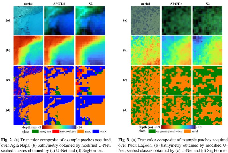
🚀MagicBathyNet features this unique region across multiple modalities: aerial imagery, SPOT-6, and Sentinel-2 multispectral data! Dive in and enhance your research on #bathymetry prediction and pixel-based #seabed classification with our dataset! https://t.co/fL6sGPhASU
On the northern coast of Poland lies the Hel Peninsula, a 35-kilometre-long sand bar extending into the Baltic Sea, which is visible in this Copernicus Sentinel-2 image acquired on 14 May 2024.
Read more:
https://t.co/czT10pIUcY
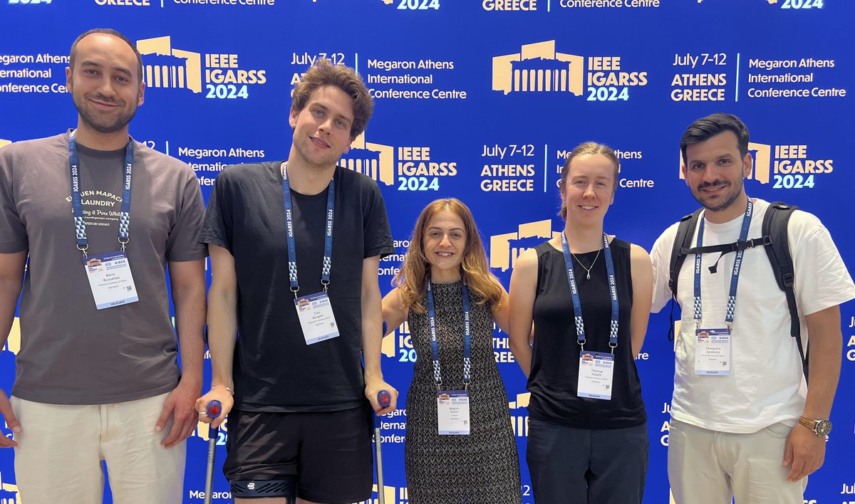
📢BIFOLD researchers presented 4 papers at IGARRS2024. The BigEarth group, chaired by Begüm Demir, focuses on fundamental research at the intersection of data management and machine learning for Earth 🌍observation. Learn more👉https://t.co/bnN5CTJ35A
📢JUST ANNOUNCED: Flagship #OceanDecade initiative @seabed2030 announces latest ocean floor mapping progress on #WorldHydrographyDay.
This global effort to uncover the Earth’s final frontier has made remarkable marine discoveries possible.
Read more: https://t.co/sVcmyqPJl5
AI for young researcher: BIFOLD at #LN8dW. On June 2nd, 2024, from 5 PM BIFOLD invites children aged 9 to 15, along with their families, to join in a captivating digital scavenger hunt. Experience a hands-on introduction to #AI, #ML, & #DM.
More: https://t.co/dz6YtH3icm
🎉We've just released MagicBathyNet! This benchmark dataset includes Sentinel-2, SPOT-6, and aerial imagery, bathymetry, and annotations of seabed classes. Created as part of the @MagicBathy@MSCA#EU project 🛰🌍🌊
Dataset, pre-trained weights, and code: https://t.co/4RdU2gu4Su
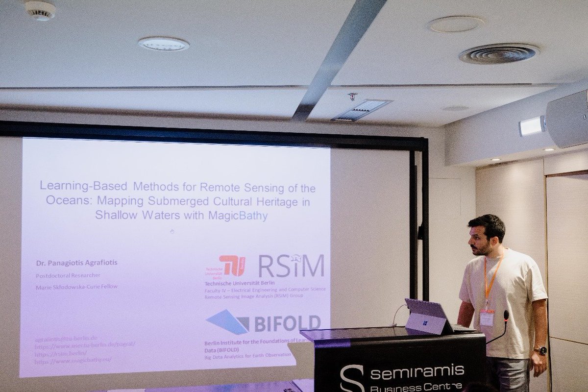
Thrilled to have @MagicBathy presented to over 40 cultural heritage professionals during 2024 #CIPA Summer School in Rhodes, Greece, engaging discussions on its AI-based seabed mapping solutions and their applicability for submerged CH mapping! #CulturalHeritage#AI#EUProject
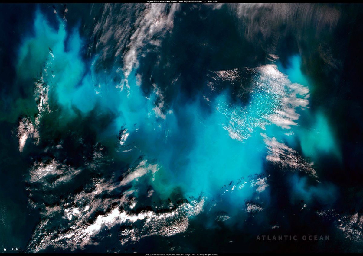
#ImageOfTheDay#Oceans in the northern hemisphere are full of activity at this time of the year, generating beautiful phytoplankton blooms visible from space
A large #phytoplankton bloom 🟢🔵 occurring west of France is visible in this #Sentinel2 🇪🇺🛰️ image from 11 May
#Eyecandy Review with us a wonderful evening at the Zeiss-Großplanetarium in Berlin at https://t.co/FHSuxfwZpf
Through three engaging lectures, scientists from @NASA , the Planetarium Berlin, and BIFOLD explained the significance of satellite images and modern AI techniques.
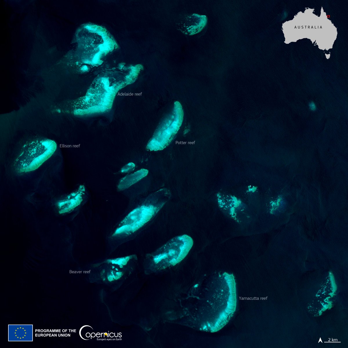
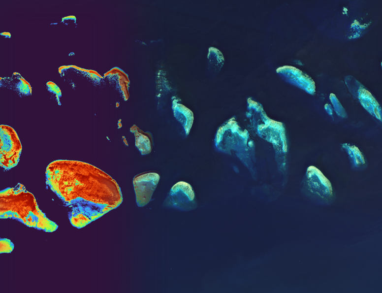
The 5th 🪸 coral bleaching event in 8 years is a reality
Ocean temperatures are rising causing biodiversity degradation
@CopernicusEU#Sentinel2 acquired this image of the reefs near 🇦🇺
Discover how we work to protect Europe's ocean, seas and coasts 👉 https://t.co/SJOGKPy70P
Last week I talked in the “SMART SKY: TRANSFORMING EARTH OBSERVATION THROUGH AI” event organized by @bifoldberlin & Zeiss-Großplanetarium in Berlin. It was such a faschinating experience to share my research in the context of @MagicBathy#MSCA#EUProject on the Planetarium dome!
Take a seat at the Zeiss-Großplanetarium in Berlin and join the BIFOLD Live Talk "Smart Sky: Transforming Earth Observation through AI."
Date: Tuesday, March 19, 2024
Start: 7 pm
Age: from 14 years
Tickets: Free of charge. No registration is required.
https://t.co/2430lRrYgH
#DYK?
#Copernicus#Sentinel2 🇪🇺🛰️ and #Sentinel3 🇪🇺🛰️ #OpenData provides accurate information on water quality across the world
More at 🔗 https://t.co/6UzuS2SYtq
⬇️The Yellow Sea as seen by Sentinel-2 on 14 February
Join us for the "EMODnet for Horizon Europe and EU Mission: Restore our Ocean and Waters projects" webinar, where we will focus on streamlining data submission, guiding data collection, optimizing data flow to EMODnet!
Email [email protected] for registration details.