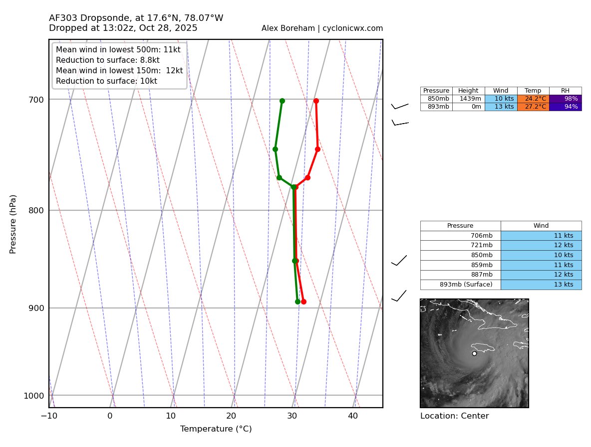
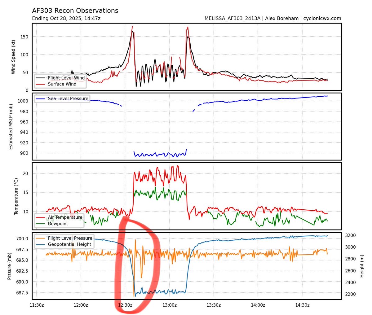
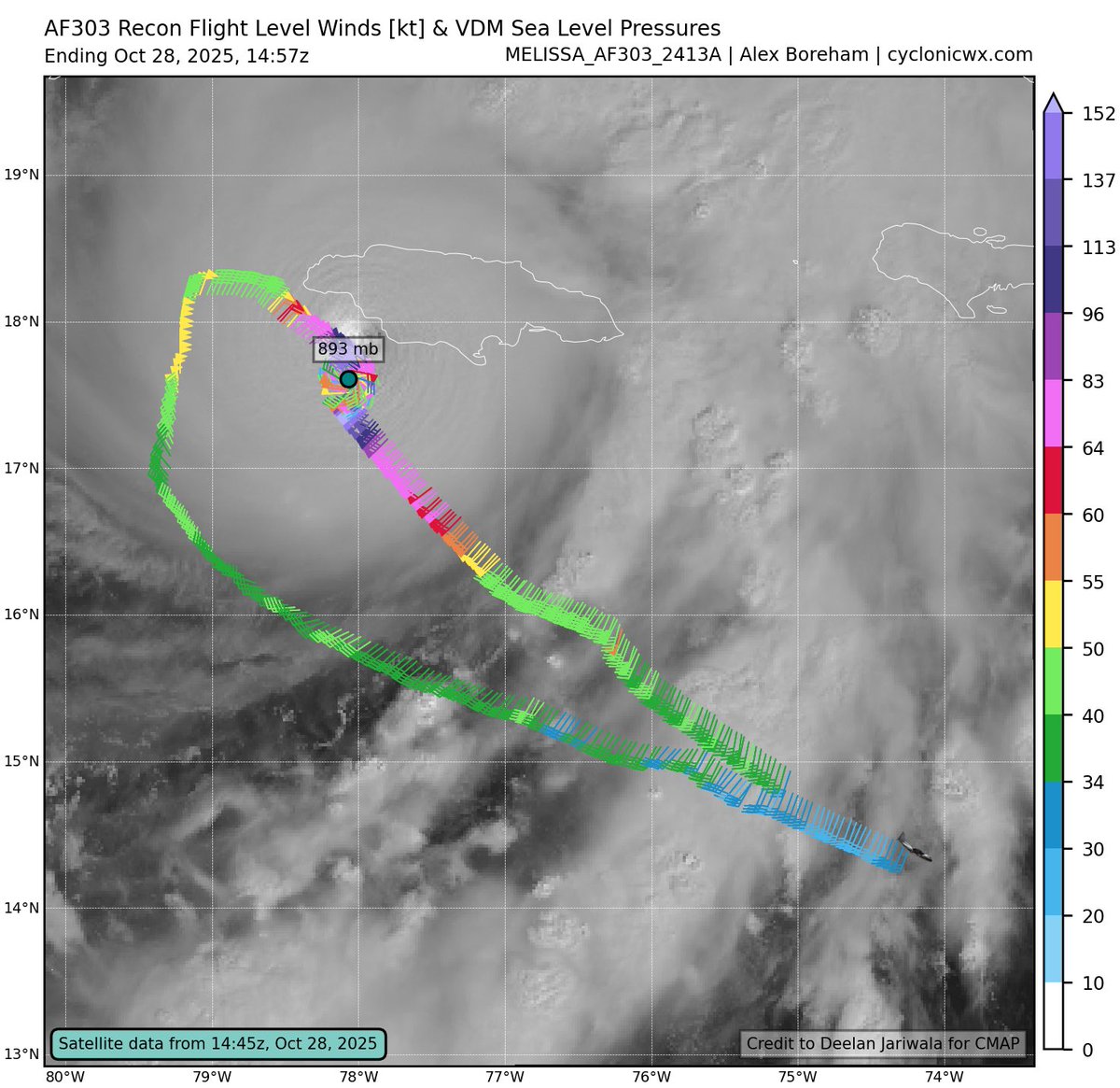
Looks like the very rough ride was confirmed. Plane had to leave early. They reported svr turb and a "sawtooth" eye. Looks like they moved 600-700ft up & down during this stretch in ~1 min. But they captured some historic data including a 893mb center drop. Mission for the ages.
Gotta get to bed since we'll be up at 3 am to do another mission into #Melissa right before landfall in Jamaica tomorrow. Here's a video I took today going through the NE eyewall into the eye. I had to tilt the phone up to get a view of the eye because it was so cylindrical (not the classic stadium effect). Reminded me a lot of Hurricane Michael in 2018.
It's CRAZY seeing twin storms so close to each other on satellite this morning! I doubt we'll ever see anything like #Humberto and #Imelda again in the Atlantic. 🌀🌀
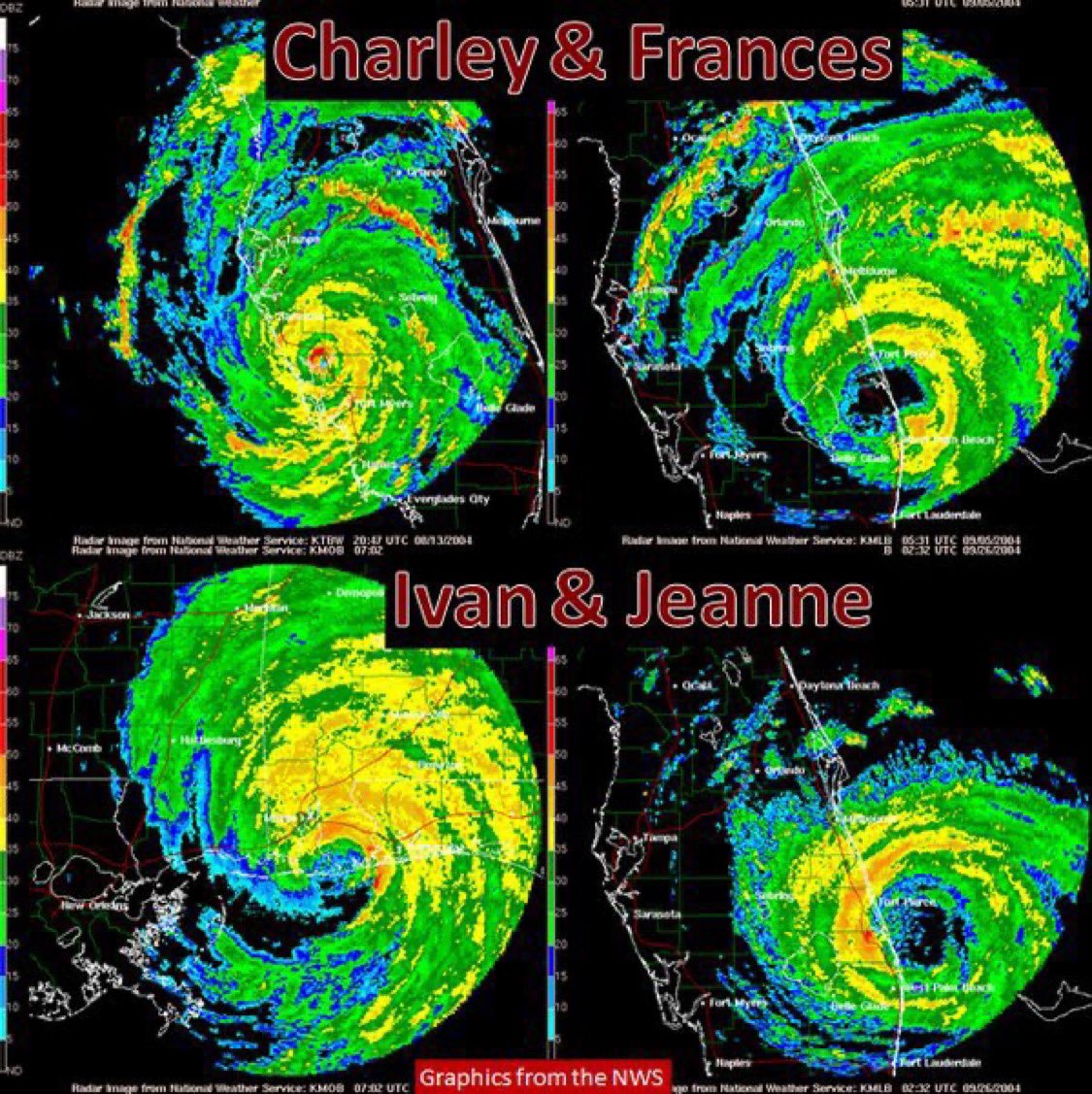
Today marks the 21st anniversary of Hurricane Charley's landfall in southwest Florida the 1st of 4 hurricanes to strike the peninsula in over 7 weeks in 2004. #Flwx
With hurricanes, the window of worry is usually longer than the window of concern.
There is lots of chatter this week about Invest #97L, a tropical wave just emerging west of Africa that will travel across the Atlantic and likely develop into a hurricane according to most models.
Uncertainty regarding whether newborn waves will cross the entire pond to threaten the Caribbean or United States before recurving northward is a tale as old as time. That journey takes 7-12 days depending on the area threatened, and in most cases, we simply don't know the outcome this early. Details of genesis location and the compounding effects of 10 days of steering forces can't be precisely predicted yet.
The window of worry is open, but we have not yet entered the window of concern. 97L will be monitored closely next week, and we'll be discussing it as the future becomes clearer. Given it is August, those in hurricane alley should be in a constant state of preparedness just in case a storm forms and heads your way.