@Mennier@Washed_Up It's right in the middle of flowering, have seen canola partially recover from a similar beating at this point in the season but the wheat across the road is a complete loss
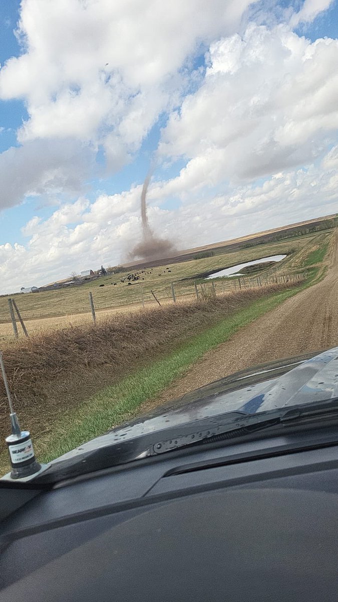
Truck is rockin in 40kmh+ nnw wind just west of Markerville. This was a beautiful canola crop a few days ago. Truck says 22C but it feels like 12. #abstorm
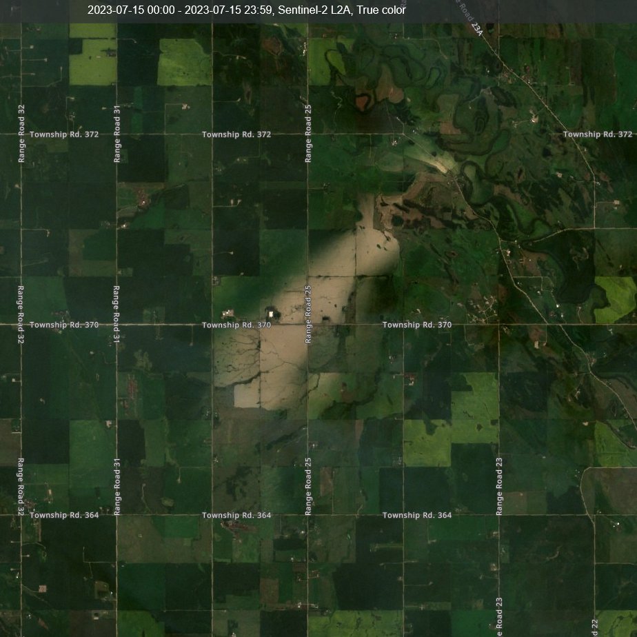
Spotted the first obvious hail scar on Sentinel just nw of Markerville from the July 10 slow moving #abstorm
Not a very big one but it's ugly. @NTP_Reports
Just tried to browse the abstorm tag and I can't do it. It is 99.97% spam, how can it be used for reporting?
Does anyone know if EC³ even watches this tag anymore?
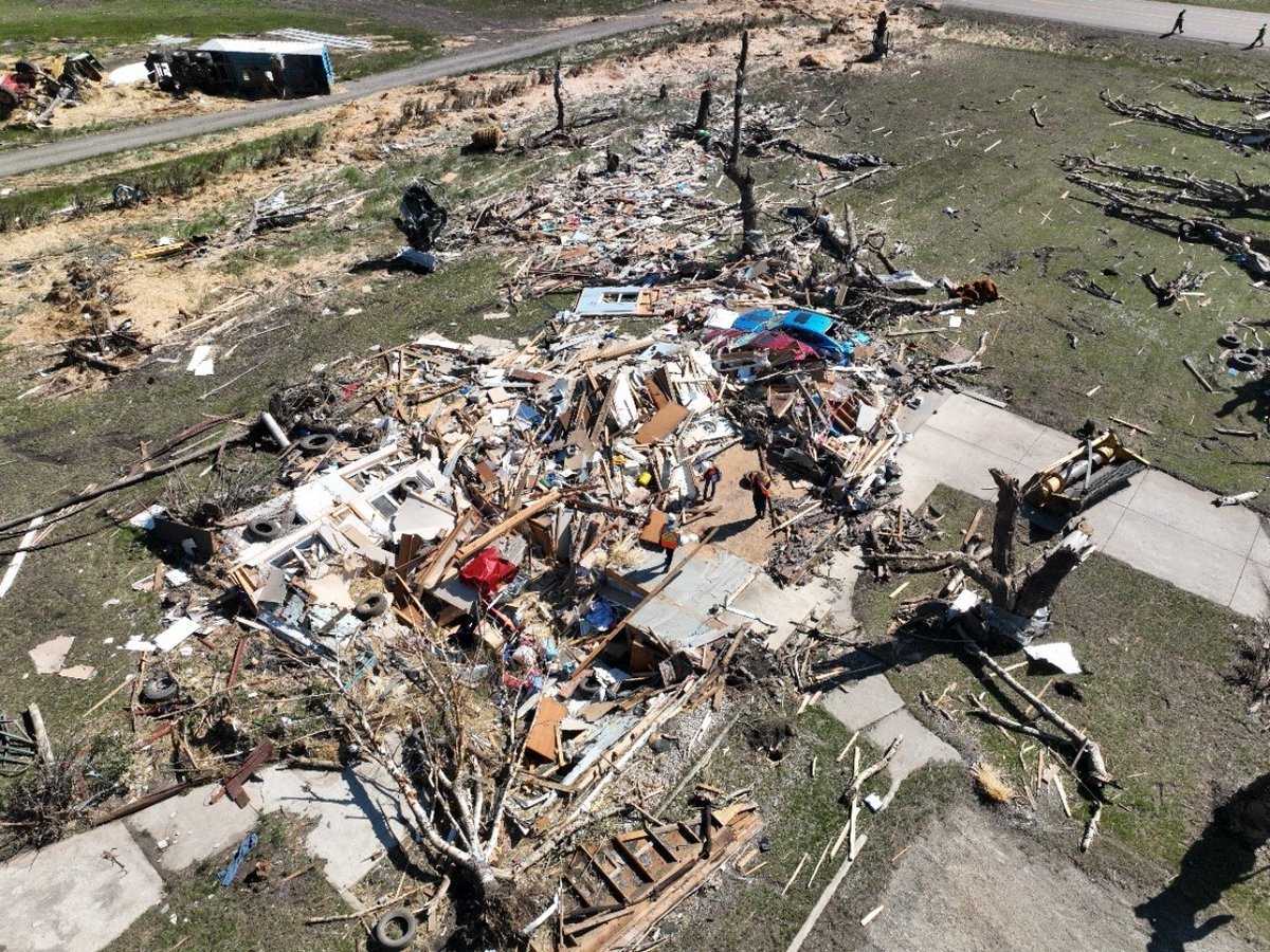
An NTP investigation, in collaboration with @ECCCWeatherAB, has concluded that the worst damage from the July 1st Didsbury tornado is rated EF4 on the Enhanced Fujita scale, making it the highest-rated AB tornado since Edmonton in 1987.
Full details: https://t.co/IsCIDSoMuo
#ABstorm
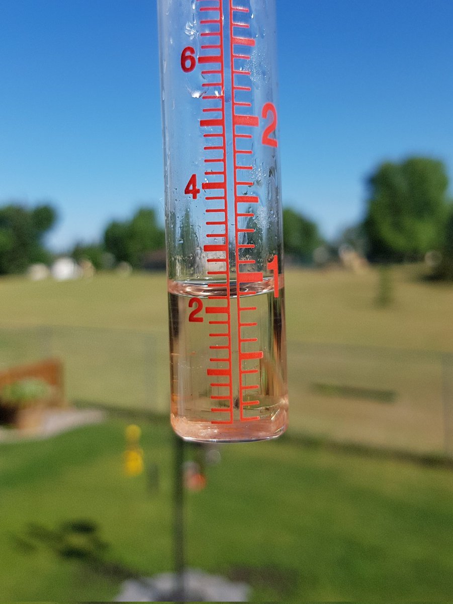
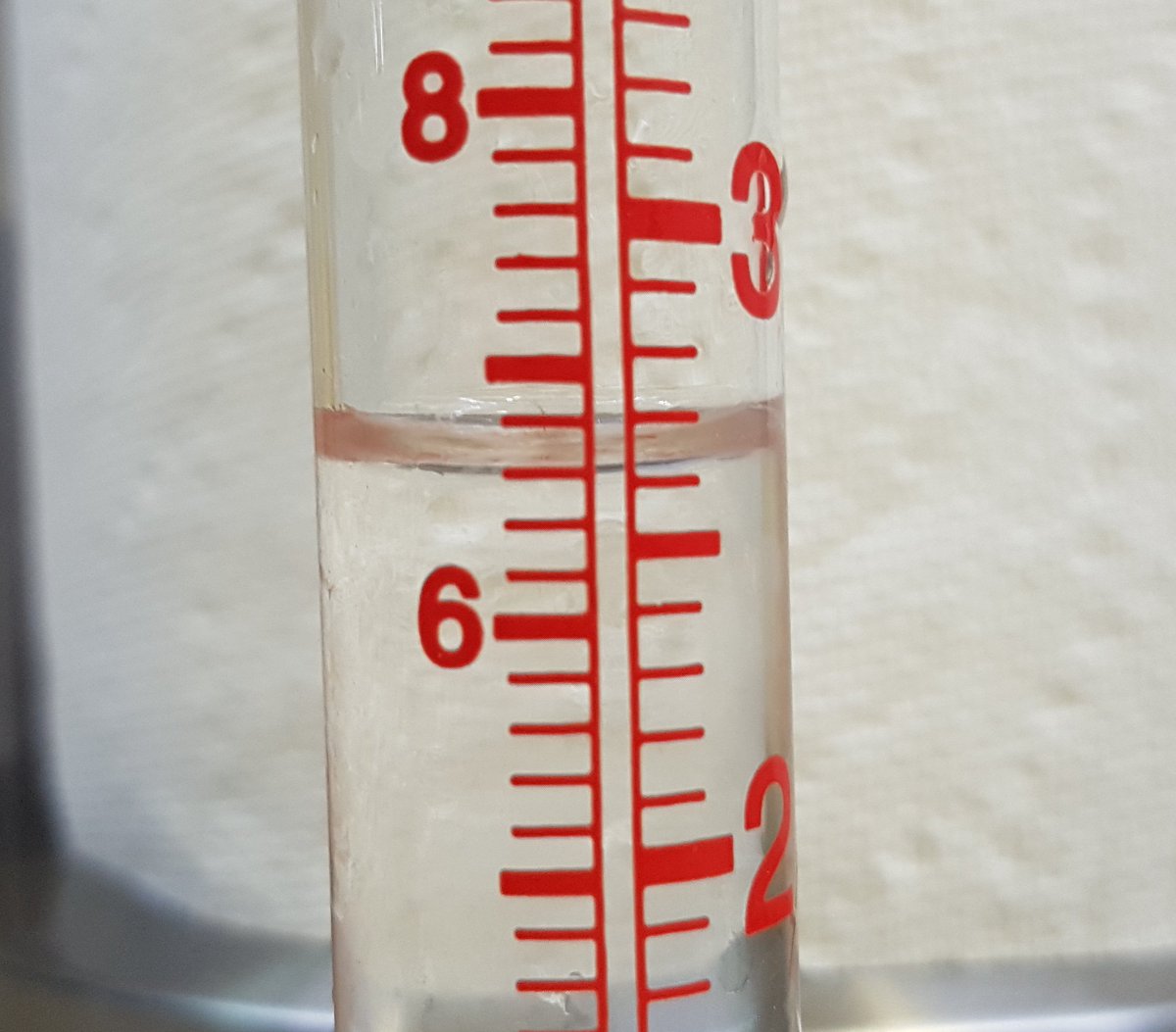
Another 22mm in the bin brings the #JuneMonsoon total in our yard to 113mm. After a week of sog the sky is extra fantastic blue this morning. #RedDeer#abstorm
We have been busy analyzing the data from 2022. Here are all 469 major hailswaths detected by radar (S of 55 N) in Canada from 1 May - 30 September. MRMS MESH > 10 mm for 30 km + at least 2 pixels of MESH >= 50 mm. Longest swath ~350 km! Prairies = hail country. @noaa
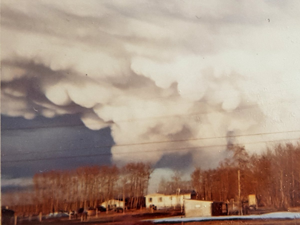
As this is the first day of spring, here is the earliest storm photo I could find in my photo albums. Instamatic mammatus shot from spring of 1972 looking towards Red Deer from Sylvan Lake. We used to call em hail bags.