Meteorologist & Ops Manager for OpenSnow residing in the Tetons of WY. Meteorology degree from @msudenver. Mountain weather, powder forecasts, thunderstorms.
Nearly all of the rain in August has happened since August 13th. Here are the hourly (top) and cumulative (bottom) 30-day precipitation charts for the Raymer Plot.
Morning thunderstorm just pushed us over 3" of rain for the month of August in Jackson, about twice the average amount. Across the higher terrain, August rain totals include 4.67" at JHMR's Raymer Plot (Teton Range) and 5.67" at Mt. Baird (Snake River Range).
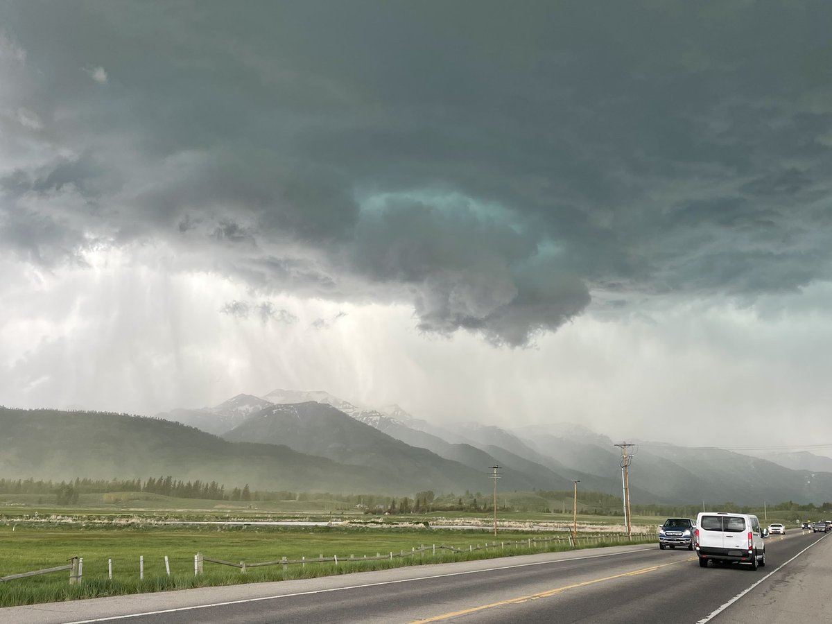
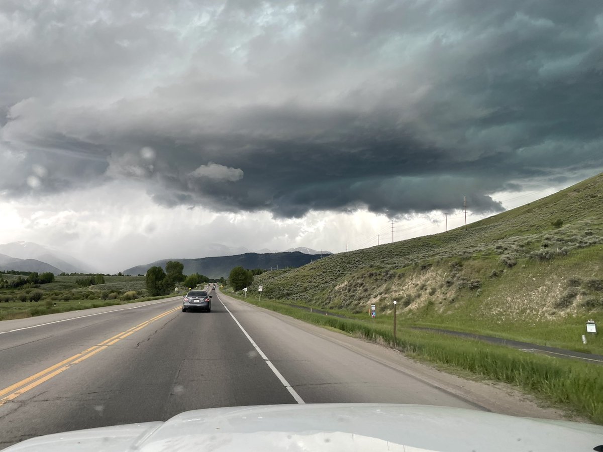
Subtle shortwave helping to trigger midday thunderstorms over the Tetons on Thursday. More widespread soaking rains on the way this weekend as a trough arrives along with a slug of subtropical moisture from the Pacific
Early round of fast moving thunderstorms approaching the Tetons from the W at 6:30am Tuesday in response to a shortwave moving through, and this may not be the only AM round. Heads up if you’re hiking or heading outside this morning!
While many areas have had good rain, totals have been lower, but still meaningful around Driggs as well as in the Northern JH Valley. This is just part of the random variation that occurs with summertime convective patterns (hit or miss showers/t-storms).
The Southwest Monsoon delivers! 3-day rain totals of 1.5 to 3 inches in the Tetons above 8,500 ft. and over an inch in the town of Jackson. Moisture levels look to stay above-average thru the end of Aug, which is great news for keeping fire danger in check.
Picked up a half-inch of rain in Jackson, WY and up to 0.83" in the Tetons on Thursday after 2 weeks of dry weather. A very fall-like high of only 62ºF in Jackson. Refreshing change after a stretch from July 11-Aug 11 with 12 days of highs in the 90s.
@Brady_Wx@JoeWorsterWX@OpenSnow In the top analog years examined, there is a below-avg snowfall signal for SLC but an above-avg signal in the Wasatch, so it is somewhat elevation dependent. But to Andrew's point, last year's temps (& snow levels) were anomalously high and I doubt we see a repeat this winter.
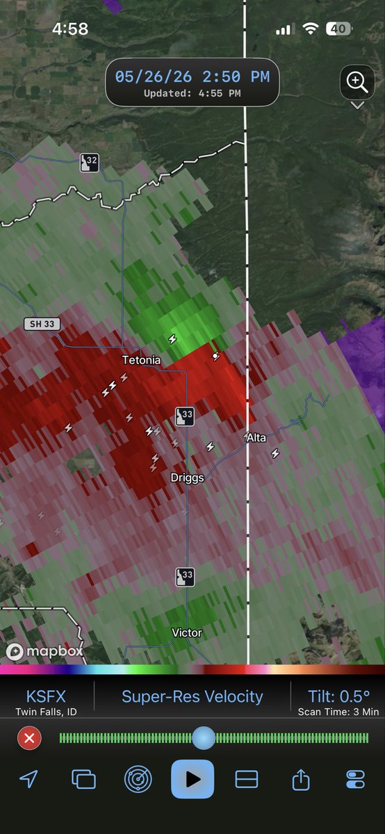
A severe t-storm moved thru Teton Valley, Idaho today, producing hail damage to vehicles in Driggs & up to 1.5” diameter hail north of town. The storm also exhibited rotation as it moved through the remote Jedediah Smith Wilderness on the west side of the Teton Range.
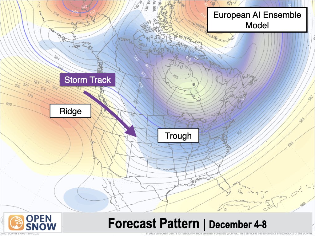
Most individual model projections we use in our blend (with our own SLR conversions) have 20-40" of snow at Targhee over the next 10 days. Highest confidence is the 4th-8th. After the 8th, confidence in snow chances is lower, and we are also looking at a significant warm-up.
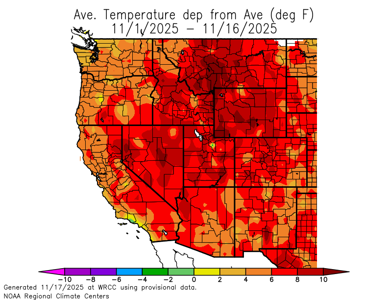
November 2025 was one of the warmest on record across Western Wyoming & Eastern Idaho. Some locations did break records. In Jackson, WY, temperatures were 8º above normal in November, and snow & precipitation were well below avg in the mountains and the valley.
The good news for skiers is that it's still very early in the season, and we do have an active stretch coming up from Dec 4th-8th as a series of storms will move through from the northwest. This will bring some needed base-building snow to the Tetons.
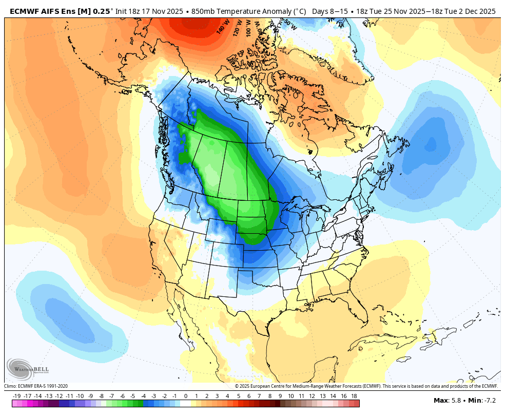
The big question, of course, is snow potential. I'm keeping an eye on the PNW, Canada, & Northern U.S. Rockies for improved snow chances (and lower snow levels) from late Nov to early Dec.
The first half of November has been incredibly warm across the West. Some ski areas are already delaying their openings due to a lack of natural snowfall, along with poor snowmaking conditions.
Much colder air is expected to spill into the Northwest and Interior West around Thanksgiving, with the coldest anomalies projected just east of the Continental Divide.