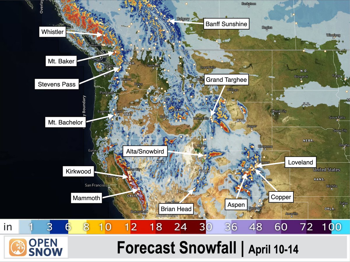
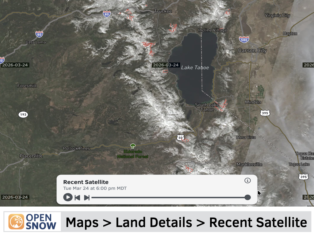
NEW: Recent Satellite Maps
Get a near-real-time view of the land to help better understand current conditions.
See if there is snow on a certain trail or mountain area, and what the landscape actually looks like within the last few days.
The satellite data from the Sentinel-2 satellite constellation is available globally, updated approximately every 3-5 days, with the ability to view imagery up to 30 days in the past.
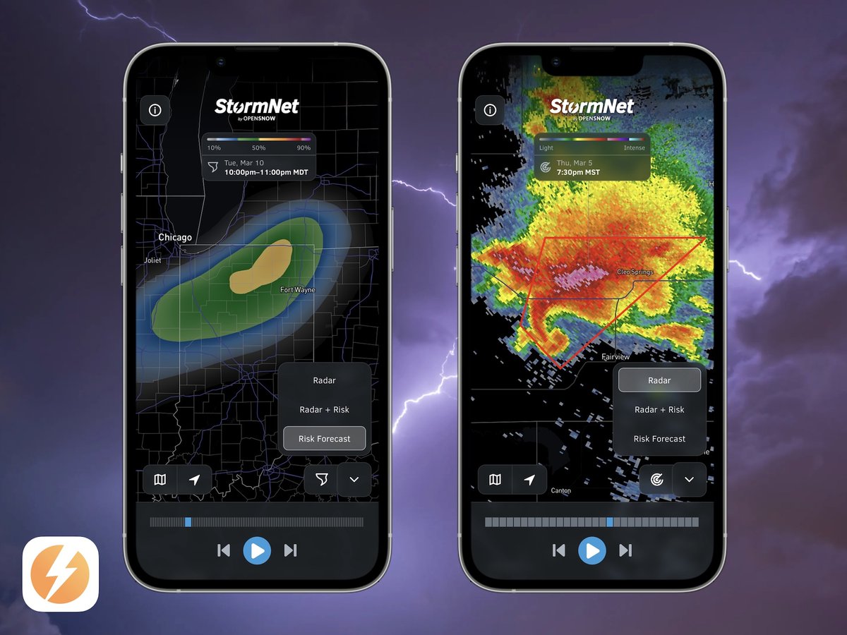
Check out @StormNetWx, our new severe weather forecast service that is optimized to help predict the risk of:
• Lightning
• Hail
• Damaging Winds
• Tornadoes
View 14-day forecasts for the United States, along with Super-Res (NEXRAD) Radar for real-time storm tracking.
Download for free on iOS and Android.