@ryanhallyall this is so terrifying! prayers everyone can get to higher ground and those vacationing can help locals with a place to go away from the coast 🙏🏼
@ReedTimmerUSA see you in marion!!! when you announced you’d be coming here i was so happy. that tornado was so awful the leftover damage is still shocking to see. i’m so excited to finally see you been my inspiration since i was 5!
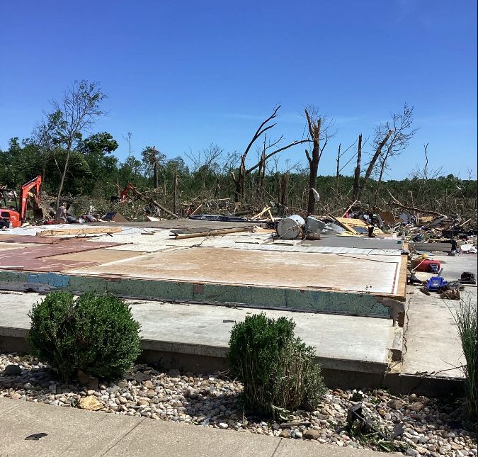
MARION, ILLINOIS! The Dominator 3 is returning to the site of the high-end EF4 earlier this May, and then the Team Dominator Show is happening October 8, 7:30 pm at the Marion Cultural & Civic Center with a heart-pounding evening. Get tickets here: https://t.co/dHvUxuuAYJ
UNREAL photo of VIOLENT nocturnal monster in Kansas – likely EF4-EF5 strength with 180-200+ mph winds. Textbook science shot of a lifetime.
In my career, I've never encountered a tornado with louder roar, more classic violent structure, etc.; there is no doubt in my mind that this was an EF5-strength tornado – damage/rating will depend on what it's found to have hit.
I never imagined I'd captured something like this – the circumstances were unbelievable. This is the massive, violent tornado that prompted a direct "tornado emergency" to be issued for Plevna, Kansas. It was a challenging intercept that requires rehearsing a procedure ahead of time and maintaining strict – and safe – precision.
For much of its life, it was rain-wrapped. Viewing it required me to "threat the needle" and position near/within its path (while ensuring I had multiple redundant escape routes). I require that one of my two escape routes always be paved, which complicated things further. I opted for North 100th Avenue north of Preston, Kansas and blasted east of the storm and then north.
Given nighttime temperature had cooled to near the dew point, fog/low cloud bases prevented me from seeing anything. I continued north into the "notch," knowing I'd have a roughly 2-minute period where the fog would lift before the RFD, or rear flank downdraft (cold air wraparound), crashed into me with wind/rain and cut off my view.
I had about 3.5 minutes to wait/set up – that meant preparing for a "blind" shoot. It was pitch black, so I had to manually focus my camera to infinity, change the ISO sensitivity, use radar to point in the correct direction, etc. Also remember that "inflow" winds were gusting to near 50 mph at times, and the only natural light were occasional flashes of lightning.
With no time for a tripod, I hung out the roof of my vehicle, closing my eyes at times to avoid the stinging of sand. The only other vehicle nearby bailed south, but I knew I had another 60-90 seconds before I'd have to evacuate. Suddenly, I heard a roar, that became VERY loud within 30 seconds.
That's when I clicked the shutter, hoping for a perfectly-timed lightning strike. FLASH. A close-range lightning bolt, only about 1,200 feet away, shot out the side of the tornado's updraft/collar cloud. It illuminated the entire structure. The tornado was RIGHT next to me. The roar sounded like the world's biggest waterfall was careening toward me.
As soon as the strike occurred, I closed the shutter again. I used an ULTRA wide-angle aspherical lens to capture the tornado's structure, meaning that, by now, it was right up on me and EXTREMELY close. I knew it would pass about a half mile to my north though, and was comfortable with my positioning.
@MyRadarWX
The NWS has confirmed that a violent EF-4 tornado with peak winds of 190 mph impacted southern Williamson County, IL, during the early evening hours of Friday, May 16, 2025. This is the strongest tornado rated by NWS Paducah KY since the Mayfield EF-4.
March 30th to April 5th was one of the most intense stretches of severe weather in recent memory. We tracked over 50 tornadoes, some intense to violent, hitting hard in communities like Lake City, Selmer, La Grange, and Potosi. April 2nd was especially dangerous, with the much warranted rare Level 5 High Risk from the Storm Prediction Center.