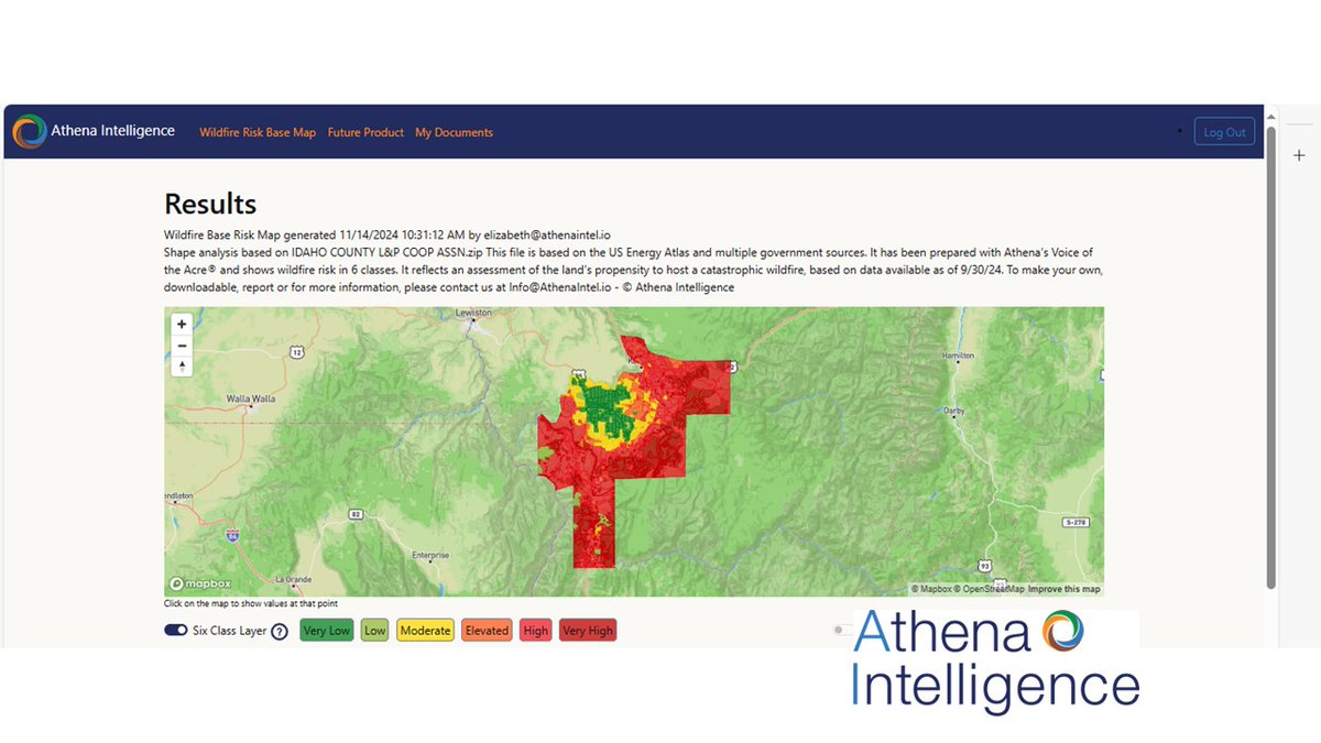
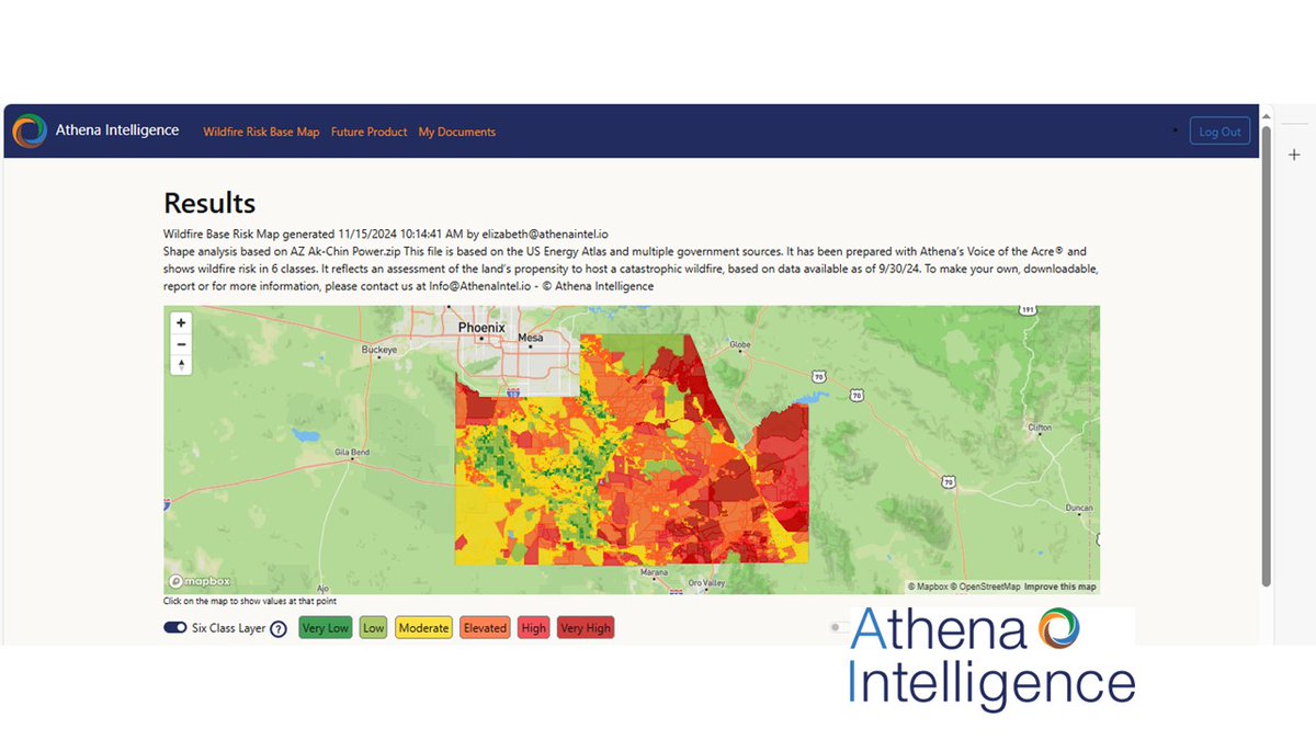
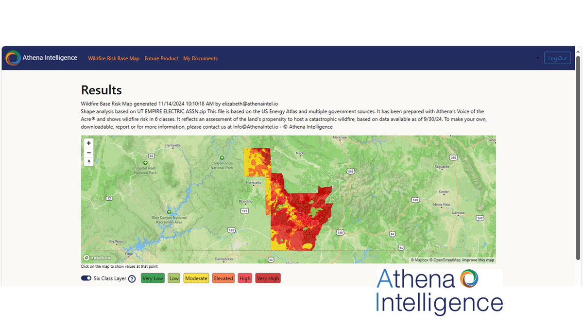
There is as much data generated around every acre of land as there is around consumers. Athena gives Voice to the Acre for wildfire and other terrain risks.
Third map today for a @arizona community This is Ajo, a small community whose power company is owned by @FM_FCX. Athena's map shows wildfire risk for 2025, based on @deptofenergy@Gridwerx and @USFS public data, processed by our Voice of the Acre #AI algorithm
Athena's assessment of the 2025 #Wildfire risk The Fort Mojave Indian #Tribe (FMIT) which has a tribal owned/operated #utility which provides power service to the #Indian#Reservation near where #California, #Nevada, and #Arizona meet.
These maps are free to rural utilities
25%+ of all #wildfires happen in areas the #WHP (USFS Wildfire Hazard Potential Maps) show as safe. Just as importantly, any good risk assessment would help you prioritize - where is the high risk and where is the low risk.
Power companies aim to maintain #reliability as close to 100% as possible, but preventing #wildfires and ensuring public safety impacts reliability metrics. A well run #vegetation management program can improve #SAIFA and #PSPS
https://t.co/1JlxH5yxqS