A weak front will sag southward into the area today. This will be the focus for shower and thunderstorm development this afternoon. Temperatures will be a little warmer than yesterday.
Showers and thunderstorms remain possible as a cold front sinks southward into the area today. It then lingers nearby, maintaining the daily chance for showers and mainly afternoon thunderstorms for the upcoming work week.
The severe weather threat has tapered off for tonight. Showers and storms remain possible as a cold front approaches from the north and then sinks down through the area on Sunday. A nearby front then maintains daily chances of rain and storms for the upcoming work week.
6/6 11 pm PDT: Life threatening flash flooding is likely across portions of southern #Mexico, #CostaRica, #Nicaragua, #ElSalvador & #Guatemala beginning Sunday and lasting through the next several days due to the two systems currently located just offshore.
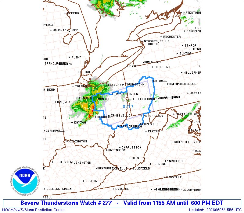
A few thunderstorms continue tonight south of Pittsburgh, but severe weather is done for the night. Heavy rain may pose a localized flash flooding threat as some of these storms "train" over the same area repeatedly.
A west to east oriented line of showers and thunderstorms sagging only slowly southward ahead of a similarly oriented and equally slow-moving cold front can lead to localized excessive rainfall due to repetitive downpours in east-central Ohio and northern West Virginia.
With this latest drop, Pratt is now at 27.3%.
For context, Trump received 26.5% of the vote in LA in 2024. It’s entirely plausible Pratt underperforms Trump.