Breaking: The June ECMWF update has trended *even stronger* with this year's El Niño.
Almost every scenario now reaches past +3˚C, with a cluster of high-end scenarios in excess of +4˚C.
This outlook now depicts the strongest El Niño on record.
Dry and increasingly warm conditions will continue through the end of the week. Clouds increase tomorrow ahead of an approaching cold front. A few showers or a thunderstorm in western Maryland Saturday afternoon/evening.
Strong El Niños are already either a big boom (2016) or bust (1997)
For us the best winters have usually come with a moderate or weak Modoki El Niño just enough to get the subtropical jet moving (Bringing Miller A’s) but also weak enough to allow colder air to sneak south
2/2
The latest SIPS (Runs every month) continues to trend towards a stronger more easterly based El Niño this winter
This puts it closer to the consistently aggressive CFS and NMME not good for winter weather prospects across America in general
1/2
Sunny conditions expected the rest of the day & temps in the upper 40s & 50s tonight before a cold front moves through the region tomorrow. A Marginal risk for severe weather exists over the Alleghenies, with sct. thunderstorms possible across the area tomorrow afternoon/evening.
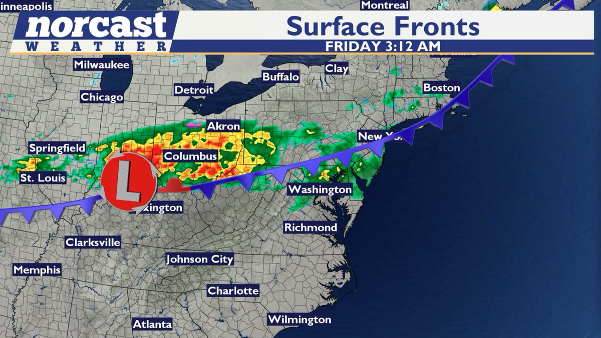
2PM-Still awaiting a strong cold front this afternoon. Most of the morning rain has ended with additional showers back toward the eastern WV panhandle.This is the area of showers & perhaps a t-storm or two that will push east toward the metros between 4-8pm. Much cooler Thursday.
Between 0.25-0.75 inches of rain is expected today through early tomorrow morning as a surface low passes through to the south. Any rainfall will help to mitigate severe drought conditions impacting the region. Temperatures will trend cooler over the next week.
Welcome home Reid, Victor, Christina, and Jeremy! 🫶
The Artemis II astronauts have splashed down at 8:07pm ET (0007 UTC April 11), bringing their historic 10-day mission around the Moon to an end.
Easter Sunday KaneCast:
- Cold front brings rain, which may be heavy at times
- 0.4-0.6" of rain expected (localized higher amounts possible)
- Timing: 9am-3pm
- Temperatures in the 60-70 degree range (turning colder Sunday night)
- Thunder possible 10am-1pm
#MdWx
Liftoff.
The Artemis II mission launched from @NASAKennedy at 6:35pm ET (2235 UTC), propelling four astronauts on a journey around the Moon.
Artemis II will pave the way for future Moon landings, as well as the next giant leap — astronauts on Mars.
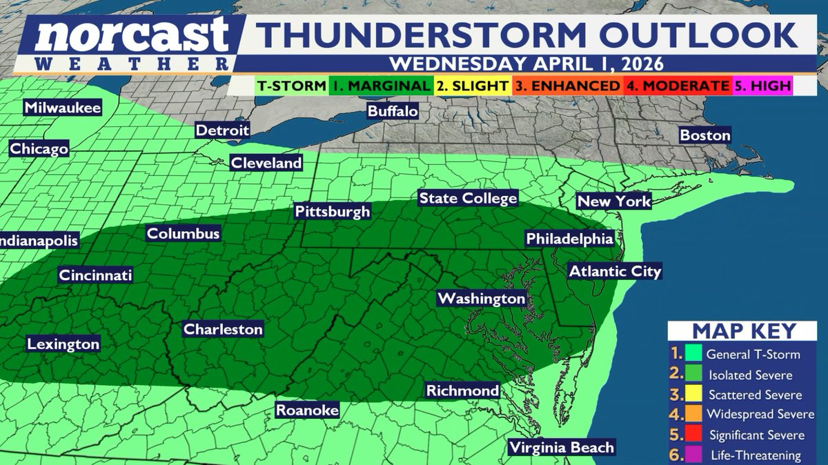
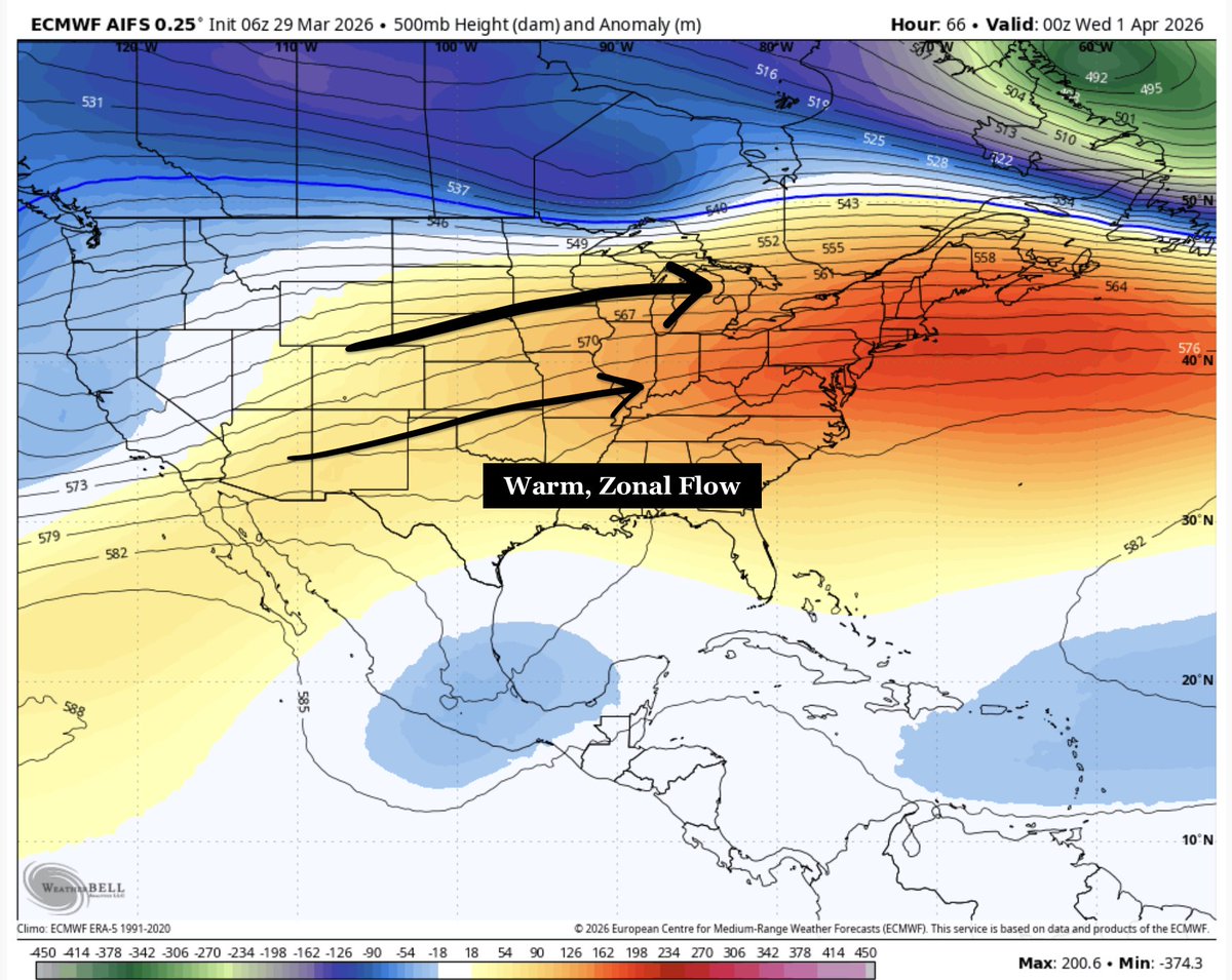
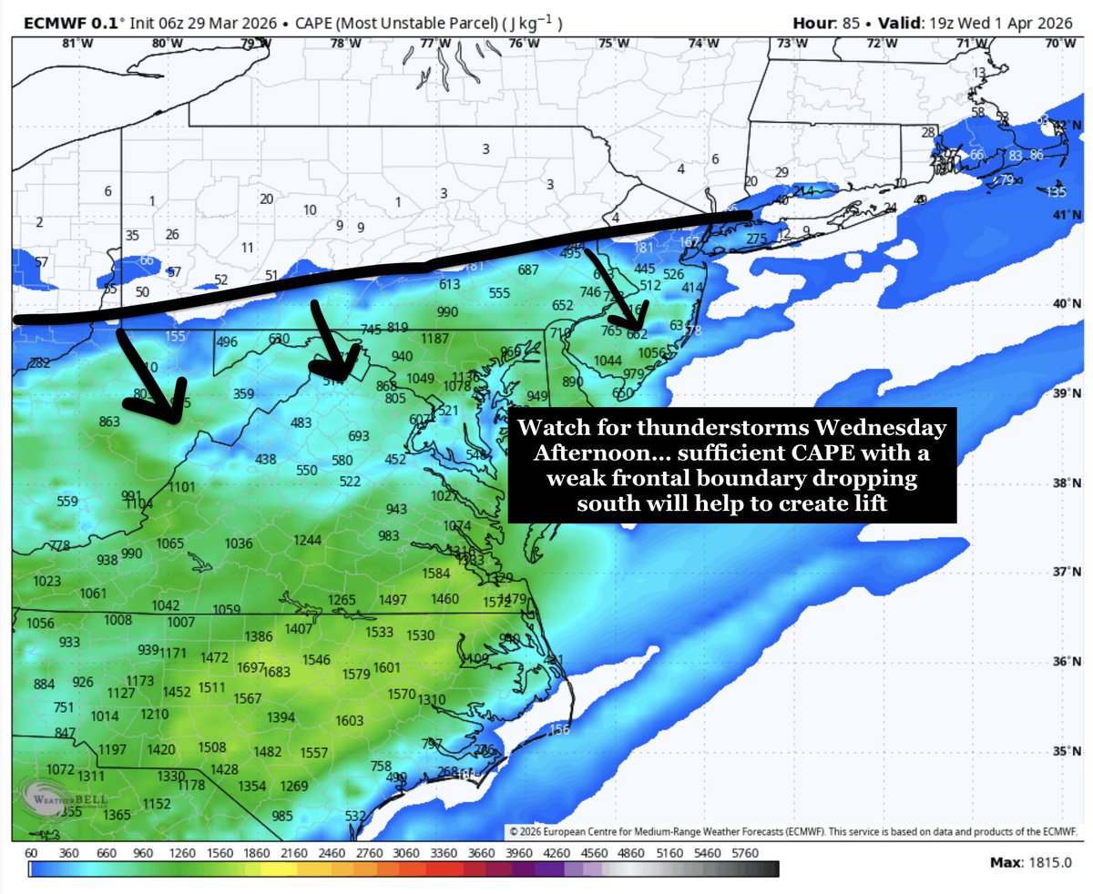
KaneCast: Wednesday April, 1st
Starting off very warm today with mostly sunny skies & temps in the upper 60s/low 70s. Highs reach the 80-85 range across the DMV with building humidity. Storms expected this afternoon/eve from 5-10pm. Isolated instances of damaging winds expected.
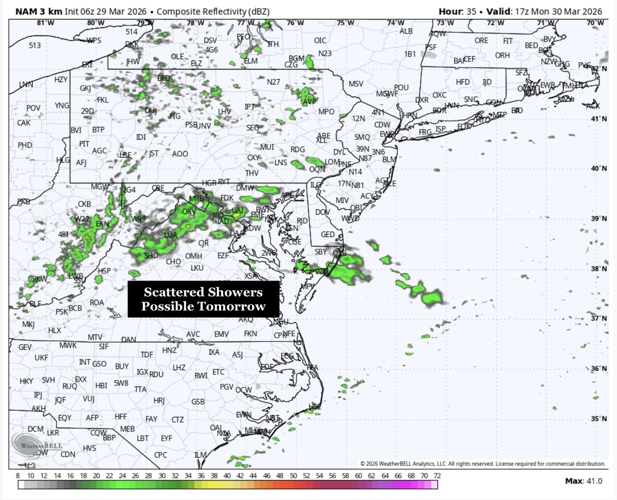
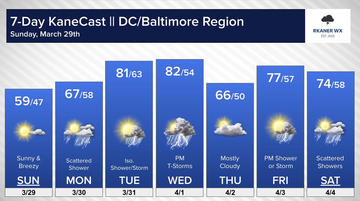
Sunday March 29th KaneCast:
- Mostly sunny today & breezy w/ highs up to 55-60
- Isolated/scattered showers Monday (not a washout)
- Isolated shower/storm Tuesday (partly sunny & warm!)
- Watch for T-Storms Wednesday PM/Evening
- Backdoor cold front Thursday?
- Showers Fri & Sat
Thursday March 26th KaneCast:
- Mostly sunny skies today with highs in the mid 70s to near 80
- Breezy conditions with southwest winds in the 10-20 mph range
- Great day for Orioles opening day! Go Os!
- Cold front pushes through tonight with showers Friday morning
#MdWx
Severe Storms Possible this afternoon & evening from western Ohio into PA. Large hail & damaging winds are the biggest threats. An isolated tornado cannot be ruled out over PA. Most of the severe activity stays north of PA line, with some showers overnight for the DMV. #MdWx