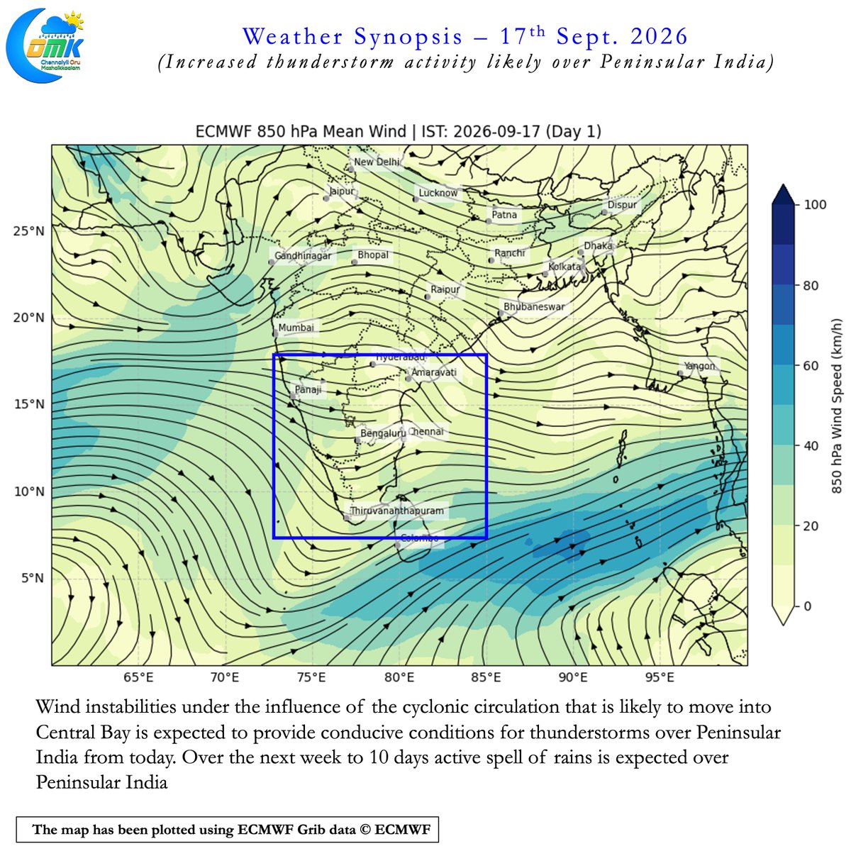
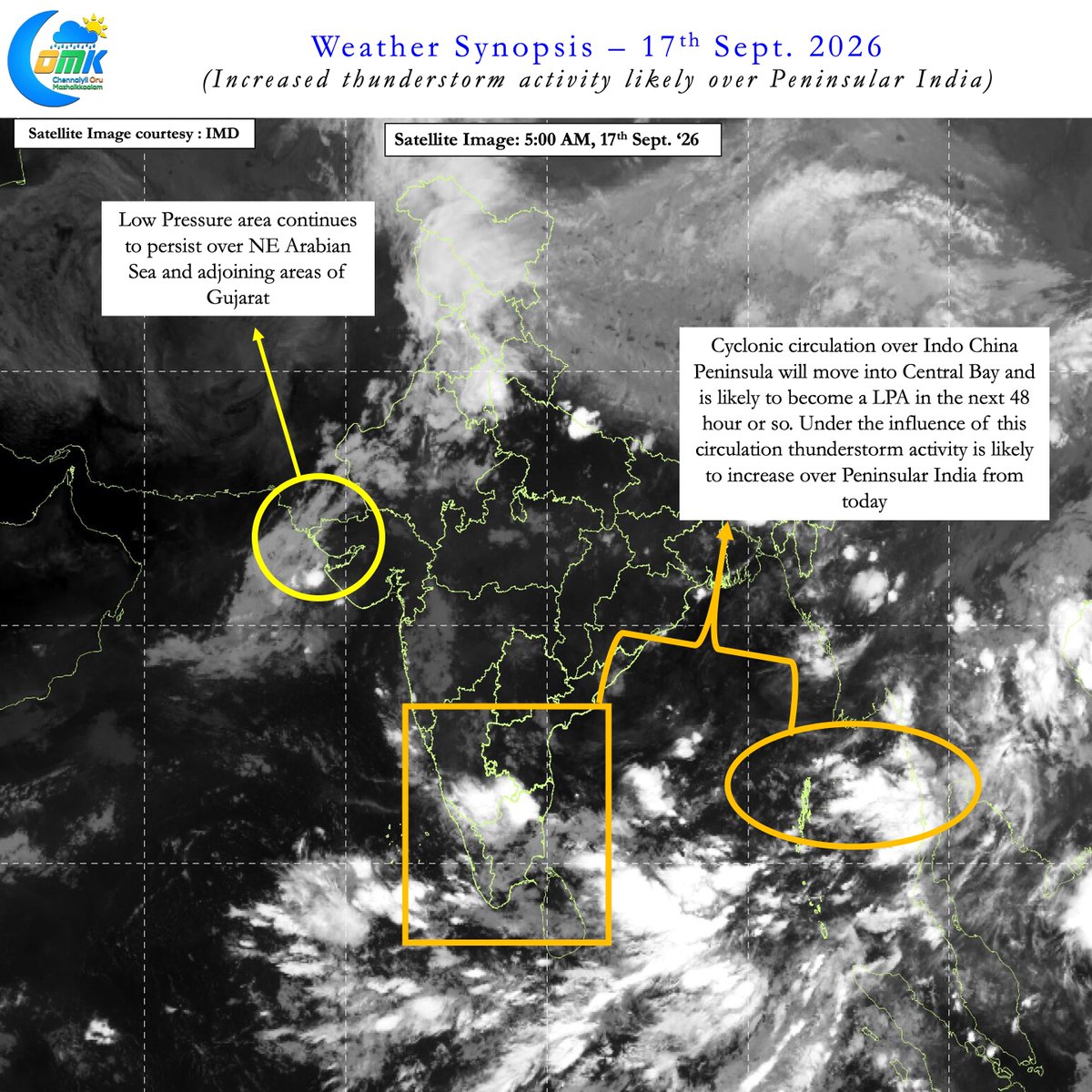
As Bay of Bengal gets ready to host yet another Low Presssure Area in the next 48 hours or so an active spell of rainfall is likely over Peninsular India for the next week to 10 days. Increased thunderstorm activity likely from today with wind steering becoming favourable once again for coastal areas. Models converging on NW Interior Tamil Nadu and North TN to benefit the most from this period of thunderstorm activity. There is a high chance today may be the last day of hot summer like conditions for North Coastal TN if things go as per model estimates over the next couple of weeks.