We always love a visit from @tsmullaney and his students! The major takeaway? The inherent interdisciplinary, and storytelling, nature of maps. So, no matter what you’re studying, we 10/10 recommend that you give the @StanfordLibs map collections a gander!
Got some ideas about virtual field trips and want to tell people? There's still time to submit to #AGU21 (Deadline 8/4). I'm co-convening a session on virtual field trips and would love to see what you've got!
https://t.co/uUOxco55TP
@StanfordEarth #virtualfield@StanfordEd
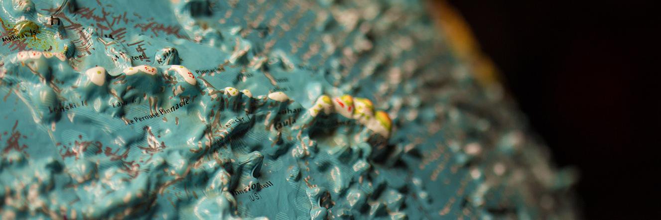
https://t.co/wlQF4MYFid now supports both #IIIF 2.0 and 3.0 ⭐⭐⭐! https://t.co/tJjUK1WKts has a beautiful collection of IIIF 3.0 maps, for example this map of Königsberg/Kaliningrad: https://t.co/UarzTcfVU3
Feeling lost? Here are some north arrows to help you find your way again.
↖️
[Seven images of north arrows on zoning maps of Mountain View and Palo Alto, CA published in the 1950-1980s.]
Stanford has so many maps in its collection but not enough online reviews to help you figure out which ones are worthy of your time. Our librarians Andria & Andrea are here to help.
Join them as they very seriously review Seutter's map of Love from 1735
https://t.co/8R32iUYDCI
Really interesting to hear about the captured German and Japanese WW2 #maps at @geolibraryucb and @BrannerLibrary. Here is one of our captured Japanese maps of China (#Sichuan#四川).
Learn more at
https://t.co/00HSejAqYT
and
https://t.co/KpG11NO61Z
What was it like to be a freshman this year, experiencing college from afar? Stanford freshman Lydia Wei felt a bit like old mapmakers, who had to imagine far-off lands that they never visited. In this spirit, she created her own fantastical map of the Stanford campus as a diary.
Do you have fluency in Dutch and English? Do you have experience cataloging cartographic and technical materials? Do you want to work with excitable map nerds? If so, then ignore this: https://t.co/u8y2f2A4Ob
One cannot have too much fun with maps! Sure, this video was made for high school students but if you’re new to thinking about and using maps more broadly, it’s worth a view 🗺
This is mapsolutely #MustSeeNHD. 🗺️
Such a fun video, and super helpful! Many thanks to Andrea Renner and Andria Olson, and everybody at @rumseymapcenter and @BrannerLibrary for supporting, encouraging, and being there for #NHD2021 and #NHD2022 students.
in our bio for more information.
🔘
[Three images of the World Maps atlas published by American Printing House for the Blind. Two images showing Mainland Southeast Asia and another the legend of symbols used in the atlas.]
One does not simply listen to the talk given by blind cartographer, @BerkeleyBlink, @rumseymapcenter without then checking in on our own tactile map resources. This Braille tactile world atlas is the first arrival of a few new additions to our map collections! Click the link
Georeferencing Maps in QGIS (Online Workshop)
April 29, 2021
9:00am to 11:00am
This hands on workshop covers the basics of georefrencing a map scan into a Geographic Information System (using the free and open source QGIS application).
https://t.co/yIOjQPP661


![BrannerLibrary's tweet photo. Feeling lost? Here are some north arrows to help you find your way again.
↖️
[Seven images of north arrows on zoning maps of Mountain View and Palo Alto, CA published in the 1950-1980s.] https://t.co/6sMIoXzNnV](https://pbs.twimg.com/media/E67w3nLVgAAaeQp.jpg)
![BrannerLibrary's tweet photo. Feeling lost? Here are some north arrows to help you find your way again.
↖️
[Seven images of north arrows on zoning maps of Mountain View and Palo Alto, CA published in the 1950-1980s.] https://t.co/6sMIoXzNnV](https://pbs.twimg.com/media/E67w3mTVEAQlqBs.jpg)
![BrannerLibrary's tweet photo. Feeling lost? Here are some north arrows to help you find your way again.
↖️
[Seven images of north arrows on zoning maps of Mountain View and Palo Alto, CA published in the 1950-1980s.] https://t.co/6sMIoXzNnV](https://pbs.twimg.com/media/E67w3mSVkAMYs1-.jpg)


![BrannerLibrary's tweet photo. Steamy road trip through Nevada in 1960 or bust, baby 💋
[Image of 1960 Nevada road map with red lipstick kiss mark left by a cheeky someone.] https://t.co/BO7ZEgyb58](https://pbs.twimg.com/media/E7V3zY9VEAEiaVN.jpg)

![BrannerLibrary's tweet photo. Feeling lost? Here are some north arrows to help you find your way again.
↖️
[Seven images of north arrows on zoning maps of Mountain View and Palo Alto, CA published in the 1950-1980s.] https://t.co/6sMIoXzNnV](https://pbs.twimg.com/media/E67w3nNVkAE9Er8.jpg)


