Founded in 1818, the Harvard Map Collection holds over 500k antiquarian & modern maps, and provides gis data and support. Check out our instagram: harvardmaps
We've partnered with the @ImperiiaProject to pilot how @HarvardLibrary can curate well-contextualized geospatial datasets for long-term discovery and access. Read about the project here!
https://t.co/cma9jK65OD
If you’ve ever wished your favorite fictional universe was real, a new @HarvardMapColl exhibition is for you. “From Academieland to Zelda” explores fictional maps from movies, books, video games, and more. Come check it out in-person: https://t.co/bJzO7UUMsD
The Harvard Map Collection is hiring a Map Librarian. If you enjoy teaching and helping with patron research, check out the job description: https://t.co/RDB7yOkv3l
Matthaeus Seutter's 1735 #map of #Brussels#HarvardLibrary
high-res: https://t.co/HkWPvQFIPt
image description: richly hand-colored map of Brussels above a bird's eye view of the city with major landmarks labeled.
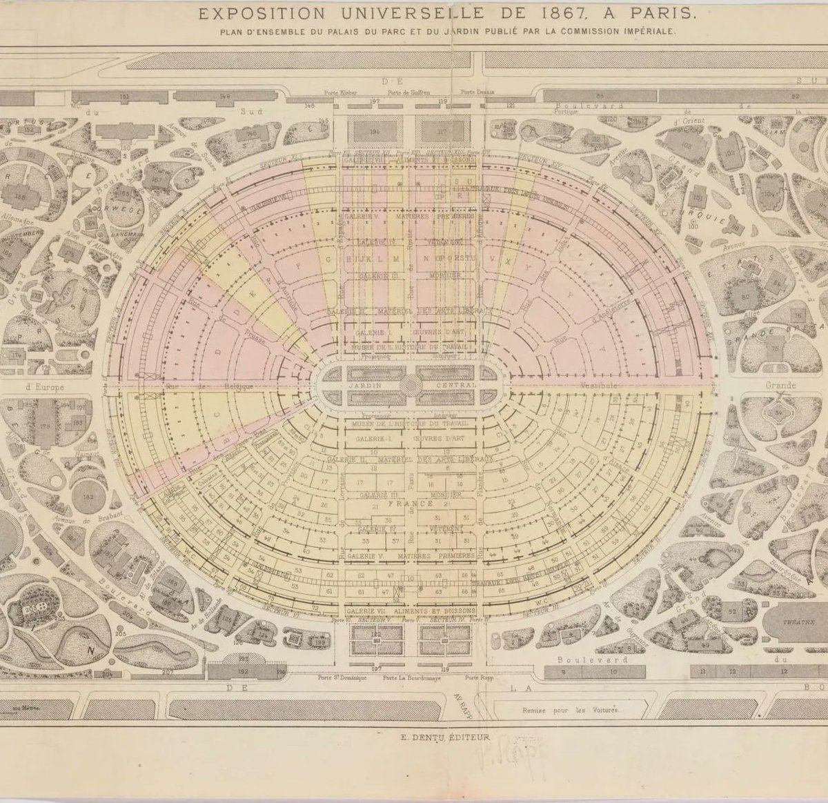
1867 #map of the "Exposition universelle" in #Paris including a plan of the palace, park, and garden. #HarvardLibrary
high-res: https://t.co/NGu5JEWp6N
Frederik de Wit's late 17C "Accuratissima totius regni Hispaniae Portugallieq. tabula et typus novissimus" #Spain#Portugal#HarvardLibrary
high-res: https://t.co/DZTFXcTpz6
The #NileRiverDelta, a detail from a large (182 x 110 cm.) multi-sheet 1743 #map by Richard Pococke of #Egypt, which was "Recently Subjected to His Faithful Eyes, Illustrated by His Travels: Adapted to the Norm of Ancient as well as Modern Choreography." #HarvardLibrary
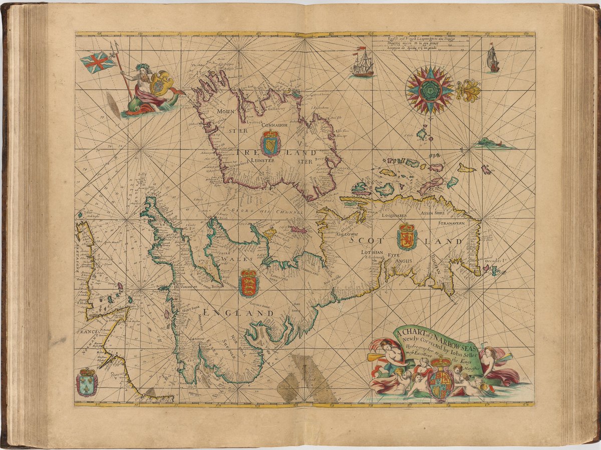
A chart by John Seller from his Atlas Maritimus (circa 1675) depicting all the "narrow seas" that surround the British Isles, along with a sea monster riding merman (Neptune?) hoisting the King's Colours on his bident. #maps#HarvardLibrary
@NV5Geospatial I'm not sure. It's copyright Rand McNally so it's probably in one of their atlases. This is a loose sheet in a folder of unprocessed Raisz material
Erwin Raisz's "United States and Canada - Physiography" with 6 colors showing different kinds of rock and his signature pictorial method for illustrating landforms #HarvardLibrary#maps