Severe Thunderstorm Watch CANCELLED. As the line of thunderstorms moves offshore, the threat for severe weather has ended over South Florida and the Florida Keys. Gusty winds will continue as well as passing showers through Friday.
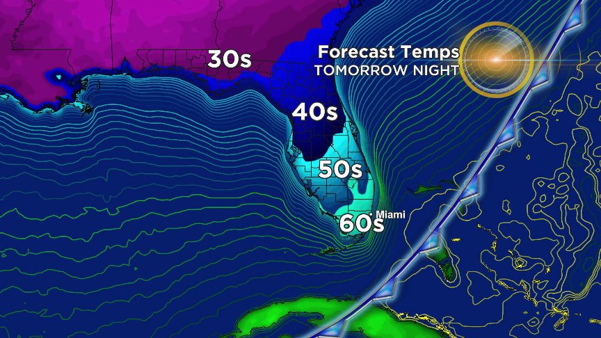
Record heat today ahead of a weak cold front tonight. Mon-Tue will see less hot, more breezy weather with passing showers. Warmth & humidity return later in the week ahead of a stronger cold front later next weekend. Almost autumn. #SetzerSays
#Michael makes landfall near Mexico Beach, FL with max. sustained winds at 155mph. The Category 4 Hurricane is producing life-threatening storm surge, hurricane-force winds, heavy rainfall & tornadoes as it continues to impact the #Panhandle. #flwx
Extreme Wind Warning now for parts of the Panhandle where winds in excess of 130mph possible. Folks in these areas should be ready to shelter in bathtub, interior rooms, have a plan if your house begins to come apart. #SetzerSays
Hurricane #Michael strengthens to a major hurricane. Michael, now a Cat. 3 storm, inches closer to the NE #GulfCoast with life-threatening storm surge, hurricane-force-winds & heavy rainfall expected in the Florida Panhandle and the Big Bend. #Flwx#CBS4
The SEVERE THUNDERSTORM WARNING for west Broward will expire at 3:45PM as the thunderstorm is weakening. Brief downpours, gusty winds, & frequent lightning are still possible as the storm moves south.
SEVERE THUNDERSTORM WARNING for western Broward until 3:45PM including Sunrise, Weston, & Davie... Damaging winds, frequent lightning, local street flooding, and small hail are possible in these areas as storms move south. #SetzerSays
Now with last advisory written on Joyce, it's the first time since September 1st when Florence became a tropical storm that we have no named tropical systems in the Atlantic basin. Nice to have a break!
Hurricane #Florence may produce more than 20" of rain along the Carolina coast with isolated areas possibly seeing more than 30" of rain @CBSMiami#CBS4
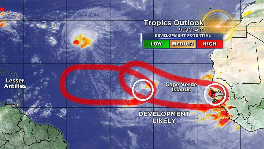
Three named systems in the Atlantic & all three threatening land. Newly upgraded Tropical Storm Isaac may impact Lesser Antilles late week, Helene impacting Cape (Cabo) Verde Islands, and of course Florence a serious threat to Mid-Atlantic/Southeast US.
Besides Florence, two disturbances expected to become Tropical Depressions by the weekend in the deep Tropical Atlantic. The lead disturbance could pose a threat to the islands of the eastern Caribbean (Lesser Antilles) by middle/late next week.
Lane quickly winding down as of Friday evening, now a 70 mph tropical storm. Main threat will be continued torrential rainfall and widespread significant flooding and mudslides for Hawaiian Islands through the weekend.
As of Wed afternoon, cat 4 Hurricane Lane still forecast to move toward the Hawaiian Islands. The predicted slowing and turning of the storm always a tricky forecast. Impacts expected, but just how bad will be based on the turn and intensity.
HURRICANE WARNING for the Big Island of Hawaii, watches up elsewhere as Hurricane Lane expected to make two important turns. The first toward the islands, the second away. Exactly how they happen will have big consequences on how bad the impact will be.