Models have been hinting at an area of low pressure to form in the northeastern Gulf at the base of a trough. The biggest hindrance to development will be its expected short period of time over water which won’t give it much time to consolidate. That being said, we pay special attention to any areas of low pressure that are expected to develop near us this time of year. NHC pegs the area at a 20% chance for development. More than likely, the net result will be an increase in rainfall over the northern half of #Florida this weekend and early next week
👀 Heads up #FLwx:
🟡 An area of disturbed weather may develop this weekend over the NE Gulf; currently Low (20%) odds
🌧️ Heavy rainfall possible locally, depending on exact location & track
📌 Reminder that FL Tropical Training week starts July 27th (https://t.co/bhctagTW2q)
“When the last tree is cut, the last fish is caught, and the last river is polluted; when to breathe the air is sickening, you will realize, too late, that wealth is not in bank accounts and that you can’t eat money.”
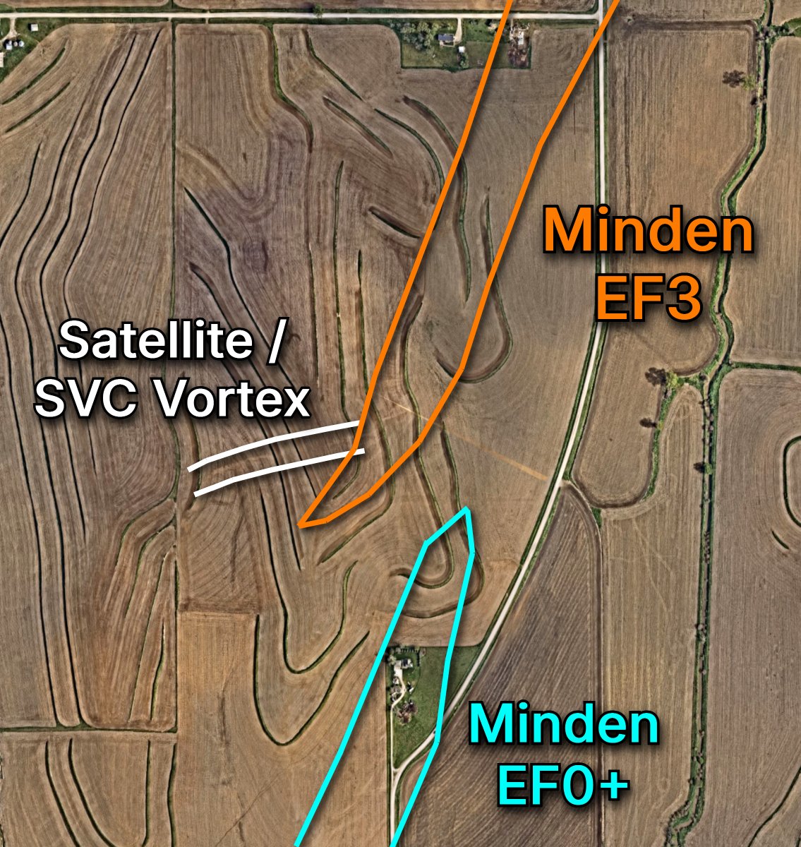
After a year of reviewing high-resolution satellite imagery, radar data, and storm-chaser video, SalticalWx and I have completed a forensic analysis of the April 26, 2024, Iowa tornado family that impacted Treynor, Minden, Shelby, and Harlan.
Our analysis suggests the two currently mapped tornado tracks may instead represent five distinct tornadoes, with multiple rapid non-occluding cyclic mesocyclogenesis (NOCM) cycles occurring in quick succession.
Our proposed analysis is:
- Treynor, Iowa EF3 (145 mph) | 5:08-5:25 PM CDT
- Bentley, Iowa EF0 (74 mph) | 5:26-5:30 PM CDT
- Minden, Iowa EF0 (85 mph) | 5:34-5:39 PM CDT
- Minden, Iowa EF3 (160 mph) | 5:39-5:52 PM CDT
- Harlan, Iowa EF3 (140 mph) | 5:53-6:35 PM CDT
The evidence is based on high-resolution satellite imagery, cycloidal debris marks, radar data, and triangulated storm-chaser video. These rapid cycles occurred so close together that they likely produced the appearance of one continuous damage path in several locations.
We are sharing our findings with NWS Omaha shortly for their consideration. Regardless of any future changes, this was an incredibly fascinating case study in tornado evolution and rapid cycling.
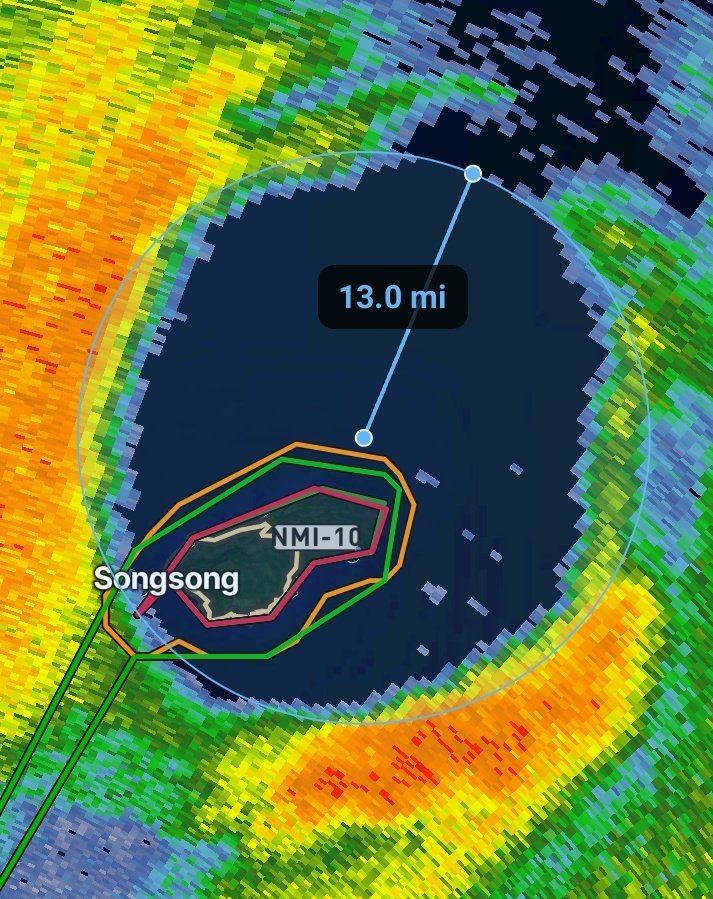
Rota is now completely inside the eye of Super Typhoon Bavi.
A brief period of calm winds and sunshine is sandwiched between some of most violent conditions on Earth.
An Extreme Wind Warning has been issued for Rota in the Northern Mariana Islands.
The eyewall of Super Typhoon #Bavi is about to impact the island, bringing widespread winds in excess of 150mph.
THIS IS INSANE! 130 MPH winds destroyed windmills in South Dakota this morning.
This is very rare. We hardly ever see windmills take this much damage from straight-line damaging winds. But when you push over 110 MPH winds, it becomes a lot easier for the windmills to crumble.
Photos via Storm Chaser Jakob McMillin
Great shots from John Hall in Highmore, SD showing the aftermath of severe winds. The storm damaged grain bins, left debris in the streets, and even flipped a camper, with winds reportedly reaching up to 131 mph. #SDwx
Oh my gosh. Very significant damage in Highmore, South Dakota from this morning’s severe MCS that moved through with wind gusts up to 131 mph.
📸 Amanda Brown via Facebook
Happy 1st day of Summer and longest day of the year in terms of daylight hours. Enjoy it now because starting tomorrow we gradually start losing daylight! 🌞
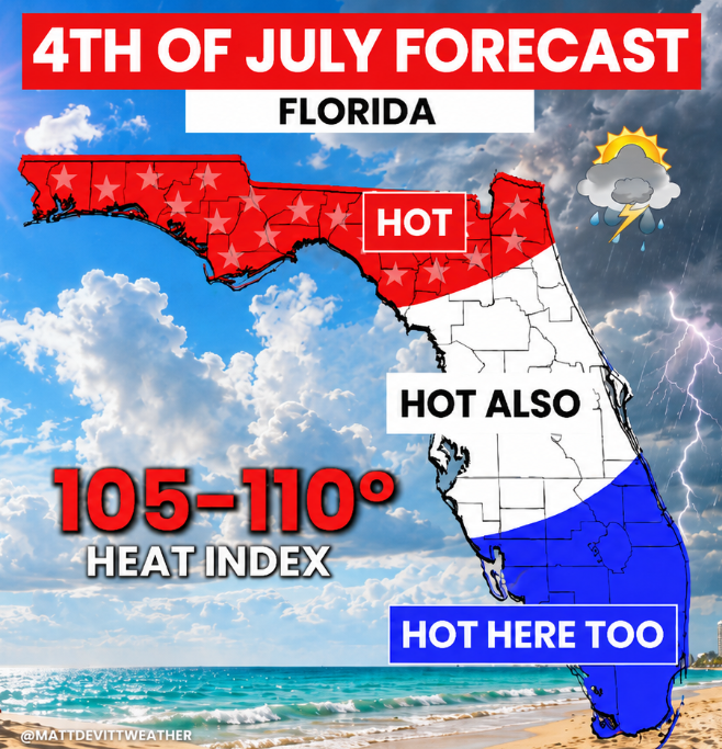
FLORIDA GETTING HOTTER! 🥵 This weekend will feel like the hottest of the year so far as heat builds across the state. Peak heat index for some will reach 105°-110°, stay cool!