@TxDOTAustin@TexasGasService 2:28 p.m. - Final Update from LTFR - LTFR is clearing the scene. Texas Gas Services has stopped the leak by installing a bypass line. There is still much work to be done and 620 remains closed at this time.
Austin and Travis County issued a disaster declaration today in preparation for high wildfire risks.
The Austin area has not had measurable rainfall since Sept. 5 and has no rain in the forecast. This is just a precaution.
More 👇🏽... via @KUT.
https://t.co/mcFqVSV6YV
Hurricane Milton is expected to bring a destructive storm surge to Florida's west coast. @StephanieAbrams uses our FloodFX simulation technology to show you what that could look like ⬇️
@TronCarterNLU Radio got it all. Including Beau asking how his relief was any different from what Kuchar got when he walked off the course (ref said he wasn't sure why that ruling was given as he wasn't there) and the ref saying BH's request was unreasonable. Also, BH asked for a 2nd opinion.
In case you were wondering why East Lothian is nicknamed "Scotland's Golf Coast" 🏴
All 16 of these courses are within a 12-mile stretch of coastline.
In Season 48 of Austin City Limits, legendary alternative rock pioneers @pavementband delivered modern rock highlights in a career-spanning hour. Watch on your local PBS station or stream starting tomorrow on the PBS App or https://t.co/pTqjZfrLJC
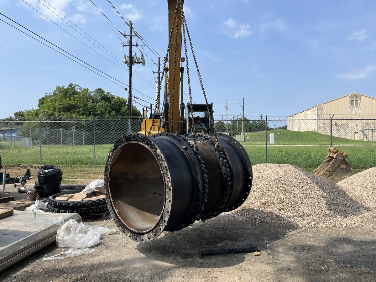
The SW Austin Water Main Repair is well underway and things are currently running smoothly. Residents in the repair region are still asked to conserve water until repairs are finished. For more information visit https://t.co/iIXqzktKlY
A 2.5 magnitude earthquake has just been reported on the USGS that occurred about 8:51 PM, and we're hearing word from people having felt it. Did you feel it? You can submit reports at https://t.co/1YVnDGkzla
🚨 Roadway Alert: As a result of standing water, officers are having to shutdown Lakeline Blvd (south of 1431) in both directions. Please find an alternate path if possible.
8:24 PM - TORNADO IMMINENT IN SAN MARCOS. SEEK SHELTER IMMEDIATELY.
STRONG ROTATION ON RADAR HEADING DIRECTLY INTO SAN MARCOS. Get into an interior room of your home immediately. This tornado will be followed by destructive baseball size hail
Large to very large hail is possible on late this afternoon and evening as a cold front moves in from the north. Damaging winds are also possible along with an isolated tornado.
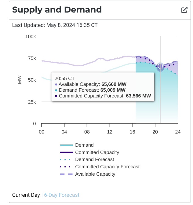
Demand forecast is now higher than committed capacity forecast but lower than "available capacity" by 650 megawatts. They roll outages at 1000MW. It's going to be extremely tight. Confused about what criteria ERCOT is using for conservation calls. #txlege#txenergy
ERCOT has issued a Weather Watch for Wednesday, May 8, due to unseasonably high temperatures, high levels of expected maintenance outages during the spring shoulder months, and the potential for lower reserves. Grid conditions are expected to be normal during a Weather Watch and can be monitored on https://t.co/4lhispubCP. Sign up for #TXANS notifications: https://t.co/tWnvs35r4E