🌀 HURRICANE ISAIAS HAS MADE LANDFALL
#Isaias made landfall near Destin, FL as a Category 2 hurricane with maximum sustained winds of 105 mph.
⚠️ DANGEROUS CONDITIONS CONTINUE! Remain sheltered and stay off the roads. The threat is NOT over just because landfall has occurred!
Hurricane Isaías has lost symmetry on final approach to near Destin, Florida. Wind shear aloft has kicked in (finally) over the last 3-4 hours and is weakening it. The last two recon passes through the eye show lowering windspeeds. It'll end up a Cat 2 at landfall by around 9 pm
🛰️ Hurricane Isaias (4 AM)
Status: Cat 2 (110 mph winds) • Location: ~200 mi SSE of the mouth of the Mississippi • Movement: NNE at 15 mph. Forecast to strengthen to a Cat 3 this morning before starting to weaken on approach to our coast.
We can thank moderate wind shear caused by El Niño for holding back Hurricane Isaias from becoming a Category 5 superstorm.
However, pressure continues to fall regardless. Isaias has a good chance to become a Category 3 major hurricane in next 24-hours.
Tropical Storm #Isaias has "the look" this morning, which often seems to precede storms that take off in terms of intensity. I expect this to push or exceed major hurricane status. Eric will have a post at @TheEyewallWx later this morning.
🌀12pm 10/07 Update - Significant impacts expected from Isaias: damaging winds, life-threatening storm surge, high surf, rip currents, flash flooding, and tornadoes.
Changes: Coastal Alabama and northwest Florida Panhandle are under a HURRICANE WATCH and a STORM SURGE WATCH (1/3)
Happy Birthday @cs_rescue!
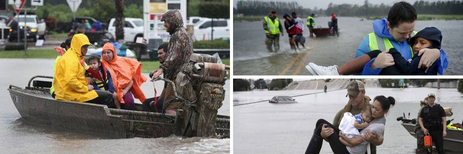
Crowdsource Rescue is a Houston mutual aid organization for citizen disaster responders. It connects people who need to be help with willing volunteers. Born in 2017, during Hurricane Harvey, @khou looked back at their unique role a year later.
A SHELTER IN PLACE order has been issued for Oxford, Mississippi as a crippling #icestorm continues. Hours of thunder freezing rain has accrued 1-2 inches of ice. Falling trees are a threat to life and property. #ice#winterstorm
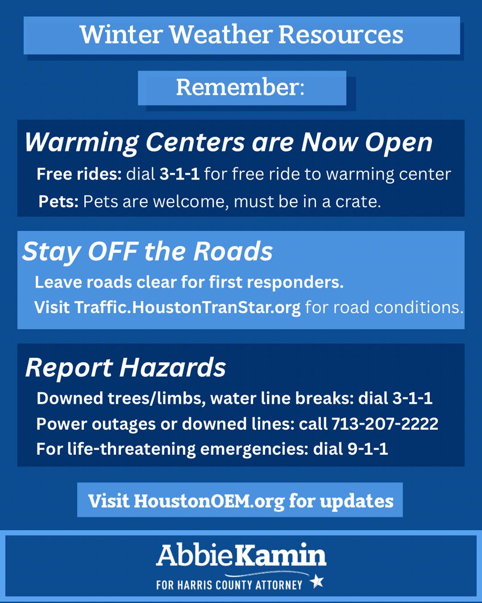
We’re not through the worst yet. Stay OFF the roads, and if you absolutely must travel, check road conditions and drive cautiously.
More info and resources available at https://t.co/XOflyvdfQY
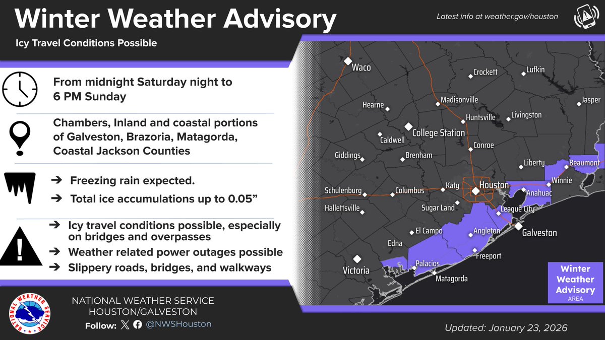
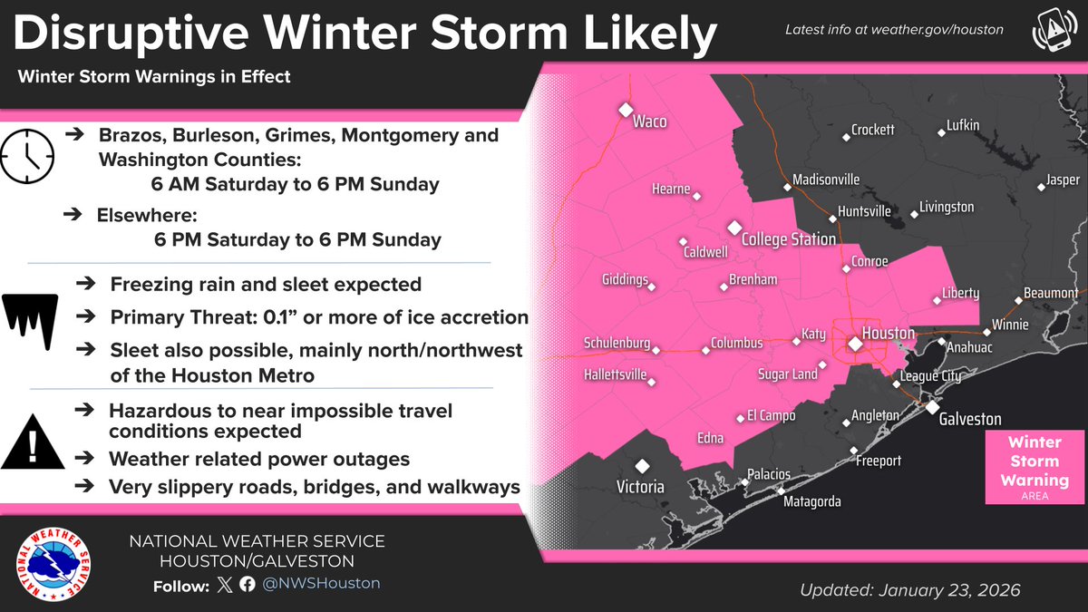
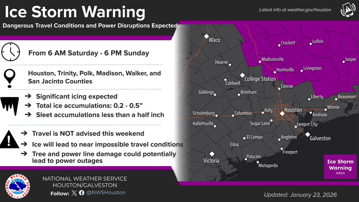
⚠️ Ice Storm & Winter Storm Warnings are in effect for ice and sleet. Expect hazardous to near impossible travel and power outages.
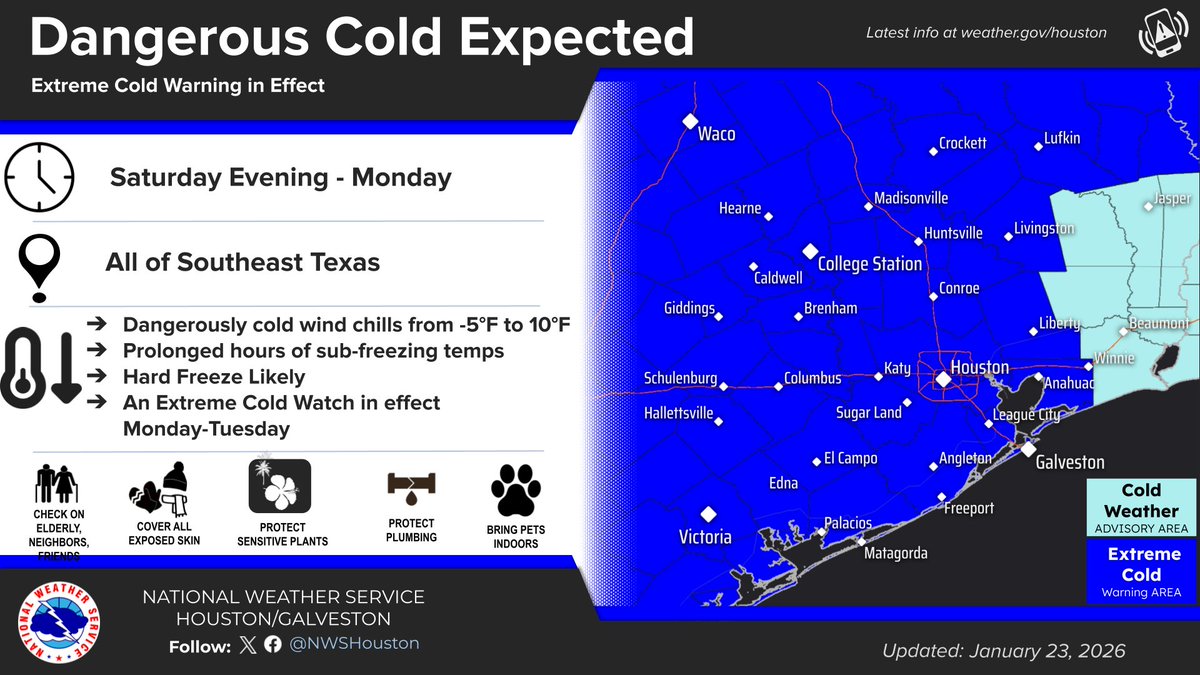
Dangerous Cold: An Extreme Cold Warning takes effect Saturday evening through early next week.
Preparations should be completed today!
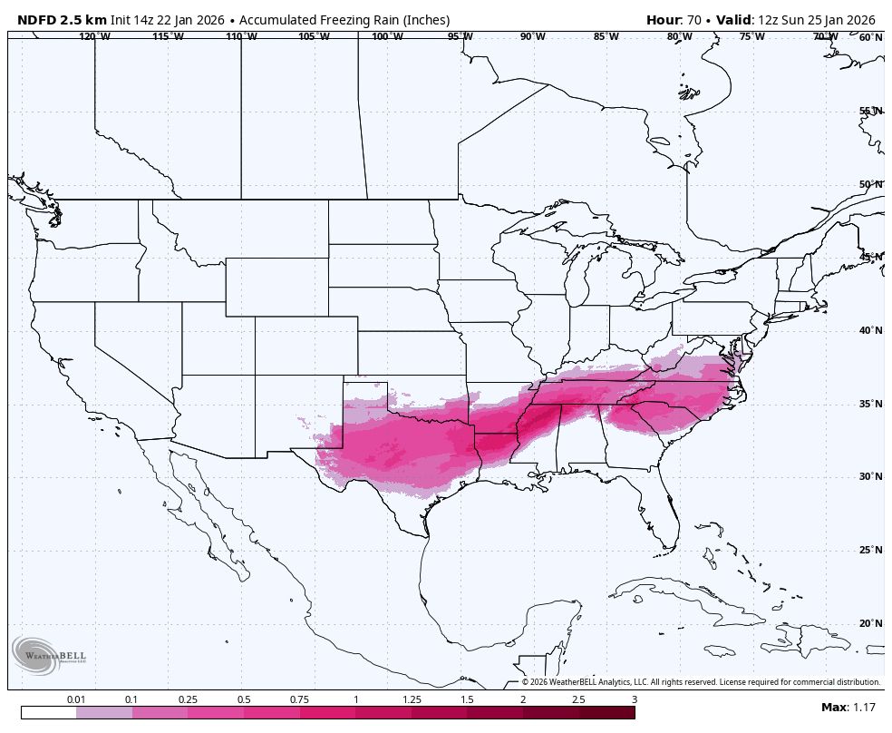
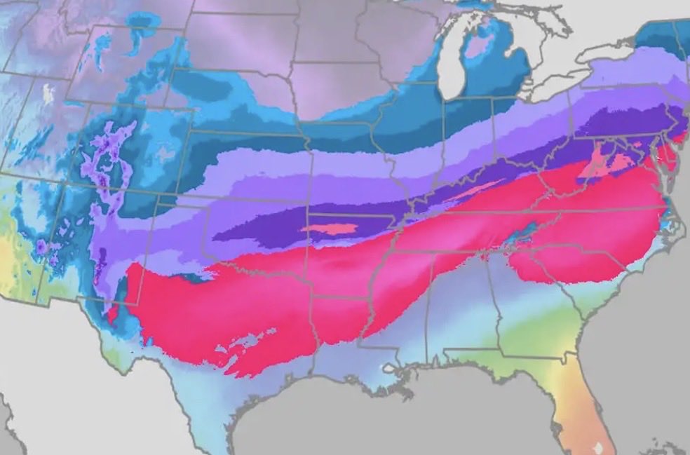
That pink on the map isn’t just “a little glaze.” It’s dangerous weight.
A quarter inch of ice can add 100–500 pounds to a single span of power line.
A half inch can pile on several hundred pounds more.
Three-quarters of an inch? That’s when lines fail, poles snap, and trees come down.
This is why ice storms cause some of the longest, most widespread power outages.
If you’re in the zone, now is the time to prepare: charge devices, have flashlights ready, and avoid travel once ice begins to accumulate. Watch @weatherchannel for the latest forecast.
#IceStorm #WinterWeather #PowerOutages #Fern
❄️ Southern Winter Storm Prep Thread ❄️ 🧵
Ice hits the South hard—power outages, burst pipes, slick roads.
60+ tips condensed into essentials. Save & share!
BEFORE THE STORM (24–48 hrs out)
1. Charge devices + power banks
2. Fill gas tanks
3. Get small-bill cash
4. Pick up meds early
5. Download offline content
6. Pick one warm room
7. Know shut-off valves/breaker box
8. Set fridge/freezer colder
❄️ WATER & PIPES
9. Drip faucets on cold nights
10. Open sink cabinets
11. Disconnect hoses
12. Insulate outdoor faucets
13. Know main water shut-off
14. Store extra water (tub, jugs) for flushing
❄️ FOOD PREP
15. Stock 3–5 days no-cook: PB, tuna, crackers, canned fruit/meat
16. Manual can opener
17. Shelf-stable milk
18. Freeze water bottles as ice packs
19. Cooler ready if power out & cold outside
20. Limit fresh perishables
❄️ HEAT & SAFETY
21. Extra blankets/sleeping bags
22. Dry firewood + clear chimney
23. NEVER run generator/grill indoors
24. Test smoke/CO detectors
25. Flashlights + batteries per person
26. Prefer battery lanterns over candles
❄️ VEHICLE & TRAVEL
27. Avoid driving in freezing rain
28. Bridges/overpasses freeze first
29. Car kit: blanket, water, snacks, charger, gloves
30. Fresh wiper fluid/blades
31. Park away from trees
32. Expect flight & highway delays
❄️ POWER OUTAGE
33. Unplug sensitive electronics
34. Battery radio or phone alerts
35. Surge protectors
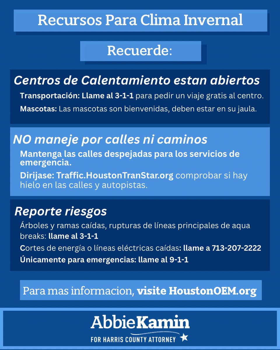
36. Know local warming centers
37. Extension cords for safe generator use
38. Keep fridge/freezer closed
❄️ PETS & LIVESTOCK
39. Bring pets inside + extra food/water
40. Unfrozen water for outdoor animals
41. Extra bedding/straw
42. Leashes/carriers ready
❄️ MEDICAL/SPECIAL NEEDS
43. List meds & dosages
44. First-aid kit + thermometer
45. Backup batteries for devices
46. Backup location with power if needed
❄️ PROPERTY
47. Move cars from under trees/lines
48. Secure outdoor items
49. Trim trees BEFORE storm
50. Photo property for insurance
DURING: Stay off roads, treat downed lines as live, safe heat only, check on neighbors.
❄️ AFTER
56. Watch for refreeze
57. Check pipes as temps rise
58. Toss fridge food >4 hrs above 40°F
59. No DIY on downed lines
60. Power restoration can take days
KEY: ¼" ice = outages. ½" ice = days of chaos.
Stay safe, y’all! ❄️
❄️ Winter Storm Update ❄️
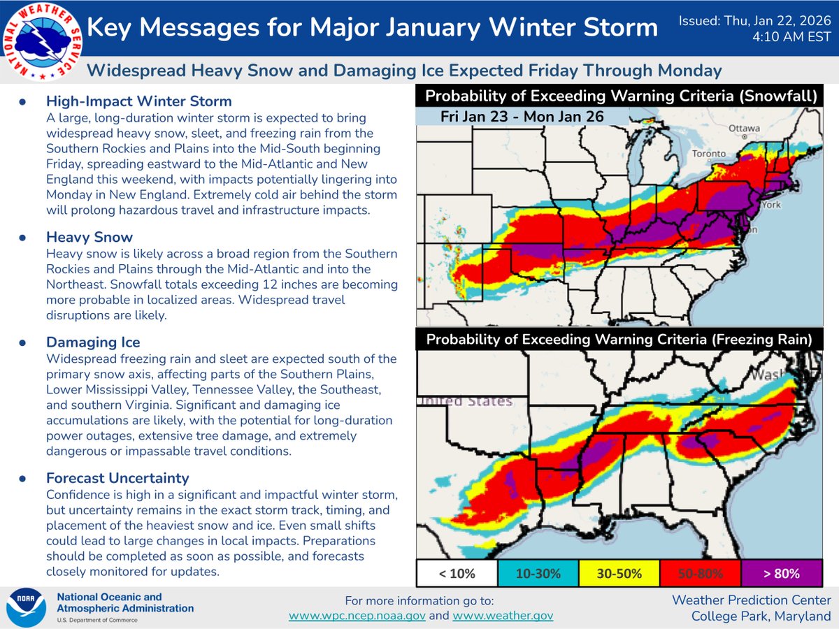
Here's the latest on the impending winter storm set to begin across the south-central U.S. on Friday. Confidence continues to increase for damaging ice accumulations across parts of the South. Preparations should be completed as soon as possible.
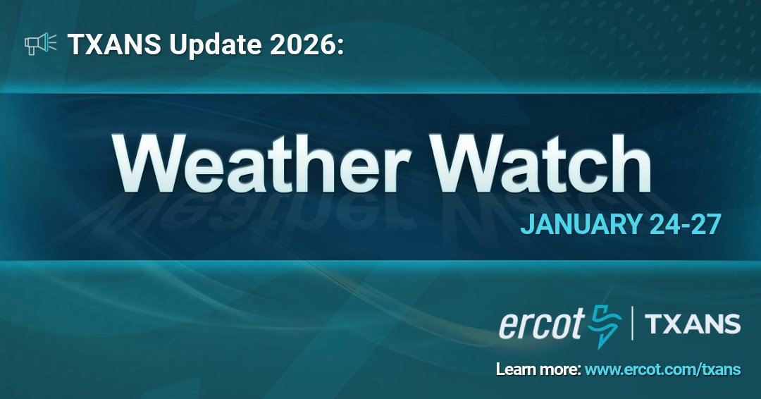
ERCOT has issued a Weather Watch from January 24-27 due to forecasted below-freezing temperatures with the possibility of frozen precipitation across the ERCOT region, higher electrical demand, and the potential for lower reserves. Grid conditions are expected to be normal during a Weather Watch and can be monitored on https://t.co/4lhispubCP. Read more: https://t.co/ZIBv3qrdmA. Sign up for #TXANS notifications: https://t.co/y6gjmE7uv1