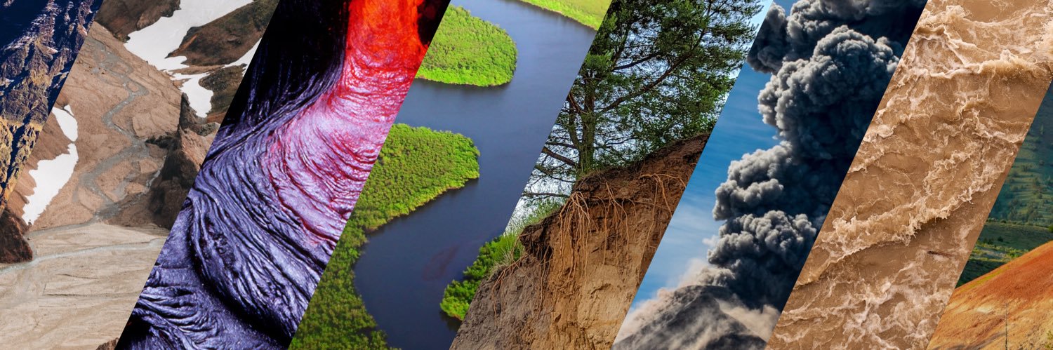
En 1970, un terremoto de 7.9Mw en el Departamento de Áncash provocó un deslizamiento de rocas y hielo desde la cima del Nevado Huascarán el cual evolucionó a un flujo de lodo frío que arrasó con Yungay y sus alrededores.
Revisa más detalles👉 https://t.co/b4H9exTuf6
Wait for it .... 11 seconds and BOOM! Some breathtaking footage from Fuego 🇬🇹 and
@BoiseState scientists in this great science update on infrasound sensors.
https://t.co/LzyJoihMqF
A massive landslide triggered a tsunami in 2017 in Karrat Fjord, Greenland, sending huge volumes of rock into the water and creating a wave up to 100m high near the source. It hit Nuugaatsiaq at around 10m, destroying homes and killing four people.
🌊 Major flooding hit Bundaberg 🇦🇺 on 10 Mar, forcing evacuations, cutting power to 2,000+ homes and closing key bridges.
🛰️ Data from @CopernicusEMS map flooded areas in blue, supporting response.
#ImageOfTheDay#CopernicusEU
🔗 https://t.co/azkPYk9AQ7
💦 Impresionante registro del "reventón" que cayó sobre Maipú este sábado 31.01.26 por la tarde.
Este chaparrón originó inundaciones repentinas.
Cedido por @hernanlizana a @meganoticiascl@Mega tomado desde un piso 15 de oriente a poniente.
Incendios forestales se desataron en las regiones de Biobío y Ñuble de Chile, provocando evacuaciones y una declaración de estado de catástrofe en el centro-sur del país.
Uno de los instrumentos de nuestro satélite Terra captó esta imagen del humo que emana de los incendios. https://t.co/nFlbd2Zj5B
Ferdinand Glacier (Svalbard)
1908 | 2018
Svalbard is the most rapidly warming place on Earth, even reaching melting point in winter recently! 🧊🔥
We are going back there to early Holocene glacier levels BUT without the same forcings! ☀️🌍🏭
https://t.co/KnFqXHq1tz
En Stop Disasters tú decides cómo proteger a la comunidad frente a incendios forestales e inundaciones.
Planifica, actúa y reduce el riesgo mientras juegas.
🎮 Descúbrelo aquí 👉 https://t.co/R94cXgvgHK
#StopDisastersGame#Resiliencia
Here are some other views of Kīlauea summit eruption lava fountaining episode 38 in Halema‘uma‘u crater on the Island of Hawai‘i, and answers to some of your questions about this activity.
This eruptive episode began from the north vent at about 8:45 am HST this morning, December 6. Smaller fountains began from the south vent at 8:49 am HST and quickly grew to over 1000 feet (300 meters) high and inclined to the south, towards a closed area of Hawaiʻi Volcanoes National Park. At 9:55 a.m., hot tephra falling from this fountain destroyed the V3 streaming camera site located within less than a mile (2,000 ft/500 m) from the eruptive vents; its burial highlights the hazardous nature of this closed area. The north vent stopped erupting at 11:50 a.m., but the south vent is still fountaining as of this posting.
In addition to the tephra, volcanic gas is being emitted, with sulfur dioxide emission rates likely exceeding 50,000 tonnes per day. The high effusion rate of this episode is also producing a very dramatic plume extending over 20,000 feet above sea level. Both the National Weather Service and Washington Volcanic Ash Advisory Center issued special advisories about this plume, and the Hawaii County Civil Defense Agency issued a message about the potential for fine glass particles in communities downwind.
Kīlauea's recent eruptive episodes have gone on for 5-9 hours; this episode has been active for about 4.5 hours now. The USGS Hawaiian Volcano Observatory staff are closely monitoring this activity, coordinating with partners at Hawaiʻi Volcanoes National Park and the Hawaii County Civil Defense Agency. #Kilauea #lava #eruption
A massive landslide struck the entrance of a tunnel on the Nanning–Youyiguan Expressway in Guangxi, China, following two consecutive typhoons and heavy rainfall.
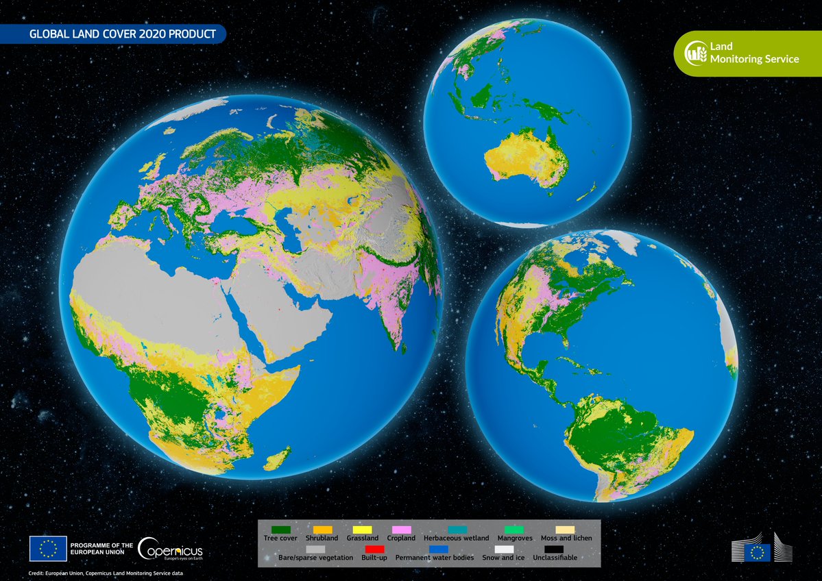
🌍 This data visualisation is based on the Global Land Cover by @CopernicusLand, released in June 2025.
🛰️ Based on #CopernicusEU#Sentinel2 data, the product provides a detailed view of the Earth’s surface.
Learn more: https://t.co/rjf7lWRzEQ
#ImageOfTheDay
A lava lake from space 🌋
This @CopernicusEU Sentinel-2 image shows Kīlauea’s main crater filled with a lava lake about 2.5 km long, after an eruptive episode during September 2025 when lava fountains reached about 100m high.
Smoke plumes are visible rising from the crater.