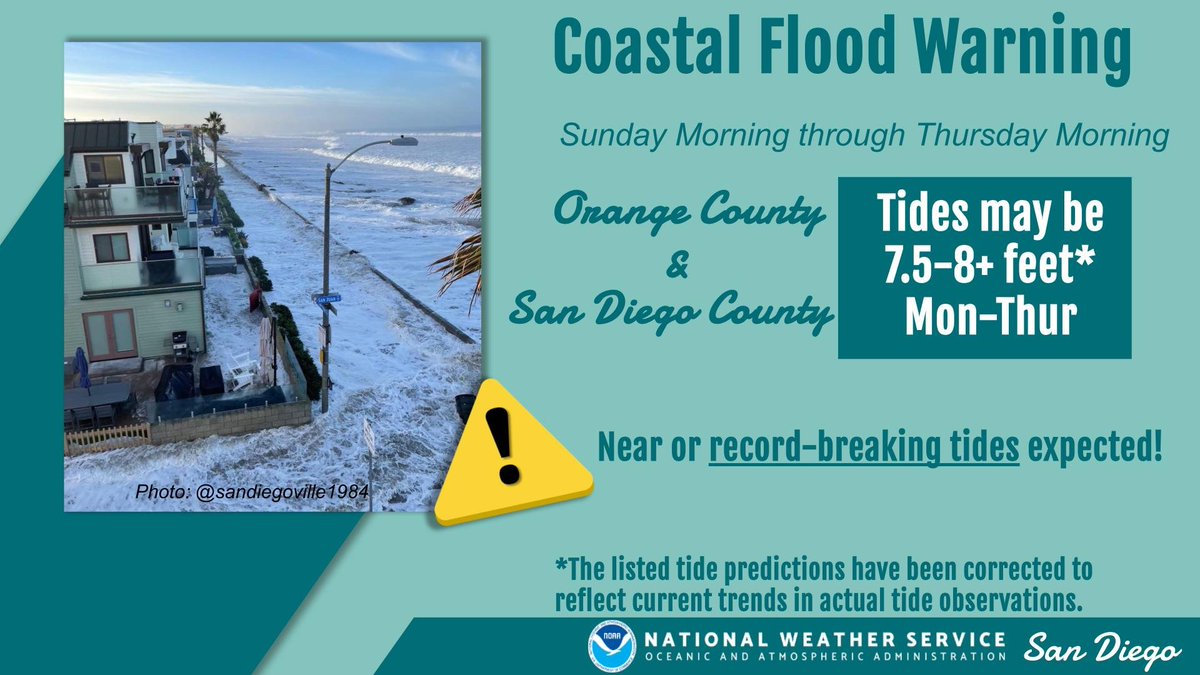
NWS San Diego has issued new Coastal Flood Warning for near-record/record-breaking tides and possible widespread coastal inundation in SoCal Sun-Thu. And there's no king tides or major storms in the mix yet...just elevated sea levels from extreme El Nino plus long-term warming.
Friday, October 23, 2026, 7:00 AM: The latest EU1 shows a central Pacific low-pressure axis approximately 240 miles due west of Santa Cruz, California, on Saturday, October 31, 2026, at 2PM, with a secondary impulse coming directly from the Hawaiian Islands and arriving late Halloween night into November 1, 2026, in Central and Southern California. This could bring potential for very heavy rainfall straight from the Hawaii region, also known as a classic pineapple express.
The details are still developing. Over the past week, I've been monitoring this situation: a strong subtropical jet stream, driven by a powerful El Niño, is beginning to interact with very warm sea surface temperatures of 85 to 94° south of the Hawaiian Islands. That warmth extends thousands of miles across the Pacific, just south of Ensenada, Mexico.
In addition, I’m also watching Vance, a tropical system in the latest series of Eastern Pacific hurricanes, which could also be ejecting moisture farther north. The trajectory, combined with this potential pineapple express, could produce rainfall totals exceeding an inch, if not more, from Santa Cruz all the way to San Diego.
The early preliminary for the most intense portion of this storm axis, looks to be from Santa Barbara to Los Angeles counties. That remains to be seen in the coming days as the situation continues to unfold. Yes more updates will come, as this could have a more widespread impact than the previous systems we’ve seen thus far. #CAwx #Californiastorms #ElNiño
The GRU hacked into Jared Kushner's iPhone. Dutch military intelligence (MIVD) then recruited a GRU spy who gave them access to the hacked phone. What MIVD discovered was that Kushner had access to two bank accounts --one Azerbaijani, the other Israeli --where Saudi Crown Prince Mohammed bin Salman and Emirati ruler Mohammed bin Zayed deposited money. It sounds like a slightly far-fetched episode of "Slow Horses," but it's real. And it proves just how eye-poppingly corrupt this administration was and continues to be as its "special envoy" decides the fate of tens of millions in Europe in the Middle East. Simply incredible reporting by Matthew Cole, drawn from his new book on Kushner. https://t.co/8AyV60gg1X
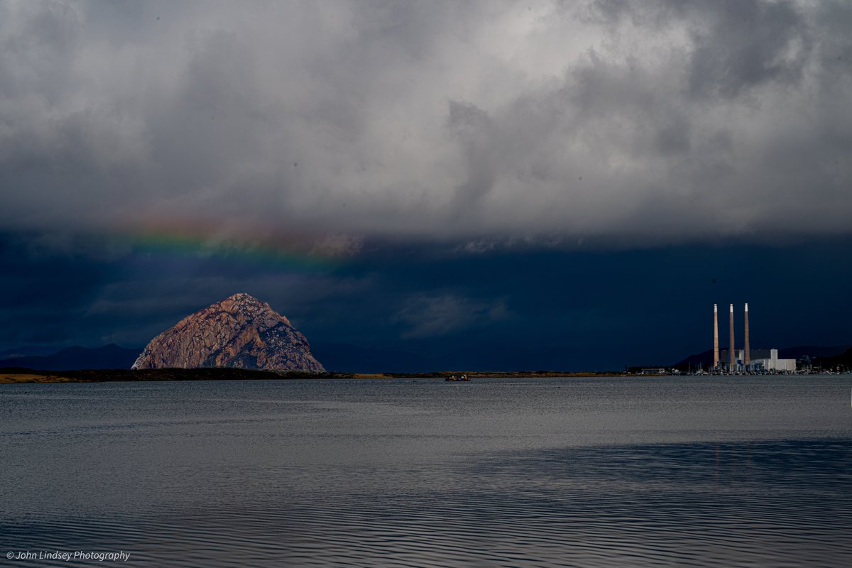
I captured this faint rainbow above Morro Rock at 11:15 a.m. today, when the sun was about 38 degrees above the horizon. At this angle, rainbows appear very low in the sky, sometimes barely peeking above the horizon.
This faint rainbow appeared as an exceptionally powerful storm continued to drench the Central Coast.
Periods of torrential rainfall will taper off tonight as a slow-moving upper-level low-pressure system, currently rotating counterclockwise off Point Sal, tracks southeastward toward the Southern California Bight.
This energetic storm certainly overperformed in terms of rainfall.
The upper-level low brought unusually cold air aloft, creating significant atmospheric instability that fueled intense convective rain showers and thunderstorms. Combined with the storm's exceptionally slow movement, these conditions allowed tremendous amounts of rainfall to accumulate across portions of the Central Coast.
The rainfall totals here in Baywood Park have been extraordinary!
As of 2:30 p.m. today, my three weather stations recorded approximately 3.5 to 3.7 inches of rainfall over a 24-hour period:
Standard rain gauge: 3.7 inches
Davis Vantage Pro2: 3.7 inches
Tempest Weather Station: 3.5 inches
Even more remarkable, at about 5 a.m., my Davis Vantage Pro2 weather station registered an instantaneous rainfall rate of 6 inches per hour! While that intensity was brief, it illustrates just how powerful some of these convective downpours became.
Thankfully, conditions will improve tonight as this slow-moving storm finally moves away from the Central Coast. What an extraordinary October storm! 🌈🌧️
Here is a list of rainfall received across our 4-county area over the past 24-hours (storm total rainfall). So far the heaviest rain has been over Santa Barbara County as multiple strong convective lines formed over the ocean and moved onshore. #CAwx
https://t.co/KeBvEHapBY
NEW: A CONFIRMED tornado, likely capable of EF2+ damage, hit Overgaard, Arizona at 7:06 p.m. MST.
This is likely Arizona's strongest tornado since an EF2 hit north of Flagstaff on September 14, 2011.
Prior to that, the October 5-6, 2010 event.
Exceptional event underway.
Churchill could have shortened WW2 by years if he had just “done a deal” with Hitler. George Washington could have done a deal to end the American Revolution. Zelenskyy is in good company.
Trump: I got Greenland. I got it… Denmark, They've only had it from 1592. That's not that old when because President Xi from China was here, I was showing him the White House. 1792, the White House, that's when it was built, and I was showing President Xi and I was so proud of it because I fixed it, you know, it, it was like a dump. They didn't take care of it
Sometime in 1983, in the northwest Valley, an unknown prankster altered the "Valley Cir" sign (for Valley Circle Boulevard) to read "Valley Girl" -- a playful reference to the newly released movie of the same name. Like, omigod!
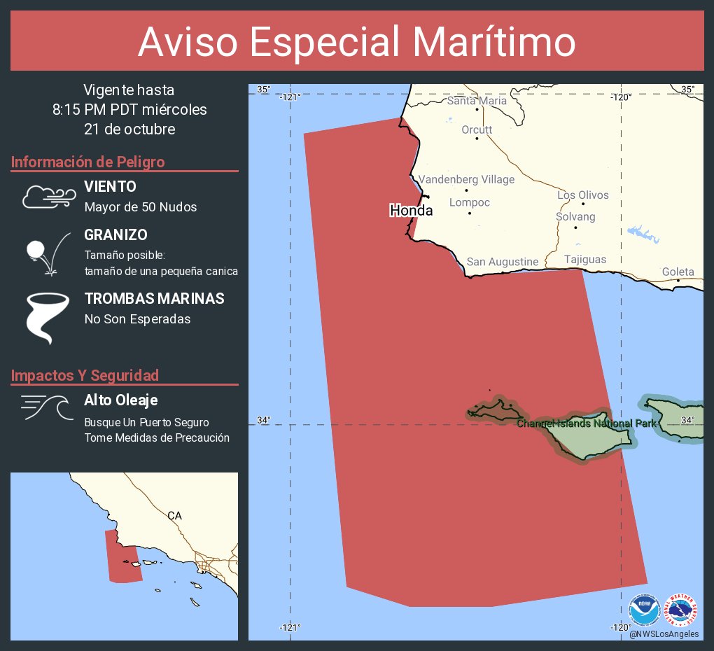
Special Marine Warning including the Waters from Pt. Sal to Santa Cruz Island CA and westward 60 nm including San Miguel and Santa Rosa Islands and Inner waters from Point Mugu to San Mateo Pt. CA including Santa Catalina and Anacapa Islands until 10:45 PM PDT
Wednesday, October 21, 2026, 6:47 PM: We’re starting to see the second unstable part of the main low-pressure axis starting to move from San Luis Obispo down towards Lompoc, California. There has been the start of a squall line taking shape. I’m going to monitor this situation over the next several hours to see if the line begins to get even larger during the early evening hours into the overnight on Thursday morning. #CAwx
Aviso Especial Marítimo incluye Aguas desde Pt. Sal a Isla Santa Cruz CA y 60 mn al oeste incluyendo las Islas San Miguel y Santa Rosa y Canal Santa Barbara Este desde Pt. Conception a Pt. Mugu CA incluyendo Isla Santa Cruz hasta las 8:15 PM PDT
Trump: We have a blockade on the Trump strait. How do you think the Arabs would like me calling it? I mean, we changed the name of the Gulf of Mexico, why can’t we change that name? I got a call from the President of Mexico. She was a ballerina. She went from ballerina to the President of Mexico. How the hell did that happen?
Trump: I think let's keep it the Atlantic Ocean, right? Pacific Ocean—we're going to call it the American Ocean. How do you think Europe, how do you think Europe would feel? Do you think they'd like that?
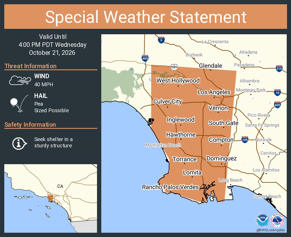
Visible imagery shows our storm off coast this afternoon. We're tracking a large area of strong thunderstorms off the Central Coast and also nearshore south of Pt. Conception. Use caution if you're driving this evening and encounter heavy rain or thunderstorms! #CAwx