Getting a little closer, this system has huge upside potential if the conditions align perfectly, but large uncertainties still remain, *especially* near Georgia where precipitation type is a big question mark. Significant cold likely early next week to hamper melting.
And for the 12th and final day of Redsmas....
Repost this for a chance to win a pair of Redsfest two-day passes! (three winners will be selected) Enter by 12/13 at 1 PM ET. Rules ➡️ https://t.co/uP02Pl461b
Conditions are increasingly favorable for flash flooding and river/creek flooding heading into mid-February. Those vulnerable to flooding are encouraged to monitor a trusted source for later forecasts and details. #kywx#ekywx
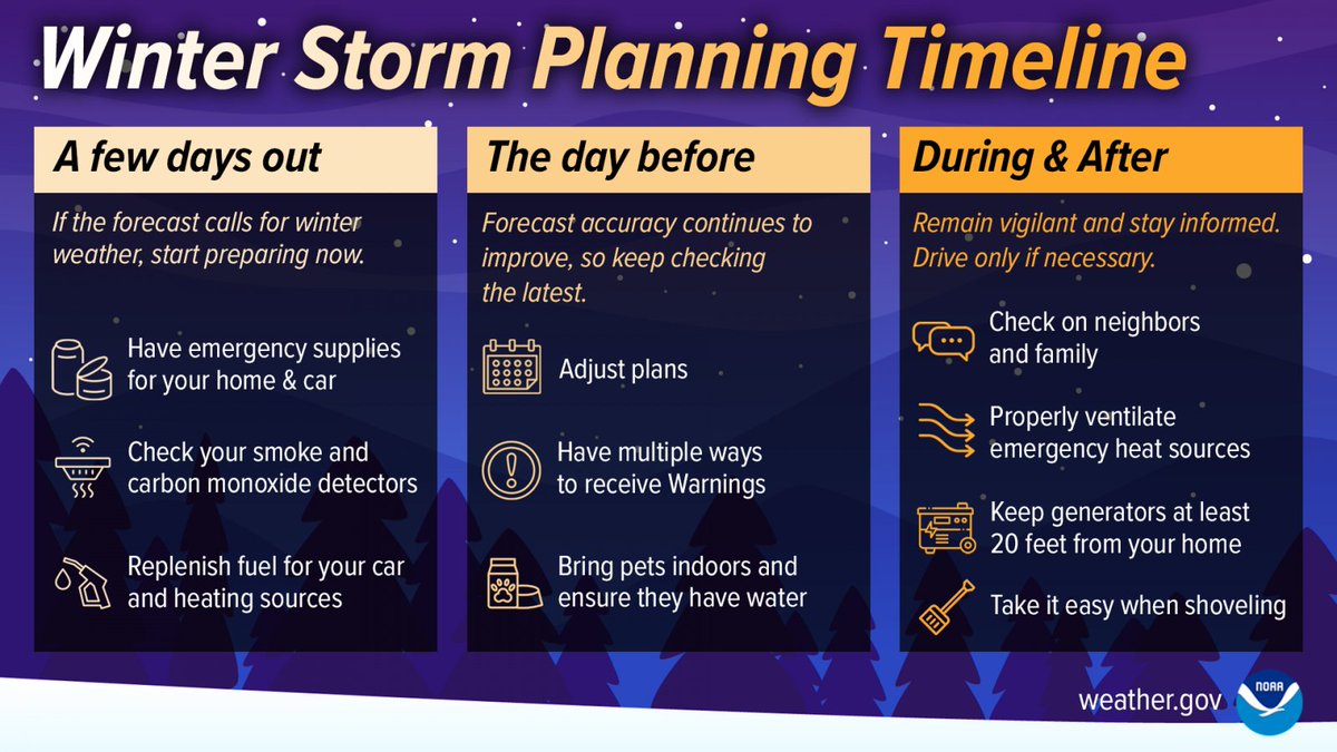
Chilly temps are in the forecast, Virginia. Make sure your winter weather emergency car kit is ready and stocked with essentials for you, your family and pets.
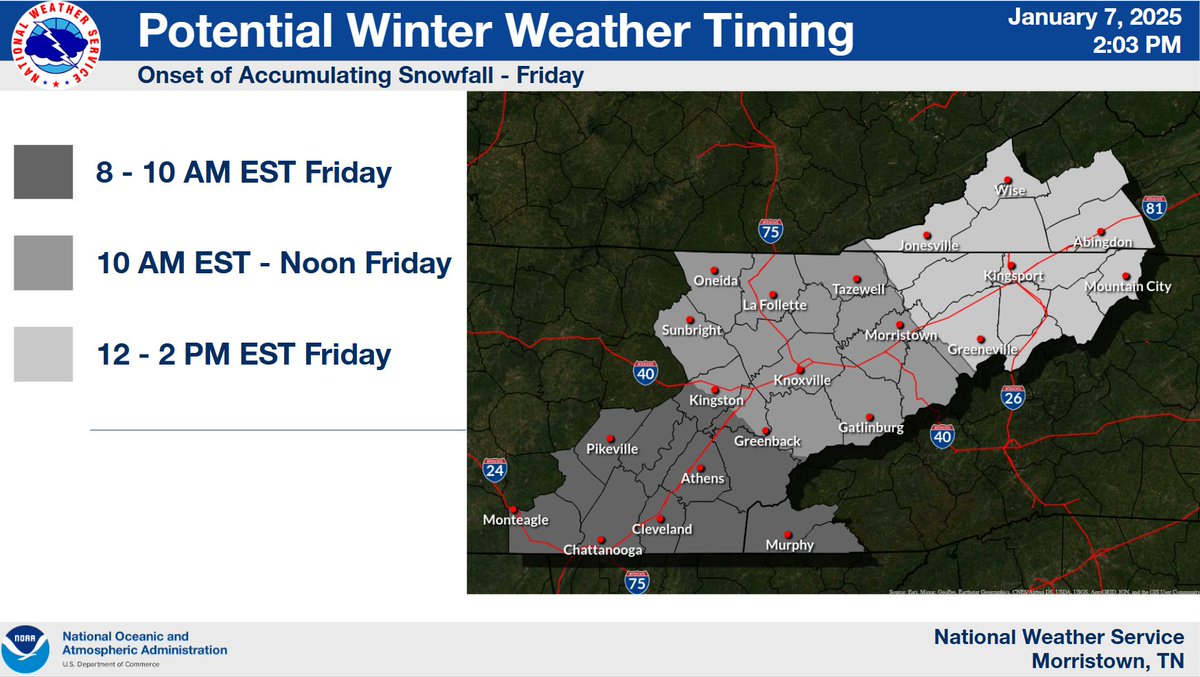
Accumulating snowfall expected across the area starting Friday morning and coming to an end Saturday morning. Here are the chances of getting at least 2", and the time of onset.
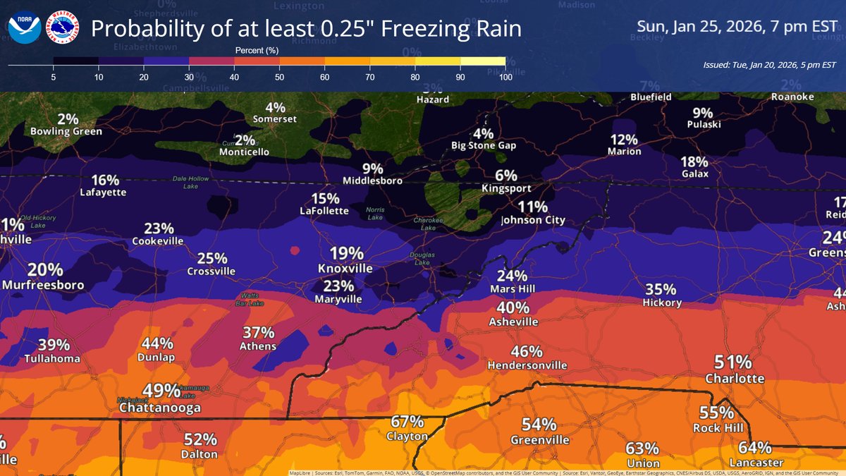
While probabilities of significant ice accumulation increases for northern portions of the region, understand that even very light accumulation of freezing rain can cause hazardous travel. Plan ahead and limit travel mid-morning Sunday through the afternoon.
Now is a good time to make sure your emergency supply kit for your vehicle is in good working order, now that there is an increasing chance for a winter storm in the forecast. #kywx#ekywx
We know you're all enjoying the mild temperatures so far this fall, and that will continue through the first half of next week. However, a big drop in temperature is expected to arrive late Wednesday. It will feel more like winter starting Thursday, with highs in the 40s. #mrxwx
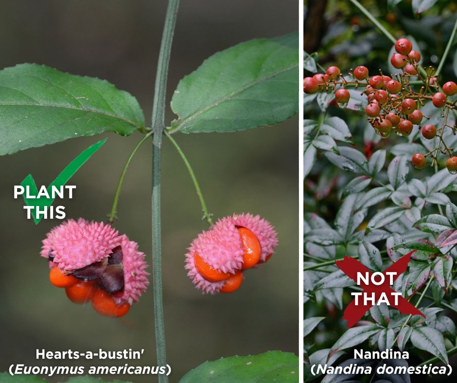
Nandina is now on DCR’s updated #invasiveplant species list! 😬 Have it in your yard? Consider replacing it with a #nativeplant like Hearts-a-bustin' to support local wildlife and #biodiversity. 🌱
More alterNATIVEs here: https://t.co/cNy6bpaZUm
Tropical Depression Fourteen has formed in the western Gulf of Mexico. It is forecast to strengthen into a hurricane early this week and make landfall along the west coast of Florida on Wednesday. No impacts are forecast for the Tennessee Valley and Southern Appalachians.
⚠️(Nolichucky Dam Update)⚠️ The Nolichucky River has crested, and the dam remains intact. Water is currently receding by approximately one foot per hour. Our Dam Safety teams are in the process of assessing the condition of the dam to determine next steps.
We are estimating water levels reached 8 feet over the record elevation.
On the heels of the apparent Joropocalypse, check out this video created by @UntamedScience, @Behind_Science, and me. This #invasivespecies can't fly, won't eat your baby, might or might not make it to the Northeast, and can we all just calm down please?
https://t.co/K69H48jjK4
Happy World Bee Day! 🐝 You can provide beautiful, vital habitat for pollinators by adding pollinator-friendly plants to your yard! https://t.co/JqZKNupvif