⚠️Orange Rain Warning
➡️Dublin, Wexford, Wicklow
⏳14:00 Fri 14/11 to 11:00 Sat 15/11
❗️Significant rainfall accumulations, especially on high ground & exposed areas
Impacts:
• Significant flooding possible
• Hazardous travelling conditions
ℹ️https://t.co/FhFWKx6AbX
⚠️#StormAmy has been named by the UK Met Office.⚠️
➡️This will bring heavy rainfall tomorrow with strong winds expected on Friday. A number of warnings will be issued today, with updates as certainty increases.
ℹ️Stay updated at: https://t.co/w5QtJ1V6un
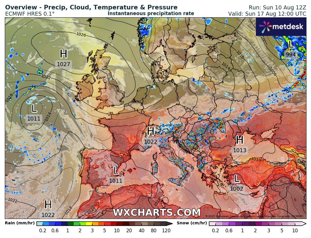
Some big seas off West coast thanks to remnants of hurricane Erin. This along with high tides could cause some overtopping and costal flooding. It will ease off by Wednesday.
A wet and windy Monday looking more and more likely but still uncertainty on the models with details varying and the UKMO model still the worst for winds. Given the timing it is one to watch carefully with festivals and tents and temporary structures etc.