Excited to announce a new paper out of the @ClasticsLab & @txgeosciences (with co-authors @zzsylvester, @PaulMGeo , and D. Mohrig) exploring the kinematics of meander bend cutoffs in timelapse satellite imagery. The full OA paper is available here [1/6]:
https://t.co/YsTBV45drG
Digital outcrop models analyzed in this study are freely available for download on @Sketchfab: https://t.co/1NyK495VVq
Data and code used in analysis and to produce and explore the 3-D stratigraphic avulsion model are available on @github: https://t.co/ujSTYaRnfC
New paper out now in Geology w/ co-authors @zzsylvester, @RiversToRocks, and @peteflaig exploring linkages between river avulsions and their 3-D stratigraphic architecture in the ancient sedimentary record: https://t.co/OuK1BZ9MPD
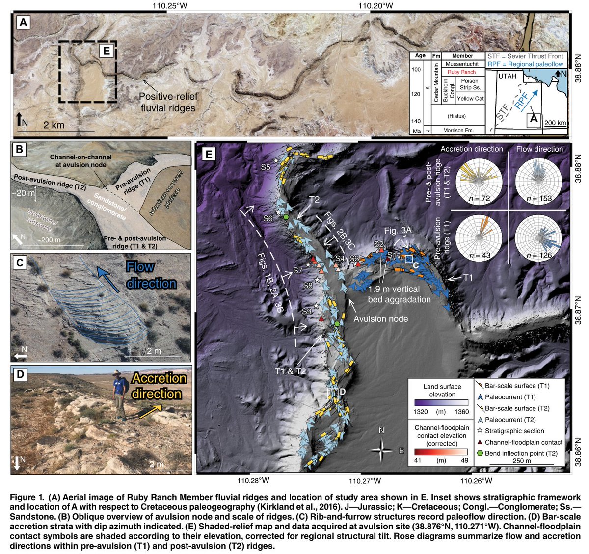
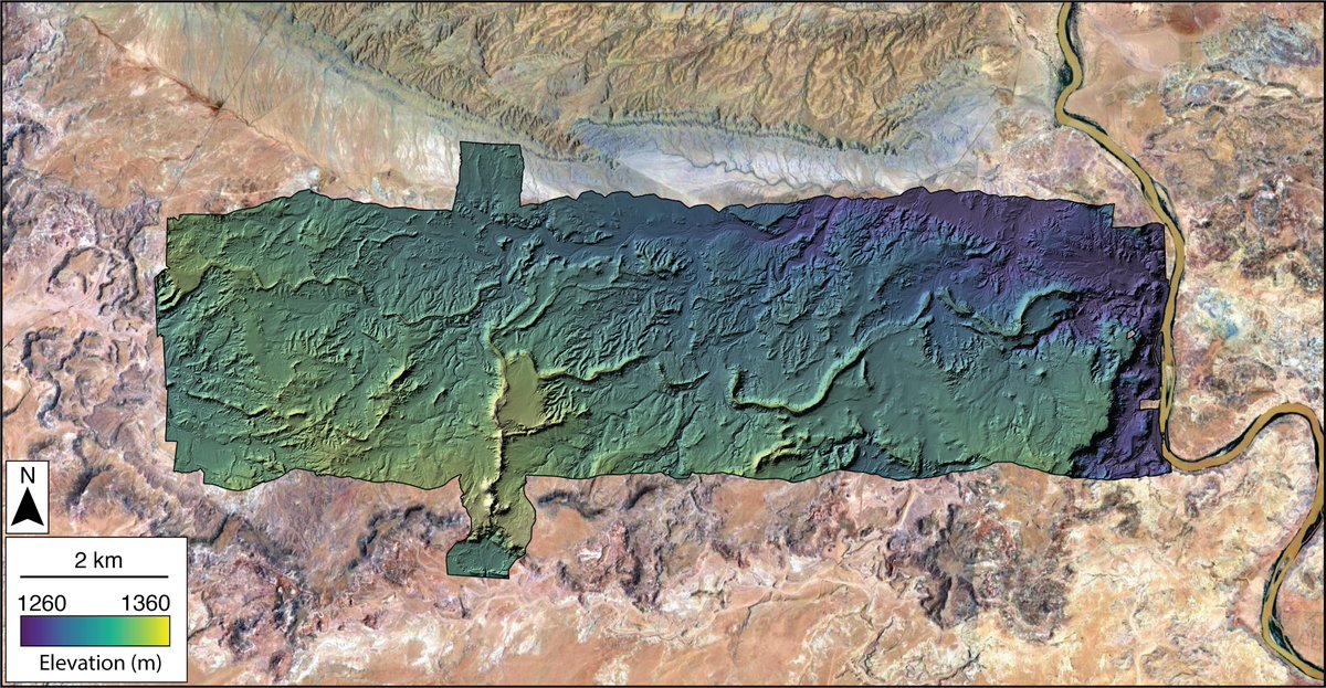
Lidar point cloud data capturing a ~50 sq. km region of the Cedar Mountain Fm. fluvial ridges, including the avulsion site analyzed here, were acquired by @NCALM_UH and are hosted by @OpenTopography:
https://t.co/eSJ1ceMHoE
Thrilled to announce the release of @GeoscienceAus#DEAIntertidal, a next-generation continental coastal dataset for Australia!
🏝️ 3D coastal elevation models
🦆 Ecological exposure maps
📏Vertical uncertainty
⏱️ Annual data from 2016
🔎 10 m resolution
https://t.co/nX0mZQ5jM9
ICYMI: New JPL Observational Products for End-Users from Remote Sensing Analysis (OPERA) Level 2 products are available at NASA's #ASFDAAC.
➡️Learn more about the new analysis-ready #SAR datasets: https://t.co/E777gTClCY
This paper is published as part of a forthcoming GSL Special Publication on Meandering Streamflows, and I am stoked for our work to be included alongside this awesome group of scientists. Highly recommend checking out the full Spec. Pub. here [6/6]:
https://t.co/w2I9pkCzpC
Excited to announce a new paper out of the @ClasticsLab & @txgeosciences (with co-authors @zzsylvester, @PaulMGeo , and D. Mohrig) exploring the kinematics of meander bend cutoffs in timelapse satellite imagery. The full OA paper is available here [1/6]:
https://t.co/YsTBV45drG
We further explore the predictability of bend migration rates and patterns based on initial planform bend geometry using the simple geometric model of Howard and Knutson (1984) [5/6].
For those still around #AGU23, drop by Moscone South this morning and chat with me about new ways to track and quantify river meandering processes (1666) and/or this afternoon to discuss Jupyter Notebook applications in-development by the OPERA project team at JPL (0207).
New blog post highlighting a suite of Jupyter Notebooks to enable programmatic access to cloud-hosted USGS 3D Elevation Program (3DEP) #lidar data. Notebooks demonstrate how to use @pointcloudpipe to access & process data hosted by Amazon Open Data. https://t.co/KFrU0EHqO6 1/2


![ColeSpeed's tweet photo. We further explore the predictability of bend migration rates and patterns based on initial planform bend geometry using the simple geometric model of Howard and Knutson (1984) [5/6]. https://t.co/QDzdbUKy3I](https://pbs.twimg.com/media/GDfRCgZWEAAh6BJ.jpg)


