Hurricane researchers describe “multi decadal” patterns largely driven by thermohaline (ocean current) circulations that change slowly over time. While we know this contributes to hurricane frequency and basin distributions, we know less how it affects landfall location frequency.
@randy54623@nynjpaweather Well, I would never bet against GDM so let’s just quietly watch, but there is so much shear, unless the next one finds another tiny window, maybe not, hopefully not
We are at the part of a hurricane event I call "baked in the cake". Very little will change between now and landfall, and only little wobbles will determine who gets the worst of the winds and surge. It's not going to suddenly weaken or turn, what we see will likely be what we get.
The prep stage is wrapping up, and the hunker down time for those in the path of Isaias is nearing. Later today and tonight your goal is to get through the storm's fury so that you can get to the often endless-feeling recovery stage. The two parts of your preps should reflect that as well. Make your home ready to get through the storm as best as possible, then the hurricane kit should have what you need to get into the beginning of the recovery.
Some tips, freeze bottles of water to extend refrigeration if power goes out. Preposition flashlights so you can find them in the dark. Make sure electric stoves/ranges are off during the storm. Use a carbon monoxide detector when running a generator. Don't rush to clean up after the storm, many injuries/fatalities come after the storm has passed.
@RonaldRamsey I guess near or just east of Pensacola but if you are in/under or east of where the center crosses the coast, it will be pretty bad. Fairly quickly to the west the hurricane impacts should diminish quite quickly.
@Federal_Green That's correct, Opal was lower end cat 3, this will likely be slightly lower than that in intensity but almost too little make a meaningful difference. At hurricane force winds, damage is damage.
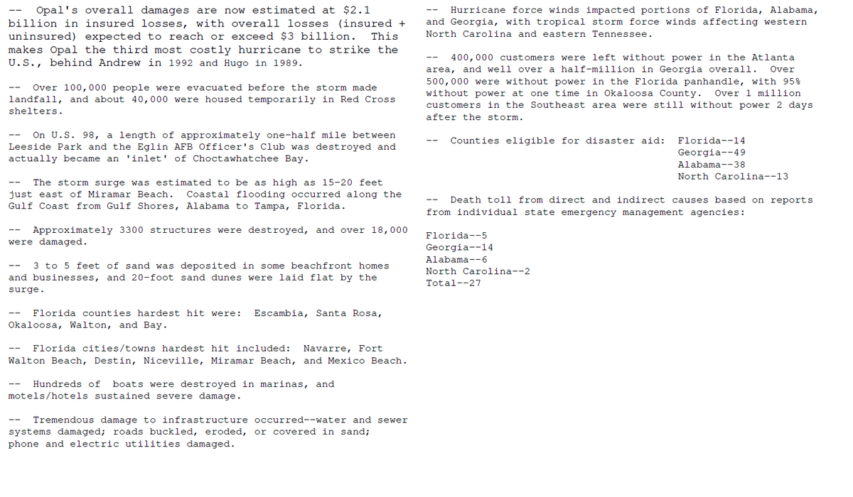
Because hurricane impacts can be infrequent events for specific areas (thankfully), we can look to previous storms to help form an idea of expectations with a current one. Opal comes to mind and likely shows the upper end of what is possible from Isaias. It was over 30 years ago but some still remember how it devastated the panhandle beaches and dunes, not to mention resulted in loss of life in the dozens.
Opal was weakening when it came ashore but had enough inertia so to speak, it was still a very destructive hurricane.
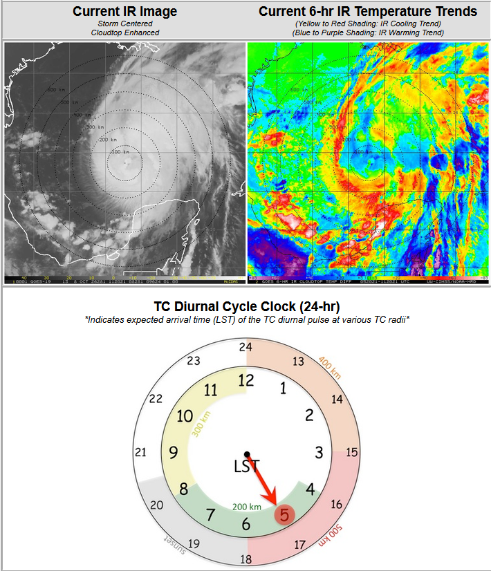
Thursday morning thoughts on Isaias. The satellite presentation is less than spectacular (thankfully) following diurnal expansion, and while the upper cloud shield has expanded, the core continues to struggle against dry air and shear.
This is a good sign in that the environment does not support a monster, rapidly intensifying storm right up to landfall tomorrow. But this does not take slow strengthening and the hurricane impacts threat off the table for a portion of the Gulf coast in the hurricane warning areas. Preps there should still be taken for all hurricane related hazards in these areas. Why? Because we never want to be surprised when a hurricane is approaching, expecting it to weaken or miss, we always plan like it will hit us, and hope it's just a minor blow.
The diurnal clock is the natural timed increase in a tropical cyclone. And while it happened with Isaias overnight, it only expanded the upper cloud shield but now we see individual convective towers rotating around an not complete circle. So the cyclone is strengthening but thankfully struggling, and this is likely limiting rapid intensification.