GeoLibre is now on Google Play!
Android users can install GeoLibre with a single tap.
https://t.co/MF10u52cZG
GeoLibre is a free and open-source, lightweight, cloud-native GIS platform for visualizing, exploring, and analyzing geospatial data. It runs everywhere you do, in the web browser, on the desktop, on mobile, and inside Jupyter notebooks, all while keeping your data local and private.
GeoLibre works across platforms:
- Android: Google Play
- Windows: Microsoft Store / winget
- macOS: Homebrew
- Linux: AUR, COPR, Flatpark, .deb / .rpm / AppImage
- Web: https://t.co/8gMtkVtfnm
Take your maps into the field, open a PMTiles or GeoParquet file from the cloud, and analyze it on your phone. Try it today and let us know what you build. Star the repo: https://t.co/VXq8c1o2Nd
#GIS #OpenSource #Geospatial #MapLibre #GeoLibre #DataScience #Mapping #Android #GooglePlay
GeoLibre has a new https://t.co/EULFqwqZ6i plugin for visualizing origin-destination data. It allows you to seamlessly explore mobility, migration, and other flow data with high-performance WebGL rendering. A big thank you to Kai Erlenbusch for developing and contributing the plugin to the GeoLibre plugin marketplace.
GitHub: https://t.co/eoRP8p6rBN
If you are interested in developing a GeoLibre plugin, check out the documentation: https://t.co/OA2YQ5L2Xb
#opensource #GeoLibre
GeoLibre v2.1 is here!
GeoLibre is a free and open-source, lightweight, cloud-native GIS platform for visualizing, exploring, and analyzing geospatial data. It runs everywhere you do, in the web browser, on the desktop, on mobile, and inside Jupyter notebooks, all while keeping your data local and private.
This release adds a QGIS-style Browser panel for exploring data from one place, animated route playback with video export, Wikipedia knowledge cards, and Mapillary street-level images.
What's new in v2.1.0
- Browser panel (Data Source Manager): explore and add data from one place. Browse map services, connect to PostGIS databases and drill into their schemas and tables, open local files, and save Favorites, all with full keyboard navigation.
- Route animation: send a marker along any line layer, follow the track in 3D with camera controls, and export the whole animation as an MP4 video.
- In-browser object detection: run ONNX/YOLO models directly in the webview, with no server or Python required.
- Map recording: capture the map canvas, or a drawn bounding box, straight to a video file from the browser.
- Native-resolution photo viewer: view geotagged photos at full detail right on the map.
- Wikipedia knowledge cards: click any place to pull up its Wikipedia summary and info card.
- More planetary basemaps: USGS imagery for nine more celestial bodies, plus a new OpenAerialMap imagery search plugin.
Try it out
- Live demo: https://t.co/hOVekblXMc
- GitHub: https://t.co/VXq8c1o2Nd
- Documentation: https://t.co/7VA2AQoCUc
- Release notes: https://t.co/JwJBqxwloH
#GIS #Geospatial #OpenSource #RemoteSensing #DataVisualization #MapLibre #GeoLibre
Just released polylabel v2.1.0, where my tiny JS library for finding the pole of inaccessibility of a polygon gets 35 times (!) faster.
This library has been around for 10 years — very satisfying to discover such massive speedups even in mature projects like this. ⚡️
GeoLibre v1.7.0 is here!
GeoLibre is a free and open-source, lightweight, cloud-native GIS platform for visualizing, exploring, and analyzing geospatial data. It runs everywhere you do, in the web browser, on the desktop, on mobile, and inside Jupyter notebooks, all while keeping your data local and private.
This release opens up the UI to plugins, adds inline color ramp previews across the styling panels, and makes the Whitebox toolbox browsable right from the Processing menu.
What's new in v1.7.0
- Plugin UI host API: Plugins can now register first-class right-sidebar panels, toolbar menus, and floating panels that dock beside the built-in Style panel instead of faking an overlay.
- Color ramp previews: Both the vector and raster style panels show each colormap's gradient inline, so you can see the colors while you pick rather than reading a list of names.
- Richer vector labeling: ArcGIS-style label controls for anchor, offset, rotation, wrap width, and letter case, plus modes that collapse stacked points at the same coordinate into a single label.
- Whitebox by category: Browse the whole Whitebox toolbox by category directly in the Processing menu, with an offline-bundled tool catalog for restricted environments.
- Collaboration at a glance: An on-canvas session badge and roster show a live dot, the connected-participant count, and who is in the session, with a clear way back to the map.
Try it out
- Live demo: https://t.co/hOVekblXMc
- GitHub: https://t.co/VXq8c1o2Nd
- Documentation: https://t.co/7VA2AQoCUc
- Release notes: https://t.co/Ki2oOpMzgb
#GIS #GeospatialData #OpenSource #RemoteSensing #DataVisualization #MapLibre #Python #Plugins
🟢 Time for a new tiny & fast computational geometry JS library from me: circle-union. It takes thousands of geographic circles as input and computes combined coverage polygons in milliseconds. Useful for various coverage maps, and hundreds of times faster than Turf circle+union.
A city isn't just roads and buildings, it's the details that make it iconic.
Our new 3D landmarks in Osaka feature vibrant billboard visuals and city-defining architecture, helping developers create experiences that feel instantly familiar to users.
Take a closer look: https://t.co/zEaE9FbagU
#BuiltWithMapbox #MapDesign #LocationIntelligence
A French engineer who lives quietly in Paris has spent 30 years writing software that the entire internet now runs on without knowing his name.
He wrote the code that streams every YouTube video, every Netflix show, every TikTok clip. He wrote the code that runs the virtual servers underneath AWS, Google Cloud, and Microsoft Azure. He calculated more digits of pi than anyone in history. He has no Twitter. He has no marketing. He just keeps shipping.
His name is Fabrice Bellard.
Here is the story, because almost nobody outside the systems programming world knows what one man has built.
Fabrice was born in 1972 in Grenoble, France. He studied at École Polytechnique, the top French engineering school. He never went to Silicon Valley. He never built a startup empire. He just wrote code.
In 2000 he started a project called FFmpeg, an open-source multimedia framework for encoding, decoding, and streaming video. He was 28. The project did one thing nobody else had done well. It handled every video and audio format that existed, in one library, on every operating system. He led it himself for years.
Today FFmpeg is the invisible engine of the internet. YouTube uses it. Netflix uses it. VLC uses it. Chrome and Firefox use parts of it. Every Android phone, every iPhone, every smart TV, every video editing tool you have ever touched runs FFmpeg somewhere underneath. If you have watched a video on a screen in the last 20 years, Fabrice's code processed it.
He was not done.
In 2003 he started QEMU, a machine emulator and virtualizer. He wrote it solo until version 0.7.1 in 2005. QEMU lets you run any operating system on any other operating system. It became the foundation of modern virtualization. KVM, the Linux kernel hypervisor, runs on top of QEMU. Every major cloud provider, AWS, Google Cloud, Microsoft Azure, IBM Cloud, runs virtual machines on infrastructure built around it. The Quick Emulator is the most cited piece of cloud infrastructure code on Earth.
He kept going.
In 2001 he won the International Obfuscated C Code Contest with a small C compiler that grew into TCC, the Tiny C Compiler. TCC can compile and boot a Linux kernel from source in under 15 seconds. In 2004 he calculated the most digits of pi ever computed at the time, using a personal desktop computer and an algorithm he derived himself called Bellard's formula. In 2011 he wrote a complete PC emulator in pure JavaScript that runs Linux in your browser, a project called JSLinux that engineers still cannot believe is real.
In 2019 he released QuickJS, a small but complete JavaScript engine that fits where V8 cannot. In 2021 he released NNCP, a neural network based lossless data compressor that immediately took the lead on the Large Text Compression Benchmark.
Then he turned his attention to large language models. He built TextSynth Server, a web server with a REST API for running LLMs locally. He released ts_zip and ts_sms, compression utilities that use language models to compress text and short messages at ratios traditional algorithms cannot reach. He released TSAC, a very low bitrate audio compression system. In December 2025 he released Micro QuickJS, a new JavaScript engine for microcontrollers, separate from QuickJS, designed for environments with almost no memory.
Fabrice co-founded a telecom company called Amarisoft in 2012, where he serves as CTO. Amarisoft builds 4G and 5G base station software used by carriers and labs around the world. He has been running it for over a decade while continuing to ship personal projects from his own home page at bellard dot org
He has no Twitter. He has no Instagram. He gives almost no interviews. His personal website is a flat list of projects with no styling, no fonts, no marketing copy. Just titles and links.
A quiet French engineer who never moved to Silicon Valley wrote the code that quietly runs the internet.
He is still shipping.
GeoLibre v0.5.0 is out! This update significantly expands data format support, making it easier to work with a wide range of geospatial datasets in a lightweight, modern GIS environment.
Newly supported formats and services include: GeoJSON, Shapefile, GeoPackage, GeoParquet, KML/KMZ, FlatGeobuf, PMTiles MBTiles, GeoTIFF, Zarr, LiDAR point clouds, Gaussian Splatting, and ArcGIS services.
GeoLibre is a lightweight, cloud-native GIS built with MapLibre and Tauri. It runs directly in the browser and is also available as a standalone cross-platform desktop application at only ~30 MB.
GitHub: https://t.co/VXq8c1oACL
Website: https://t.co/7VA2AQpaJK
Live demo: https://t.co/Cq5Mg3oRDo
Feedback, ideas, and contributions are welcome.
#geospatial #opensource #maplibre
Uno de los libros más fascinantes que he leído sobre la historia de la IA y que, quizá, me llevó a dedicarme a la filosofía de la IA. Feliz día del libro.
🚨🚨Atención, nostálgicos: acabo de dar con el archivo de Discoplay.
Pincháis en el año y aparecen todas las portadas de ese año; pincháis en una portada y se abre el contenido. Vamos, canelita en rama y billete directo al pasado.
@ladecada_80
https://t.co/zWrjL9rfIO
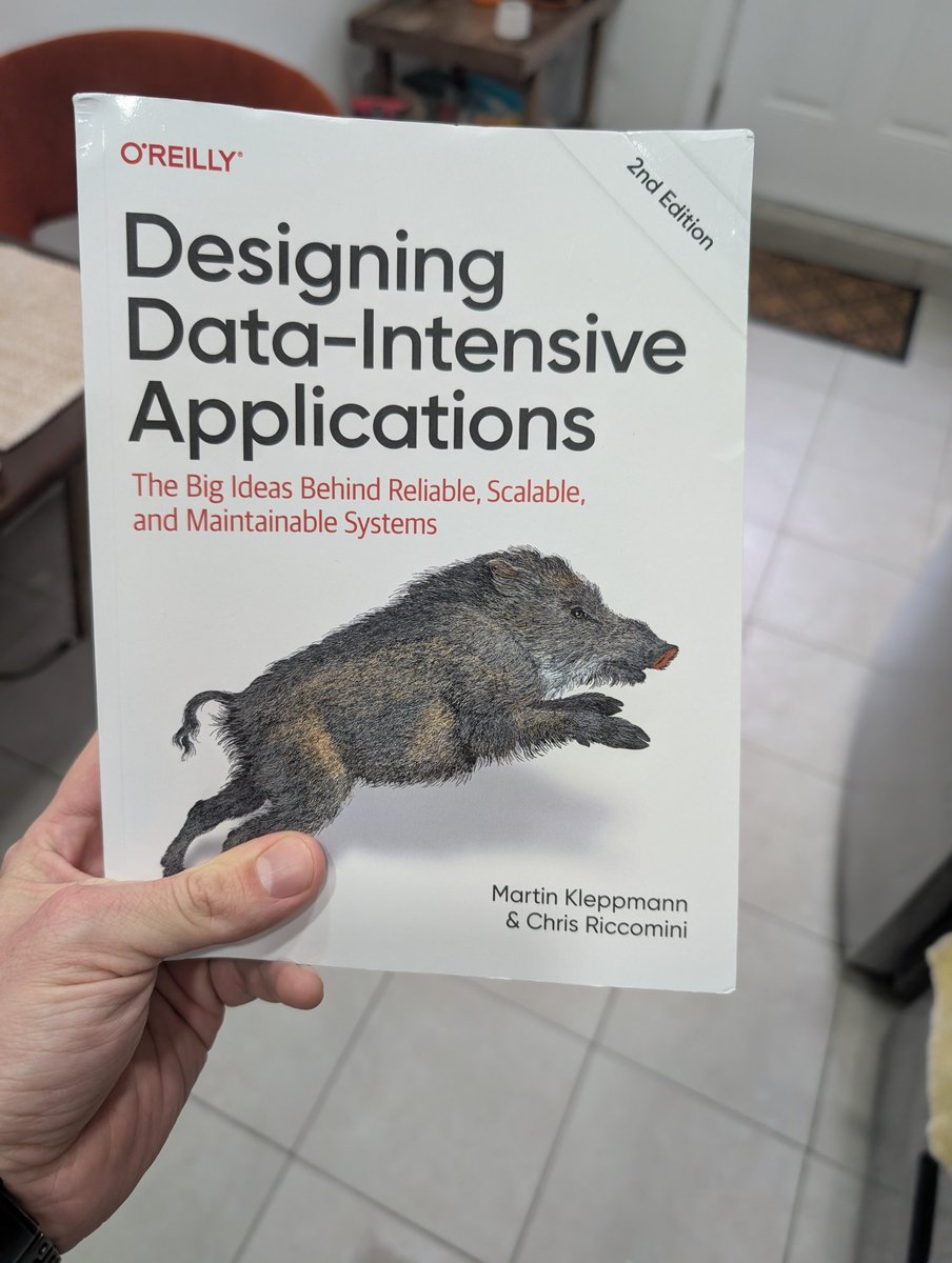
I first tried to read this book in 2018 and couldn't make it through because I thought it was too hard.
8 years later it's the only book I recommend every developer reads, and I had the chance to review the 2nd edition.
Join a study group, give it a read.
Acabo de ver que el libro de @mundospectrum está PIRATEADO en @Scribd, así que oye, como ya no tenemos vinculación editorial con Dolmen y el libro es difícil de encontrar, aquí lo tenéis para leerlo. A cambio, un RT (sigue hilo abajo).
https://t.co/JvIOFjKslE