Will need to keep an eye on the weather for overnight Friday 09th Jan and into Friday daytime. There could be a named storm and there could be snow involved. This time it would be Southern UK impacted
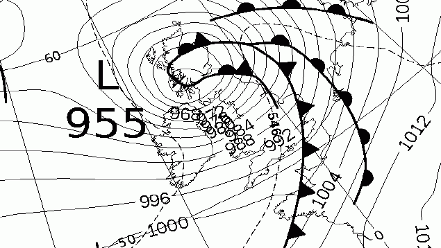
If this chart is correct the UK is in for one of its biggest Storms for some years. Red wind waring should be expected soon. We need to keep watch and see...
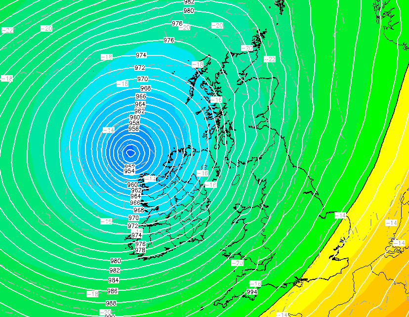
There is now a RED wind warning for parts of the SW and West, don't be surprised if warning levels increase for other areas during the day and over night. Please take this seriously and look after yourselves 😨
We MIGHT get Storm Darragh Friday Night into the weekend. If the third low pressure heading towards us crosses the Jet Stream, which is exceptionally strong at over 250 MPH, to the cold side we might get a very impactfull storm for Midlands and Southern England
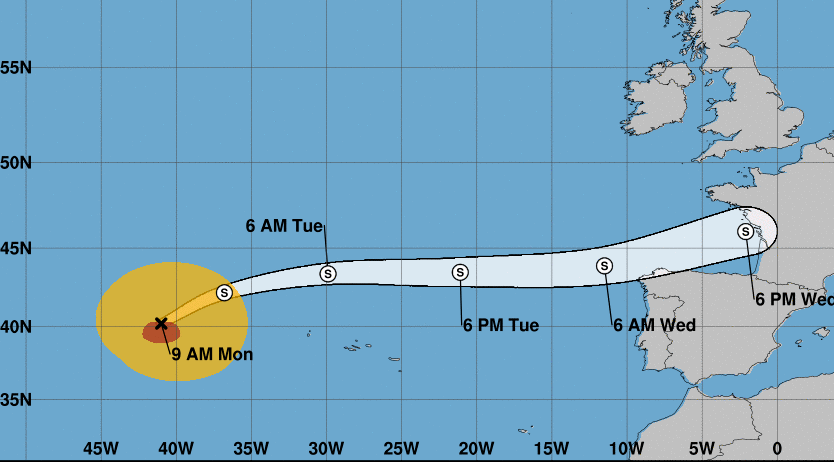
We will need to keep an eye on what happens to Hurricane Kirk once it stops being a hurricane and heads our way as a possible powerful storm around Thursday or Friday of next week. If it happens like shown below we will be in for a big blow!
Former Hurricane Ernesto is arriving with us as Storm Lillian tomorrow early in the morning. If you are in North Wales or Northern England it will be very windy, up to 75MPH. Please take care. During next week it will turn hot
Many parts of England will experience Compression Heating Sunday and Monday. It will get hot even inside buildings. You would need an airtight room to escape this effect. The SE , Midlands and East Anglia will feel it the most. This is quite a rare event
@ECMWF I have the same difficulty with the Mean sea level pressure: Weekly mean anomalies. Could you not use Blue for wet / low and red for dry / high?
@ECMWF I have a color deficiency. I find it very hard to read your Precipitation weekly mean anomalies chart, unable to tell difference between wet and dry. For me the -10 and +10, the -30 and +30 and the -80 and +80 all look the same. Thanks
This can bring us a change in our weather, Sometimes to very hot conditions and other times to wet cool conditions. Some travel across the Atlantic and arrive as an energetic storm. I will keep you posted
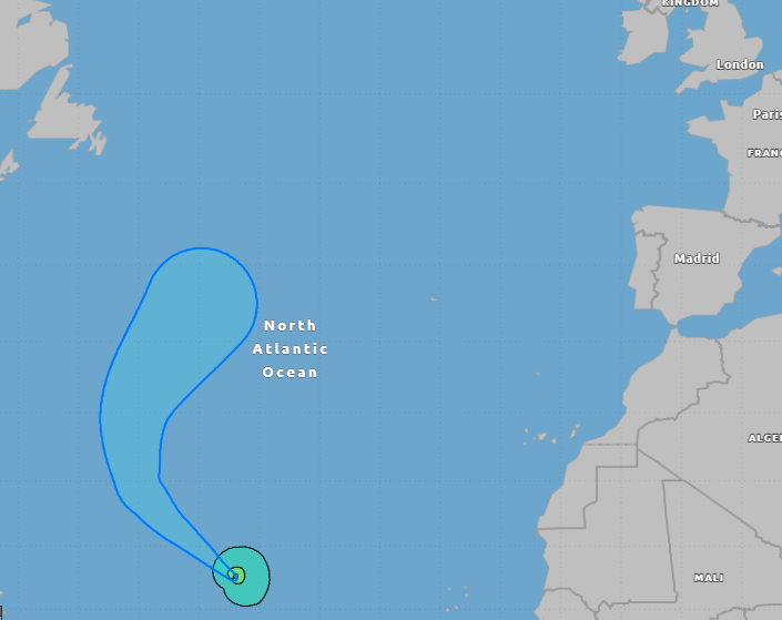
This is just one to watch for now. Most models are forecasting a very active Atlantic Hurricane Season. These storms do not impact us directly but do influence our weather, especially Aug to Nov. When they track North us the East coast of the USA they effect the Jet Stream
We have our 11th named storm of the 23/24 season, its called Kathleen. Named by the Irish Met Office. Most of the Western edge of the UK will also be impacted by strong winds. Over in the East of England it will bring us a breezy but very warm day, we could reach 21C!
Feb 2024 was the warmest on record for England. Also very wet and well below average sunshine. The winter overall was warmer, wetter and winder than average for England
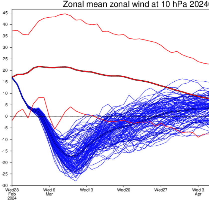
This has been a winter of many SSW's but none delivered cold weather. This is because they only just managed to reverse the polar winds a tiny amount -0.5 for example. We are about to have a big SSW, by 10th March the polar winds could be at -15, that's powerful.