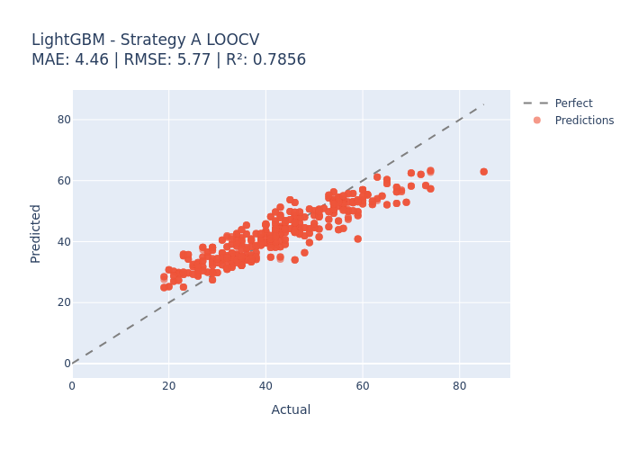
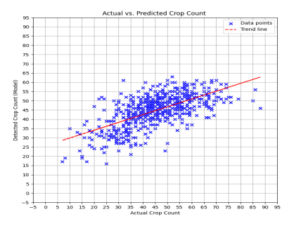
When #swatcam started general cereal #plantstand counting our accuracy was the 1st chart in blue - contrast with todays #barley chart in red. With over 1m acres of images processed now - we are excited to see the new models at work in 2026 - automated AI system in use!
📗Henry’s Handbook of Soil and Water is officially re-stocked and available for order on our website!
Written by legendary Saskatchewan soil scientist Les Henry, this book has become a trusted reference for agronomists, farmers, and anyone passionate about understanding how soil and water shape crop production. It outlines the five soil-forming factors: climate, vegetation, parent material, topography, and time.
Les Henry was a farmer and former professor and extension specialist at the University of Saskatchewan. His practical, common-sense approach to soil science resonated with farmers and agronomists alike. Before his passing, Henry transferred the copyright of Henry’s Handbook of Soil and Water to Cory Willness, CEO of Croptimistic Technology, ensuring the continued availability of this foundational resource.
Order your copy here 👉https://t.co/jRBAVmVcMJ
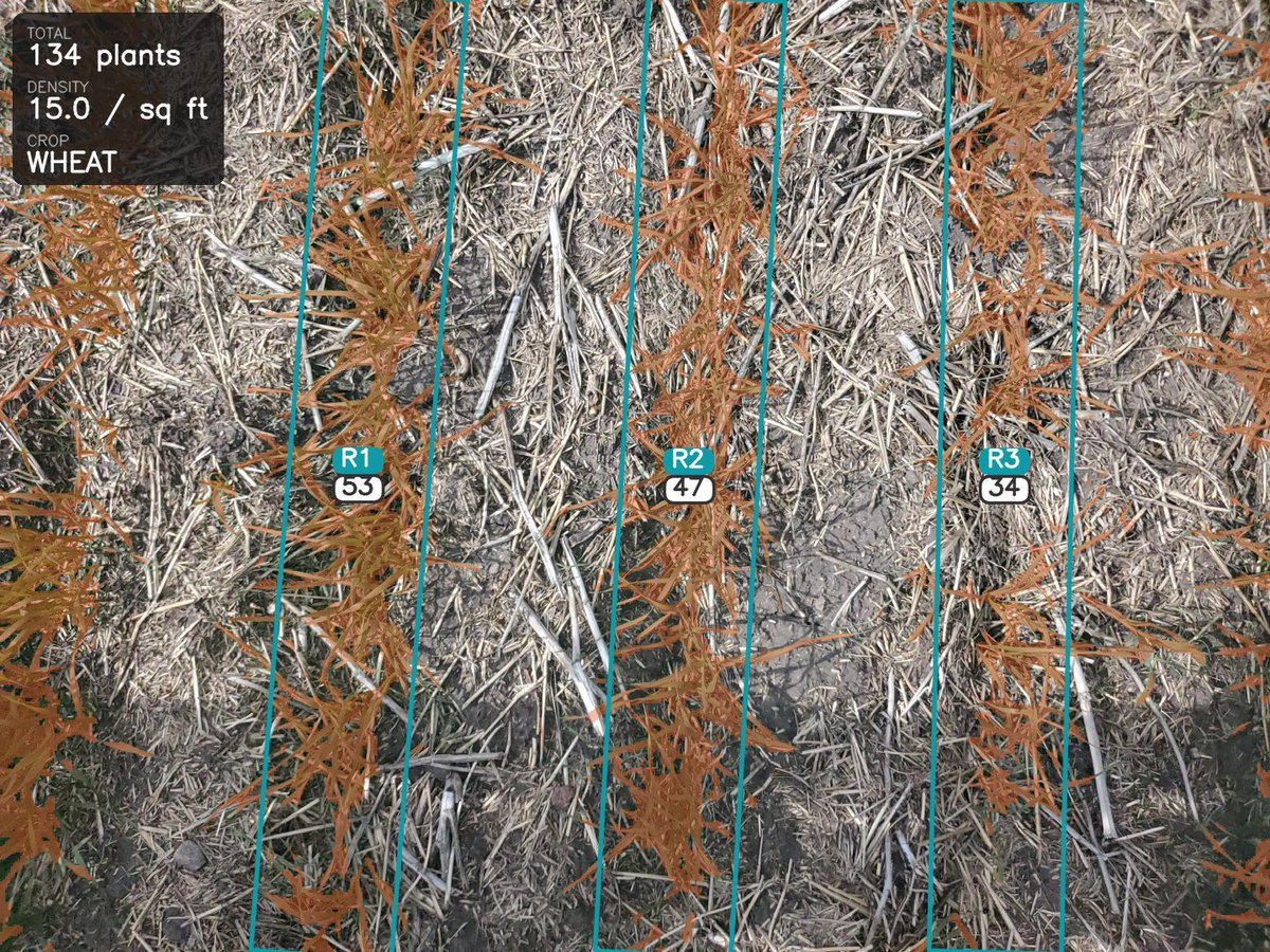
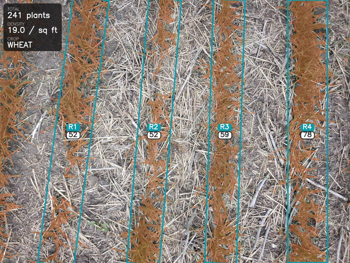
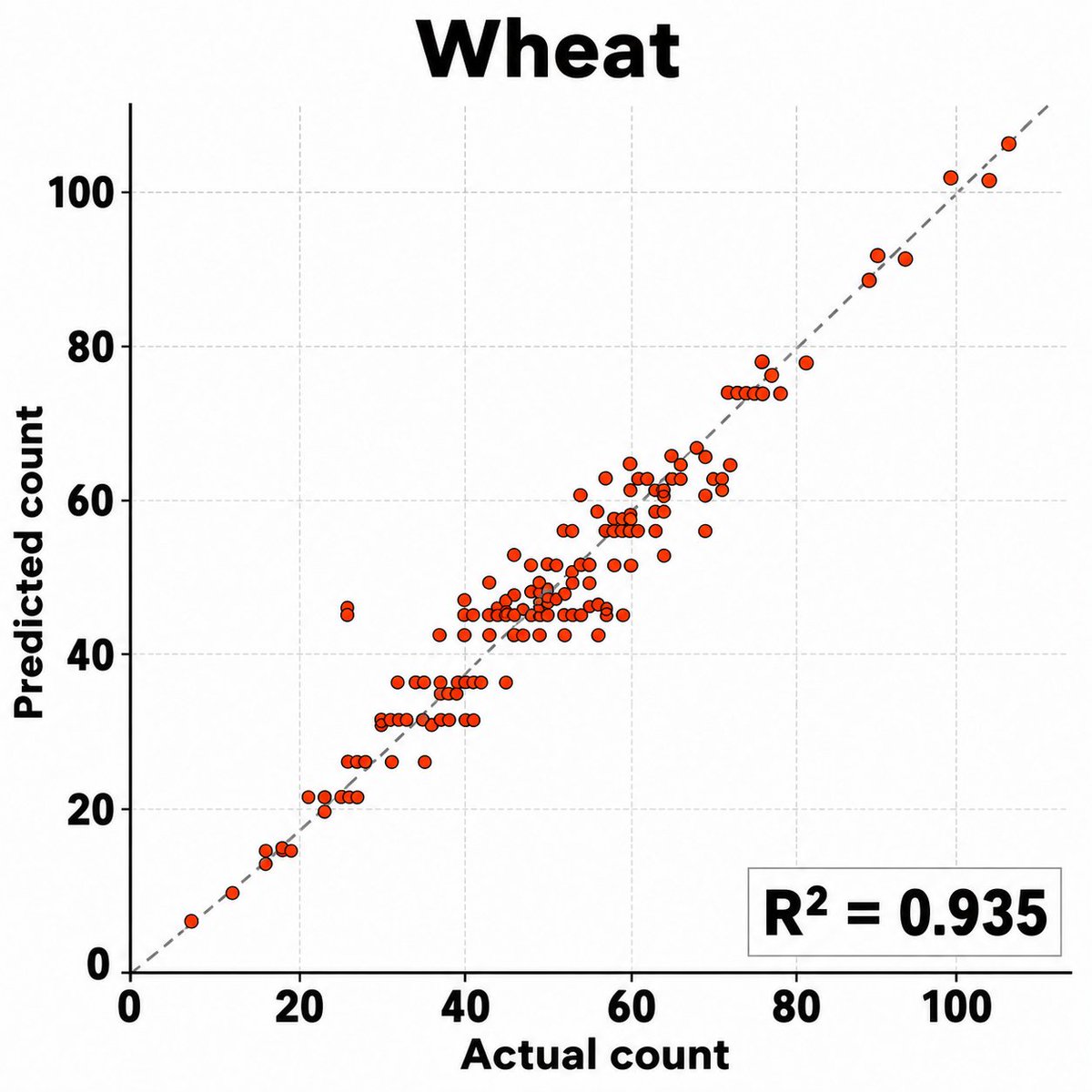
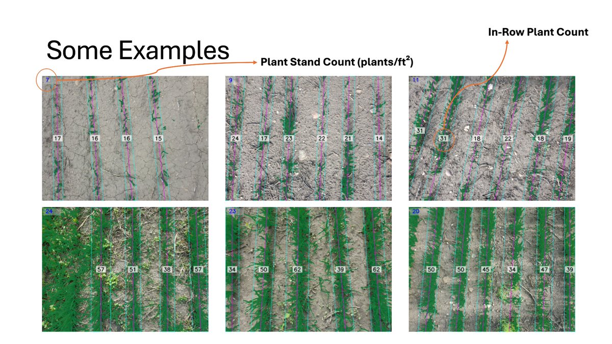
We have significantly improved our wheat plant stand count model for 2026. Here you can see it doing the the row counts and our latest correlations of predicted to actual are up to 94%! #swatcam
NEWS RELEASE:
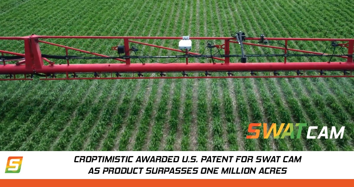
Croptimistic Technology Inc. has been awarded a U.S. patent for the SWAT CAM process, the company’s autonomous in-field imaging and crop analytics product.
The patent, titled “Method and System for Automatically Capturing and Extracting Data From Images of Agricultural Field Crops and Weeds Using Machine Learning Processes,” recognizes Croptimistic’s innovations using artificial intelligence.
The announcement comes as SWAT CAM surpassed one million acres mapped in western Canada in 2025 in just it’s third season, marking a major commercialization milestone.
READ THE FULL RELEASE 👉 https://t.co/zyPtkRX7iW
#SWATCAM #precisionag #agtech #SWATMAPS
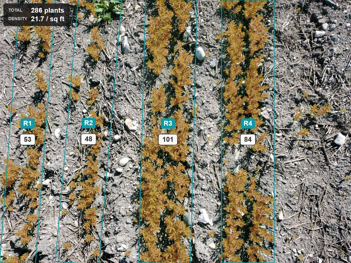
New flax plant stand counting model for SWAT CAM being released shortly. Example of counts of 32 and 22 plants/ft2 with variability across rows. Beta model working well at R2 near 0.9
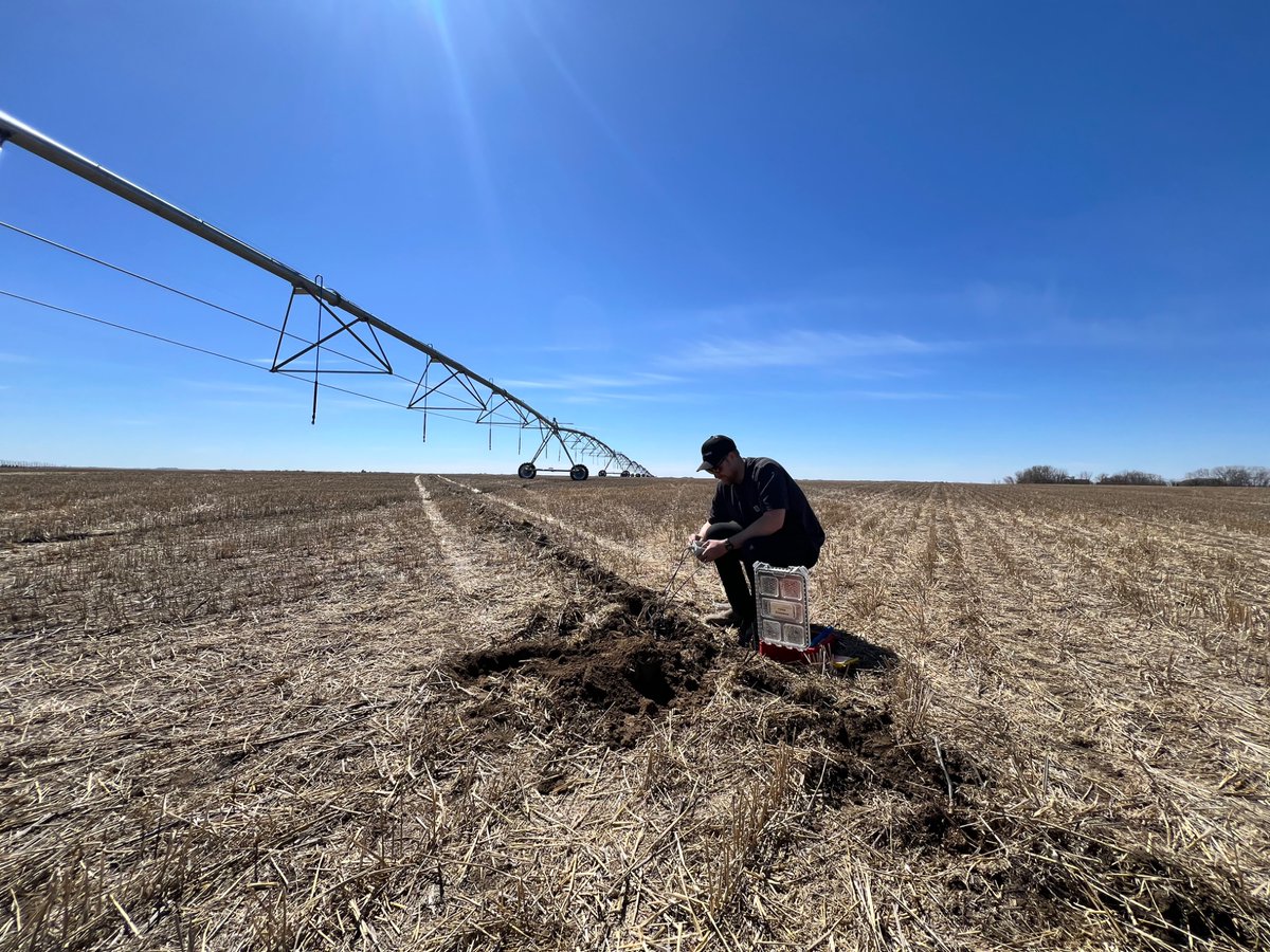
SWAT WATER Station install day. Looking forward to seeing what insights we’re going to get off this irrigated land over the coming years! Lots to learn with permanent multizone observations of soil moisture and temperature profiles #water@swatmaps
@markbratrud We have our own system now - trenched in cables to three probes covering the zones. Weather station at side of field so no need to take it down. Permanent install.
Have to find the fence first before we send the 🐎 out on pasture here. It has melted here several times already. This part of the fence is in the area that drains the yardsite so thought best to clean it out! Naicam SK
Ready to see what SWAT MAPS can do for your farm? We're offering your first field up to 160 acres completely FREE!
Your free field includes:
✔️Mapping
✔️Ground truthing
✔️Soil sampling
✔️Soil Assessment & Prescription
*Must have capable VR controller and equipment.
This is the perfect opportunity to experience the power of soil-based zone mapping completely risk free. Get started today and go into the 2026 season with confidence! 👉 https://t.co/OUxgmGacr4
#SWATMAPS #agtech #precisionag #CdnAg #soil
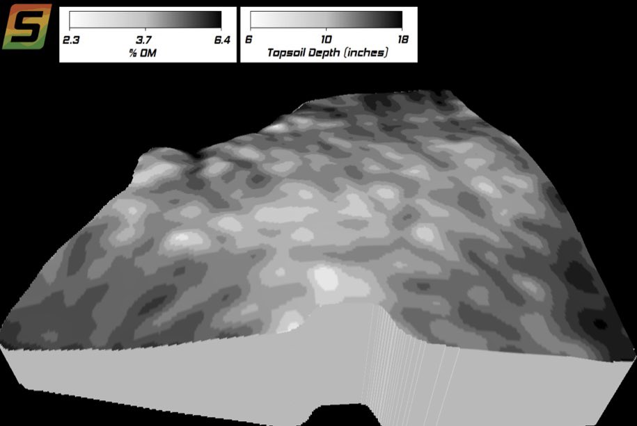
Did you know? #swatmaps provide th optimization of rates for soil applied herbicides. 2 examples we conducted using #avadex. VR Granular was applied from 8lbs on low OM hills to 12.8lbs in high OM depressions. Another application was VR on/off liquid with 62% reduction in product
This was backed by #swatcam where actual wild oat populations were mapped - and to no surprise - they are prevalent in wet high OM areas and almost non-existent on hills. Satellite imagery was deemed useless - it doesn’t know what is crop or weeds!