Weather for a bike ride in DC? Curated by friends of Dave Salovesh 6/24/19. Notification friendly: one morning tweet & occasional severe updates as needed.
An easy start to the day for runners, riders and walkers. Get that extra mile in if you can. Tomorrow morning will also be comfortable but we all know it can't stay THIS cool for long during a DC summer. @nbcwashington
Ample sunshine today with lower humidity and cooler than normal temperatures for this time of year. Complete forecast: https://t.co/5RyZgoXicj #DCwx#MDwx#VAwx#WVwx
#BikeDC the heat and humidity will rise throughout the day, and a cold front will bring stormy weather chances in the afternoon. Prepare accordingly. 🚲💉🦠☀️🌧 #StaySafe
A touch more humidity today as a cold front crosses the area, bringing a chance for strong to severe thunderstorms this afternoon, mainly east of the Blue Ridge Mountains. Damaging wind gusts will be the primary threat. Details: https://t.co/5RyZgoXicj #DCwx#MDwx#VAwx#WVwx
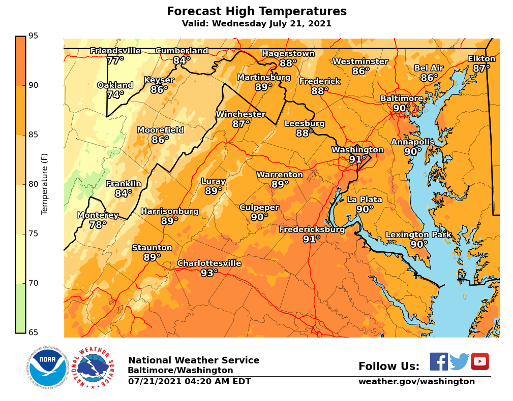
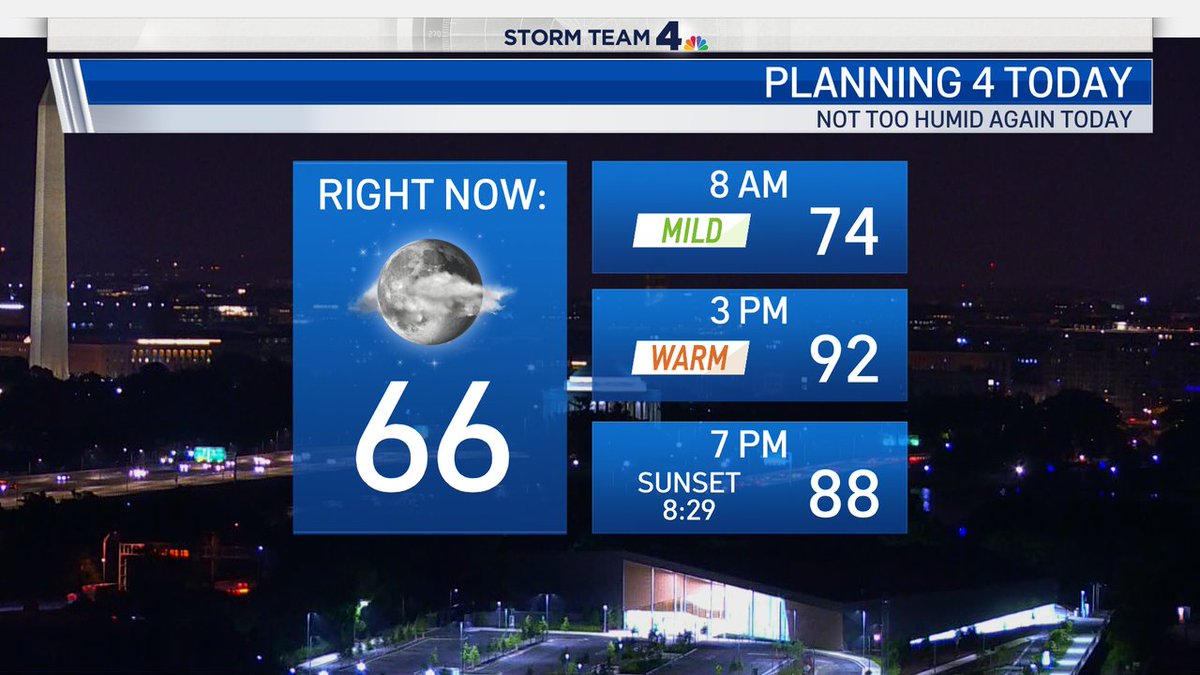
Good morning. Coming up on 5am and (as long as you are not in the city or next to the Bay) temperatures are in the comfy 60s. It will be a typically hot afternoon with temperatures around 90° but the humidity levels remain in the "tolerable" range. News4Today is ON. Come join us.
Humidity levels will remain in check for today but sunshine will be a bit limited - especially for areas South of the DC Metro. Rain chances are too low to post (well under 20%) for today and tomorrow but a PM storm or 2 will be possible on Wednesday. On the whole, typical July.
We Made it! TGIF! Meet Phoebe, she's a 4 year old #GreatDane who needs a new home. Danes are the best (and biggest) couch potatoes imaginable. Find out how to adopt her by visiting https://t.co/NZRjX6yNSh and see for yourself how sweet the gentle giants can be as a family pet.
Warm and humid conditions continue for today. Chance for afternoon/evening showers and thunderstorms, especially the metropolitan areas and NE MD. Some storms may become severe with the greatest impact being damaging winds.
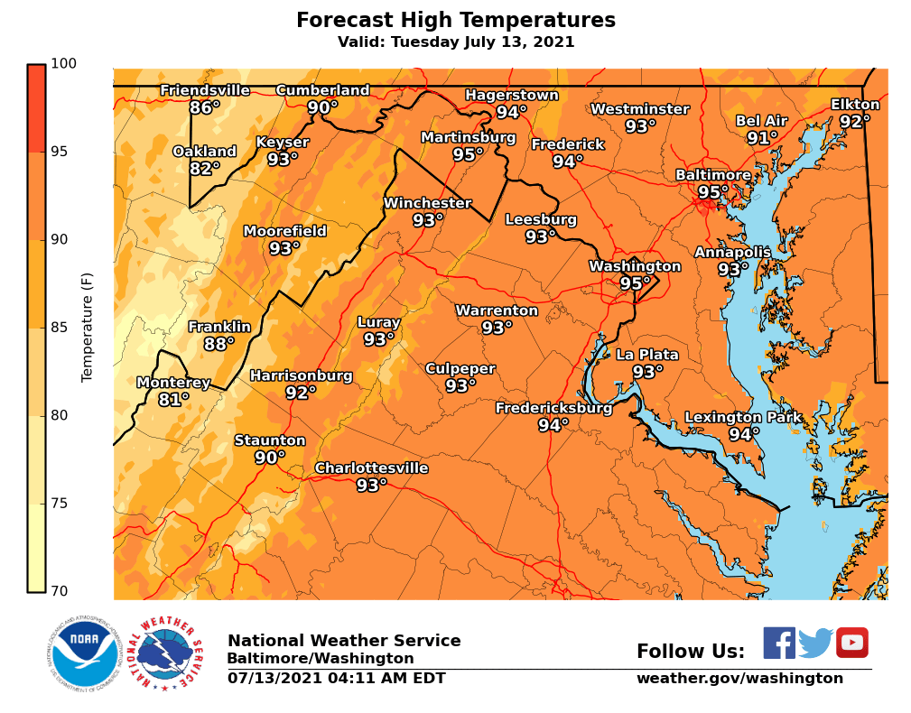
Another hot July day is in store as temperatures rise well into the 90s and humidity levels remain elevated. Afternoon & evening showers and thunderstorms will be possible once again, with the best chance for a strong to severe storm across northern/western MD and eastern WV.
Back to working and walking in the city. Any long walks will need to be completed before 10am to avoid the heat and the hot pavement. Check out Billy on https://t.co/mRYpXUzaTk to see if he would be a good fit with your family. #PetAdoption
Tropical Storm Warning is now in effect for Calvert and St. Mary's counties. A Flash Flood Watch is in effect for areas inside I-95 where rainfall is expected to be the heaviest. Timing for impacts will be late this afternoon through early Friday morning. https://t.co/zLJWOmxqEh
#BikeDC today is a near carbon copy of yesterday with heat indices approaching 100F - stay sun safe and hydrate well if you venture out for a ride. 🚲💉☀️🦠🔥 #StaySafe
Another hot and humid day expected with heat indices in the upper 90s to low 100s. Chances for showers and thunderstorms persist this afternoon through this evening for areas mainly along and west of the Blue Ridge. https://t.co/8JYfBWPN4x
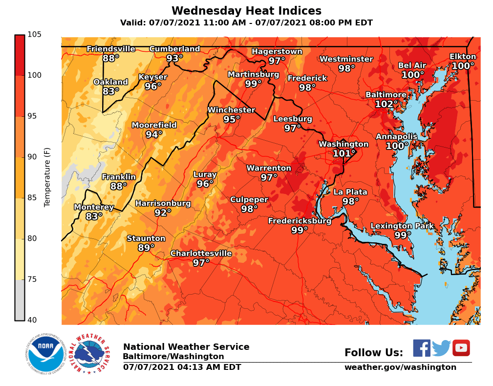
Hot and humid conditions today. A Heat Advisory is in effect for the eastern Panhandle of WV, north-central, and northeastern MD including Baltimore. The map attached shows the maximum heat indices for today. See https://t.co/i3OeK3x0sV for details about heat safety.
With the cold front slowly exiting the region today, showers and thunderstorms remain in the forecast. While not expecting any severe storms, there is some residual flooding potential across far southern MD. Cooler temperatures with late day clearing is expected.
WEATHER ALERT: Flash Flood WACH in place for your Thursday and Thursday night in all the highlighted counties including Metro DC. Heavy storms this afternoon could leave a quick 1" to 2" of rain and cause a rapid rise in water levels. Avoid high, fast moving water at all costs.
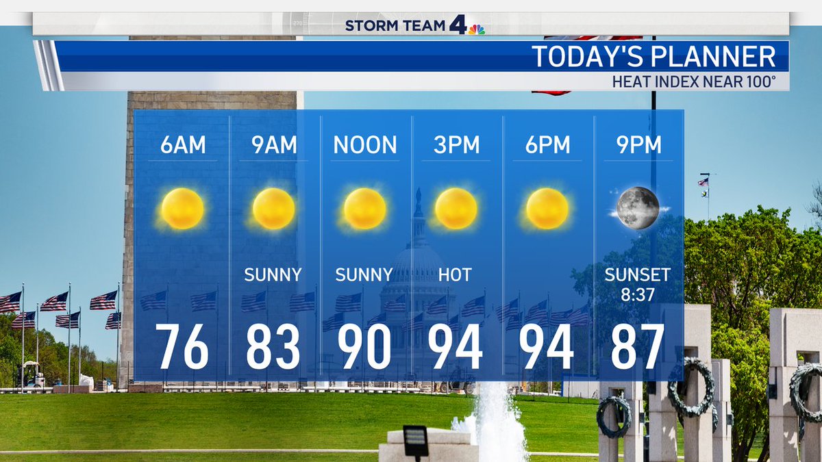
Today is a STAY HYDRATED alert day. Heat index near 100° all afternoon. Limit your strenuous outdoor activities as much as possible and remember to drink an extra glass of water with each meal or snack. Heat is one of the biggest weather threats of all. @nbcwashington#HeatWave
Happy Monday morning. It's super muggy now and that will not change today... or tomorrow... or Wednesday. Remember to drink extra water and layer on your SPF, if you're going to be spending much time outside. Back into the 90s today. Small rain chances in the Shenandoah Valley.