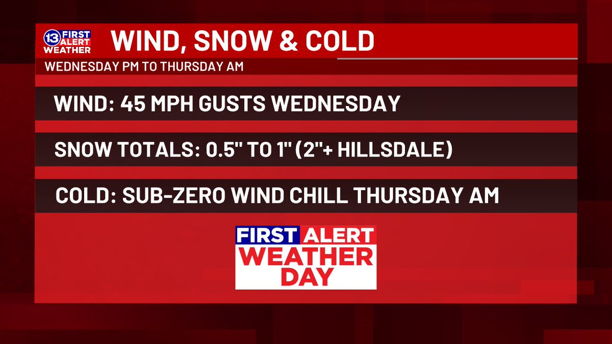
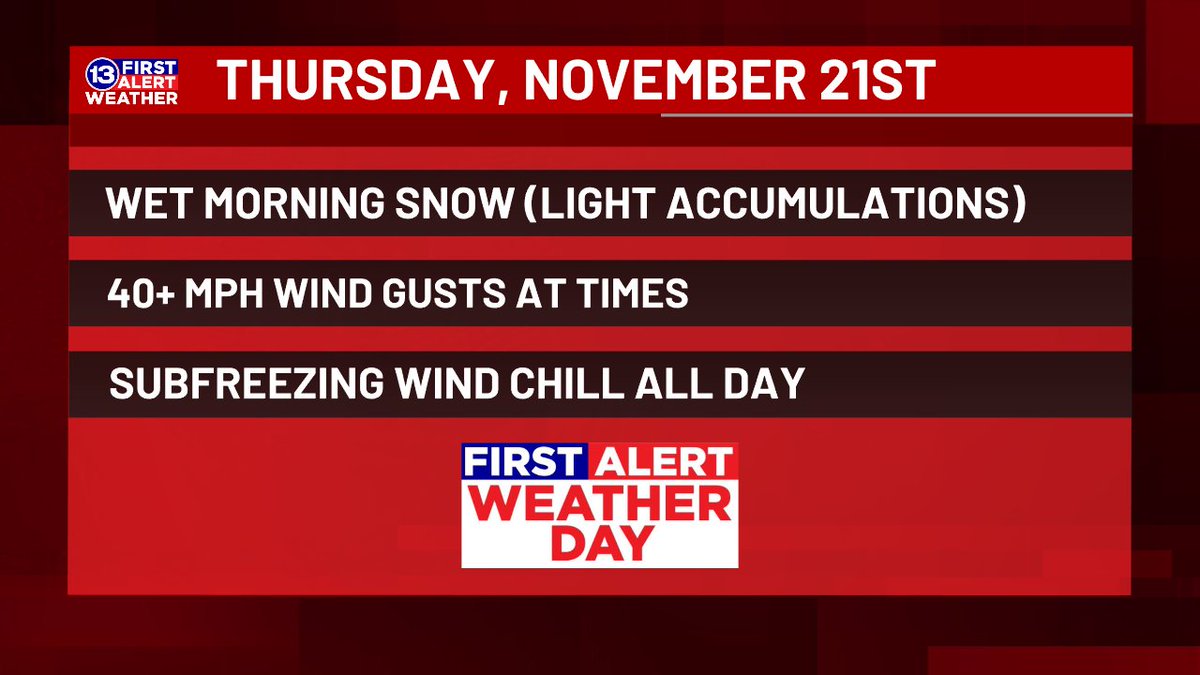
We're issuing a First Alert Weather Day for late Wednesday through Thursday morning. Winds have ramped up even more, peaking near 45 mph both Wednesday (from the SW) and Thursday (from the NW). Windchill near zero Thursday AM, along with quick bursts of snow reducing visibility.
Chilly winds combining with wet snow Thursday morning has prompted a First Alert Weather Day to be issued. While snow *amounts* will be fairly low (a little over 1" on the grass), the *rate* during the AM commute will likely reduce visibility and could lead to slick spots.
Tropical Storm Rafael has now formed between Cuba and Colombia, expected to make landfall in western Cuba as a Category 2 storm early Wednesday. Unlike Helene/Milton, the Gulf does NOT look to help Rafael intensify before a TX/LA landfall late this weekend.
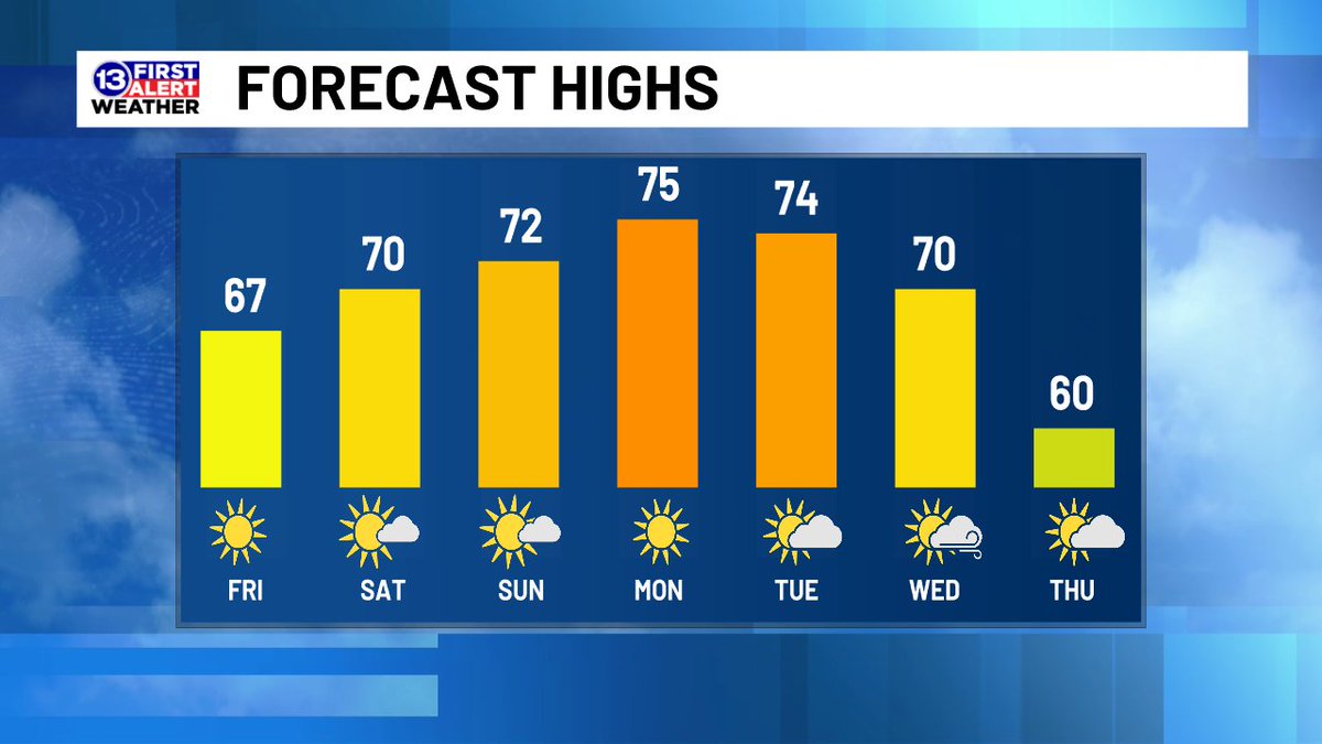
FORECAST HIGHS: While morning lows will still get some frost forming just before dawn Friday/Saturday, the warming trend continues a few degrees at a time through early next week.
FIRST ALERT: Storms are approaching this evening, and we're expecting rounds of them throughout the night. Heavy rain is possible, especially north of US-6.
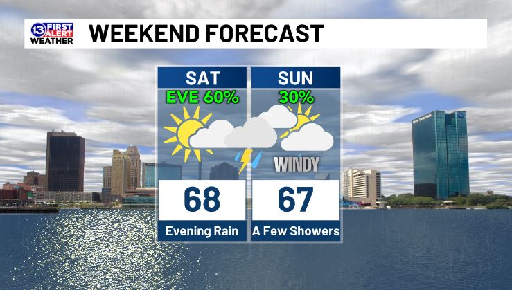
Saturday morning and afternoon are looking dry, the rain shouldn't arrive until the evening. Waves of showers and storms are likely Saturday night, and there could be some heavy downpours. Then, just a brief shower or two is possible Sunday with a NW breeze gusting up to 35 mph.
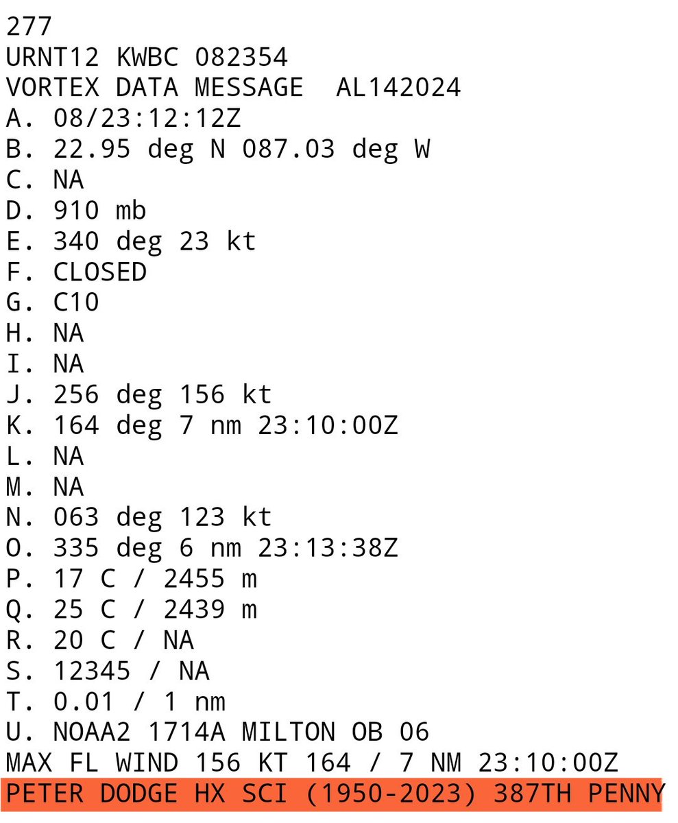
Beautiful tribute from @NOAA_HurrHunter who earlier this evening honored longtime radar scientist and researcher Peter Dodge who passed away in March 2023.
His ashes were dropped in the eye of Category 5 Milton tonight –
PETER DODGE HX SCI (1950-2023) 387TH PENNY
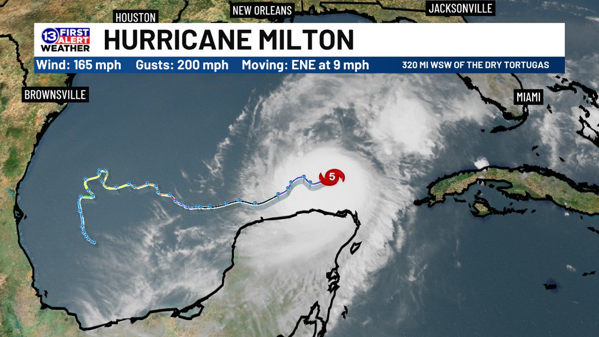
5pm update: As expected, Milton has regained Category 5 strength thanks to its "eyewall replacement". It's still slated to come back down to a borderline Cat 3/4, with offshore wind shear reducing its power before making landfall near Tampa late Wednesday/early Thursday.
A jaw-dropping, high resolution view of Hurricane Milton's powerful, small eye.
This 30-second imagery from GOES-19 is preliminary and non-operational.