🌲 Game Changer for the Forestry Sector! Nationwide Mobile Coverage! 🌲
We’ve been using OneNZ’s SpaceX Starlink mobile phone text service, and the results are game-changing! 📡 Even in the most remote areas, and often under tree canopy our field crews and foresters can now communicate seamlessly using their standard mobile phones. Connecting to satellites passing overhead just like a cell tower. Moving forward, this will open up new methods of communication and cost efficiency for the sector. It will lead to increased productivity and enable environmental or security monitoring systems, and IoT device connectivity.
Read more about how this technology is transforming our operations: https://t.co/BGUDC1FX4y
#ForestryInnovation #SpaceX #OneNZ #MobileCoverage #Interpine @SpaceX@onenzofficial
🛰️ Space Image Friday: Experience the 2025 Rātā Bloom! 🌿
Experience the 2025 NZ Rātā Bloom from space with stunning daily satellite imagery of South Westland. 🌺✨ Discover how remote sensing can revolutionize ecosystem monitoring, providing real-time insights into land management and conservation efforts. Learn more and access daily imagery by contacting our team.
👉 Read the full article: https://t.co/ii4mERSYMN
#RataBloom #SouthWestland #PredatorFree #Conservation #SatelliteImagery #RemoteSensing
Enhance Your Drone Flights with Terrain Following!
We’re excited to share our latest article on how to create a Digital Terrain Model (DTM) for use with DJI Pilot 2 from the LINZ Data Service or your own data. This feature is essential for ensuring consistent ground sampling distance and accurate forest inventory with our TreeTools VirtualPlot.
Highlights:
Terrain Following: Maintain consistent plot sizes and improve precision in tree stocking results.
Step-by-Step Guide: Learn how to download and adjust DTMs from LINZ Data Service.
Compatibility: Works with DJI Matrice 4/300/350 RTK and DJI Mavic 3 Enterprise, TreeTools VirtualPlot
Read the full article to get all the details and enhance your drone operations today! https://t.co/wcxaTOA4YL
#DroneTechnology #ForestInventory #DJIPilot2 #TreeTools #InterpineInnovation #VirtualPlot
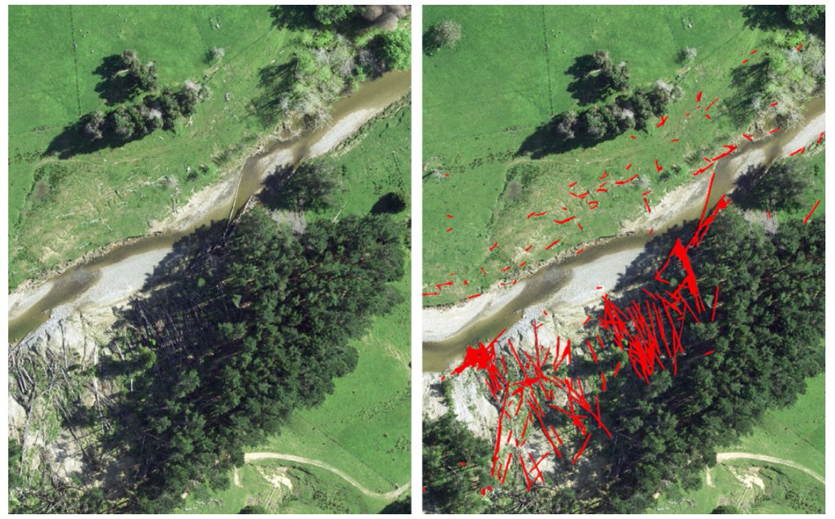
🌟 Revolutionize Woody Debris Detection with AI! 🌟
Traditional woody debris detection is costly, time-consuming. Our AI detection service uses 10cm imagery to quickly and accurately identify woody debris.
Creating a fast, cost-effective, reliable and repeatable method to map and monitor woody debris in catchments, forests and coastlines! 🌲✨
🔍 Learn more: https://t.co/KmBOKOB74b
#AI #Forestry #Innovation #WoodyDebrisDetection
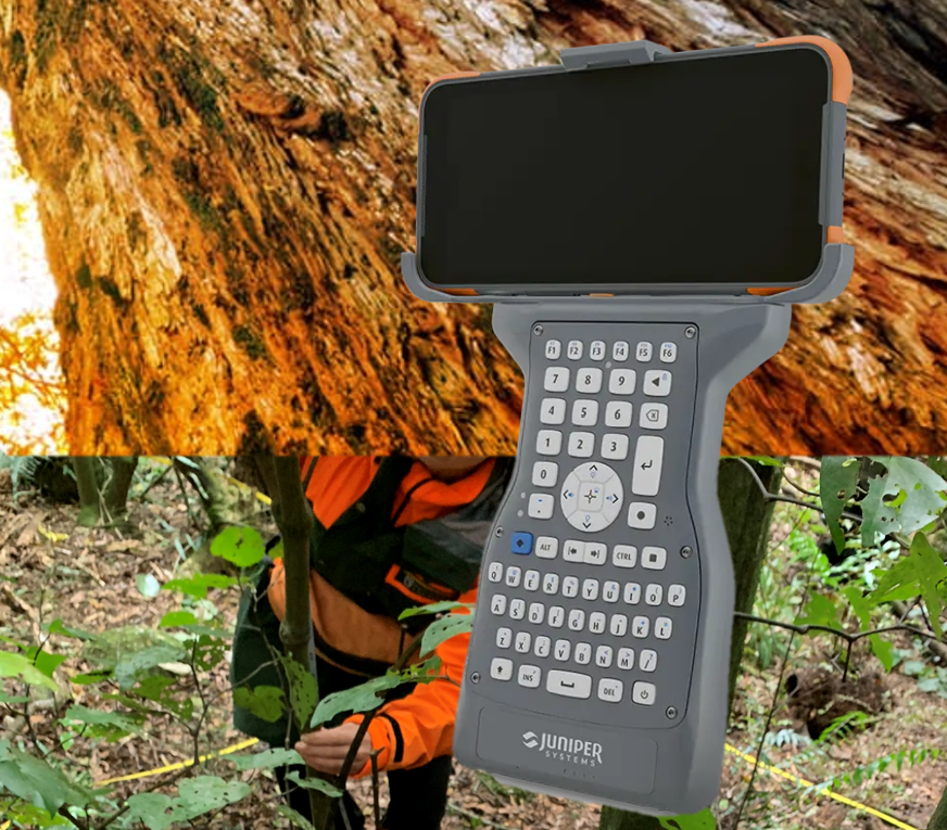
The Juniper Allegro is back, enhancing field data collection with Interpine using this next-gen hardware. Interpine offers software tools for forestry and environmental sectors, and the Allegro Field Computer, known for its large buttons, full keyboard, and rugged design, remains a top choice. With the release of the Juniper Archer 4, Interpine has collaborated with Juniper Systems to ensure our software is ready for the Allegro's return. The Allegro Bluetooth keyboard, paired with the Archer 4, provides a reliable solution for field data collection. Contact us to upgrade your systems to Android, compatible with the Archer and Allegro Bluetooth keyboard.
Excited for #ForestTech 2024! 🌲✨ Join the Interpine team as we unveil our #TreeTools software, leveraging #LiDAR and drone imagery for optimal tree thinning management. Plus, see our #drone-based forest woody debris assessment in action, ensuring #NES-CF compliance. Don't miss out!
🎉 Interpine won two awards from Timberlands for our HSW innovation and cultural initiative. Thanks to Timberlands for recognizing our team’s efforts. Mihi tīma, whakahirahira ki te haumaru, mahi whakamataku 🎉
The ForestSAT 2024 website is live now. This will be a #conference you don't want to miss!
Visit https://t.co/LWx3GJHcs1 now to find out about registration, sponsorship, the destination & to subscribe to our mailing list for updates. #ForestSAT2024
The ForestSAT 2024 website is live now. This will be a #conference you don't want to miss!
Visit https://t.co/jqK1Us2Dal now to find out about registration, sponsorship, the destination & to subscribe to our mailing list. Follow @ForestSAT for updates. #ForestSAT2024
Starlink is available on all 7 continents, in over 60 countries and many more markets, connecting 2M+ active customers and counting with high-speed internet!
Thank you to all of our customers around the world 🛰️🌎❤️ → https://t.co/D6L8BSisQq
Today's kupu o te rā (word of the day) is ngahere which means forest. Learn more about Te Wiki o te reo Māori and how you can get involved at https://t.co/GX7AFWIOnx.
#ReoMāori#ngahere#forest
Scion’s Remote Sensing team is combining aerial images & AI to map cyclone impacts on #forestry. It's part of the Digital Forest Project that's mapped forests in Hawkes Bay+Gisborne using a model that detects & maps planted forests using aerial imagery. 📖 https://t.co/P0MHnnDzTa
Ngā mihi to our CEO, Te Kapunga (T.K) Dewes for being named the New Zealand #Forester of the Year for 2023. He has been actively involved in the growth and promotion of Maori forestry, ensuring the preservation of Maori land rights and fostering optimal land usage.
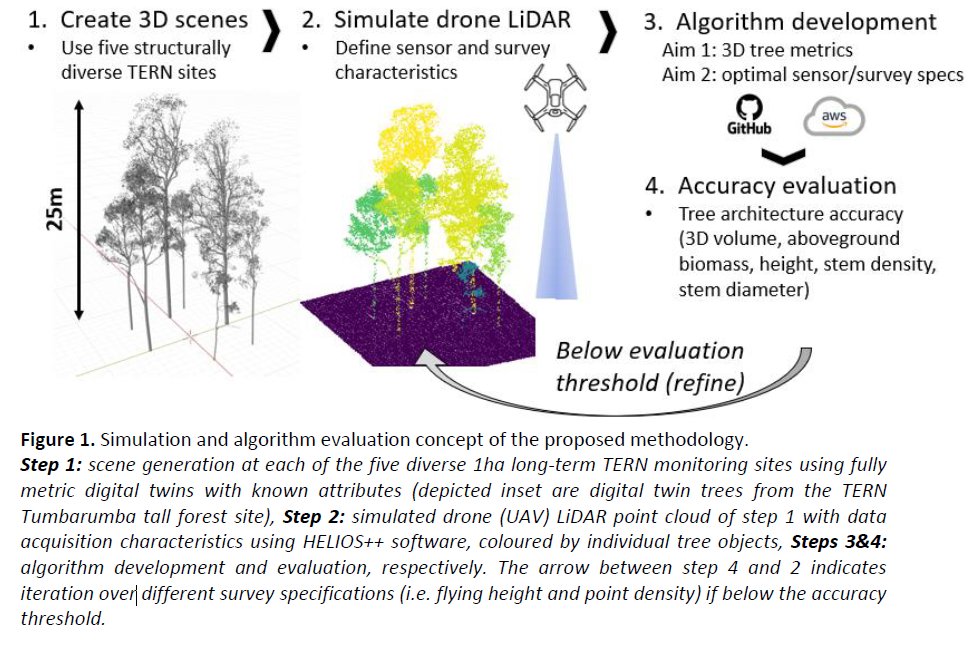
Full PhD scholarship now available to research above-ground biomass methods from drone LiDAR 🌲🌾
Full description here: https://t.co/kDBVDC3Sfe
Team based at UQ, Aus.
Please retweet! 🙏
#FieldWorkFriday:
IRSS students Liam (@IrwinLiam_UBC), Rik (@Nuijten_R) & Olivia capturing RGB, #lidar, & thermal data using the Matrice 300 RTK #drone over a natural beech forest and shrublands in the mountains of South Island New Zealand while visiting @ForestryScience@UCNZ
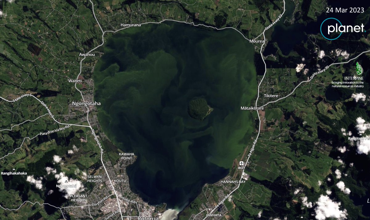
#Monitoring#water#quality in Rotorua lakes with Interpine's partner at @Planet. Using 8-Band near-daily #satellite imagery to detect #algae blooms and aid public health warnings. Learn more about #remotesensing for resource management - chat with our team. @PlanetOfData
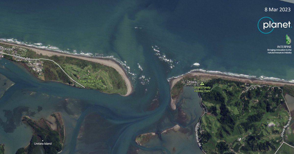
@Planet satellite #monitoring does not stop at forest 4 our team. Crossing a #bar at a #harbour entrance is one of the #riskiest things you can ever do, no matter how experienced you are. Another example; where near #daily images can be used to reduce the #risk and inform users