#CanterburyMaps Christmas Challenge
Share how you make use of Canterbury Maps to social media with the hashtag #CanterburyMaps and mention "https://t.co/mWtGUWmzW1" and be in to win!
Easy as that!
Like something from another world, this is the amazing trilobite beetle! This is the young stage, where they look nothing like adult beetles! Amazingly, females stay in this stage as adults!! #TrilobiteTuesday (📽️IG TobyTortellini)
We are looking forward to participating in this year's @EsriUC! Come demo GO, a self-service #geospatial#analytics platform, and learn about integration capabilities for @Esri Users. To schedule a time to meet with us, please email: [email protected]#esriuc2019
#VectorMaps for all! Mapbox vector maps now power mapping and geographic visualizations in @Tableau, for powerful analytics at scale, easy customization, and fast data exploration. https://t.co/vuRVNpsFZa
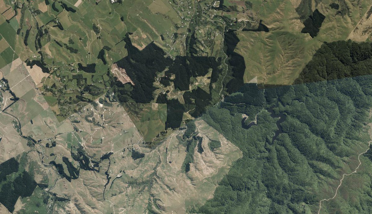
Explore and uncover the Manawatu-Whanganui regions in 3D with the latest DEM and DSM from the LINZ Data Service https://t.co/1lCGuyeRHi. Classified point clouds are available from @OpenTopography https://t.co/fQ2jZzXMA0 #opendata#Lidar Image: Turitea Dams
We're pleased to announce that the #CacophonyProject is a finalist in the 2019 @NZHiTechAwards under the "Best Hi-Tech Solution for the Public Good" category. It's great to see the efforts of the open source community working on saving New Zealand's native birds being recognised
Not to be outdone... we have just published four new urban imagery datasets for the Wellington region. There is more to come over the next few weeks too https://t.co/lb1t7nLzmM #opendata
Thanks to support from NZ spatial industry, the 2017 Awards are free to enter (but closing soon!) Enter online now...https://t.co/T68kHcANx8 https://t.co/CItQ4tILg8