EMFT PIO is on scene in Alexandria at the missing autistic juvenile. All Indy media have been sent missing person poster. @WTHRcom@FOX59@CBS4Indy@RTV6Desk
Strong winds ahead of a cold front on Sunday will bring thunderstorms, with severe storms possible. Damaging winds are the main threat, but isolated tornadoes are possible. Stay weather aware as the forecast is updated and be prepared for watches and warnings. #inwx
A winter weather advisory is in effect for our area today. Snow is expected to cover the area later this morning. Use caution when driving and allow yourself extra time. #winterweather#chesterfield#eastmadisonfire
A Winter Weather Advisory is in effect on Friday with the potential for 2-4 inches of snow accumulation. Be prepared for difficult travel as the evening commute will likely be impacted. #eastMadisonFire#inwx
The ‘Who, What, Where’ of Calling the Mayday: https://t.co/ci2sHp7sIW
In a life-threatening event, keep it simple with "who, what, where." This approach calms you and your crew, controls air supply + ensures your Mayday is heard. Calling the Mayday is the first step to safety
Bargersville Fire Department warns against venturing onto ice over bodies of water in central Indiana due to unstable conditions. Authorities urge caution, warning of potential dangers and recommending calling 911 in case of emergencies. https://t.co/bjvyIc0PTm
Mother Nature made me sweat it before finally saving the forecast last night. I've got 5.4" on the snow board in far North Anderson, and several of you have reported similar 5-6" amounts from Frankton, Alexandria, and Summitville. County roads are pretty rough. So be careful if you have to be out.
It has been a long couple of days, and we might do it again Friday. Stay tuned for those updates. Thank you so much to the majority of you who were so kind when it looked like this would bust!!! I really appreciate you!!! #MadCoWx #INwx
🚨 We’re in FULL CALL OUT🚨
Visibility is low, we’re still seeing snow fall as of 9 p.m., and our #YellowTrucks are still out and about. If you have to leave tomorrow morning, please leave early, slow down, and be present behind the wheel.
Stay safe and warm! #INDOTWinterOps
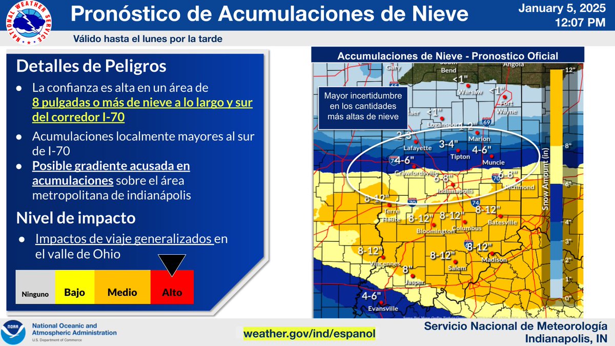
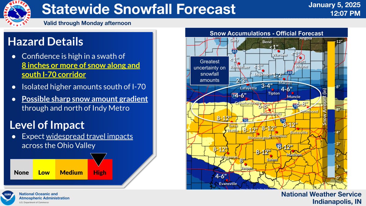
Noon Winter Storm Update
Actualización Mediodía de Tormenta Invernal
(English and Spanish graphics)
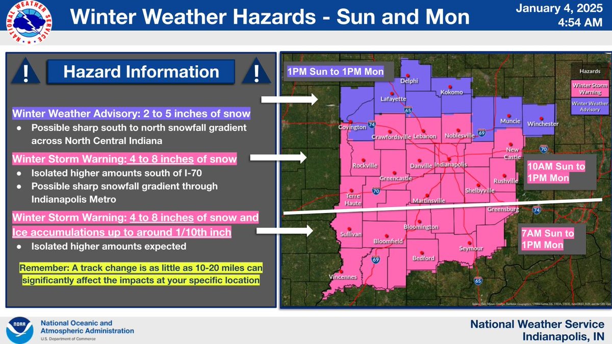
Updating snow accumulations for the I-70 corridor and points north as there will be a sharp snowfall gradient just north of the Indy Metro. #inwx
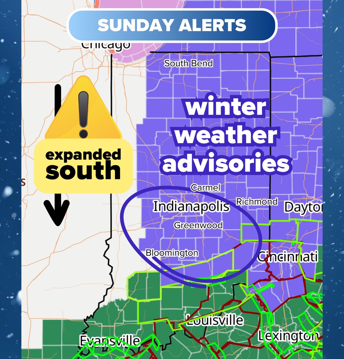
A Winter Storm Warning is now in effect Sunday into Monday across much of central IN with widespread 4-8 inches of snow expected and locally higher amounts possible. A Winter Weather Advisory is in effect for north-central IN where 2-5 inches of accumulation is possible. #inwx
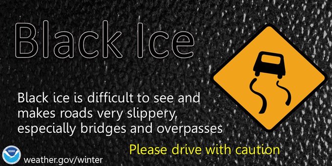
Many of the pretreated roads are wet with scattered slick spots this morning. Secondary roads, and neighborhood streets are slick. Watch for black ice.