Interceptor 006 has successfully prevented around 3,000,000 kg of trash (and counting) from reaching the Caribbean Sea in the last five months.
As the end of the flooding season in Guatemala approaches, we continue to capture and extract trash with every rainstorm.
We mapped grassland-use intensities across Switzerland based on satellite time series. The resulting maps explained biodiversity patterns in Swiss grasslands well. 🛰️
#Sentinel2#Grassland#LandUse@DomiWbr@MarcelSchwieder@KochTiziana @WSL_research
https://t.co/3XzrIekBJc
We have a job offer for you:
Join team at EnviDat to grow the platforms UI & UX.
Bring in your innovative ideas & solutions for Tools & services for #environmental#science
@WSL_research
Stack: #vue, #vuetify, #python with a #postgreSQL DB #digitalCH
We have a job offer for you:
Join team at EnviDat to develop a #GIS web app. Bring in your innovative ideas & solutions for Tools & services for #environmental#science done @WSL_research
Stack: #vue, #node, #python with a #postgreSQL DB
#digitalCH
https://t.co/QtlCOSbpZ2
Meet #CHELSA@EnvidatService@DirkNKarger! It provides global #climatedata on a very high spatial and temporal resolution for the past, present & future. It is the only data set that can provide these resolutions and is highly used across many disciplines. https://t.co/STbxUjnEw5
Registration is open for the @re3data@CoreTrustSeal online workshop on #Data quality management at #repositories on October the 5th!
🏃Hurry up - first come first serve basis - 100 virtual seats available 👇
https://t.co/UKbDpC4Wc8
Der schweizer #Wald liefert nicht nur den nachhaltigen Rohstoff Holz. Er speichert zusätzlich CO2, reinigt und speichert Trinkwasser, fördert die Biodiversität und bietet Raum für Erholung.
Welchen Stellenwert haben diese Funktionen?
WaldKongress:
https://t.co/uJIPUPaUXH
The article "Cloud Optimized Raster
Encoding (CORE)" Is online:
https://t.co/0xEREugxxr
It's about a "Web-Native Streamable Format for Large Environmental Time
Series".
Published in @Geomatics_MDPI#environmental#Science
Auch der #Ramerenwald, gleich neben der @WSL_research, wurde stark zerzaust. Gut sichtbar in der Drohnenaufnahme nach dem Sturm vom 13.7. #UAV@DJIGlobal#Phantom4RTK
@WSL_research @opendataswiss The update frequency will be every week. Also to clarify not all data is integrated due to licencing and other factors, if you missing something check out https://t.co/jHCweqmmul
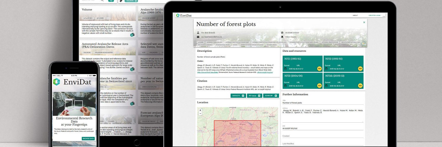
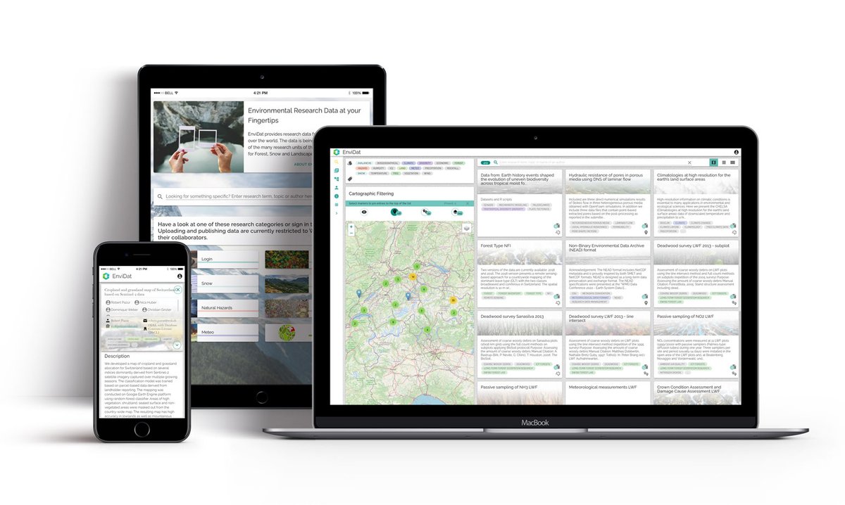
.@EnvidatService is a portal #madewithvuejs & @vuetifyjs by @WSL_research providing access to a wide range of environmental monitoring and research data! 🌳🌍️ - https://t.co/ku4uH9EeMF