***ANOTHER CHILLY NIGHT***
With mainly clear skies temperatures will tumble into the 30s tonight which could lead to a light frost in areas so protect those fresh blooms tonight.
***COOL OPENING NIGHT FOR LOUISVILLE KINGS***
Dress warm as it will be a chilly night at Lynn Family Stadium for opening night of the Louisville Kings.
***SHOWERS FRIDAY MORNING***
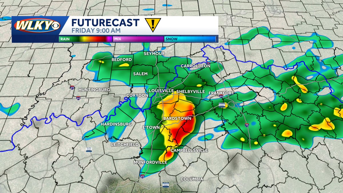
A cold front will slide over the region Friday morning producing scattered showers and a few rumbles of thunder right during the commute. Take it easy in the morning but we will dry up in the afternoon.
***RECORD HIGH THURSDAY***
This afternoon we set a new record high in Louisville hitting 86° breaking the old record of 84° set back in 2007 and 1907. This is our second record high over the past 5 days.
***WINTER CHILL TONIGHT***
You will need the winter coat tonight and Tuesday morning as lows bottom out in the lower 30s with a light freeze possible outside the city so protect any sensitive plants that have started to bloom.
***MORNING STORMS THURSDAY & FRIDAY***
We will have a couple systems swing through the area toward the end of the week sparking of scattered showers and a few storms Thursday and Friday morning.
SEVERE THUNDERSTORM WARNING issued for Orange and Jackson counties until 11PM for strong storms producing large hail up to ping pong size and gusty winds. Seek shelter now.
***SEVERE THUNDERSTORM WATCH***
A thunderstorm watch has been issued for our southern Indiana counties along with Trimble until 1AM tonight for the possibilitiy of a few strong to severe storms this evening that could produce large hail and gusty winds. Stay weather aware.
***RECORD HEAT POSSIBLE SUNDAY***
If you thought Saturday was warm Sunday is going to be even warmer, almost Summer-like, with near record highs in the mid to upper 80s. Right now, I am forecasting a high of 87°, which is just 1° shy of the record of 88° set back in 1907.
***SPRING BEGINS FRIDAY***
The Spring Equinox is 10:46am Friday morning and it is sure going to feel like Spring for much of the country with highs in the upper 70s Friday and Saturday in Louisville.
***Spring Warm Up***
The warming trend will continue in a big way the next several days with highs back in the 60s Thursday, then with the official start of Spring on Friday it will sure feel like it with highs in the 70s Friday and Saturday.
***TORNADO WARNING***
Adair and Russell counties are under a Tornado Warning until 1:45AM for a storm that is trying to rotate that could produce a tornado. Seek shleter now!
***SEVERE THUNDERSTORM WARNING***
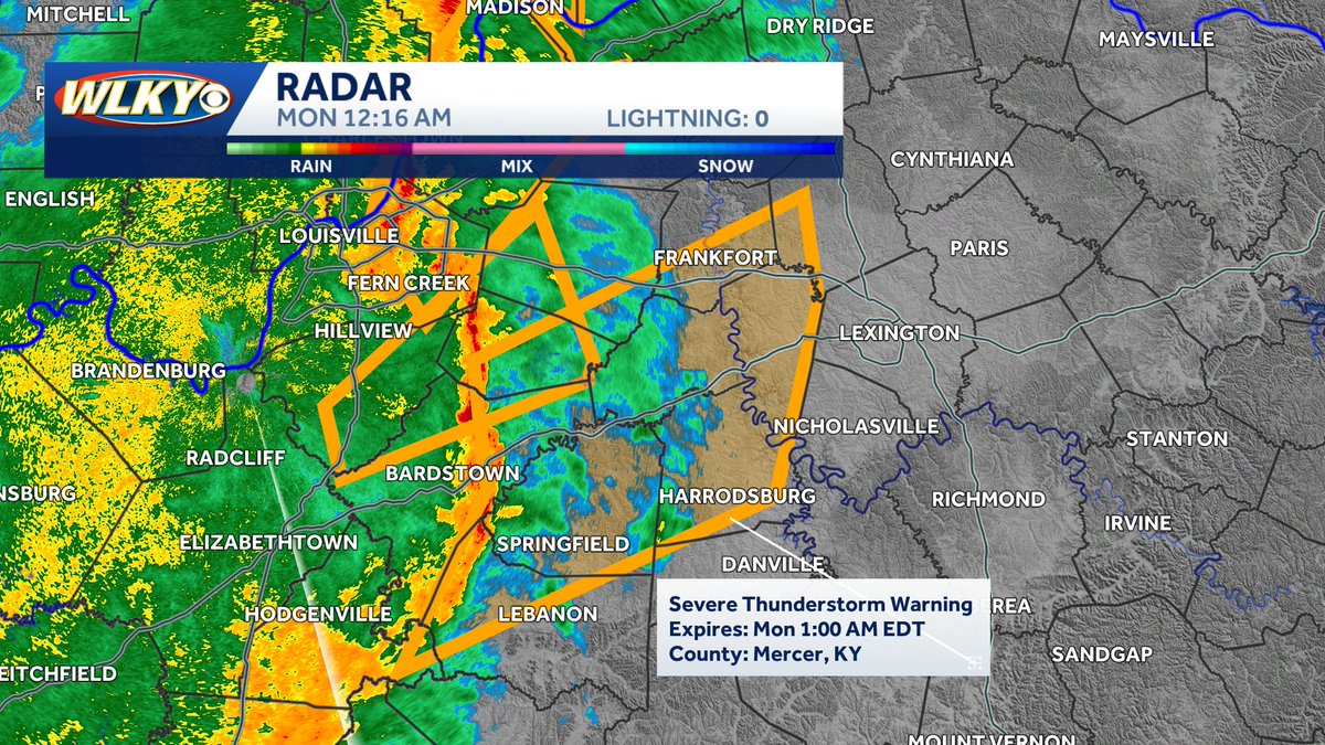
Franklin, Henry, Scott and Shelby counties are under a Severe Thunderstorm Warning until 1AM for a line of storms capable of producing wind gusts up to 60 mph. Seek shleter now!
***SEVERE THUNDERSTORM WARNING***
Franklin, LaRue, Marion, Nelson, Scott, Shelby, Spencer and Washington counties are under a Severe Thunderstorm Warning until 1AM for a line of storms capable of producing wind gusts up to 60+ mph. Seek shleter now!
***SEVERE THUNDERSTORM WARNING***
Clark, Henry, Jefferson, Oldham, Shelby and Trimble counties are under a Severe Thunderstorm Warning until 1AM for a line of storms capable of producing wind gusts up to 60 mph. Seek shleter now!
***TORNADO WARNING***
Bullitt, Franklin, Henry, Jefferson, Shelby and Spencer counties are under a Tornado Warning until 12:30 for a storm trying to rotate that could produce a tornado. Seek shleter now!
***SEVERE THUNDERSTORM WARNING***
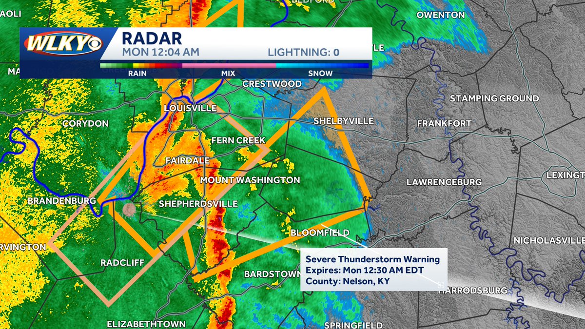
Bullitt, Jefferson, Nelson, Shelby and Spencer counties are under a Severe Thunderstorm Warning until 12:30AM for a line of storms capable of producing wind gusts up to 60 mph. Seek shleter now!
***TORNADO WARNING***
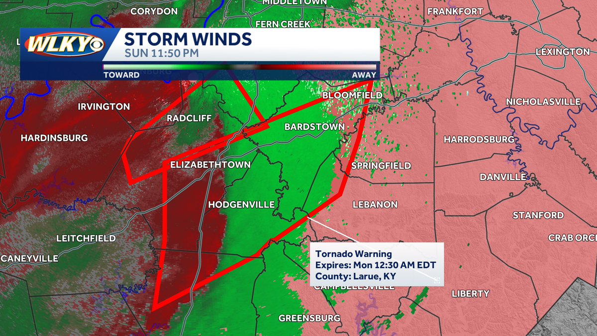
Hardin, Hart, LaRue, Marion, Nelson and Washington counties are under a Tornado Warning until 12:30AM for a storm that is trying to rotate that could produce a tornado. Seek shleter now!