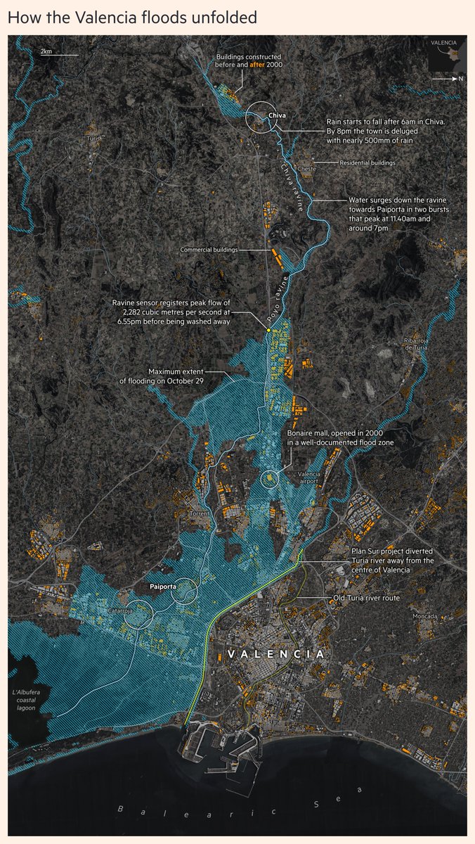
NEW: The largest map I've made at the @FT, highlighting the tragic events in Valencia
@barneyjopson's report looks into the failed implementation of risk reduction plans, building on known flood zones and failure to heed warnings on the day
https://t.co/UNmdJ8fDdy
#dataviz
🚨 Flash Flood Map of #Valencia 🌊
We developed new maps using satellite data and machine learning to show the full impact of recent floods. #EO and #AI for disaster response.
https://t.co/bnyzXrOKBQ
#ValenciaFloods#EarthObservation#DANA
Prof. Gustau Camps-Valls got the 2024 IEEE David Landgrebe Award of @IEEE_GRSS for outstanding contributions to #remotesensing image analysis and #MachineLearning.
Deeply honored & thankful to his team and collaborators! Award presented at #IGARSS24#IEEE#IGARSS
Congrats!
🚨 Want to join us?
- We offer 5 postdoc positions in European projects in València
- ML/DL, #Earth science, #hybrid modelling, #climate model #parametrization, #UQ, #diffusion & #foundation models
- Apply by Aug 1st 2024: https://t.co/hnAtT8q4L7
Happy summer! 🌊🌞🥘⚽️
📢Great news! The MeDiTwin project will start soon!
* A digital twin of the Mediterranean for climate extremes & impacts
* Science on causality, XAI & #deeplearning
* Capacity building, hackathons, data curation, researchers mobility & workshops
@OrionLab_NOA@MPI_BGC@ECMWF
I'm developing new interactive dashboards using #Python and @matplotlib to teach #MachineLearning concepts.
Here’s a sneak peek into a simple artificial neural network implementation. Throughout each training epoch, I demonstrate:
Forward Pass: Calculation of the loss function, showing how inputs transform through each layer to produce the output.
Backpropagation: Computation of the gradients with respect to all the weights with the chain rule, illustrating how the network learns by adjusting weights to minimize the loss.
The dashboards illustrate the flow of information forward and backward through the network, making complex concepts accessible to all!
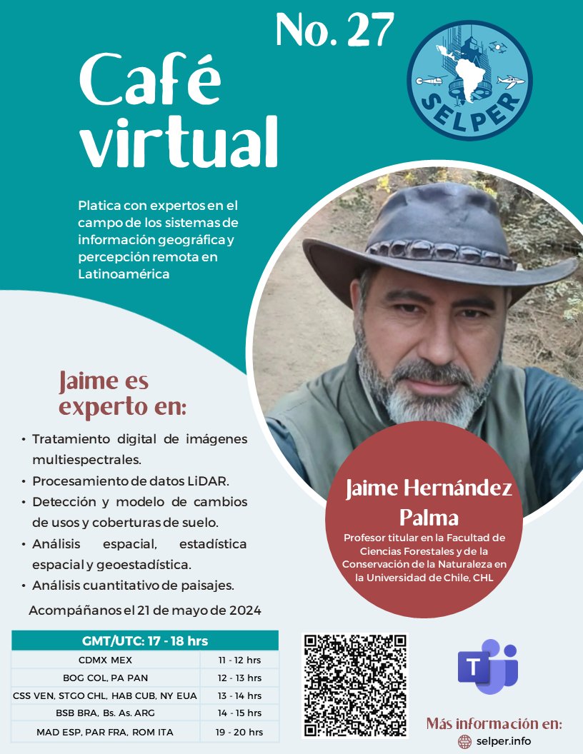
¡Este martes 21 de mayo, el Prof. Jaime Hernández estará en este Café Virtual sobre sistemas de información geográfica y percepción remota! ☘️💧🪵
@uchile
Looking forward to introducing the open-source AIDE toolbox (https://t.co/LhtRi92cbM), an effort of @isp_uv_es for the quick and easy deployment of AI for anomaly/extreme event detection and impact assessment in spatio-temporal data. @m_gonzc@JorCorAn@tristankew@mengxue_rs
Just yesterday I wrote an e-mail to all the wonderful participants at our AI for Climate Risk Mitigation workshop that we held at last years @WCRP_climate OSC in Kigali. Let us continue the discussion on using AI for Early Warning and Anticipatory Action this year!
🧠🤝🌍
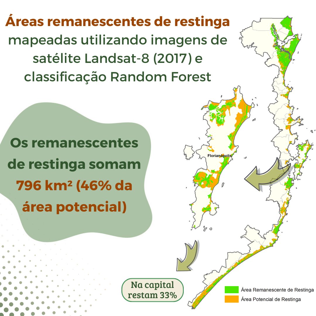
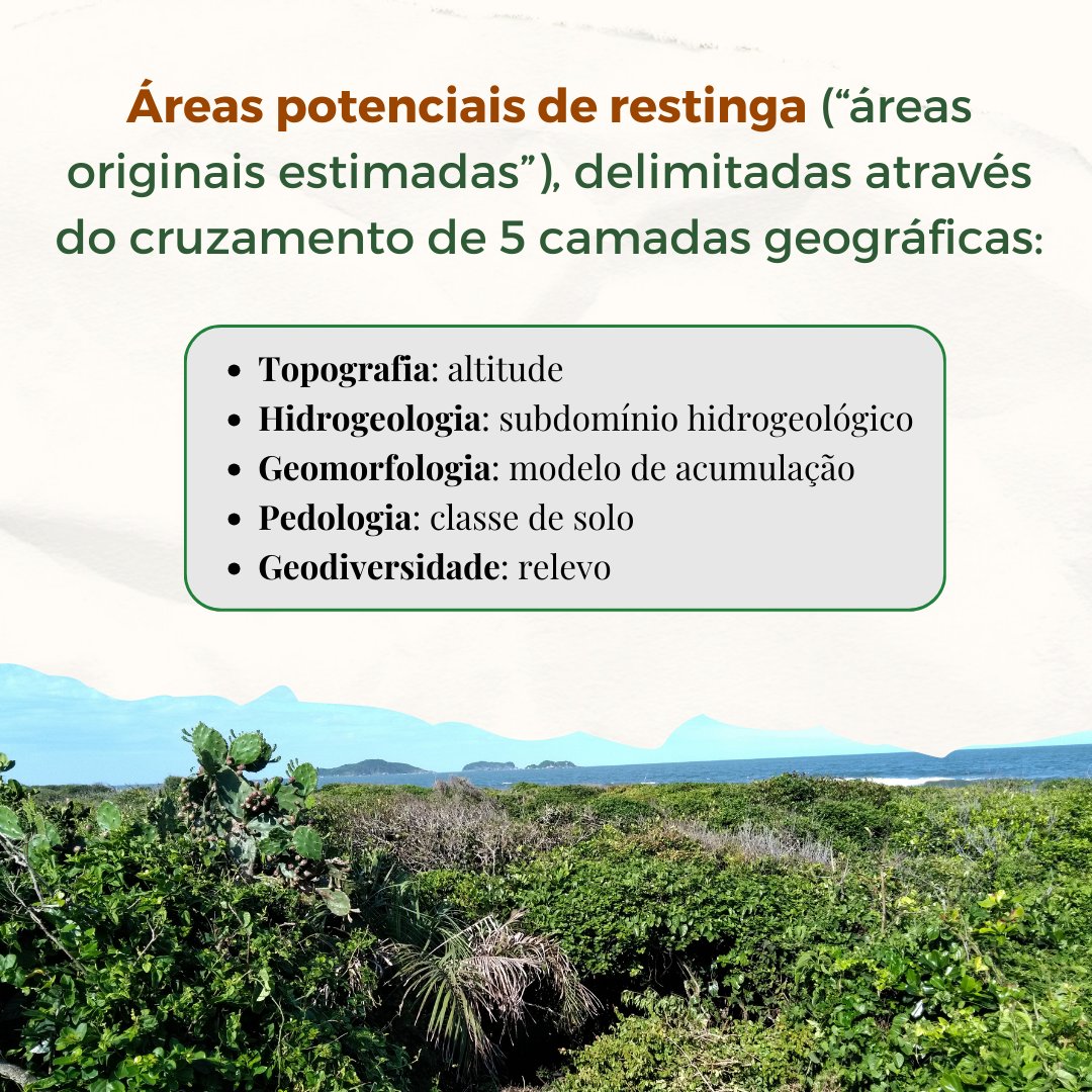
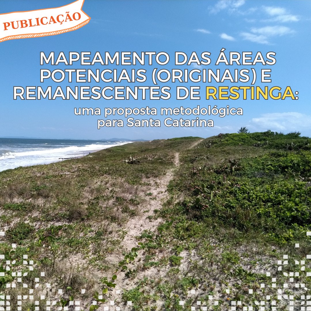
🌿SAIU A PUBLICAÇÃO SOBRE O MAPA DA RESTINGA!! Fruto de um trabalho de 3 anos, realizado para gerar um mapa sólido da restinga, aplicável em ações de conservação, planejamento territorial e licenciamento.
Artigo: https://t.co/kjawVIAgOI
Baixe o mapa: https://t.co/pu0EnNIIf6
Hoy somos anfitriones de la reunión de lanzamiento del proyecto #SMURF, un Horizon Europe en el que nos estrenamos como coordinadores.
Hasta 2027, a través de un consorcio de 10 socios europeos, buscaremos y ofreceremos soluciones para las pequeñas propiedades #forestales (🧵)
Great talks by Tamara, Mengxue, Óscar, Timothy, Joël & Tristan at @isp_uv_es in the AI4Extremes workshop. Detection, attribution, forecasting, multihazard susceptibility, exposure, impacts & more with our friends from @VUamsterdam ! @XaidaProject@DeepExtremes@ELLISforEurope
Great news!🎓 Anna Mateo Sanchis just defended her PhD thesis "Crop yield estimation using remote sensing and machine learning" 👩🌾🌽🛰️🌍🤖
The advisors, colleagues, family & friends are super proud! Thanks @sbegueria @belenfranchgras@DChaparro_EO, for the great evaluation!
👇
🌍 Exciting News! 🌟
🎓 Emiliano Diaz just defended his thesis
"Towards Causal Discovery for Earth System Sciences" @isp_uv_es@UV_EG 🌍🛰️☁️
#CausalDiscovery#EarthScience 🤖
The advisors, colleagues, family & friends are super proud! 🥳 Thanks @ERC_Research!
🧵