It’s exciting to see how #Sentinel imagery is advancing global research! In this comment in @NatureGeosci, we highlight the critical role of China’s more accessible satellites in tackling global 🌍challenges. #GlobalResearch 👉 https://t.co/ONZPcqy7rd
Interested in Mediterranean soils🇮🇹🇬🇷🇪🇸🇵🇹🇫🇷🇨🇾🇭🇷? Follow the EU Soil Observatory Forum today and tomorrow online. We plan to develop an ALTAS 📘📒🔖https://t.co/5FYUvnkzrI
The ongoing olive 🫒oil crisis in Europe🇪🇺 has been triggered by adverse climatic conditions, including prolonged droughts🏜️, elevated temperatures 🌡️and erratic rainfall🌧️. Read our @naturesustainab article📰 https://t.co/BUnwiZePKe
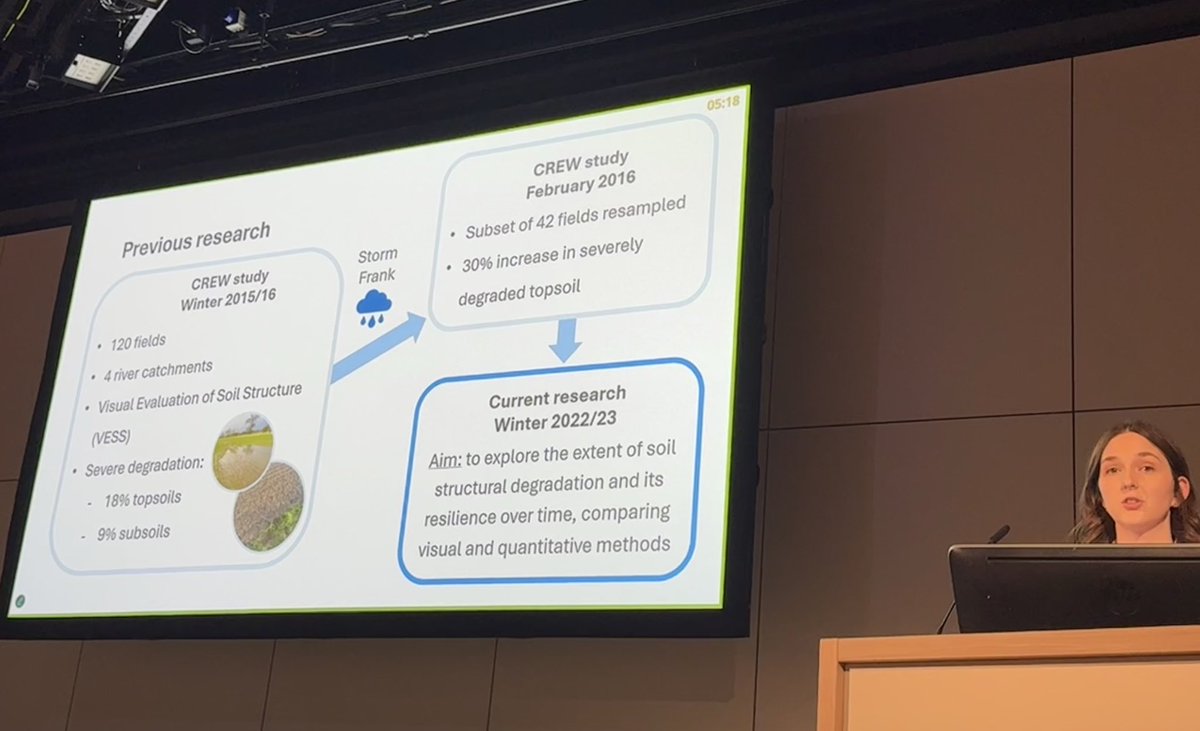
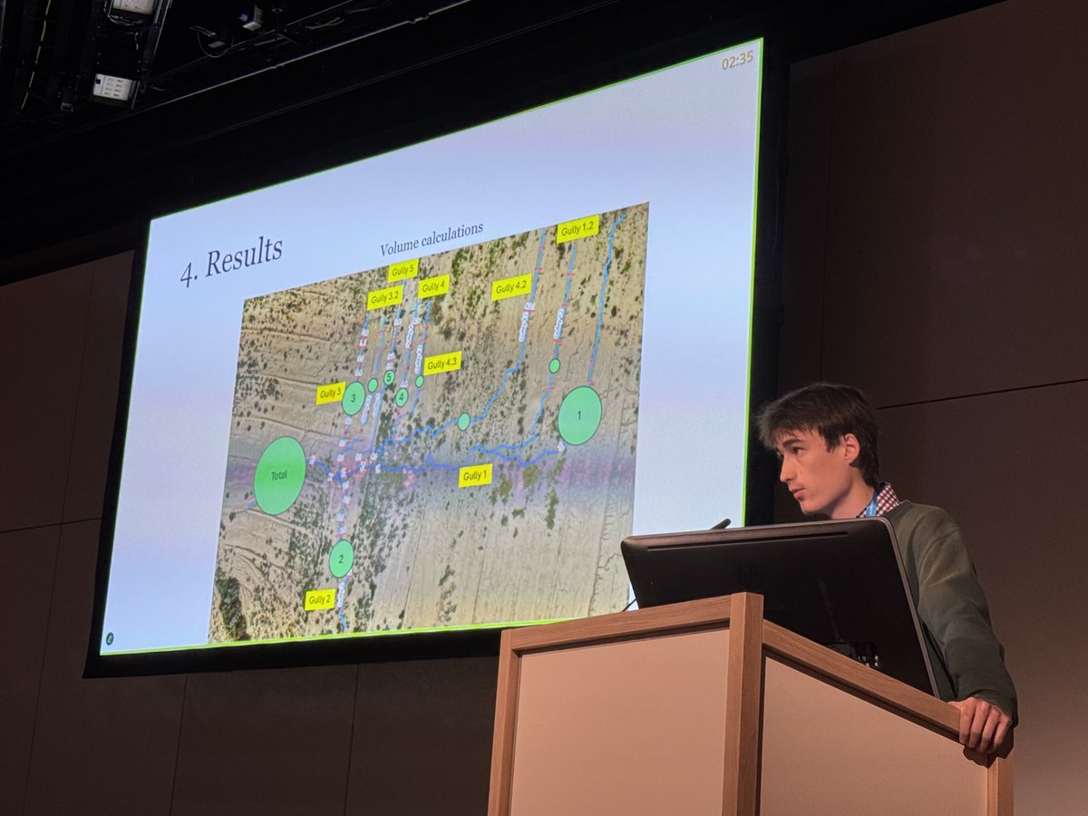
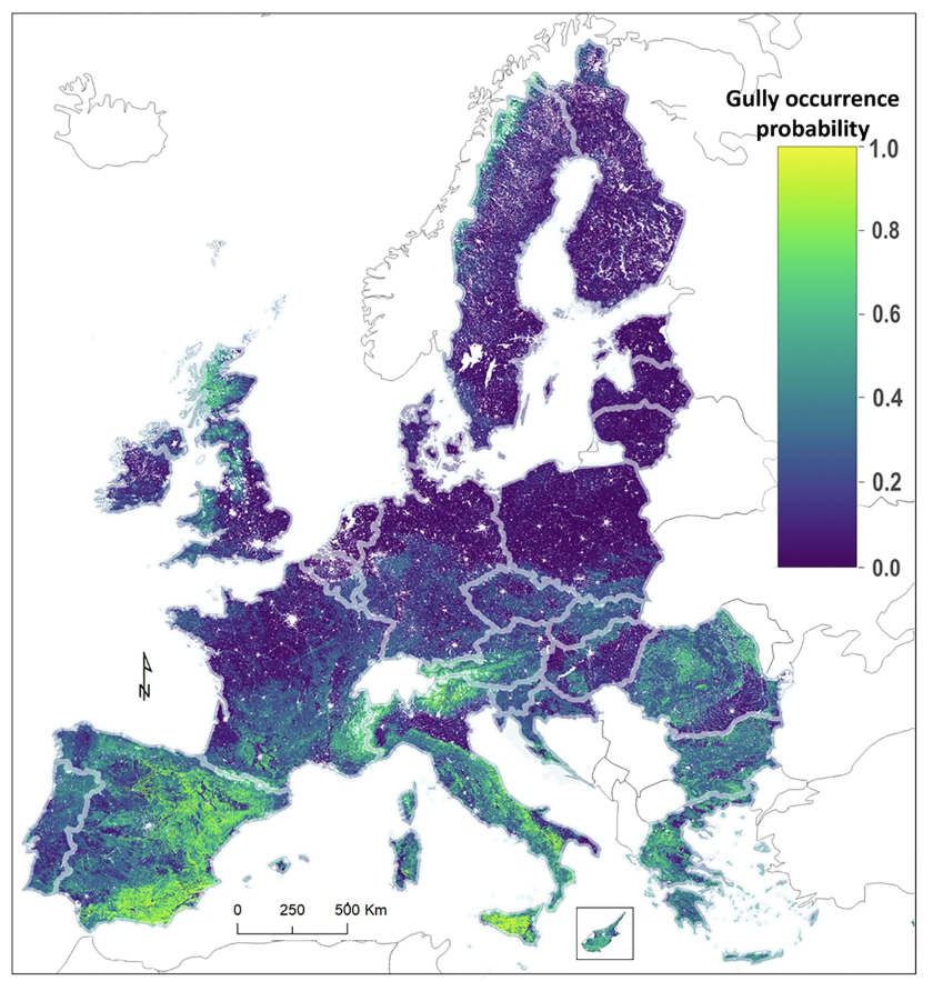
Just published in #NatureScientificData a gully (incisional #soil#erosion) feature dataset from LUCAS survey observations covering the EU. We give an accompanying first estimation of the probability of their occurrence and outline future advances through data and models
🆕The first Gully erosion occurrence probability map of the 🇪🇺 just published📜. It is using 400,000 LUCAS earth observations. 0.8% of all monitored locations show gully occurrence. #SoilHealth#missionSoil https://t.co/IrmO41otWS
This gives scientists a unique opportunity to learn how their research fits into soil health monitoring in the European Union and policymaking in general.
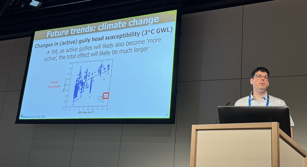
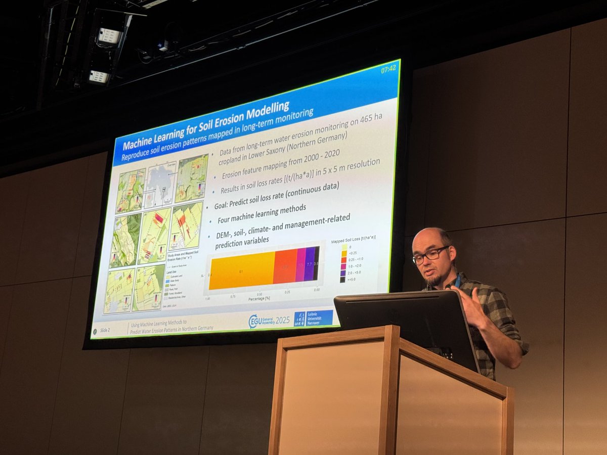
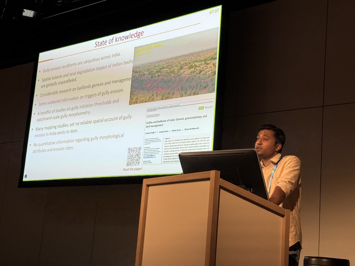
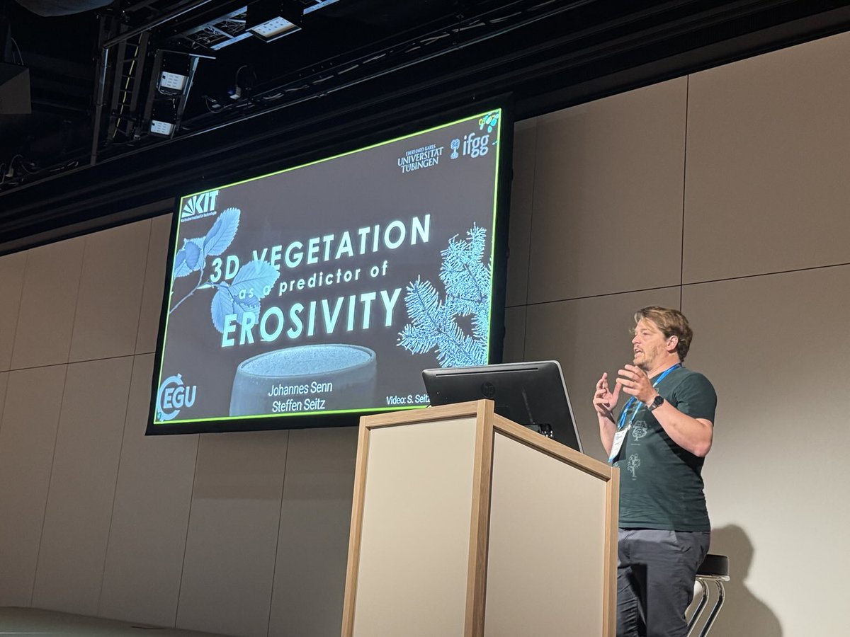
With #EGU25 fast approaching in Vienna, we warmly invite attendees to join our session (SSS2.2)“Soil Erosion, Land Degradation and Conservation“, orals on Wednesday 30 April. Full session here: https://t.co/7Z5SWg5in7
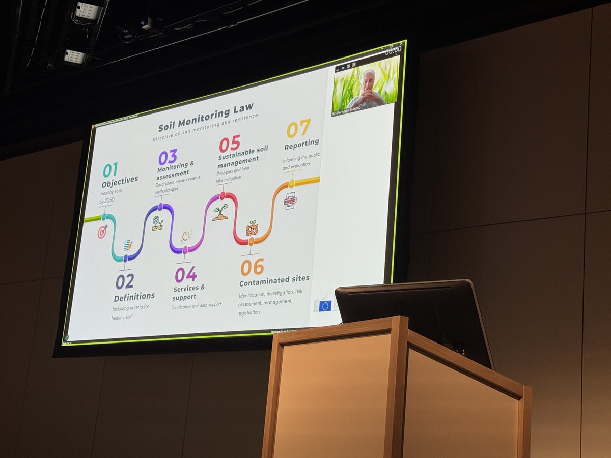
This year we have multiple scientific presentation formats and a presentation and discussion with policymakers from DG ENV of the European Commission on the Soil Monitoring Law and the role of science in policy implementation and monitoring.
We’re organizing the most extensive community-based global #soilerosion mapping initiative ever using Google Earth imagery (or similar). Want to be part of it?
Join us by sending an email to [email protected] with your full name, affiliation, & country.
Deadline: May 31
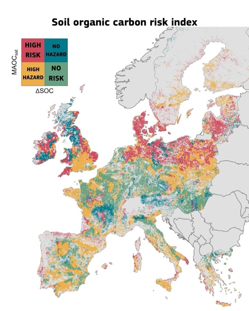
🇪🇺European farmlands 🌱🌾are losing soil organic carbon.@EU_ScienceHub study @NatureComms introduces a new risk index to identify areas vulnerable to carbon loss. 🔴 Up to 44% of EU+UK agricultural land is at risk . 🟢 But 50 million ha could absorb more https://t.co/etPeU8RkWN