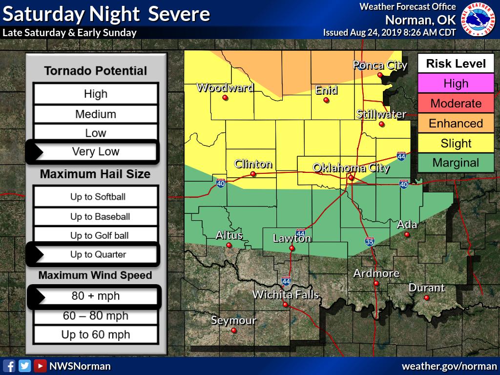
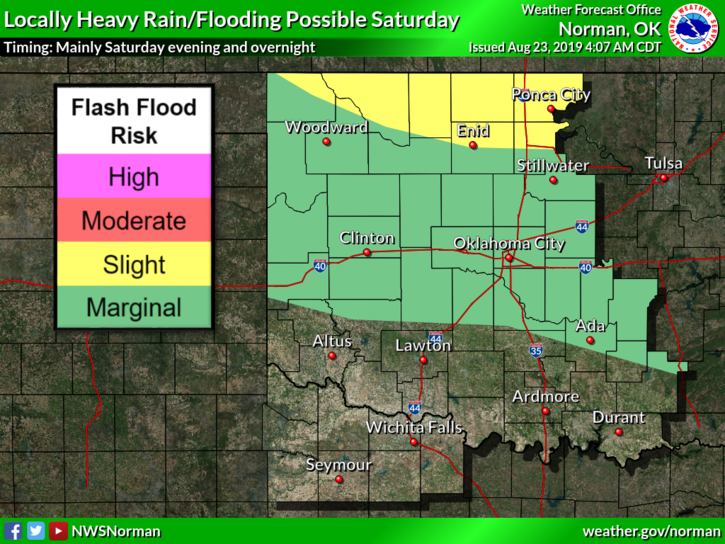
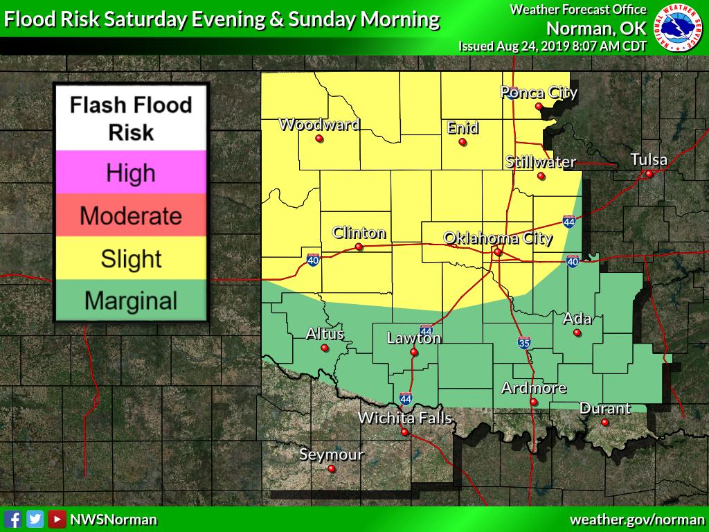
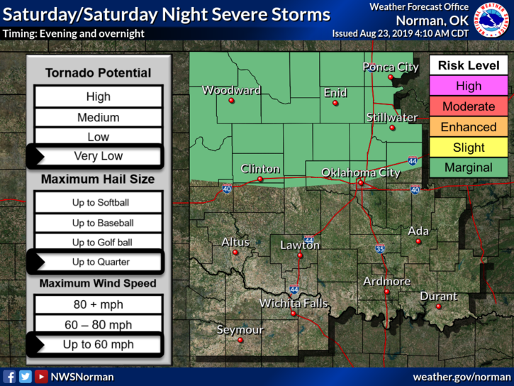
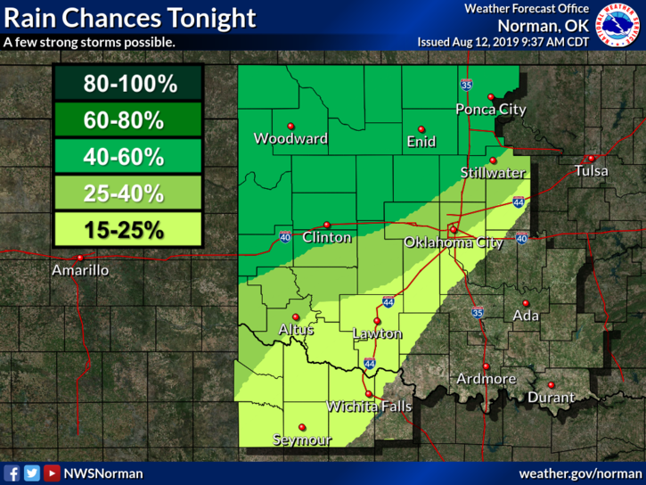
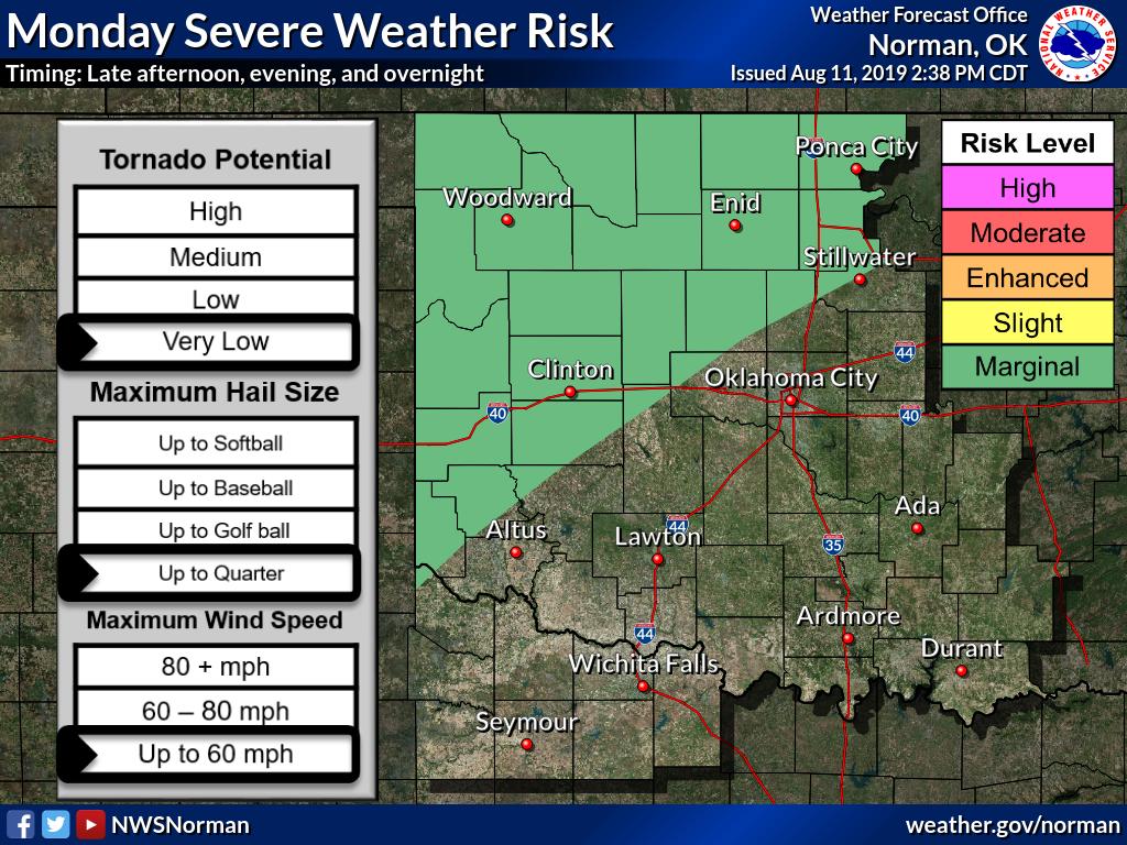
Damaging winds are likely overnight in part of northern Oklahoma when a large thunderstorm complex is expected to arrive from the north. Heavy rainfall may cause flooding of some areas.
Its hot again....we have a chance for rain and storms this evening, overnight, and tomorrow.....temperatures tomorrow should be cooler... #okwx#grantcountyok#hotweather#storms
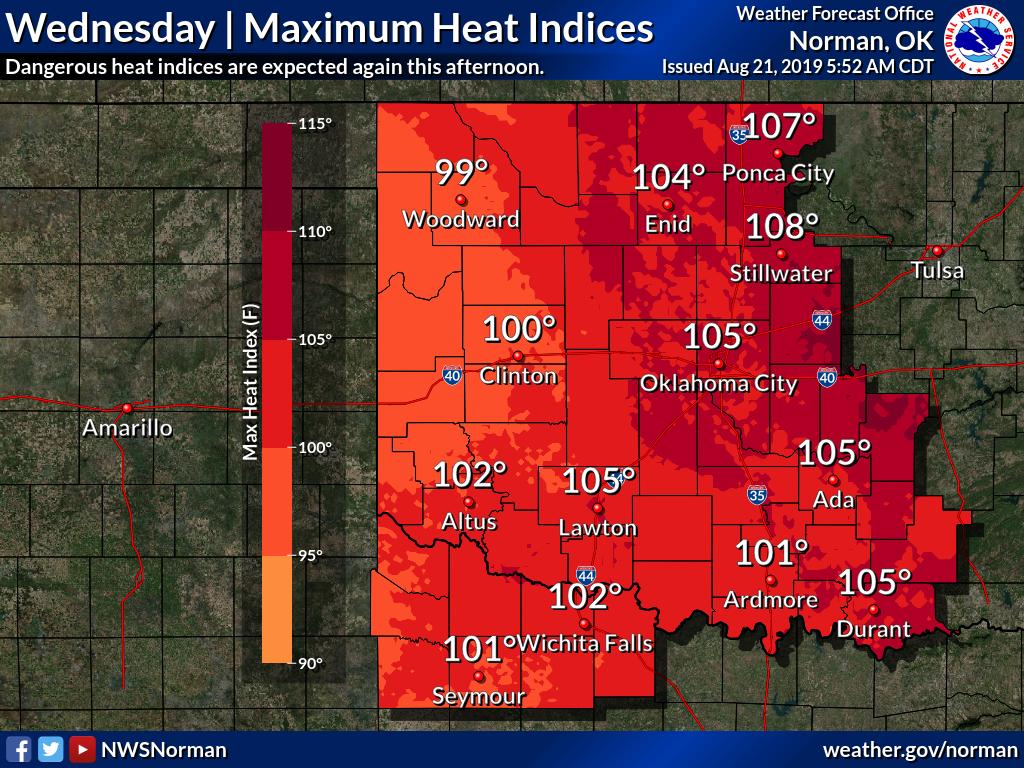
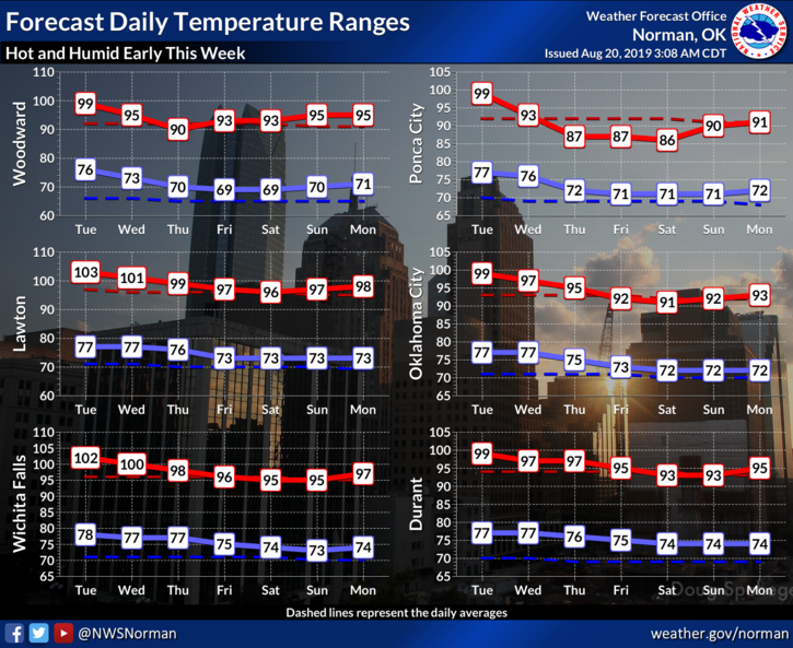
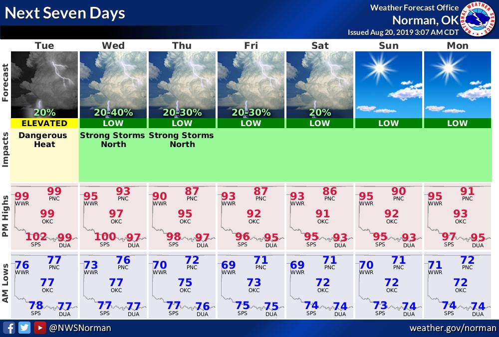
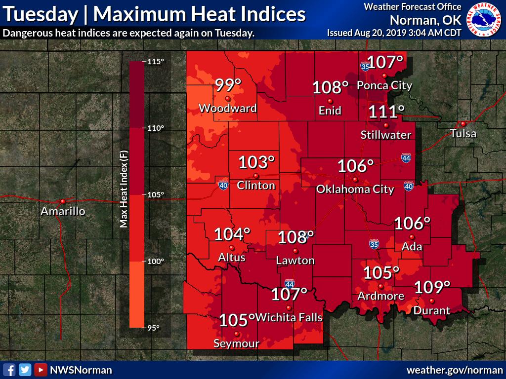
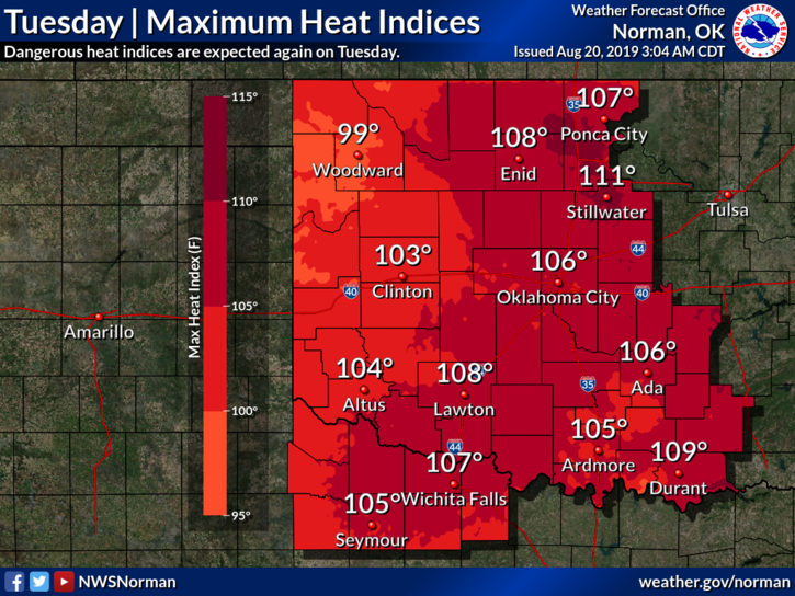
Excessive Heat Warning continues from noon - 9 pm today in Ponca. With high of 99 heat index will reach 107. South wind 6-10 mph. Low tonight 76. A few severe storms possible Wed. - Sat evenings in northern OK.
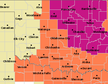
OUN updates Severe Thunderstorm Watch (cancels Dewey, Ellis [OK], expands area to include Kay [OK], continues Alfalfa, Blaine, Garfield, Grant, Harper, Kingfisher, Logan, Major, Noble, Woods, Woodward [OK]) till Aug 14, 2:00 AM CDT https://t.co/PzKhIuu5gJ
We are in a Heat Advisory until 8 P.M. this evening.....There is also a chance for some thunderstorms this evening and overnight.....Please watch the weather and remember please don't drive into high water..... #okwx#grantcountyok#heat#rain
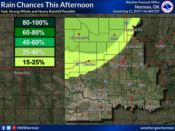
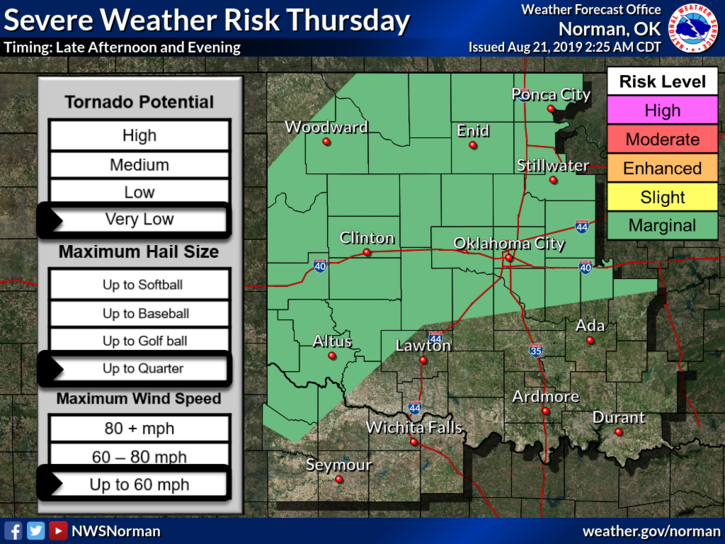
A few strong to severe thunderstorms will be possible across northern and western OK late Monday afternoon thru early Tue morning. Wind gusts up to 60 mph and small hail up the size of quarters will be possible. #okwx
This is Highways 64 just east of Nash, Oklahoma...they received several inches of rain last night....please do not drive into high water.... #okwx#grantcountyok#flooding
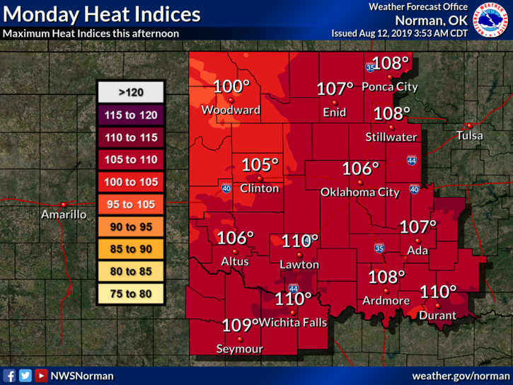
Hot and humid conditions are expected again today with heat index values expected to range from 105 to 110 across portions of the area. A Heat Advisory is in effect. Take steps to prevent heat related illnesses.
Isolated strong to severe storms remain possible late this afternoon into the evening hours.
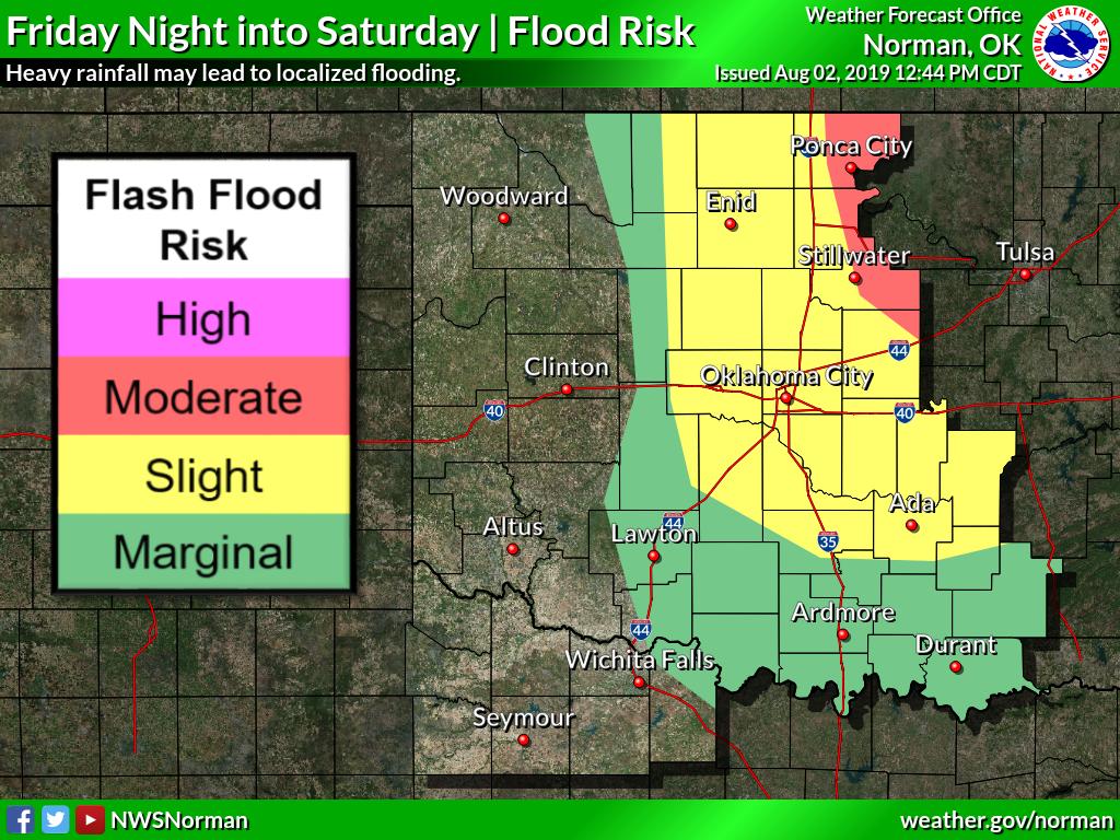
More widespread rainfall is expected tonight into Saturday, especially across north central and east central Oklahoma. A Flood Watch is in effect for this area. #okwx#texomawx
Today is the last day FEMA's Disaster Recovery Center will be open in Ponca City. If you had any kind of flood damage to your home or business don't miss this opportunity to talk to FEMA directly. Located at 420 E. Grand & open till 6 pm.
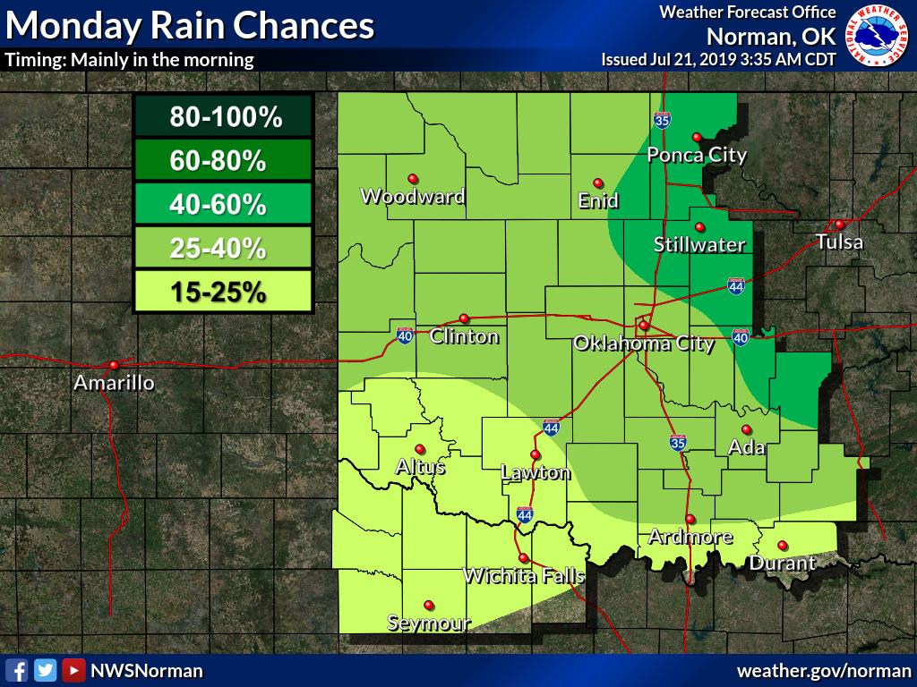
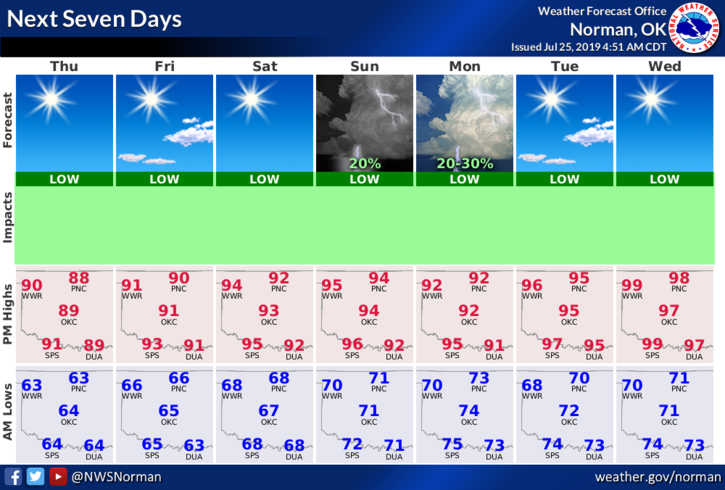
Rain chances will continue this afternoon through a good part of Monday. No severe weather is expected and most of those that see rain will not see much. Overall, looks like a hot and dry week ahead. #okwx#texomawx
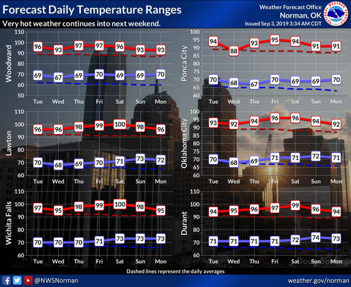
Warming trend continues this week reaching 90s for weekend. Very low thunderstorm chances Sunday & Monday. High today 88 with sunny skies & wind SE from 5-9 mph. Low tonight 65.
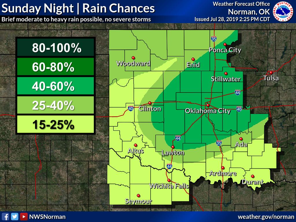
A cold front will enter northern Oklahoma late this afternoon and will move across the rest of the state by mid morning Monday. Widely scattered showers and storms will develop behind the front, especially Sunday evening and night. #okwx#texomawx